
A weekend for peeping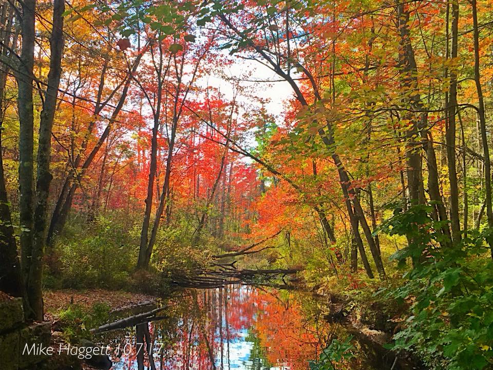 Most of the state is looking good for foliage, and this will be a good weekend to check it out. Saturday could be a bit breezy and a bit cloudy in the north and west as a weak front approaches in the afternoon. The chill on the way will assist color in southern areas as next week unfolds. 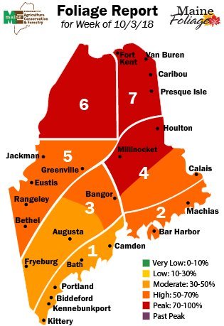 Pick your spots, take your camera and enjoy the peace and scenery. It's a beautiful time of the year. A couple of chilly mornings ahead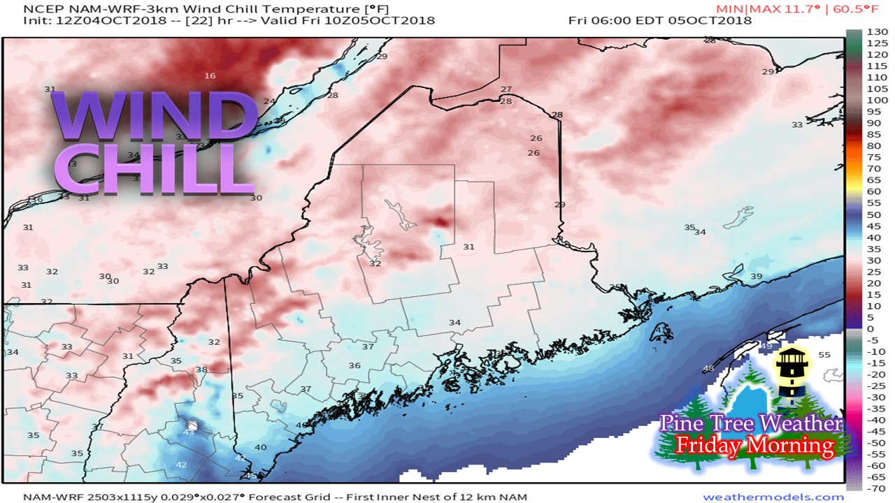 Friday and Saturday mornings appear to feature some nippy starts. It will be a bit breezy in the north country as high pressure moves in Friday morning. The breeze settles down as the day progresses. That sets up a chilly start for Saturday with a good portion of the north country at or below freezing, and 30s for much of the coastal plain. Bring in the mums, cover any plants if necessary. Surf from Leslie to impact the shorelines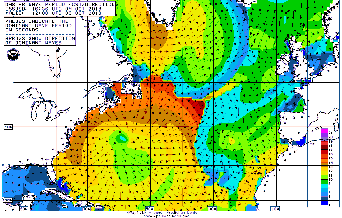 High tides Friday (9 AM / PM) and Saturday (10 AM / PM) could bring some splash over in low lying or prone areas as waves from Leslie reach the area. Curious viewers should respect the ocean, understand that the waves could be unexpectedly large at times, and caution should be used while enjoying the show. 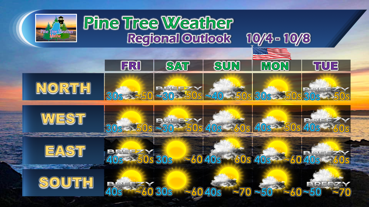 All in all, a bit on the cool side, but a pleasant stretch through early next week. A frontal boundary may bring a light shower over the north Saturday night into early Sunday, but that is about it for rain until later next week. Stay updated! For the latest official forecasts, bulletins and advisories, please check in with the National Weather Service in Gray for western and southern areas, or Caribou for northern and eastern parts of Maine.
For more information from me, please follow the Pine Tree Weather Facebook page and my Twitter feed. Thanks as always for your support! Please consider making a donation to keep Pine Tree Weather going. Check out the donate page on how to contribute. Always stay weather aware! - Mike |

Mike Haggett
|


