
Summer starting to wind down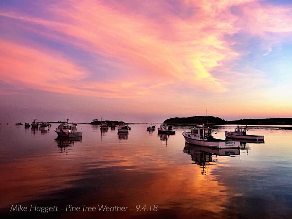 With the heat and humidity going down to more early fall like temperatures over the next few days, it's time to break out the light jacket, chamois and/or sweatshirts for the folks in the north country for the weekend. After one more day of 70s statewide on Friday, daily highs appear to be in the 50s Saturday and Sunday for the mountains and much of the crown of the state. Daily highs for southern areas will be on the cool side in the 60s. The next chance for rain comes Monday into Tuesday as the remnants of Gordon tag onto a warm front that will work in from the southwest, and it will be that front that will bring temperatures back up tp to the 70s for much of the state by Wednesday. After all of this heat and humidity, we now return to reality for September in Maine, and that is frost. Gardeners... plan on covering your plants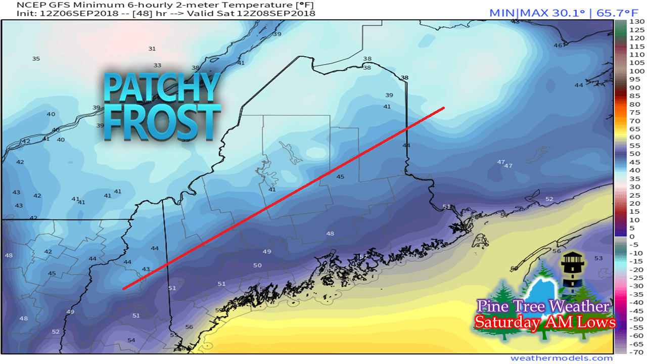 Saturday night, patchy frost is the main concern over the mountains and north. I suspect northwest Aroostook around the Allagash and Estcourt could see temperatures drop far enough for more widespread area of frost in that area. 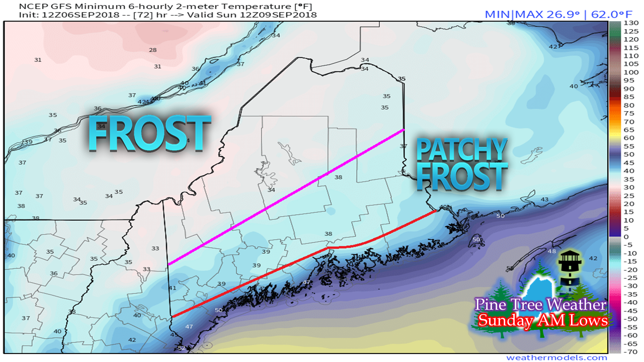 Sunday is a concern for a larger area of frost impacts over the north and mountains. The foothills to the coastal shorelines could see some patchy areas of frost. 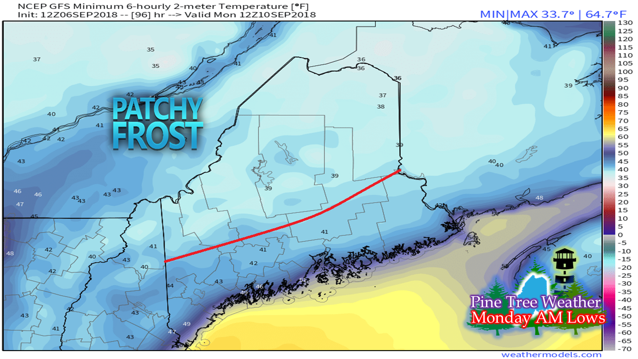 Monday morning will see the chance for patchy frost over the mountains and north once again. After we get through this stretch, the blankets may not be needed again until later in the month. Florence destination still in question Hurricane Florence had a tough day working through some strong wind shear. The National Hurricane Center downgraded the storm to a low end Category 1 storm with 80 mph winds.  The storm does not look nearly as strong as it did yesterday. The wind shear has weakened it considerably, and may continue to over the next two days. If it can survive the next couple of days, it will reach a favorable area for intensification. The storm is slowly heading into warmer waters, and calmer winds. 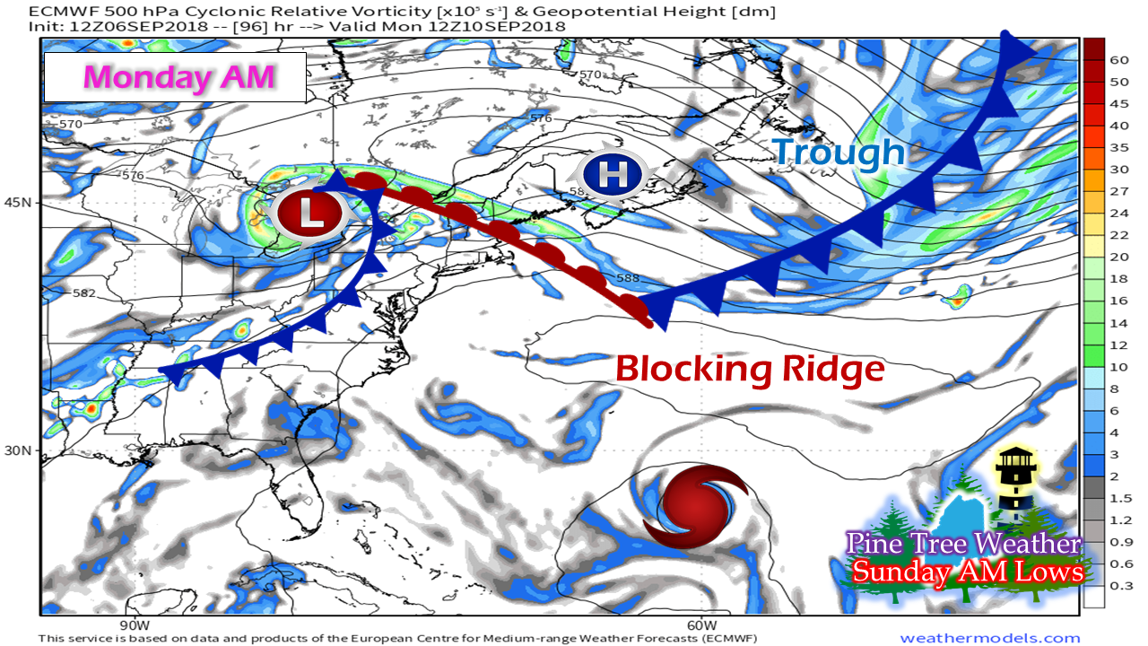 There are still many questions on where the storm is going to end up, but time is slowly beginning to run out for preparation concerns. My questions at this point are: 1. What condition the storm is in after working through the wind shear? If it survives... 2. Position of the high near Maine and New Brunswick that is delivering the cool down this weekend. 3. Remnants of Gordon move up into the Great Lakes and the influence that has with... 4. A strengthening blocking ridge over the Atlantic. Earlier this week, there was an idea presented that there was a narrow window where the trough could pick up Florence and take it out to sea. Operational models are saying no to that idea at this point. The blocking ridge is likely to be the key piece that could guide Florence to the east coast... IF it strengthens as models suggest. All of this is hypothetical. Unfortunately, hypothetical is all any forecaster with integrity has to go on at this point. It may be Sunday or Monday when the storm approaches near Bermuda before a handle on the track can be achieved. By that point, the window to make preparations could be very small. If I were a betting man at this point, I suspect there is a 65% chance for this storm to make landfall somewhere between South Carolina and Southern New England... IF it survives into Saturday and restrengthen. Oh, and we'll be hearing about Hermine and Isaac soon, more than likely. Any storm preparations will not be done in vain. October is coming, and we know all too well how that ended up last year. Are you prepared? Do you have a plan? Check in with Hurricane Strong for more information. One thing that Maine may receive from this storm is ocean swells and potential for dangerous rip currents... stay tuned on that. Anthony Macari Steps In Next Week Since I will be travelling to Las Vegas next week on a business trip, WAGM-TV Presque Isle morning meteorologist Anthony Macari has been gracious enough to take over for me and keep you fine folks updated on the Pine Tree Weather Facebook Page while I am away. Anthony is very familiar with New England weather, having grown up in Rhode Island. He received his degree in broadcast meteorology from Lyndon State in Vermont in 2016. He has been with WAGM working alongside long time veteran meteorologist Ted Shapiro since graduation. Anthony will be covering for me Tuesday through Friday, and will post updates when time permits for him. Please give him a warm welcome and your support while I am away! You can follow Anthony on his Twitter and/or his Facebook page for more in-depth information on the weather for the north country! Stay updated on the latest informationFor the latest official forecasts, bulletins and advisories, please check in with the National Weather Service in Gray for western and southern areas, or Caribou for northern and eastern parts of Maine.
Thanks as always for your support! Please consider making a donation to keep Pine Tree Weather going. Check out the donate page on how to contribute. Always stay weather aware! - Mike |

Mike Haggett
|


