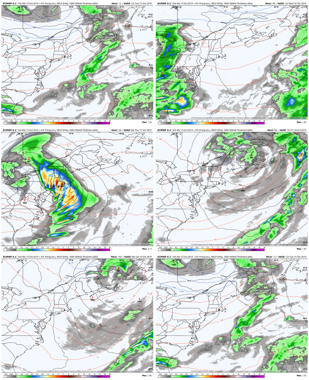
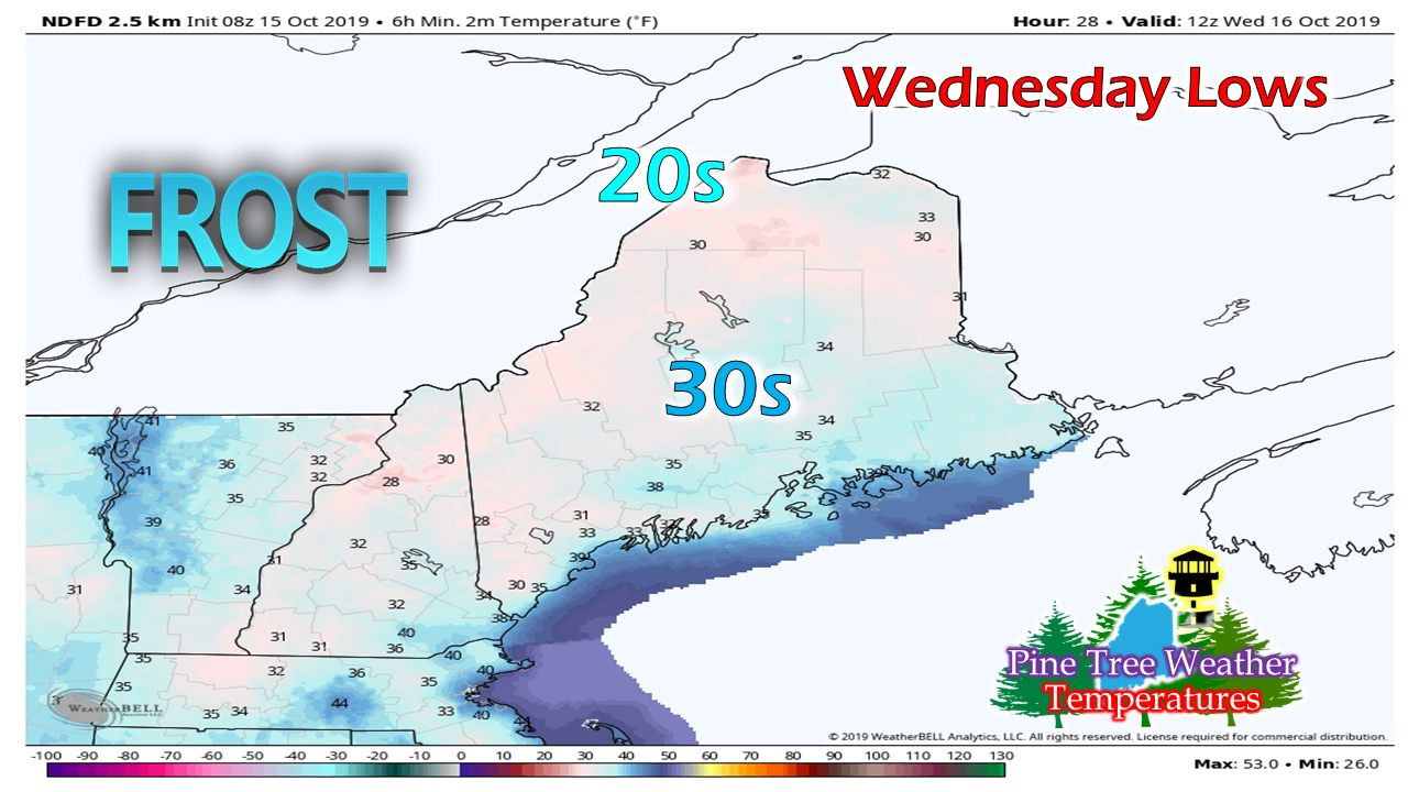
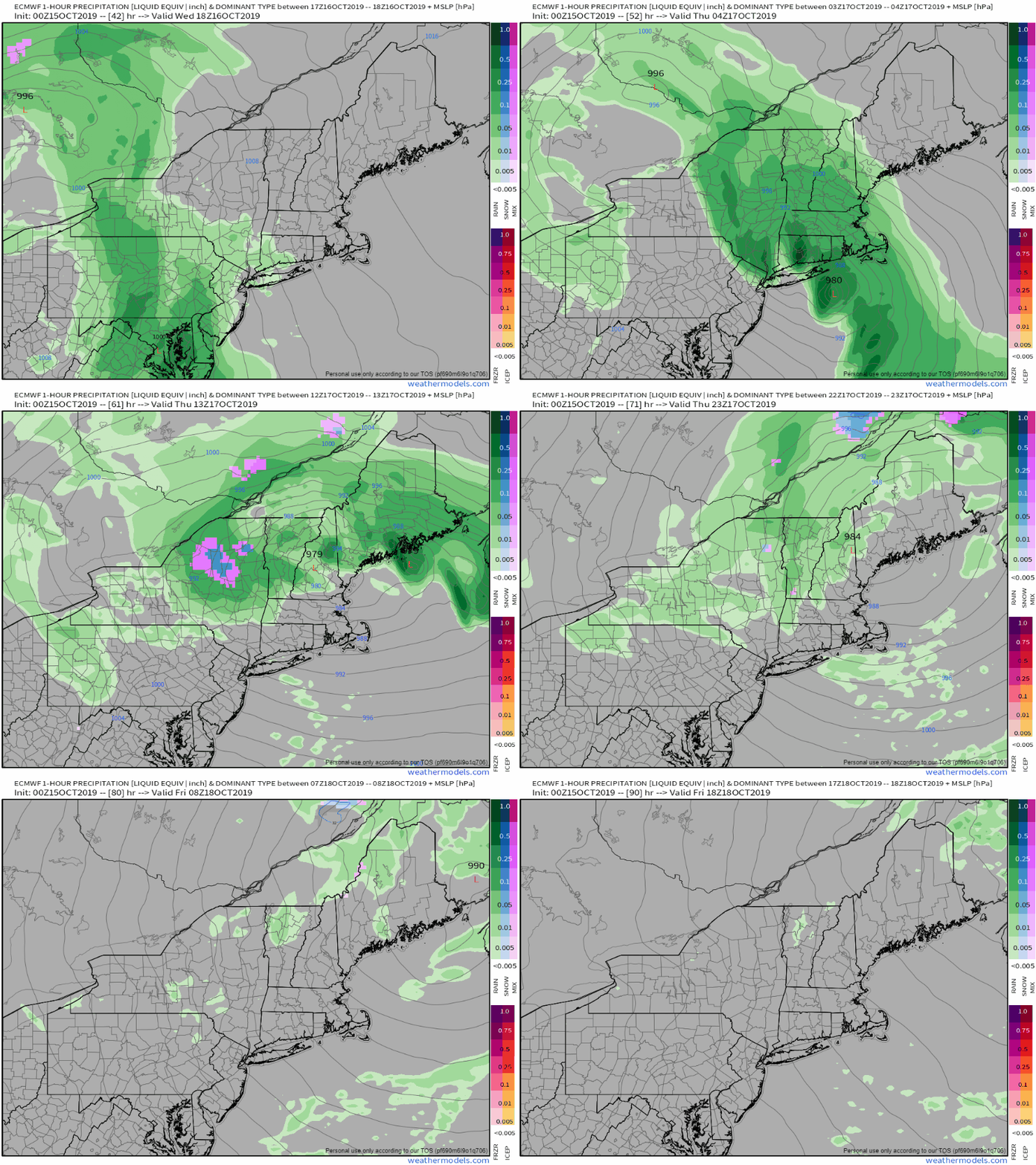
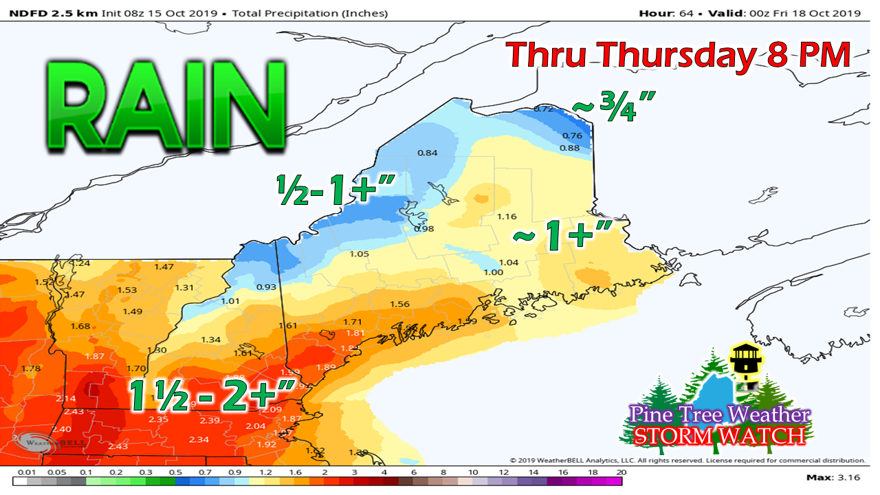
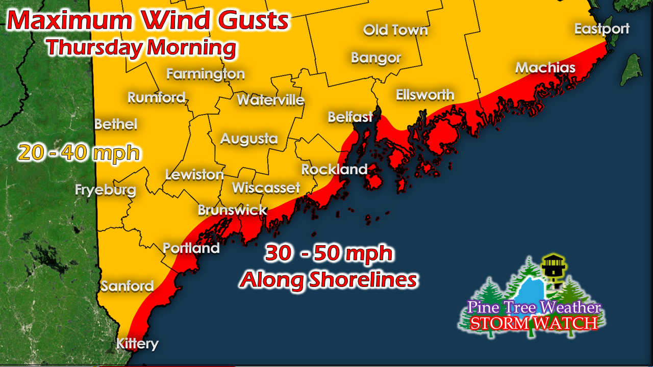
Tuesday and Wednesday dry before storm arrivesWith the departing frontal boundary quickly moving to the east, the sky will clear out during the day Tuesday bringing a pleasant day overall. It may be a bit breezy in the higher elevations as high pressure moves in, otherwise wind appears light for the state. High pressure settles over the region Tuesday night and thus give us a chilly start to Wednesday. High pressure then moves east ahead of the storm on the way to impact Thursday. The weekend appears mainly dry for now. Frost possible for most areas Wednesday morningCover the mums up Tuesday night as temperatures appear to flirt with freezing in most locations by the time the sunrises Wednesday morning. This appears to be our coolest night until this weekend when high pressure returns Saturday into Sunday. Leaf stripper storm on the wayWednesday remains mainly dry for the state. Southern areas may get a light shower or sprinkle late Wednesday afternoon, but the main event will not arrive until overnight into Thursday morning. The morning commute could be rough one with heavy rain and gusty wind, causing reduced visibility and ponding on roadways. Gale watches have been posted for the coast. Seas of 7-12 feet are expected Thursday morning. If there is a high tide to be concerned with, it would be 2 PM Thursday afternoon, with splash-over the main concern in the usual areas. This is best estimate I can see at this point for potential rainfall. Once the storm phases together and pressure drops rapidly, rain will fall very heavy at times Thursday morning before tapering to scattered showers Thursday afternoon. While there is little concern for river flooding, a few brooks and streams may rise quickly in areas of heavy downpours. With the wind stripping leaves, clogging of storm drains may cause localized street flooding, along with slick roads from accumulating leaves are the main concerns. My main concern for the strongest wind gusts comes in areas of heavy rain where downdraft wind may occur. This may cause some spotty power outages in areas and cause flying debris. As the storm pulls away, the wind will slowly diminish Thursday night into Friday.
Stay tuned for more updates! ► ► For the latest official forecasts, bulletins and advisories, please check in with the National Weather Service in Gray for western and southern areas, or Caribou for northern and eastern parts of Maine. ► ► DONATION DRIVE UPDATE - $920 shortfall for the year ahead! You can help keep Pine Tree Weather going with a donation of any amount now through VENMO @PineTreeWeather, a monthly donation on Patreon or messaging me on Facebook or Twitter to send a check in the mail. Thank you for your support! For more information from me, please check the Pine Tree Weather Facebook page as well as my Twitter feed. Always stay weather aware! - Mike |
Mike Haggett
|

