
Wednesday the pick of the week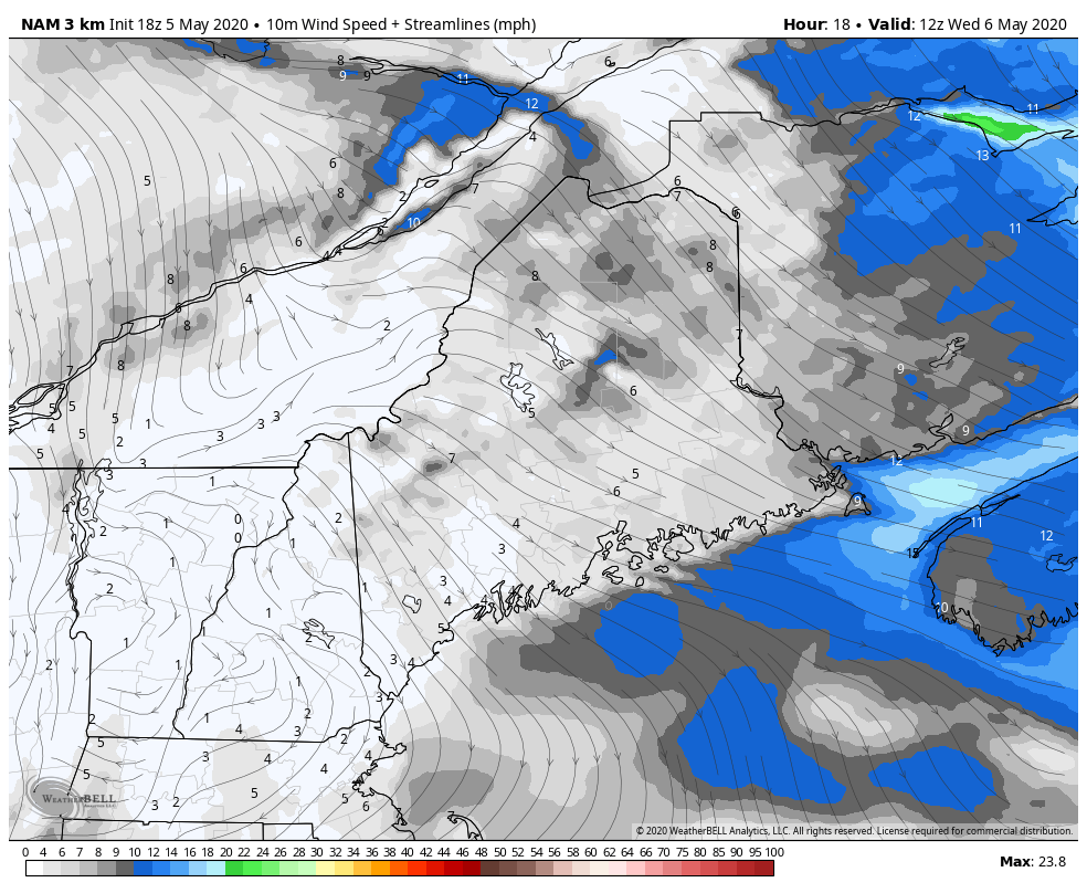 NAM model wind speed and direction Wednesday 8 AM to 8 PM I mentioned on Facebook and Twitter earlier Tuesday about frost potential overnight to start Wednesday. If you have a garden, it would be wise to cover it up just in case. After a mainly sunny start, clouds begin to filter in during the day from the southwest as warmer air works in aloft ahead of the storm on the way for the MidAtlantic and southern New England that they will deal with where our region stays dry through the day. Highs for the day should reach the 50s for most with a few 60s possible for the interior coastal plain. An onshore breeze keeps the coastline cool. The clouds keep overnight lows into Thursday a bit warmer with 30s and 40s, but some 20s are possible in the Allagash region where clouds clear out. There is a chance for an overnight shower for the coastal plain as the storm that passes by to the south races eastward. The set up for potential snow Friday night into Saturday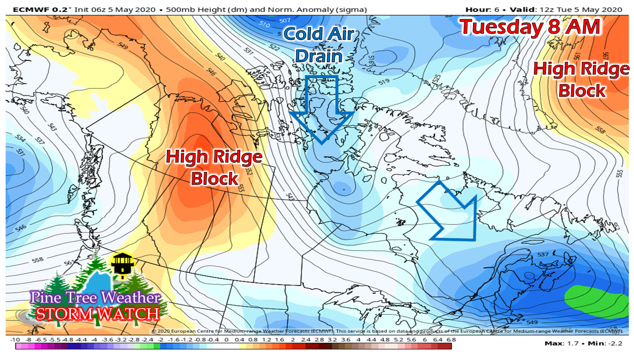 I was asked by a friend on Facebook about what is going on with this weather pattern and why are we so cold. This graphic here sums it up. All the cold air that was bottled up north all winter is breaking off in chunks as we head closer to summer. Due to blocking to the west and the northeast, that cold has nothing keeping it from going south and southeast. This is parts of the "troposphere polar vortex". You know me, I am not into hype very much, but in meteorological terms, that is what it is. Until we see a breakdown of the western ridge that stretches to Siberia, we'll be dealing with this through mid-month, at least. 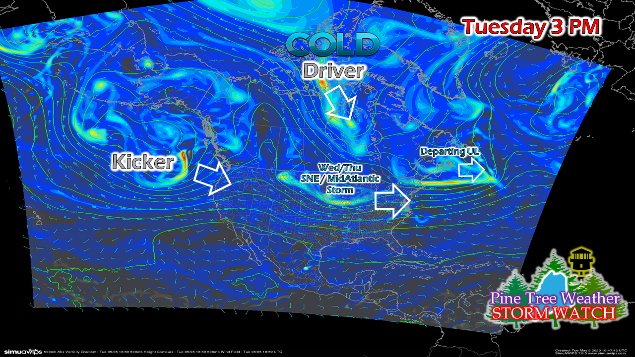 I know the graphic isn't the best for those with vision issues, but since this is real time, I wanted to use it to explain the set up for snow potential for late week. As my previous graphic indicated, the cold is breaking off and dropping down. That "driver" sets up the cold. The kicker is offshore of the northeastern Pacific, and that holds the cards in how this is going to play out. 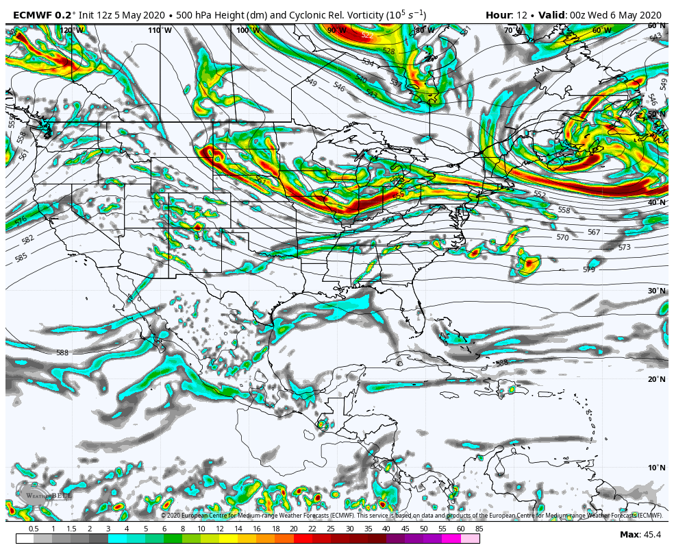 If you watch this loop carefully, you'll see the kicker move onshore in the Pacific northwest, while the cold sinks down from Hudson Bay. The kicker's timing of arrival and consequent storm formation is a critical element in what happens here.  Looking at it from a surface point of view , after a weak cold front passes through the region Thursday night into Friday, the stage is set for the cold driver to meet the moisture from the kicker. As the energy from the two come together, the storm rapidly intensifies and begins to affect our region Friday afternoon into Saturday. Guidance is pretty scattered with ideas at this point. Part of the reason why is the figuring out the kicker's role in all of this. Once that energy makes landfall in the Pacific northwest on Wednesday, ideas should begin to come together and the forecast should begin to come together. For now, this is a 1-3" snow event from Bethel to Houlton north and west, with 3-6" possible in the higher elevations above 2000 feet. The coastal plain could get some flakes out of this. Expect heavy wet snow where it does fall. With a rapidly developing system, wind is possible and that means power outages could be a concern. Don't hold me to all of this just yet. This is the idea for now. I will update on this Wednesday afternoon. ► ► For the latest official forecasts, bulletins and advisories, please check in with the National Weather Service in Gray for western and southern areas, or Caribou for northern and eastern parts of Maine.
Thanks as always for your support! - Mike |

Mike Haggett
|


