
Gardeners on alert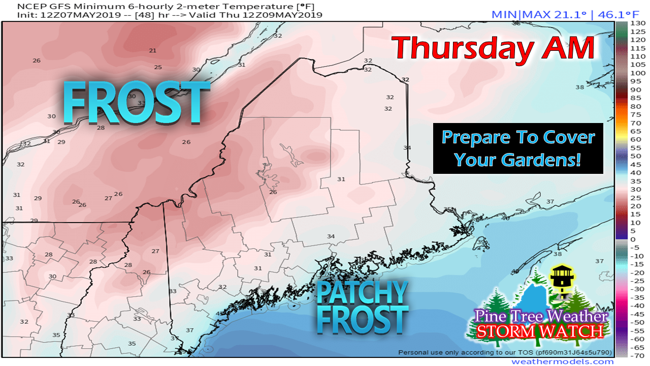 For folks that have got a jump on growing season, you'll need to have the covers ready for action Wednesday night. Unless you can see or smell the ocean from your planting point, chances are good that you may see some frost on the ground come Thursday morning. The trend has been consistent on this idea for several days now. I expect frost and/or freeze advisories to make the weather headlines Wednesday. A soggy end to the week Another trend that has been consistent has been this long wave frontal boundary on the way for Friday. Looks like 1/2"-1" of rain is possible with this one. The day appears to be a washout at this point, with drier weather working in for Saturday. Outlook through Mother's Day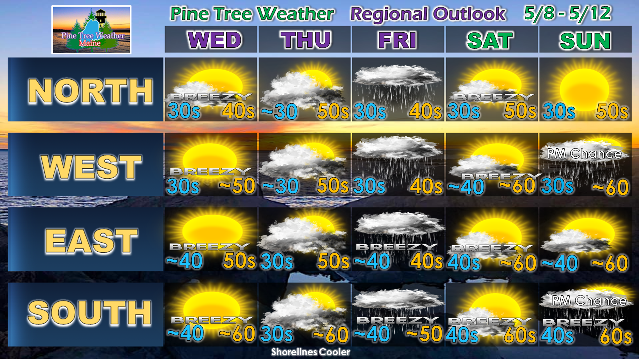 After a cool, breezy day on Wednesday and a chilly Thursday start, clouds increase ahead of the rain moving in for Friday. High pressure moves in Saturday and will bring breezy conditions and closer to seasonable temperatures. Mother's Day is in question for western and southern areas as for now there is a chance for afternoon showers, but confidence in that is low for now.
I will update on that as the weekend gets closer. ► ► For the latest official forecasts, bulletins and advisories, please check in with the National Weather Service in Gray for western and southern areas, or Caribou for northern and eastern parts of Maine. ► ► Your financial donations are much appreciated to keep this site funded and for further development. I sincerely appreciate your support not only financially, but also in sharing my efforts with others. For more information from me, please check the Pine Tree Weather Facebook page as well as my Twitter feed. Always stay weather aware! - Mike |

Mike Haggett
|


