
High pressure controls the weekend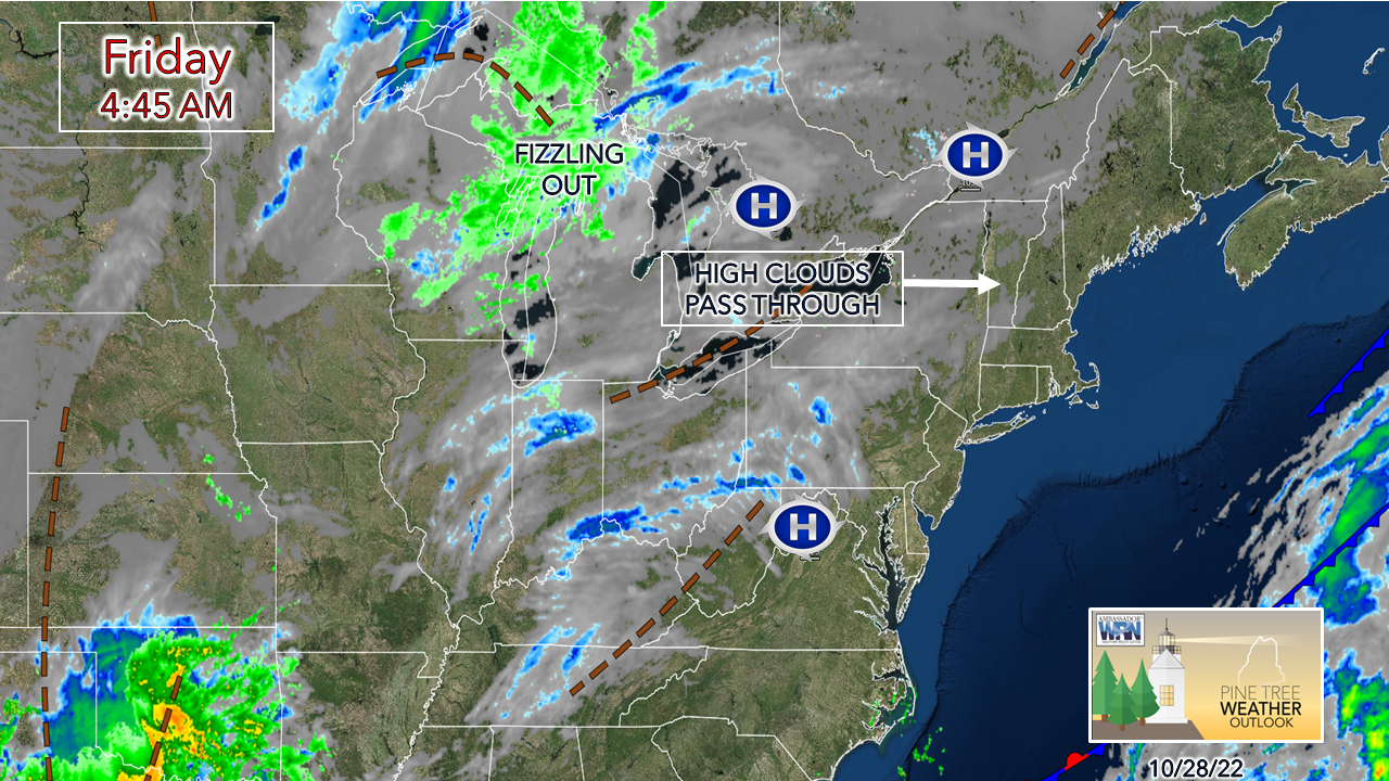 After a rainy stretch over the past week, dry times return to the region as high pressure moves in. Some high cirrus associated with an upper-level ridge are expected to pass over the area, which may dim the sky at times in areas. 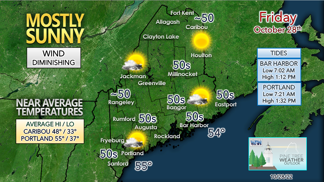 An early morning breeze settles by around midday. Temperatures are expected to be close to the daily average, which may feel a bit cool compared to the well above normal values as of late. Coolest start of the season possible Saturday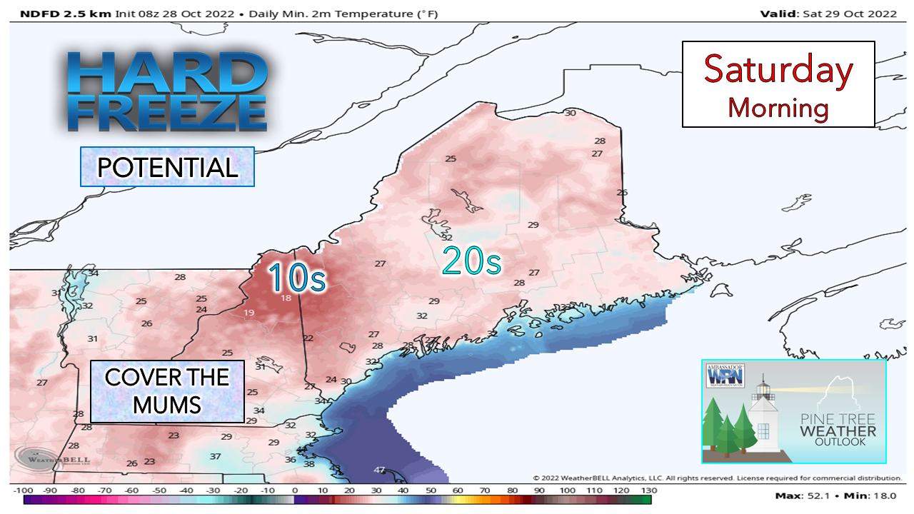 As of early Friday morning, guidance agrees that the high cirrus clouds of the day dissipate overnight. If that does occur, most areas see temperatures plummet into the 20s, with teens possible in the Rangeley / Aziscohos Lake region Saturday morning. Time will tell what the upper-level ridge thinks of that notion. For much of the coastal plain, it could be the first hard freeze of the season. There is potential for freezing fog around the lakes and rivers. If you are a photographer, it could be prime to pick up pictures of hoar frost, like the image below that I captured from Middle Range Pond in Poland back in 2017. 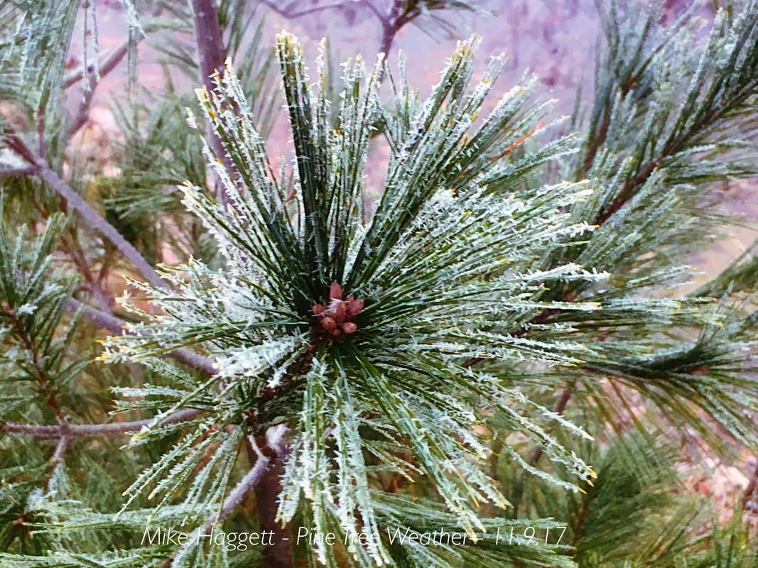 Please contribute to keep PTW going into its 11th year Showers possible for Halloween and Tuesday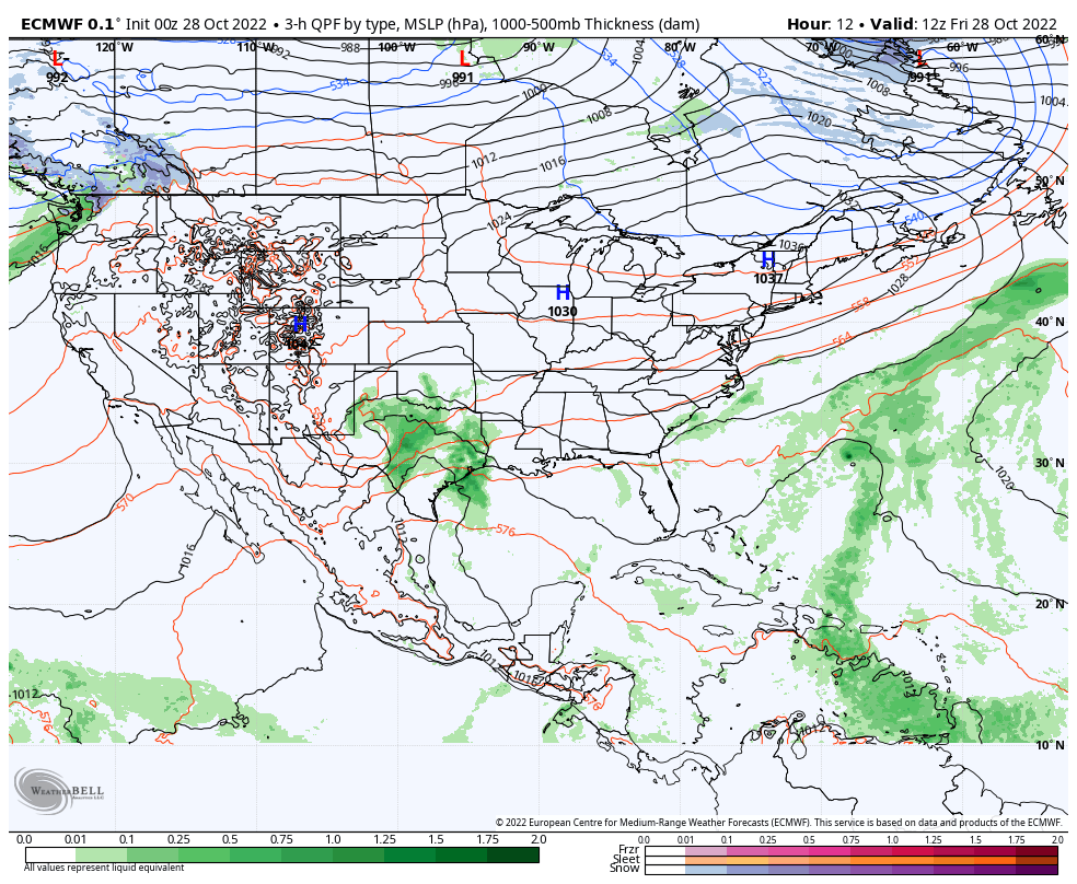 Friday 8 AM to Tuesday 8 PM - There are a couple of things going on here. A cut-off upper-level low over the southwest, along with a tropical disturbance near Bermuda. The cut-off low taps into Gulf moisture and throws it northeastward into the ridge. The tropical disturbance wants to move northward but runs into a roadblock with the ridge. Until Thursday morning's guidance runs, Halloween was looking wet. The overnight ideas have cut that back considerably. For now, there could be some light showers possible by trick-or-treat time. Based on history, guidance does not read upper-level energy well over the southwest, and some models are worse than others. Stay tuned for a better idea on how it plays out over the weekend. 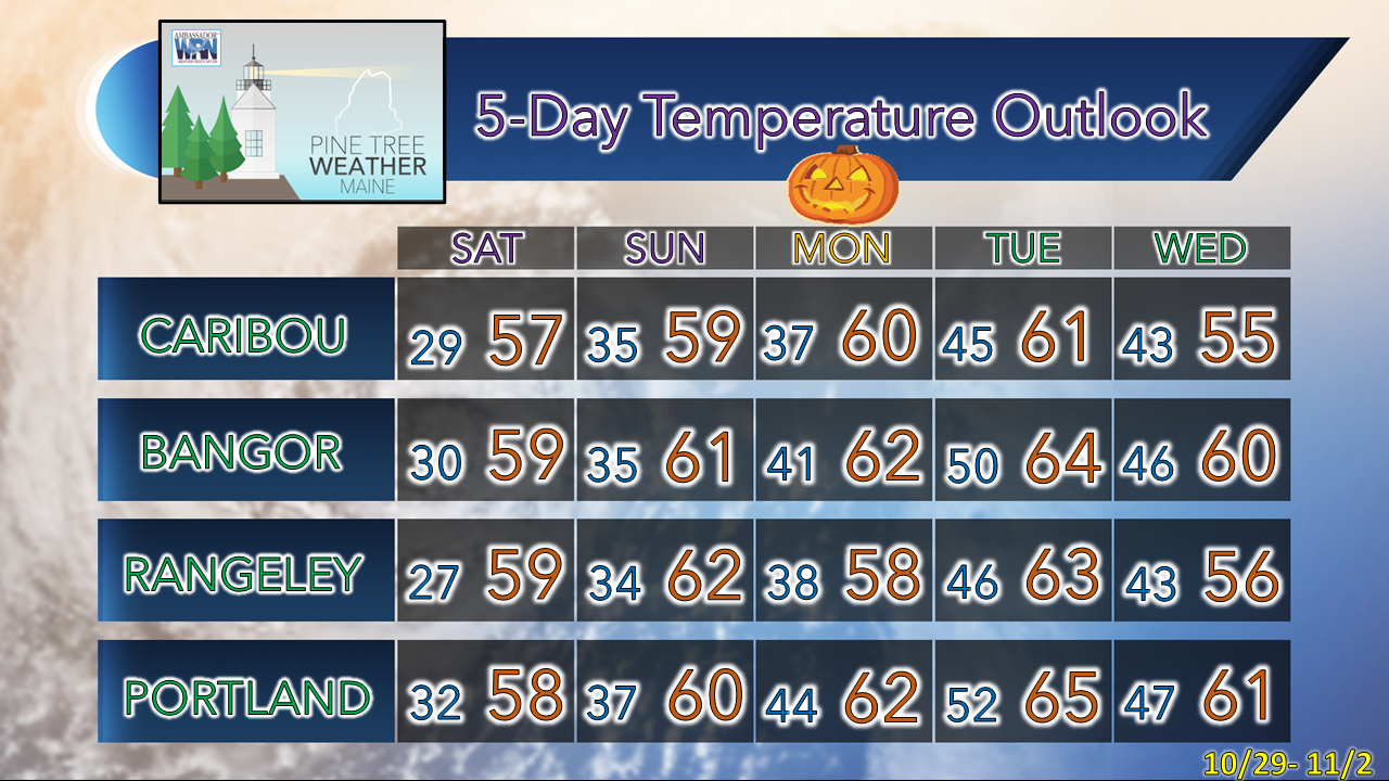 Upcoming winter SKYWARN spotter training sessions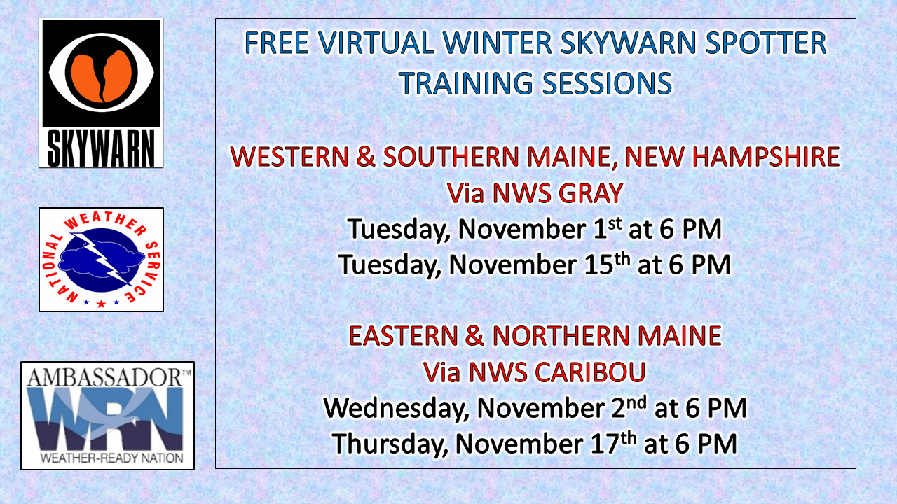 LINKS TO REGISTER: For western and southern Maine and New Hampshire, please register with NWS Gray. For eastern and northern Maine, please register with NWS Caribou. These are fast paced, fact-filled, and informative sessions for weather enthusiasts ages 16 and up, younger is good with an adult present. These sessions are completely FREE of charge. NOTE: The forecast information depicted on this platform is for general information purposes only for the public and is not designed or intended for commercial use. For those seeking pinpoint weather information for business operations, you should use a private sector source. For information about where to find commercial forecasters to assist your business, please message me and I will be happy to help you. |

Mike Haggett
|


