Here we go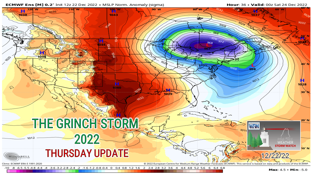 Hopefully you are all prepared and ready to go. Watching other forecasters in other areas that will be dealing with impacts are saying the same things, power outages, flooding on land and sea, all with a flash freeze chaser at the end. Several hundred thousand people (maybe a million with Canada included?) are going to lose power in the areas affected. I am still running with the idea of 300,000 dark in Maine, which I hope would be the biggest bust forecast in my 11 years of doing this. I am cheering for myself to be wrong. It's both comical and scary to see even the model ideas look like the Grinch as I have been tracking it all week. Just look at it... a gnarly, sinister one-eyed Grinch. Moving on... The wind she's gonna blow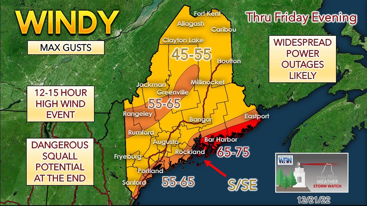 No changes in my thinking here. Most of the state is under High Wind Warning, the western foothills under a Wind Advisory. Just because the foothills is under a Wind Advisory, if you live there, please don't think you are going to escape and have the mentality "Oh, it ain't going to be that bad!" You aren't off the snide here. An inversion may cap it off for a while, but those areas will see some hefty gusts when the front moves through, and deal with power outages as well. The timing of the wind: Increases over the south and west Thursday 10 PM, MidCoast 11 PM, Bangor / DownEast Midnight, North by 6-7 AM Friday. Gusts increase 1-2 AM south and west, 2-3 AM MidCoast, 3-4 AM Bangor / DownEast, north 10 AM. High end gusts arrive 5 AM south and west, by 6 AM MidCoast, 7 AM Bangor / DownEast, Noon for the north. High end gusts decrease 2-3 PM south and west, 3-5 PM MidCoast / Bangor / Bar Harbor, DownEast and north 5-8 PM. The breeze remains stiff with gusts 30-45 mph for the coast, mountains and north overnight, gradually diminishes over the coastal plain & Bangor with gusts 25-35 mph into Saturday morning. Breezy continues at some velocity through Monday. If you still have power on Saturday morning, you are in business. Help out some other poor chaps that are in the dark and may need a coffee and a place to thaw out. A touch of winter to start offA winter weather advisory is posted for the mountains and north as a precursor to the rain on the way. 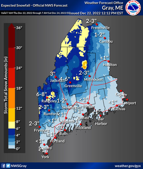 Ski country, you are cheering for this. I can't say this will save your blades from abuse on Saturday, but it can't hurt to have some of the fresh snow absorb some of the rain on the way. 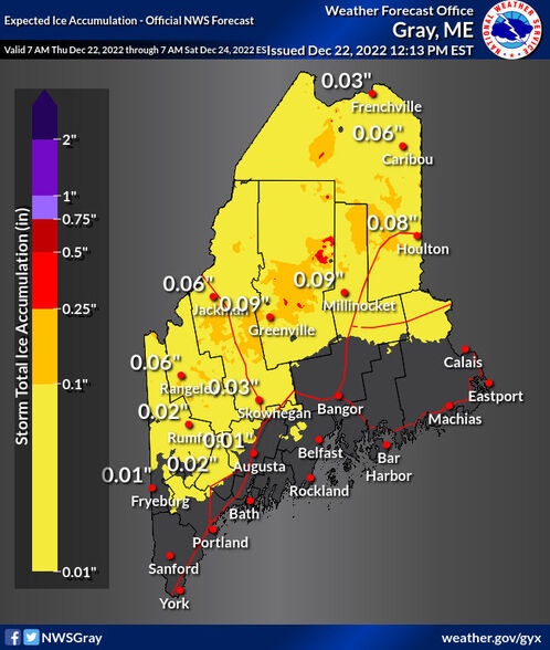 As warm air moves in from the south/southeast, cold air damming from an area of high pressure to the northeast is expected to intrude at the low level and set up the potential for a period of freezing rain perhaps mixed with some sleet. Not sure if Bangor completely escapes or not, so keep that in mind and watch you car thermometer. Anything less than 37° on the car thermometer could mean 32° or less on the road surface. Timing of precipitation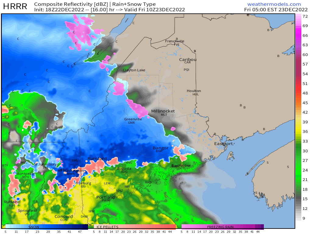 5 AM Friday - Greenville, Bangor, and Bar Harbor south and west are seeing either snow, sleet, freezing rain or rain. For you early birds that are on the road early, allow for extra time and expect this not to be completely correct, especially in the foothills, Waterville, Augusta, Fryeburg and perhaps Lewiston. This idea may be a bit warm, so freezing rain, sleet and snow may be going on there. The closer to the coast, the wetter it will get. 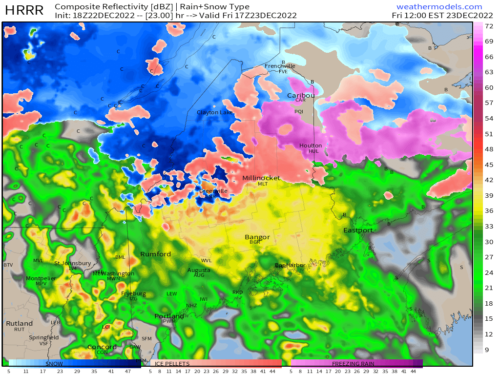 Friday Noon - By this point, if the mountains have not flipped to rain, they will be rather soon. Millinocket on up into Caribou maybe dealing with junk storm conditions (sleet, snow, freezing rain). The fire hose and free car wash may going on Bangor up towards Greenville over to Eastport. Southwestern areas, after going through all of that in the morning, will see more on the way. 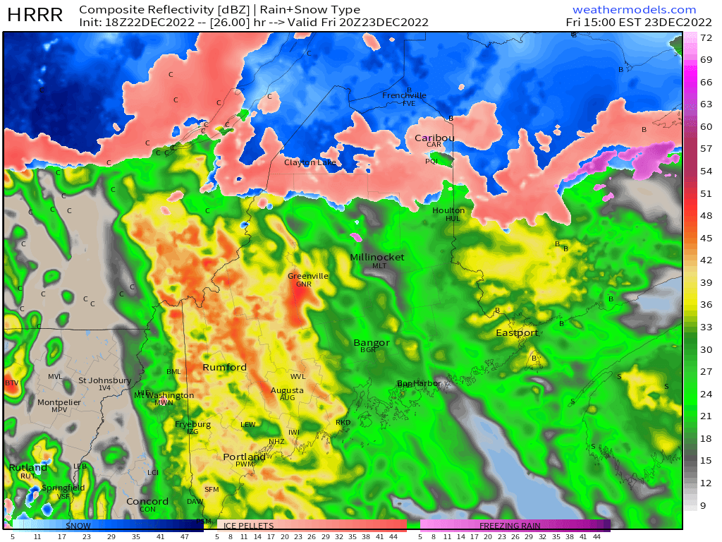 Friday 3 PM - This is where flash flooding could ramp up over the west as the power wash cranks on high. Thunderstorms are a distinct possibility in the afternoon. Not only is there the heavy rain threat, but also a downdraft wind threat as the low-level jet screams at 90-100 mph at 3,000 feet. Precipitation for all but the Allagash area may be flipping to rain at this point. 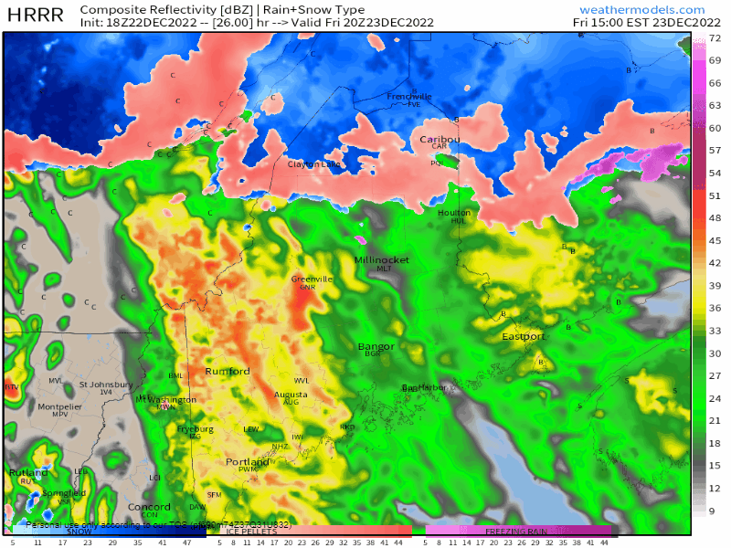 Friday 3 PM to Saturday Midnight - I specifically looped this part to note the frontal passage. I am concerned that with the extremely strong frontal boundary that there may be a squall line ahead of it with damaging wind, along with snow squalls on the back side that could make evening and overnight driving dangerous with reduced visibilities, white out conditions, and ice from the freeze up. If you are driving around at any time during this time, you really need to pay attention to what is going on. The situation can flip in blink. This is no joke here, and may be the most dangerous point from a driving perspective in the storm. The temps rise, then the freeze up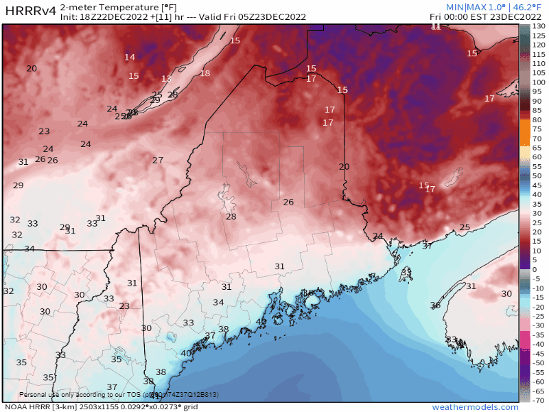 Friday Midnight to Saturday 7 AM - Here's a 30-hour loop of the rise to spring then the fall into the arctic abyss. I am seeing reports to temperature falling 20-30° in 5 minutes with this front. This has flash freeze written all over it. With all of the water and flooding from the rain, this is the final insult to be delivered from the storm. It may make you want to burn your Trans-Siberian Orchestra records if you step outside and end up on the ground. You need to keep the salt and sand handy here. This is going freeze about as fast as a Zamboni resurfacing an ice rink. Onto the hydration... Rain and interior flooding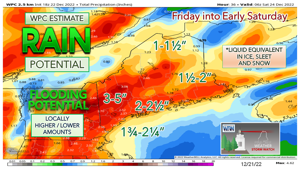 Minuscule changes here from the Weather Prediction Center from their ideas I have shared here over the past three days. Mentioned at length in yesterday's post about the snowpack ripening with the increase of dewpoints above freezing. It's looks like roughly a 12-hour span of that, and that is where the snowpack gets eaten up south and east of the mountains. This is the main concern for the flooding. Northern areas are likely to see low amounts of liquid, so there is no concerns for flooding issues there. 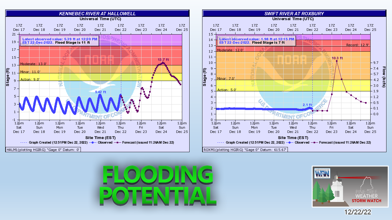 Of all the rivers south of the mountains I could get data for, this is the two areas I see with the greatest potential to flood. Water Street in Hallowell is going to be a disaster. The peak time of flooding appears to be around noon on Saturday when the temperature will be 14°. With no warm up to speak of to melt the horrific mess that is going to create until late next week, this is the place that will get the worst of it. The Swift River in Roxbury floods in the summer during a thunderstorm, so it's just another day there. The other river to watch will be the Saco in Conway / Fryeburg. Watch out for flash flooding and potential for washouts. 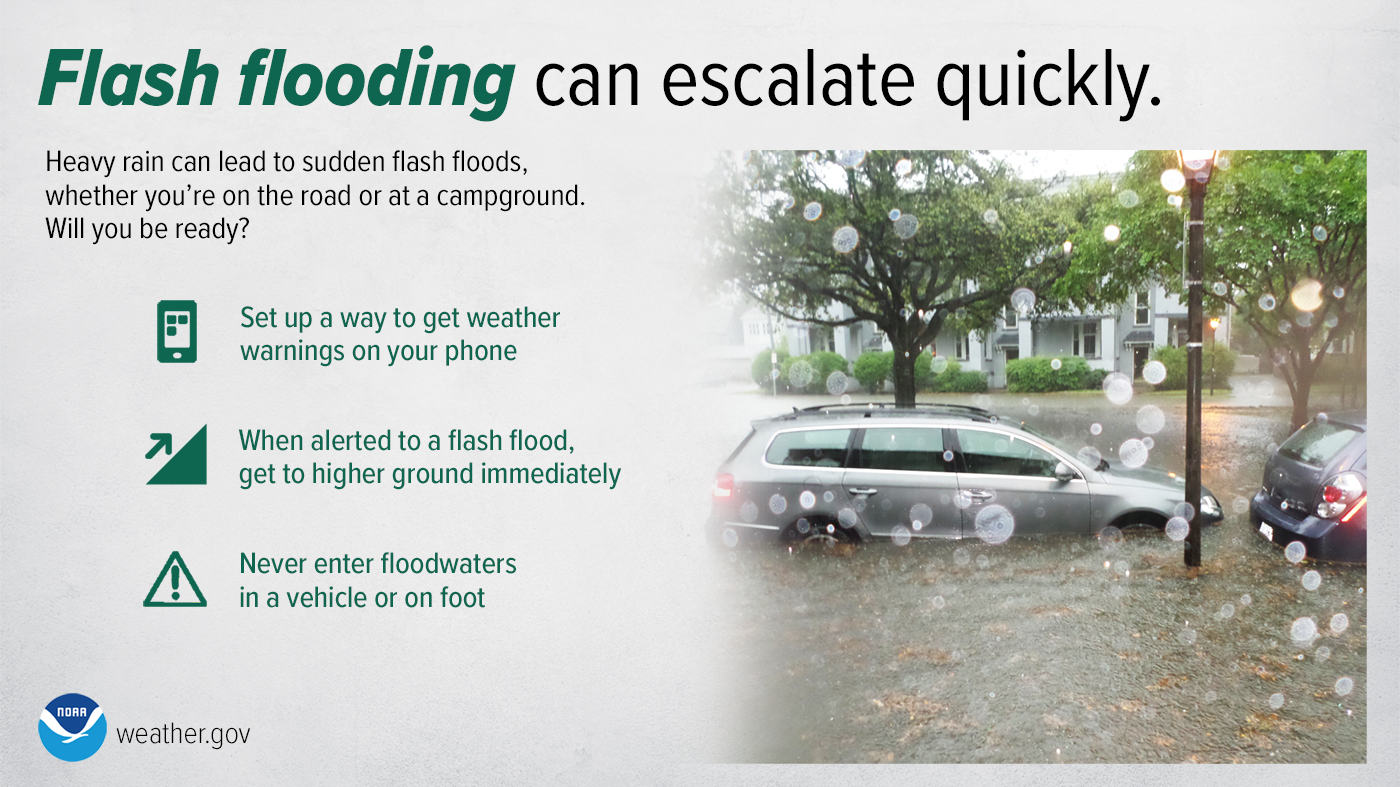 The coastal flooding idea is getting worse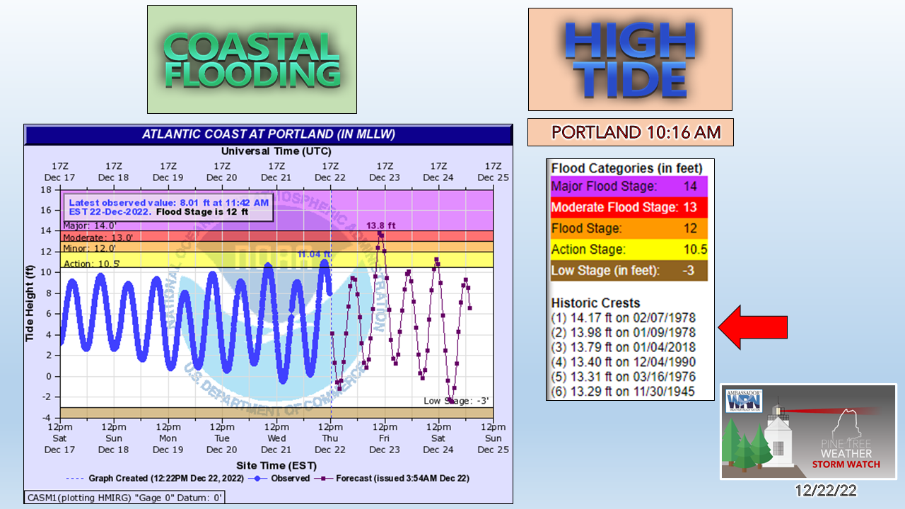 For those along the shorelines, this is a very concerning situation here. Towns with beaches are already blocking of roadways in anticipation of flooding. Astronomical high tides, freshwater runoff from the snowmelt, storm surge in the 2-4' range and the timing of the wind moving closer to the high water mark all adds up into potential for moderate to major coastal flooding. As you can see in the graphic, forecast high water in Portland is expected at 13.8'. If that verifies, that would put it 3rd all-time for recorded height. Some ideas put it higher than that, coming very close to an all time record. It will be wait and see on what happens there. Waves in 15-20' range will hammer the coast Friday and Friday night and slowly settle down Saturday into Sunday. Some inundation is likely. For those that live along the shores need to pay attention to what is going on and be prepared to evacuate if told to do so. Storm coverage Friday is on Twitter. Godspeed. If you appreciate what I do, |

Mike Haggett
|