
Showers end, breeze kicks up Friday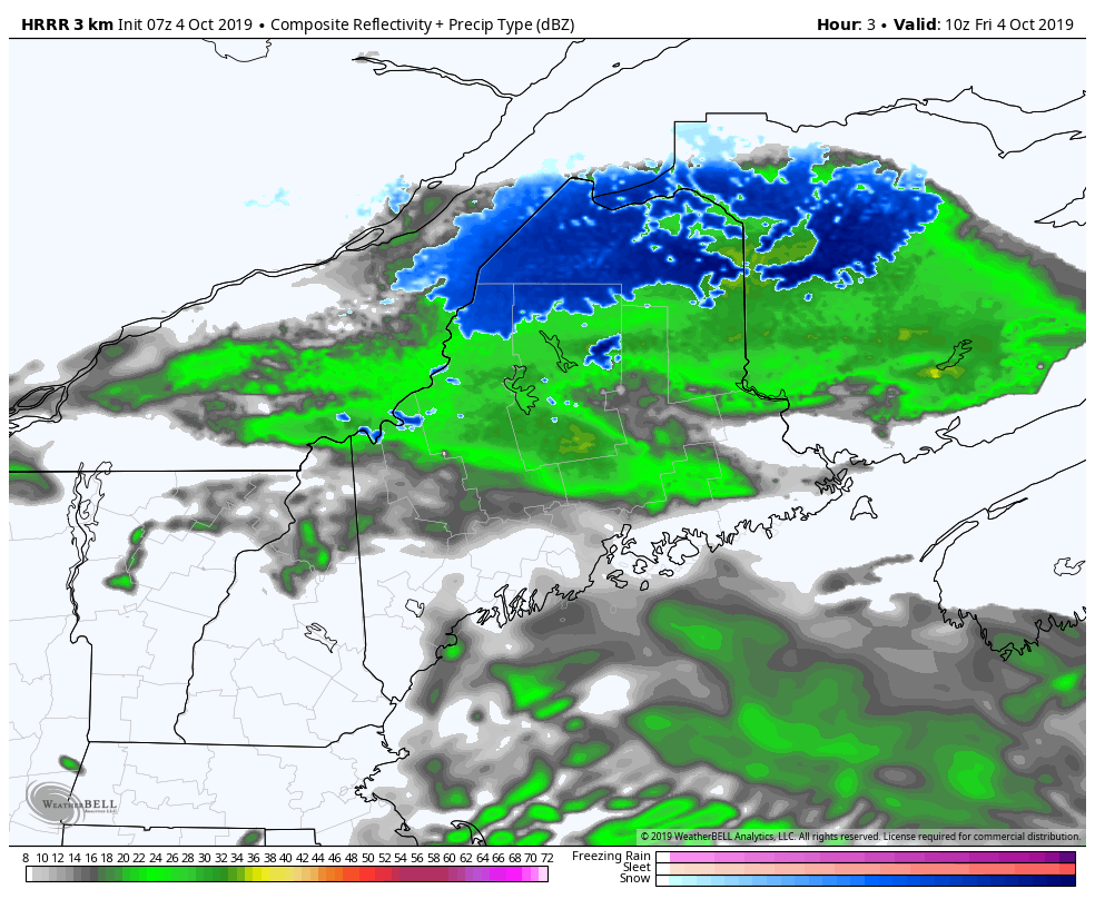 Steady rain and/or snow showers end quickly for most areas Friday morning. Some isolated spot showers associated with the passing upper level trough may pop over the western mountains, north and east this afternoon. As the trough continues east, any remaining showers appear to end by early evening. 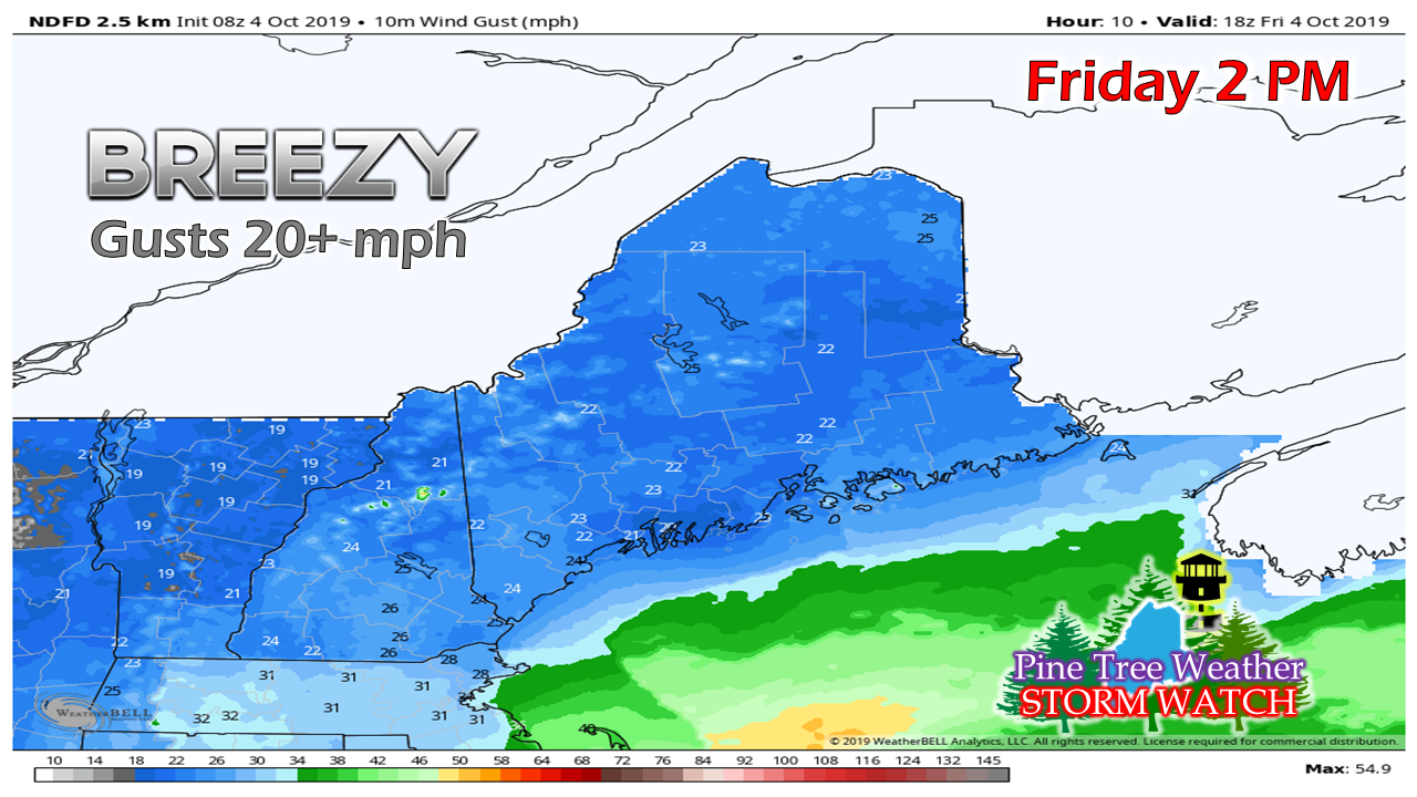 With the departing trough to the east and surface high moving in from the west, the breeze increases through the day. It's not quite a Flying Trash Can Alert but it may tip over a few barrels through the afternoon. The wind slowly settles down overnight. 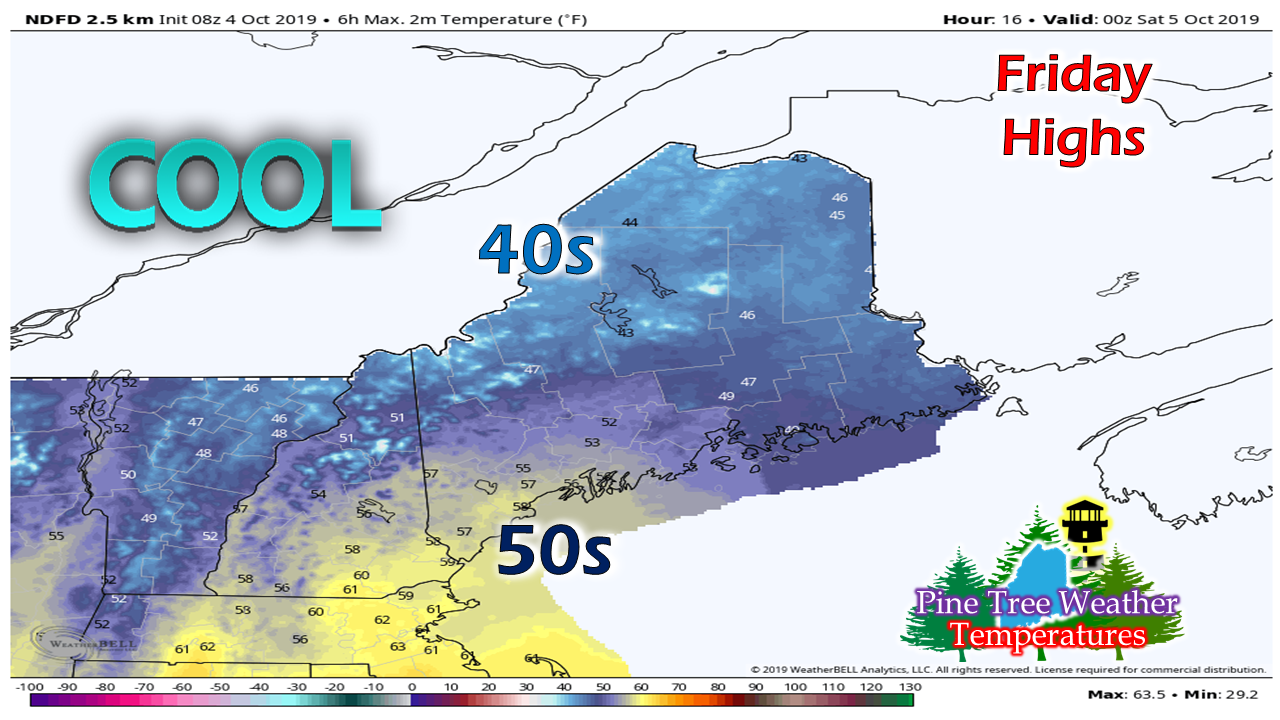 The temperatures for the day appear to run roughly 10° to 15° below the seasonal average. With the north breeze moving dry air in, it will feel cooler as wind chills could range in the 30s and 40s in areas through Friday evening. Frost threats Saturday and Sunday mornings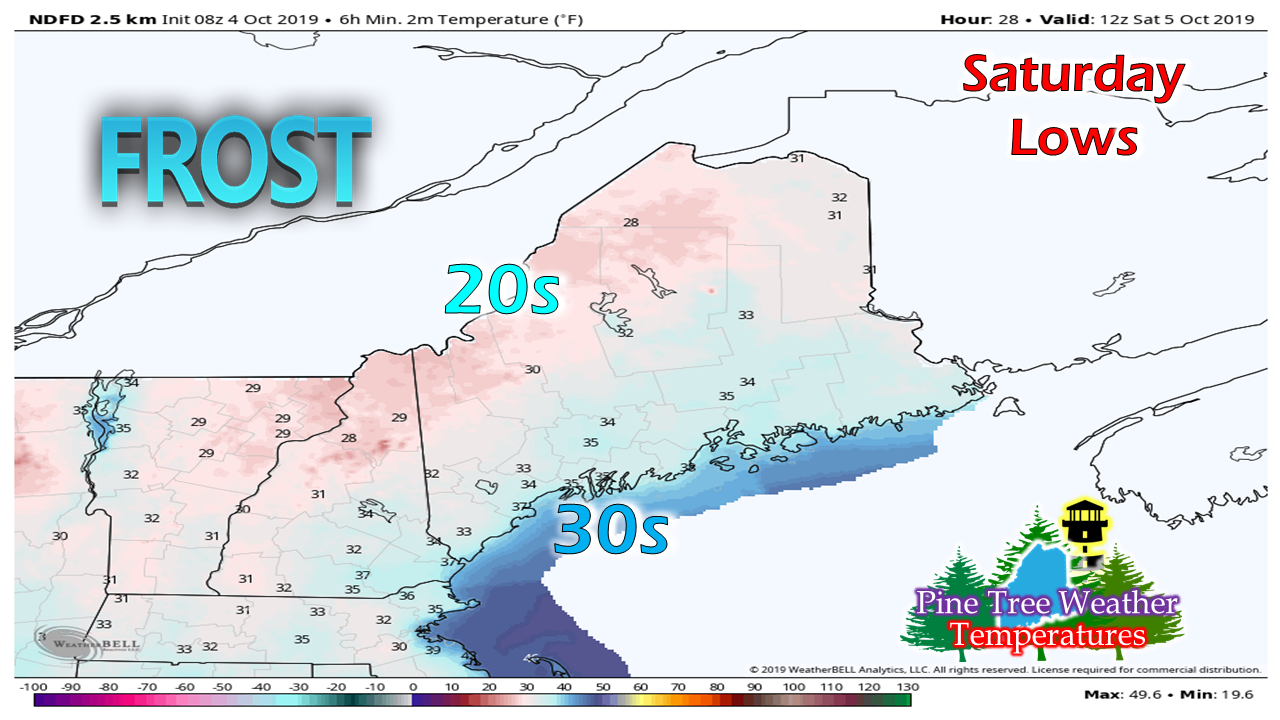 Frost advisories and/or freeze warnings have been issued by both the Gray and Caribou weather offices. This is a tricky forecast as it all depends on the wind. If the wind slacks off at some point in the wee hours of Saturday toward daylight, temps could dip into the 20s frost will develop quick. Cover up any plants as a precaution. 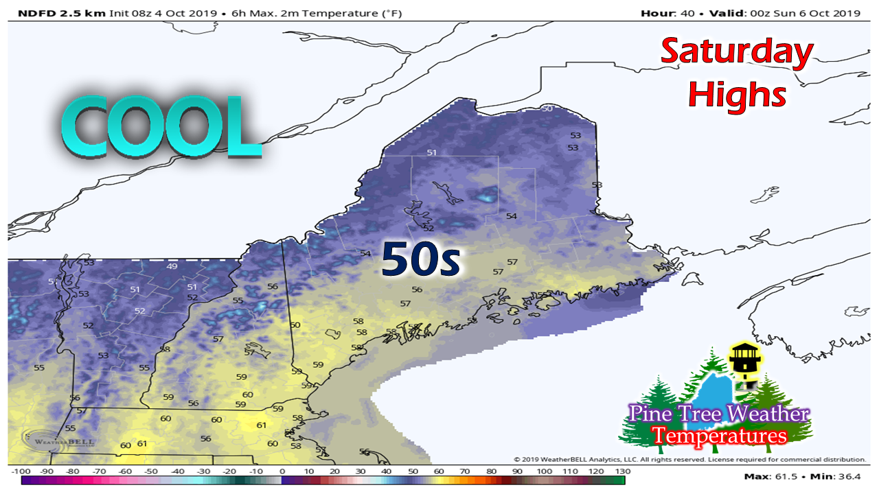 Abundant sun will be the rule of the day for Saturday, but it will be a bit on the cool side as temperatures appear to run roughly 5° below normal. Most areas will reach the 50s with 40s the high point on the higher hills. 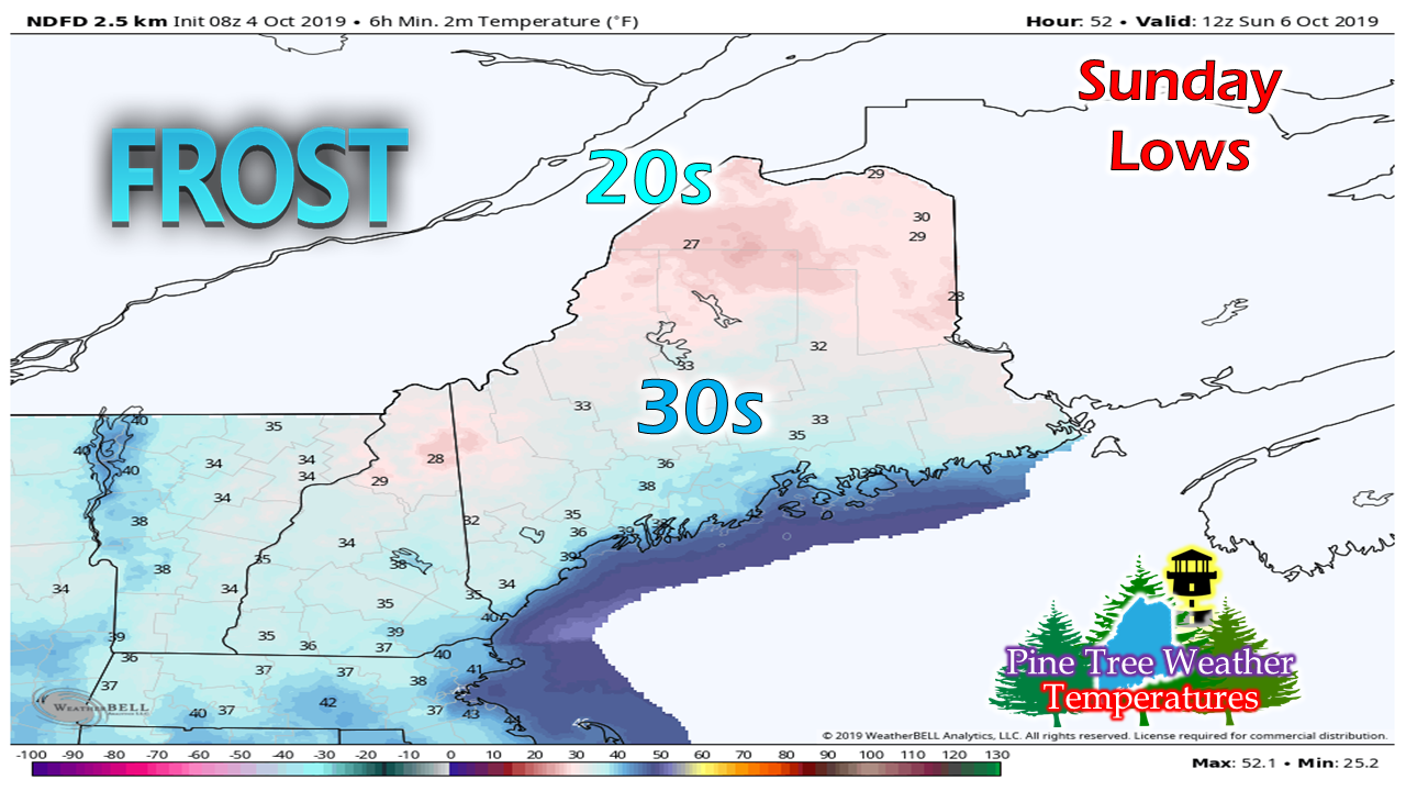 With clear sky, frost concerns arise again for Sunday morning. High pressure at this point may have shifted east enough to allow a southwest flow to develop which may keep the shorelines above freezing. As a precaution, it would be wise to cover up any plants of importance once again. 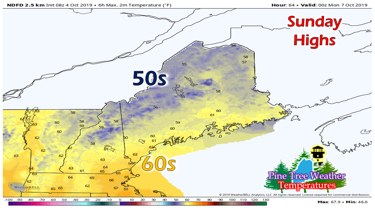 High temperatures for Sunday appear to be where they should be for this point of the season. Clouds will be on the increase during the day, and spot showers are possible ahead of the approaching frontal boundary on the way. Rain to start the work week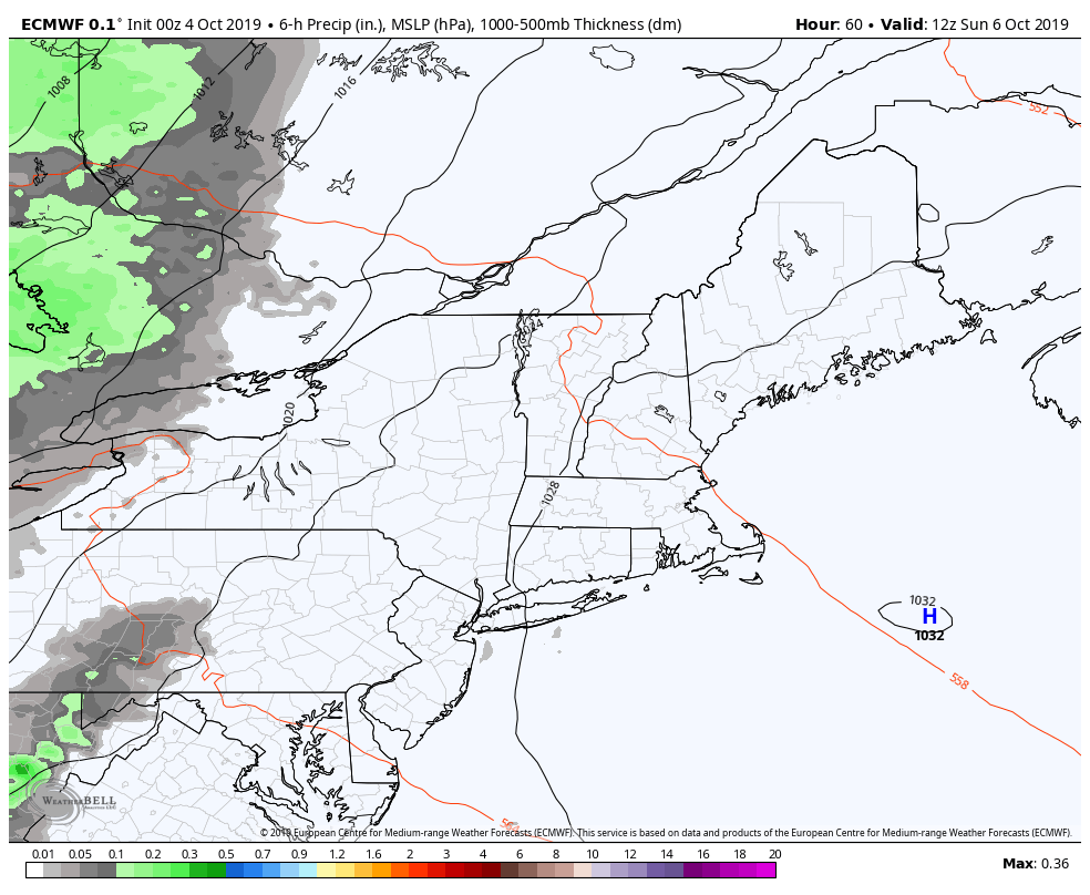 Guidance is indicating a more progressive nature with the forecast front on the way, which could cut down on rain totals. Steady showers develop over the mountains and north Sunday night into Monday morning and then move east in the afternoon and reach the coast Monday night. Steady showers taper off over the mountains, north, and south early Tuesday, and eastern areas Tuesday afternoon. A trailing area of low pressure may bring scattered showers to the north Tuesday afternoon and end in the evening. 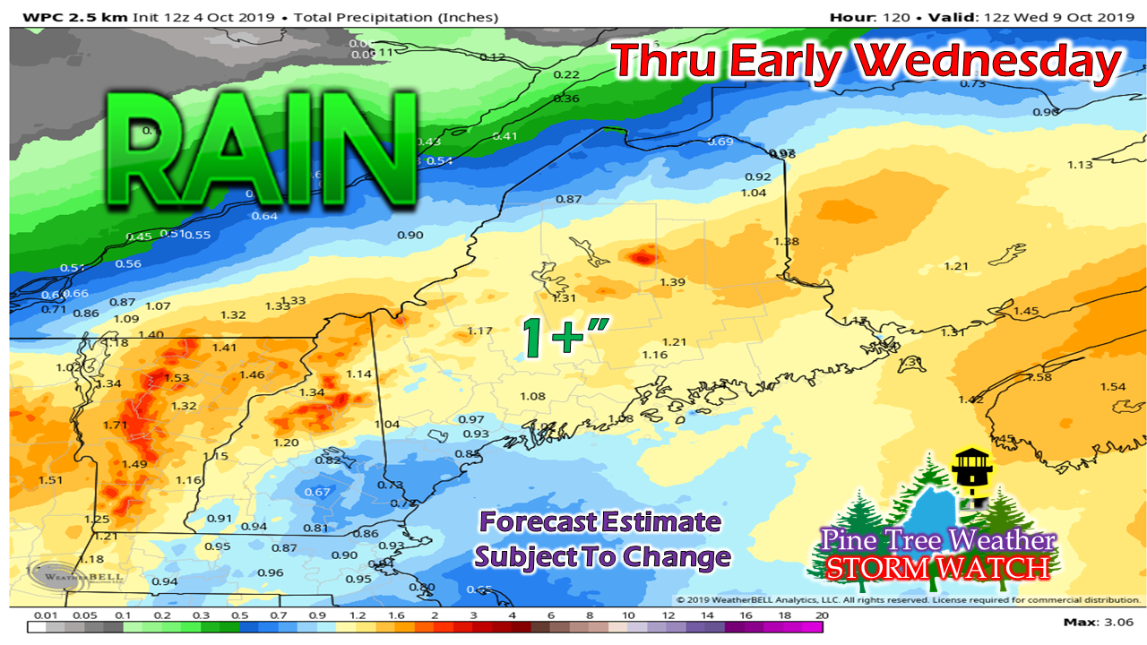 Western and eastern areas appear to get roughly an inch of rain from this as it appears for now. It's still a bit early in the game to nail down amounts. Since this front will tap into moisture from the Gulf of Mexico, a slow down in progression of the boundary could add additional rain totals. I think this is good estimate for now based on the latest trends, but confidence overall is low on suggested amounts for now.
Stay tuned... ► ► For the latest official forecasts, bulletins and advisories, please check in with the National Weather Service in Gray for western and southern areas, or Caribou for northern and eastern parts of Maine. Financial support of Pine Tree Weather is needed to keep operations going for 2020. Your help would be sincerely appreciated! For more information from me, please check the Pine Tree Weather Facebook page as well as my Twitter feed. Always stay weather aware! - Mike |

Mike Haggett
|


