
Travel hazards through the periodThursday will be a soggy mess as rain will vary with intensity through the day. There may be lulls in activity from time to time, but the main event works through Thursday afternoon into the evening and into Friday morning. Rain could be heavy at times in areas for the evening commute. Ponding on roadways and potential street flooding along with reduced visibility from heavy rain and fog could make driving a challenge. Add the wind increasing Thursday night into Friday and it could present "white knuckle" driving conditions on the speedier roads for the morning commute. Conditions will improve during the afternoon into Friday evening. Two phases of gusty wind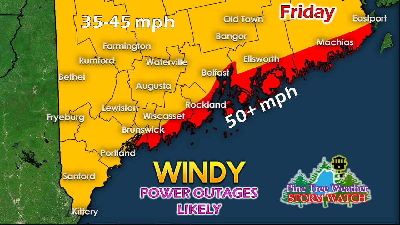 The main concern for the strongest wind comes late Thursday evening into Friday morning. Gusts from the south could exceed 50 mph for the MidCoast on up the DownEast shorelines between around 2 AM - 8 AM Friday. Over interior areas, the higher gusts will occur from the west-northwest behind the cold front Friday morning through the afternoon. 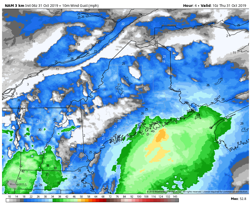 Forecast imagery shows the wind building over the Gulf of Maine Thursday and becoming stronger through the overnight hours. Gusts ride up along the frontal boundary on its approach and kicks east during the early morning hours. After the frontal passage, temperatures fall as wind from west-northwest intensifies, dragging crisp air down from Quebec and drying the area out Friday afternoon into early Saturday. High pressure settles over the region and calms the breeze by Saturday afternoon. Rain axis moving north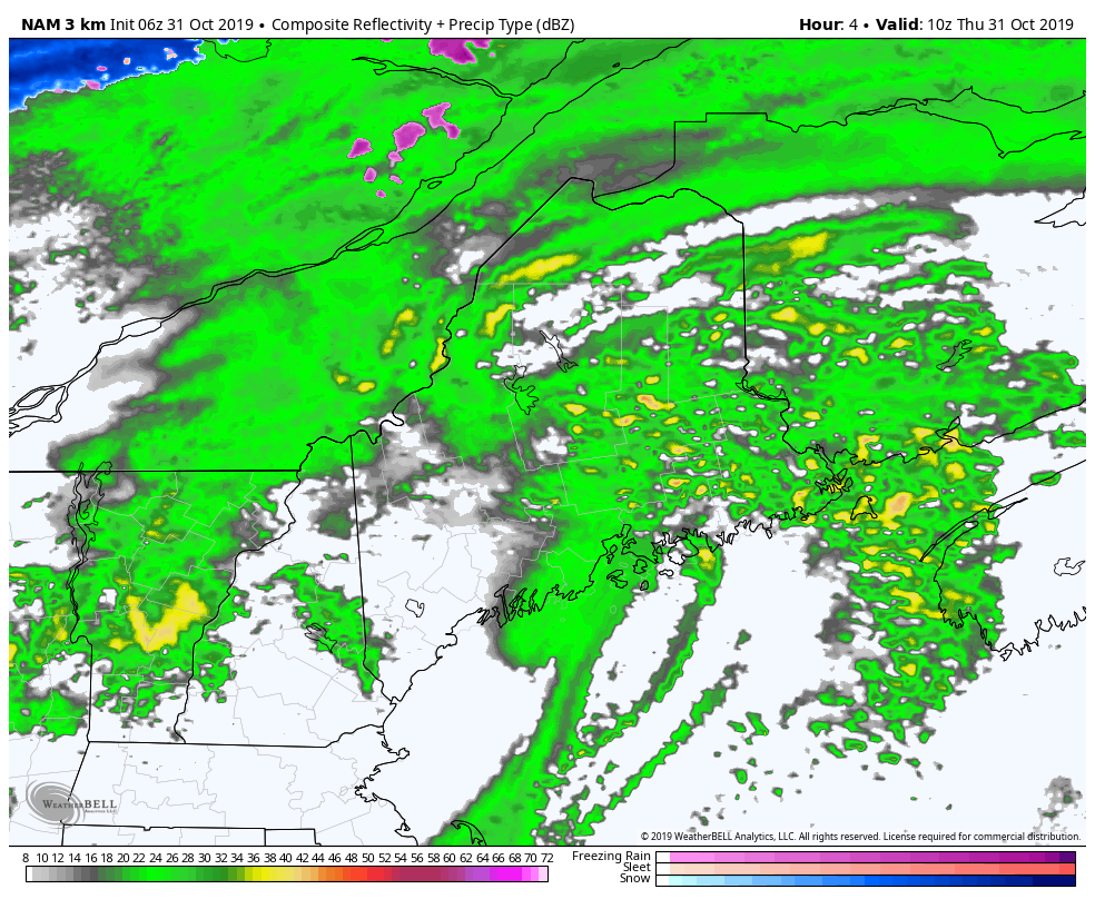 Showers will be off and on through the day Thursday, and become more widespread by Thursday evening. As the cold front approaches Friday morning, there is a risk for a thunderstorm, and a remote chance for a severe storm. Folks in the mountains may get an early morning rumble that may substitute for the alarm clock. Any severe storms that develop could contain damaging wind and hail. After the passage of the front, some light snow is possible for the higher elevations and the north, with little accumulation expected. 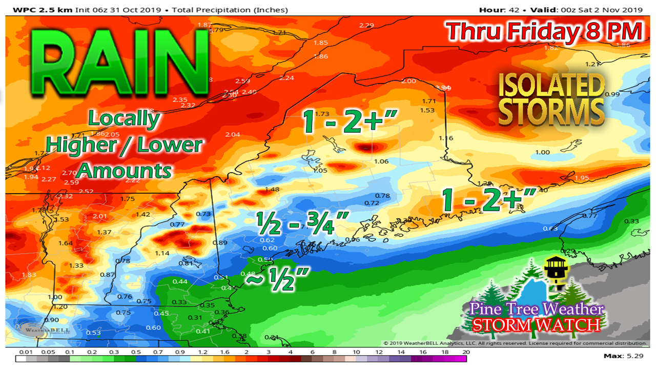 With the axis of rain moving more north into Quebec, that means lesser amounts are expected for southern areas. Rivers and streams around the mountains will need to be monitored for potential flooding from 2 or more inches of rain. Shorelines to get battered with surf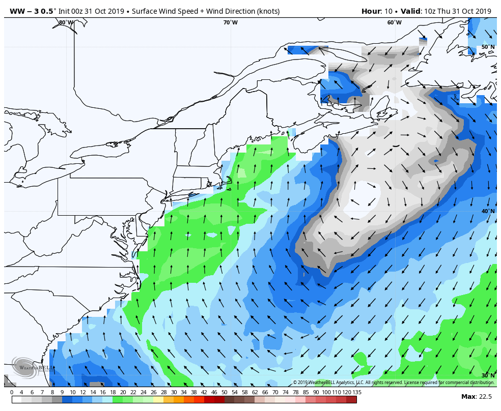 The good news for the shorelines is we are past peak from the recent king tides from the recent new moon. That said, the coast will get battered with seas upwards of 17 feet Friday morning. High tide occurs during the 2 AM hour Friday morning. Gusts from the south may cause splash-over and minor flooding at that time, but will recede with the outgoing tide towards daylight. After the cold front passes by, the waves subside through the remainder of the day and settle down by Saturday morning. In addition to the seas, some minor beach erosion is possible.
► ► For the latest official forecasts, bulletins and advisories, please check in with the National Weather Service in Gray for western and southern areas, or Caribou for northern and eastern parts of Maine. ► ► DONATION DRIVE UPDATE - $840 shortfall for the year ahead! You can help keep Pine Tree Weather going with a donation of any amount now through VENMO @PineTreeWeather, a monthly donation on Patreon or messaging me on Facebook or Twitter to send a check in the mail. Thank you for your support! For more information from me, please check the Pine Tree Weather Facebook page as well as my Twitter feed. Always stay weather aware! - Mike |

Mike Haggett
|


