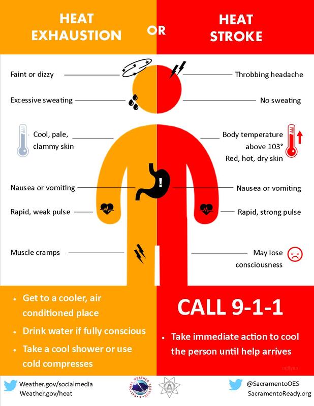
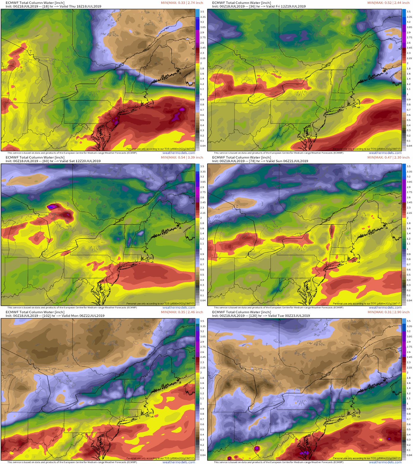
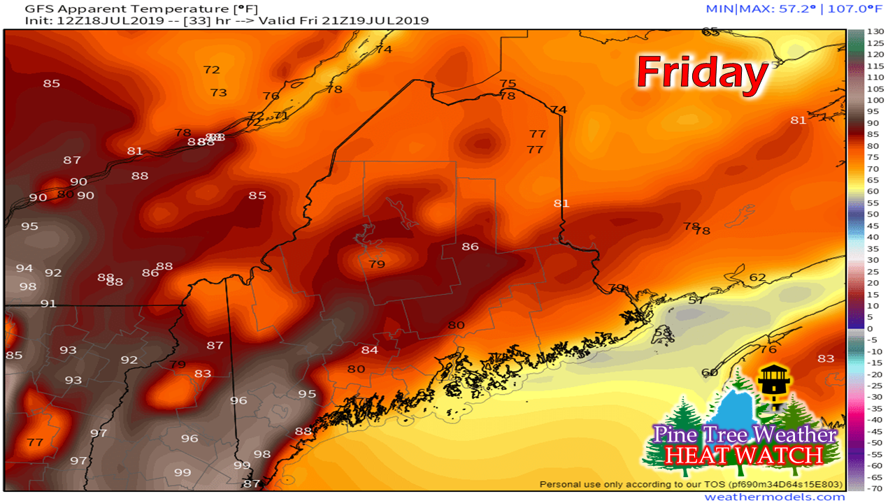
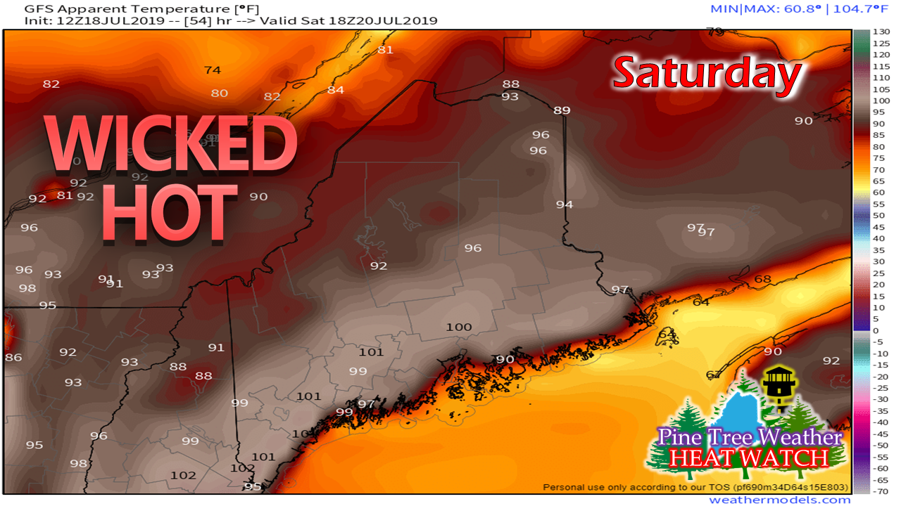
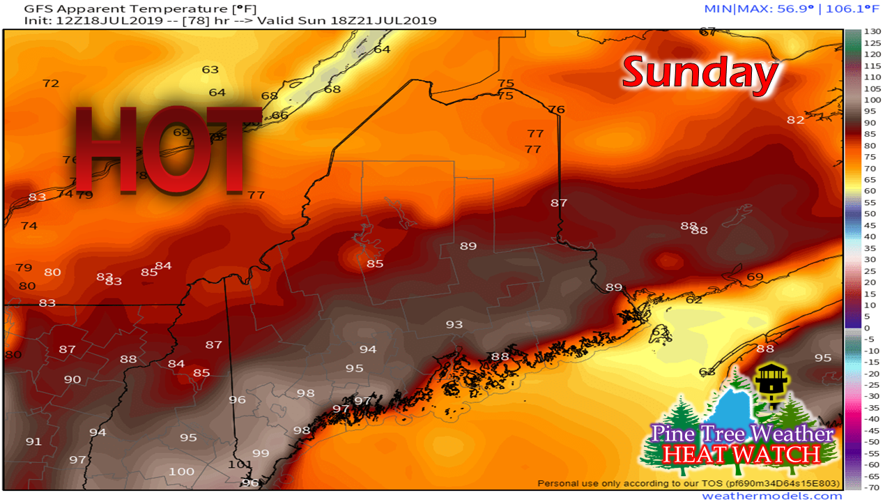
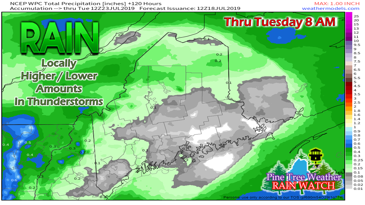
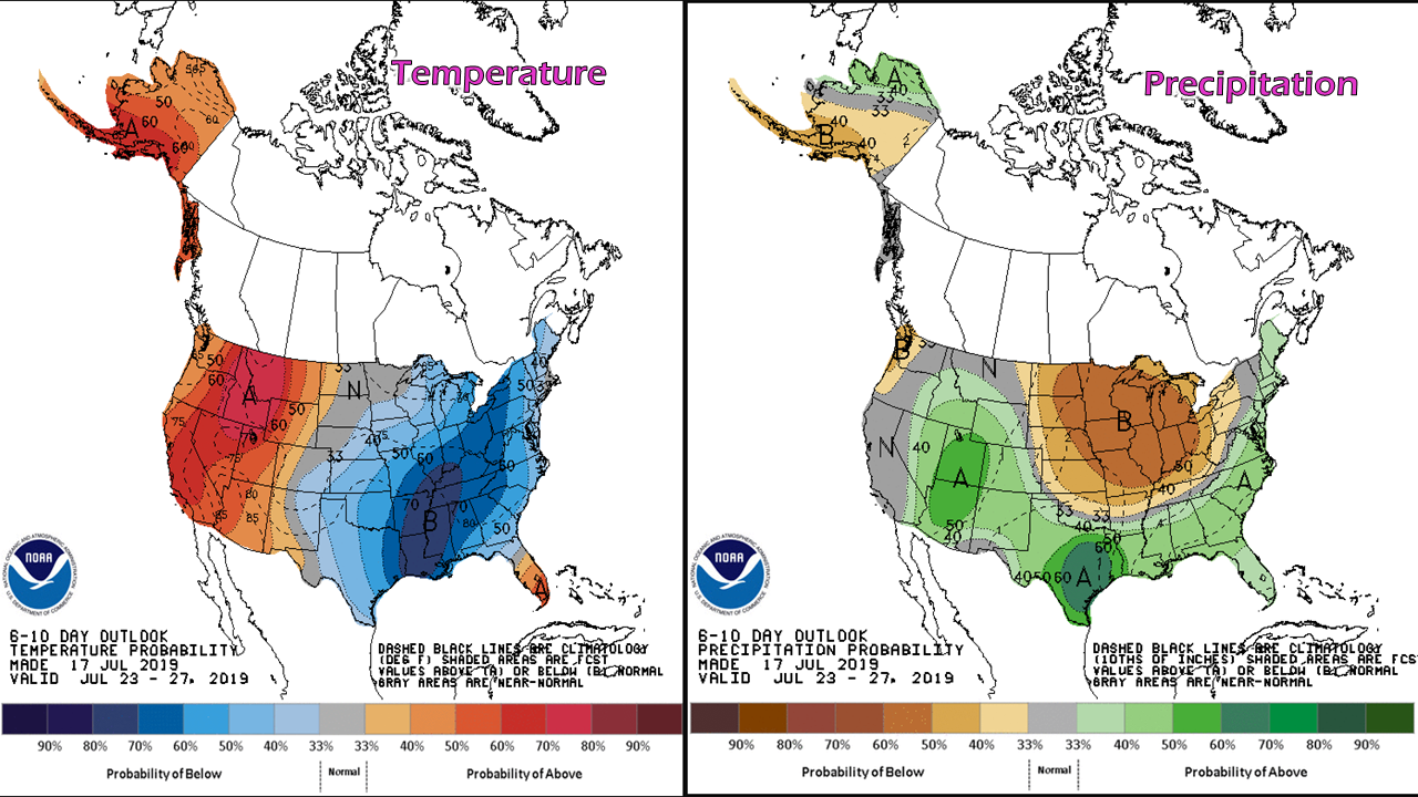
Those lazy, hazy, crazy days of summerIt's just going to be hot for much of the state over the next few days. If there is a place to escape the worst of the heat, I'd suggest the shorelines from the peninsulas of the MidCoast to DownEast areas. The Allagash may not roast as bad as other interior areas. Other than that, it will be toasty, so plan accordingly. Know the signs for heat related illnessesMy personal experience here. On July 4th in 2018 I played golf with my wife and daughter. Those that remember, that day was hot and humid affair. I developed heat stroke that afternoon. I totally ignored the warning signs, thinking "I'm going to make it". I was a mess for two days after that, and it ruined the weekend. Age does not matter here. Heat stroke can happen to anyone, including the pets. For those who run or need to get yard work done, do it early. Find someplace cool to be by late morning. Hydrate with plenty of water, Gatorade or Powerade. Lay off the alcohol. I could tell you a personal story about heat stroke with booze, but I will skip it for now. Maine sizzles through SundayI prefer showing precipitable water amounts versus dew point temperatures in this case as it shows the humidity levels a bit better. The water content in the air will increase steadily over the next three days. While Friday will be a muggy one, Saturday and Sunday will be the "weather you can wear" days. As the cold front approaches Sunday afternoon, the coastal plain will see the most humid conditions in the three day range. The front will clear out most of the humidity, and next week appears to be much more comfortable. If there is an area where an official "heat wave" is likely to occur, it's southwestern areas. Lewiston, Fryeburg, and Sanford will be in the running for sure. Saturday will be a roaster for all areas. The heat index of 100°+ is a strong possibility, even along the southwest coast. For those heading to the ocean beaches, keep in mind high tide comes at mid-afternoon through the weekend. Pick your spots accordingly. Northern areas will get relief as the cold front sags down on Sunday. For the coastal plain, this will be the most humid day of the weekend. The heat indices depicted here may be a bit underdone. I suspect the century mark could be achieved over southwestern areas again. NOTE: Keep in mind there is a good chance for record high minimums at night through this period. Much of the southwest interior on up into the western foothills may stay above 70° for overnight lows. The mountains, central highlands and north should cool down Sunday night. The coastal plain is likely to be muggy through early Monday. Rainfall outlook through early next weekFolks in the mountains and north should keep their eyes peeled for thunderstorms on Saturday. The cold front coming through on Sunday may bring some widely scattered showers and thunderstorms for the north and mountains during the day, and for the coastal plain towards the evening. While the atmosphere will rich with water content, the front appears to have little energy with it to cause widespread precipitation. At this point, I expect any rainfall to be localized. Where rain comes could be very heavy, with localized flash flooding a concern. Outlook through next weekWe're going to take a bit of a break from the heat next week. We'll continue to be in the west to east zonal flow pattern, which brings weak fronts through the region. This keeps the showers in the mountains and north, and coastal plain on the dry side. Thank you as always for your support!Do all you can to stay cool this weekend. Watch the kids and the pets. Please check in with the senior citizens in your neighborhood.
► ► For the latest official forecasts, bulletins and advisories, please check in with the National Weather Service in Gray for western and southern areas, or Caribou for northern and eastern parts of Maine. Please consider supporting Pine Tree Weather ► ► Your financial donations are much appreciated to keep this site funded and for further development. FUNDRAISING FOR 2020 BEGINS SOON! I sincerely appreciate your support not only financially, but also in sharing my efforts with others. For more information from me, please check the Pine Tree Weather Facebook page as well as my Twitter feed. Always stay weather aware! - Mike |
Mike Haggett
|

