Areas of fog to start the day Tuesday, with hazy sunshine likely by mid-day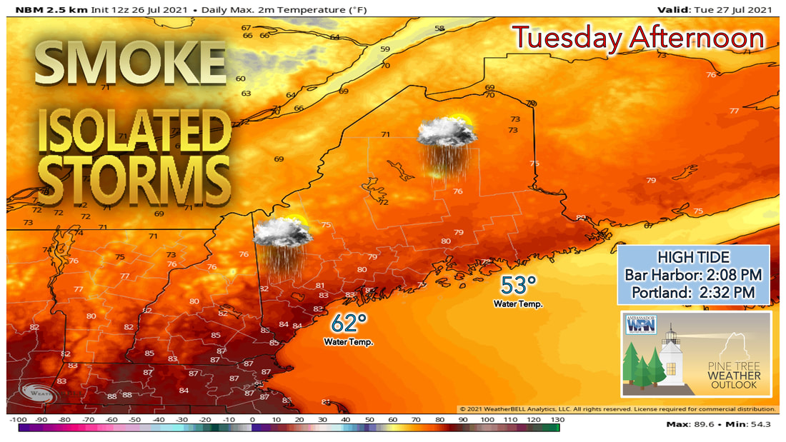 Showers and thunderstorms are likely Tuesday afternoon as a cold front moves through the area. Wednesday brings a return to sunshine across the area with relief from the humid air. That is short-lived heading into the latter half of the week and into the weekend. Tuesday morning starts with most places a few degrees on either side of 60 before the sun rises. Areas of fog are likely to develop through the overnight hours, which could make traveling Tuesday morning more difficult. Just make sure to leave a few extra minutes heading out the door on Tuesday in case you do encounter any fog. 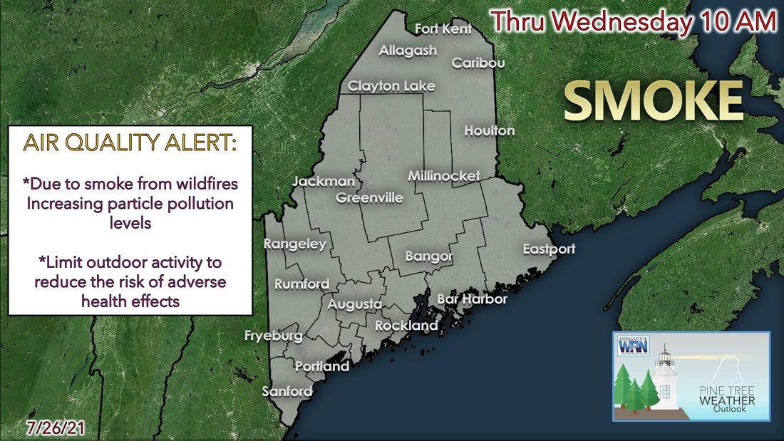 Once the fog burns off Tuesday morning, most of the state will likely be left with hazy sunshine through the mid-morning and early afternoon hours. This is thanks to the wildfires that continue to burn in the western part of the U.S. and the upper-level wind pattern continuing to bring that smoke to the east. The National Weather Service has issued an Air Quality Alert because of this smoke in the atmosphere. This Air Quality Alert is geared more towards individuals who are sensitive to increased levels of particulate in the atmosphere. This includes the very young, the elderly, and those with pre-existing respiratory problems such as asthma and or heart disease. The Maine Department of Environmental Protection recommends that individuals consider limiting strenuous outdoor physical activity to reduce the risk of adverse health effects. You can find the latest air quality information online at maine.gov/dep/ or by calling the free air quality hotline at 1-800-223-1196.Showers and storms possible Tuesday afternoon Showers and storms possible Tuesday afternoon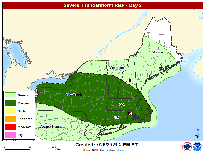 Heading into Tuesday afternoon, the Storm Prediction Center has issued a marginal risk for severe weather just to the south of the state for the day Tuesday. Meanwhile they have issued just a general risk for thunderstorms for southwestern 2/3 of the state. Keep in mind that just because we're not under a marginal risk for severe weather, doesn't mean we won't see any severe storms. There is still a chance, although lower than places through southern New England, for some of these storms to produce gusty winds as they pass through the area Tuesday afternoon. 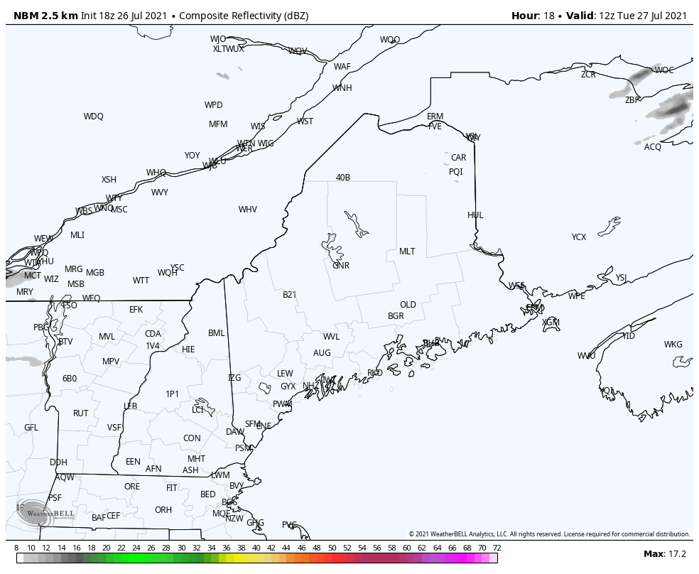 The best chance for showers and storms will likely be the southern and western parts of the state. The severity of some of these storms likely will depend on what areas see hazy sunshine during the morning and early afternoon hours Tuesday. Areas that see more hazy sunshine will likely warm into the lower 80s during the day, and likely provides the instability needed for some of the stronger storms. High temperatures in the northern half of the state, where the cold front passes through first, will likely only make it into the lower 70s, while southern areas that get stuck with the humidity during the day once again likely climb into the upper 70s and lower 80s. A break from the showers and storms Wednesday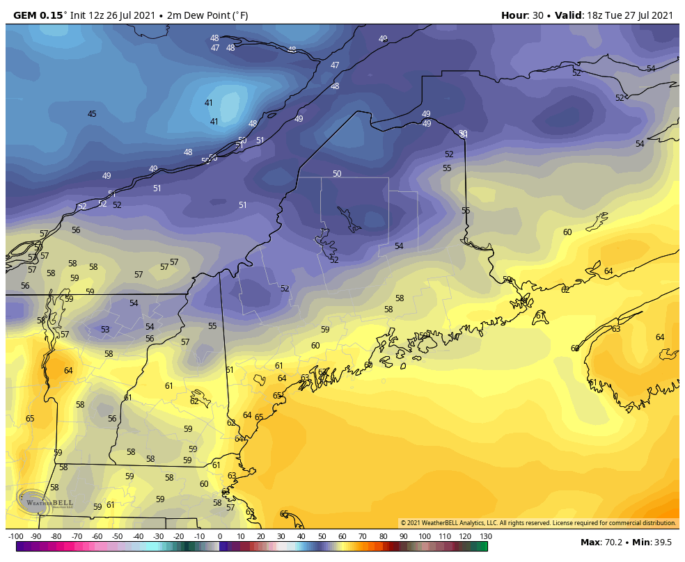 Wednesday looks to bring us relief from the humidity as northwesterly winds bring cooler and drier air into our region. The northwesterly wind is thanks to a high pressure system sitting to our north and west, that will slowly slide its way off the coast of the state during the evening hours on Wednesday. 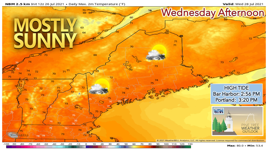 With the sunny skies likely Wednesday, temperatures likely will be cooler than average heading into the afternoon on Wednesday. With high temperatures likely climbing into the mid-70s during the afternoon, it won't be cold by any means, but more of a nice summer day. Keep in mind that high tide will occur mid-afternoon on Wednesday, so folks heading to the beach that day will want to plan accordingly. Unsettled weather continues late week and into the weekend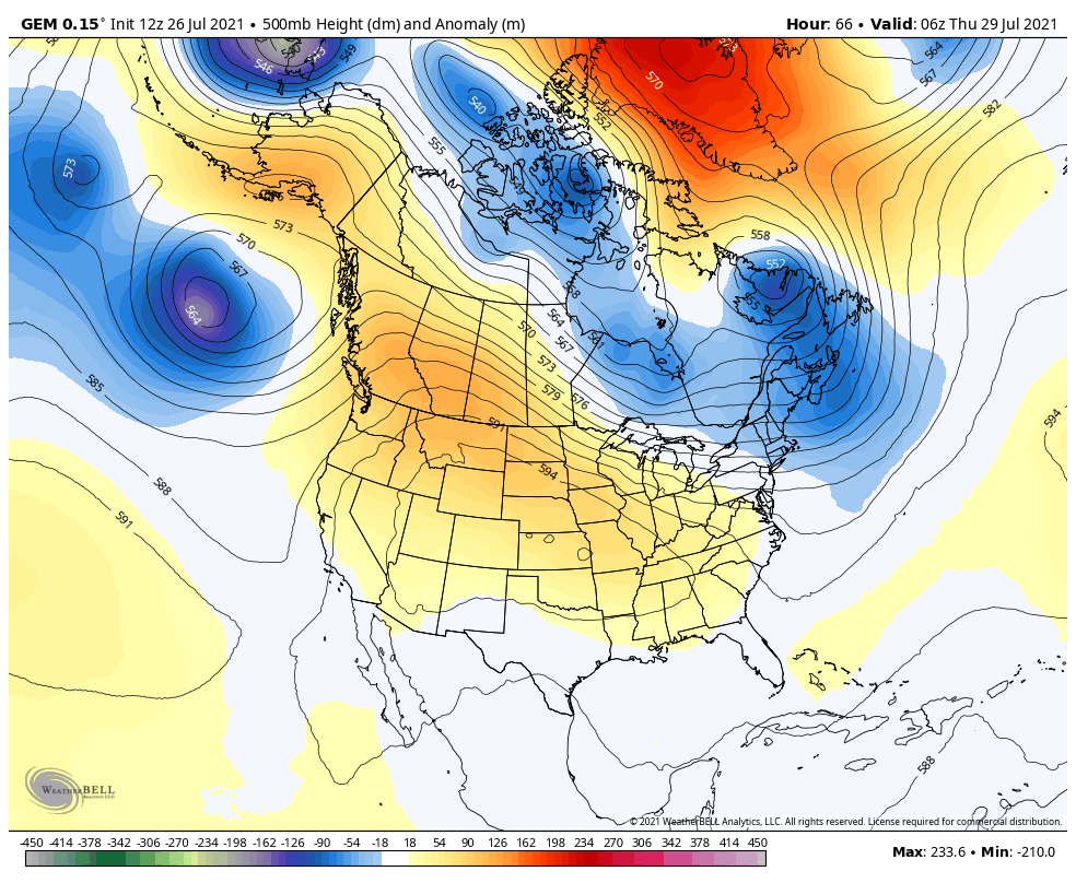 The overall pattern heading through the end of the week and into the weekend remains an unsettled one. An upper-level trough will continue to sit over New England, bringing chances of rain showers into our area Thursday night and into the morning hours of Friday. While the weekend doesn't look entirely wet at this point, shower chances will remain in the forecast, especially heading into the day Sunday. 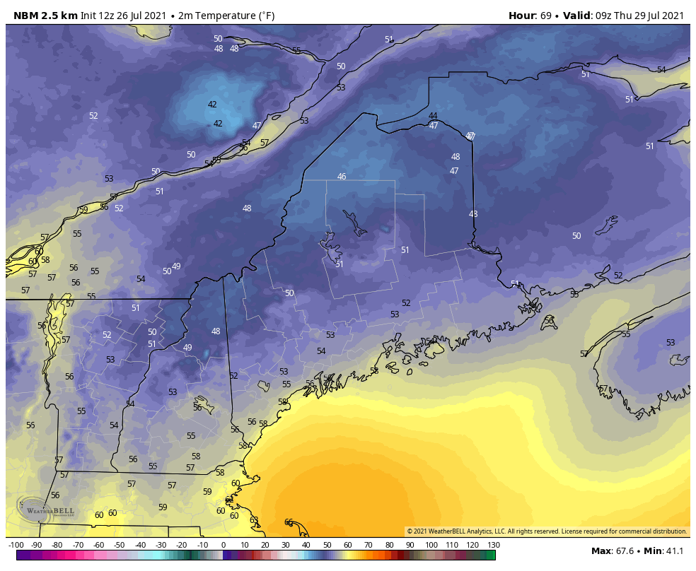 Temperatures through the latter half of the week actually remain below average. This is thanks to the upper-level trough setting up overhead during this time, resulting in cooler air filtering in from Canada during this stretch. By no means will it be cold during this time, with high temperatures still likely to climb into the 70s, but it'll feel cooler compared to some of the heat that we saw earlier in the summer. Dew points remain comfortable through the weekend, with Sunday feeling slightly sticky as dew points climb back close to 60 degrees. Air Quality Alert Do you know what to do if an Air Quality Alert is issued? Stay inside, stay informed, minimize your use of vehicles and other gas-powered machines, and do not burn waste or other items. Visit weather.gov/safety/airquality to stay Weather-Ready. Temperature outlook through next ThursdayIt looks as though the cooler pattern is here to stay looking at the temperature outlook. Most places across the state will likely remain at or below average temperature heading through the extended forecast. No significant sign of heat is in the forecast, so enjoy the cooler stretch as a it is a rarity for this time of year. 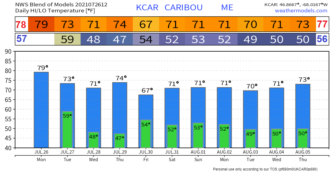 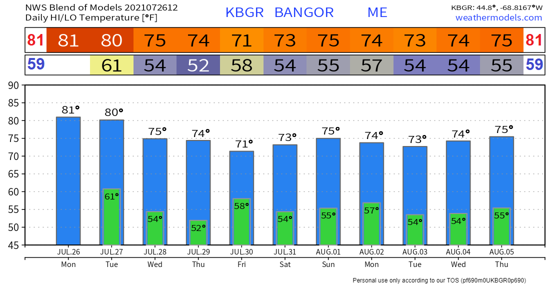 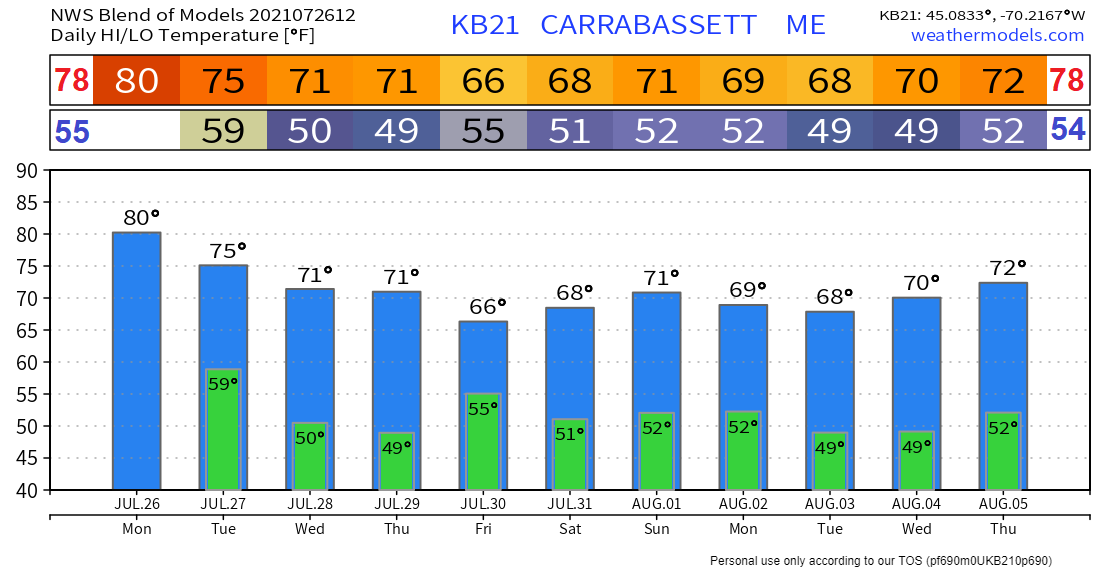 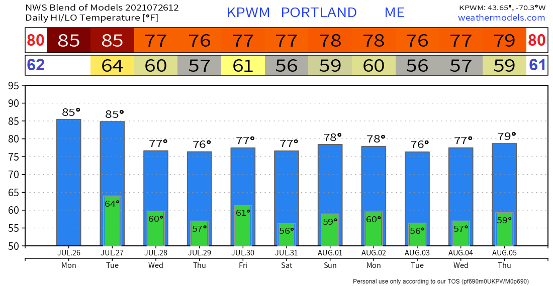 Be prepared to receive alerts and stay updated!
For more information in between posts, please follow Pine Tree Weather on Facebook and Twitter.
Thank you for supporting this community-based weather information source which operates by reader supported financial contributions. Stay updated, stay on alert, and stay safe! |

Mike Haggett
|