
|
Full warning, I am going to make this one of my nerdier posts. Often times I show you the basics of precipitation loops and temperatures, but there is so much more to it than that. I tend to focus on specifics, which is important, but given the pattern we are in, it's the same potential impacts through the first of the week. Heat and humidity will be around, along with the risk of showers and strong to severe storms over the next several days. Also, a mention of appreciation to Mark LaFlamme of the Lewiston Sun Journal who included my thoughts in a column posted online and, in the paper, Hot enough for ya? Locals seek relief from ‘juicy air’, talking about the heat and the pattern. A look at a Bermuda High from above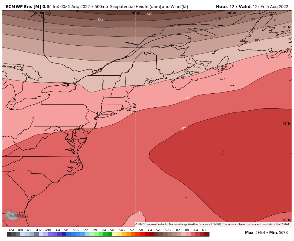 Friday 8 AM to Wednesday 8 PM - So much of the focus of forecasting is based on what happens at the surface, which is understandable. The atmosphere operates from the highest height of the stratosphere downward to the surface. What happens up top tells the tale of the impacts below. What you see here in this loop is the 500mb (~20,000 ft) steering level of the atmosphere. The darker reds indicate higher heights (high pressure) and the browns indicate lower heights (lower pressure). When I mentioned in Thursday's post about the Bermuda High flexing itself at times over the next several days, here's what I am talking about. This is a blocking pattern, and Maine is on the outer rim of it. Anytime the heights are in the 591 - 594 dm (decameter) level to the south and east, there is a strong likelihood the temperature is going to be a blast furnace at times and the cyclonic nature of the high continuously pumps hydration into the air, which is where the high humidity comes into the picture. This loop shows heights falling heading into next week. That indicates a pattern change. An upper-level trough begins to enter the picture over the weekend to the north which brings cooler and drier air there, but not strong enough to squish out the heat and humidity for the coastal plain and the foothills. A look at temperatures from above...  Friday 8 AM to Wednesday 8 PM - A look here at the 850mb (~5,000 ft) level for temperatures in degrees Celsius shows what I explained. As the Bermuda High flexes, temperatures increase aloft, which with wind mixes down to the surface and heats the surface. A back door cold front associated with the upper-level trough that passes by to the north shuts down the heat and humidity there Friday and Saturday. The Bermuda High shifts to the east and props the ridge back up and surges heat and humidity northward for Sunday. A cold front drops down into the north on Monday which cools and dries out that area, and then a stronger upper-level trough kicks up a long wave cold front that approaches the region midweek, takes the humidity out and sends the Bermuda High out into the north central Atlantic. The tale of two Maines for Friday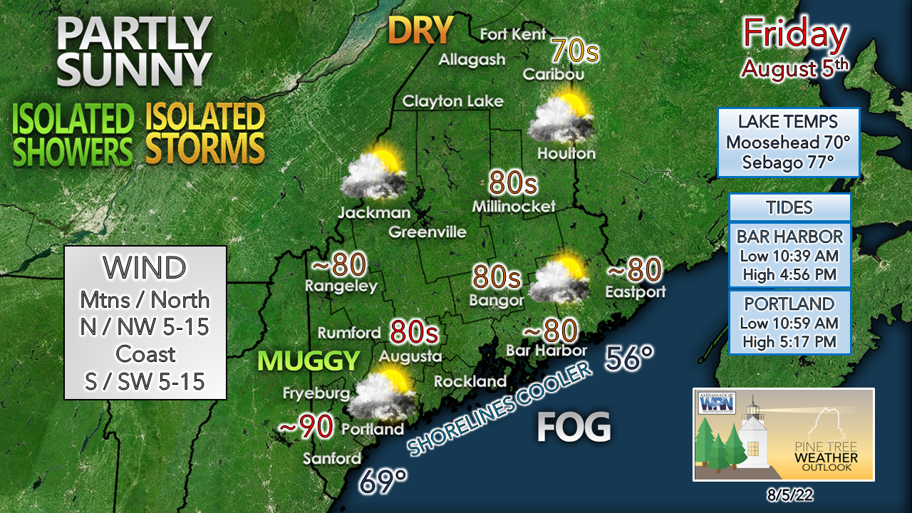 With the cold front dropping down across the north in back door fashion, dew points drop to more comfortable levels there as the day moves on. The clash of cooler, drier air to the north and warmer, tropical air to the south brings more clouds into the region. The best chance for showers and storms appears over the coastal plain south of the front. The question I have is will there be enough sun to trigger any. It's as simple of a case of if the sun gets out, look out. Storms could be of the pulse variety that could dump torrential rain which would cause localized flash flooding and potential for damaging wind as the heavens open up. Fog hugged the DownEast shorelines east of Bar Harbor Thursday and may do so again today. Temperature outlook through midweekAgain, the threat of pop-up showers and storms are likely to occur over the weekend and then increase in potential heading into next week. I am cautiously optimistic that some rain of value comes out of this for parts of the coastal plain Tuesday. 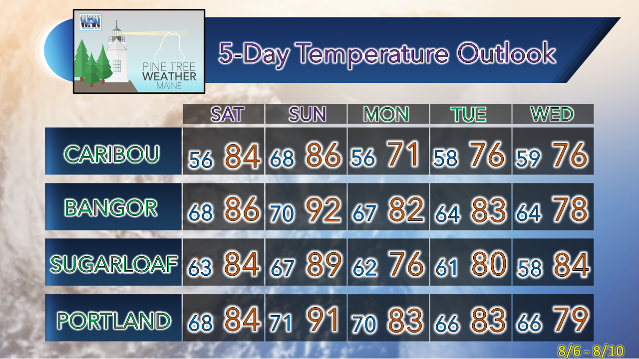 Taking a break over the weekend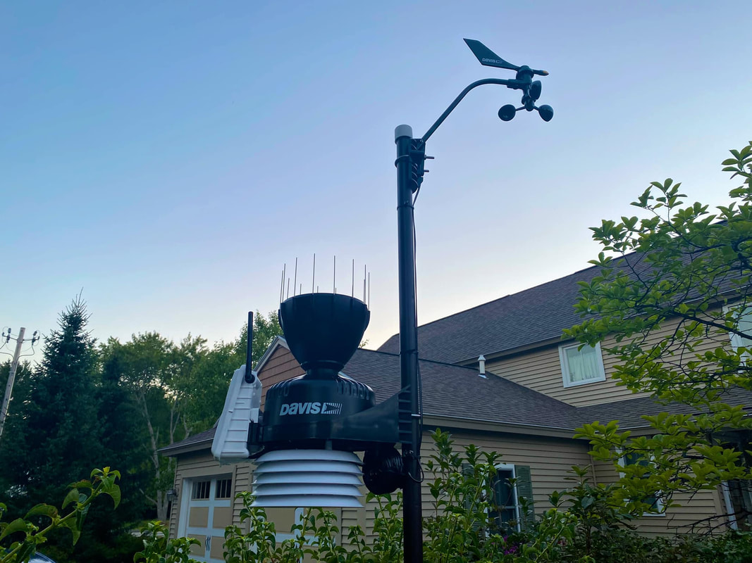 Recently I noticed that my humidity and dew point readings on my Davis Vantage Vue weather station were severely erratic, so I opted to upgrade to the Davis VantagePro2 and installed it last weekend. When I have spare time, I am working on compiling 38 months' worth of climatology reports generated from the Vue on spreadsheets and going over the data with a fine-tooth comb. I am finding it to be a fascinating research project, and I will share pieces of it over time. I am going to chip away at that since the heat takes me out of any outdoor activity as well as spending some much-needed time with my family. That said, I am keeping watch on what is going on. My Twitter feed operates 24/7/365 with bulletins from the National Weather Service, Storm Prediction Center, Weather Prediction Center, as well as the National Hurricane Center. I will post observations and forecast updates there when I have time. The feed is public, you do not need an account to view it. Look for information from me there, and I will post an update here on Monday. Thank you as always for your support and have a great weekend! Thank you for supporting this community-based weather information source which operates by financial contributions from people like you. Stay updated, stay on alert, and stay safe! NEXT UPDATE: MONDAY - Mike NOTE: The forecast information depicted on this platform is for general information purposes only for the public and is not designed or intended for commercial use. For those seeking pinpoint weather information for business operations, you should use a private sector source. For information about where to find commercial forecasters to assist your business, please message me and I will be happy to help you. |

Mike Haggett
|


