Areas of fog expected Tuesday Morning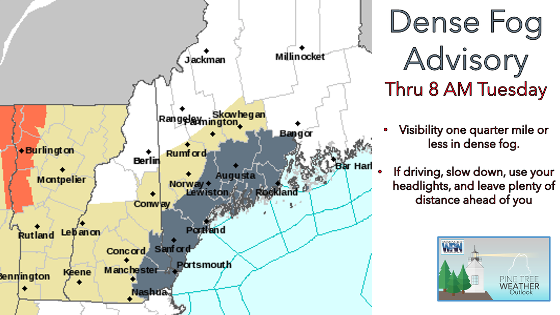 As winds remain southeasterly though the overnight hours Monday into Tuesday, areas of dense fog are likely to develop along southern coastal plain and midcoast areas. Because of this, the National Weather Service has issued a Dense Fog Advisory for these locations going into effect Monday night and lasting through 8 AM Tuesday. Just make sure you give yourself some extra time tomorrow morning if you do encounter any of this fog. Also please make sure to turn on your headlights in any fog so other cars on the road can see you! A nice day expected Tuesday if you like the heat and humidity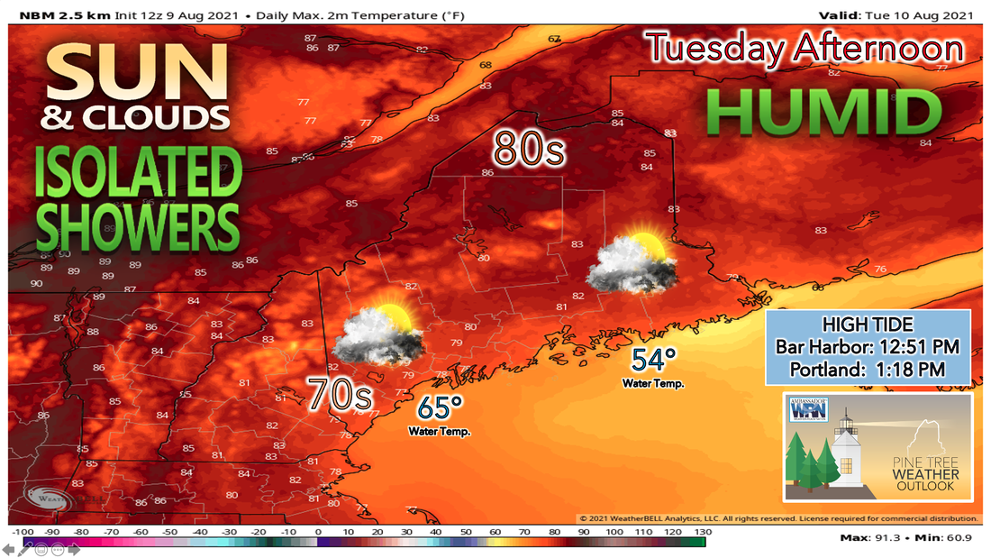 An upper level ridge sets up over us through the rest of this week, resulting in warm and humid air moving into our region. While there's a chance for some isolated showers during the afternoon Tuesday, the better chances will come later in the work week. There is some signs of relief from the humidity coming this weekend. We'll have to get through the heat and humidity first however. Tuesday looks to be a partly sunny day, with more sunshine likely the further north you head in the state. This results in northern areas climbing into the lower to mid 80s for high temperatures during the day Tuesday. The rest of the state, which likely sees more clouds throughout the day will only see highs climb int the upper 70s. I wouldn't be surprised if some of the warmer spots in inland southern Maine make it into the low 80s as well, but the south southeasterly wind likely helps to keep temperatures along the coastline in the lower 70s. 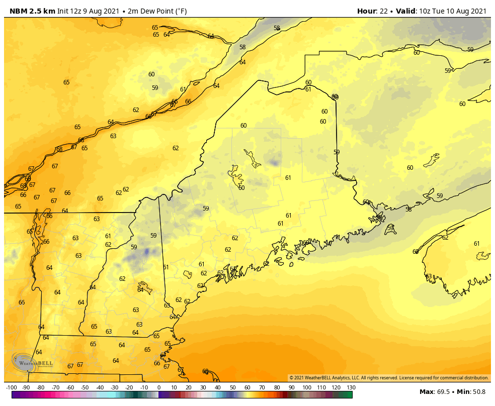 The bigger factor people will likely notice tomorrow is the increase in humidity throughout the day Tuesday. While most of the state starts the day with dew points in the lower 60s. The south southeasterly wind will likely help to usher in the more humid air. By Tuesday afternoon dew points are likely in the mid to upper 60s, helping to make it feel even more sticky outside than it has over the past few days when dew points were only in the lower 60s. Get used to the heat and humidity though, as it looks likely to stick with us through the end of the work week. The upper level ridge keeping us in this pattern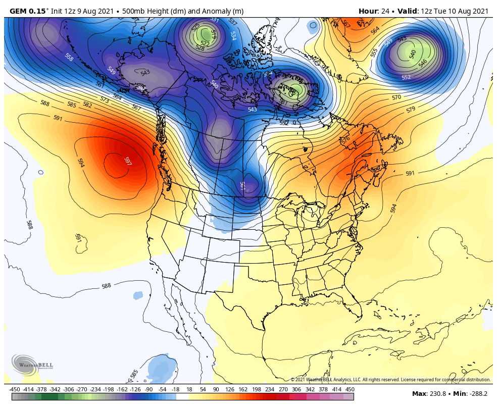 All of this warmer weather is thanks to an upper level ridge that has developed over the eastern United States. This upper level ridge has helped to bring in warmer air aloft in the upper atmosphere. As it continues to build and eventually push off to our east by the end of the week, it makes way for an upper level trough that's currently impacted the central United states and great lakes region. As this upper level trough gets closer to our area, a surface low pressure system along with a cold front will begin to make its way closer to us out ahead of the trough. 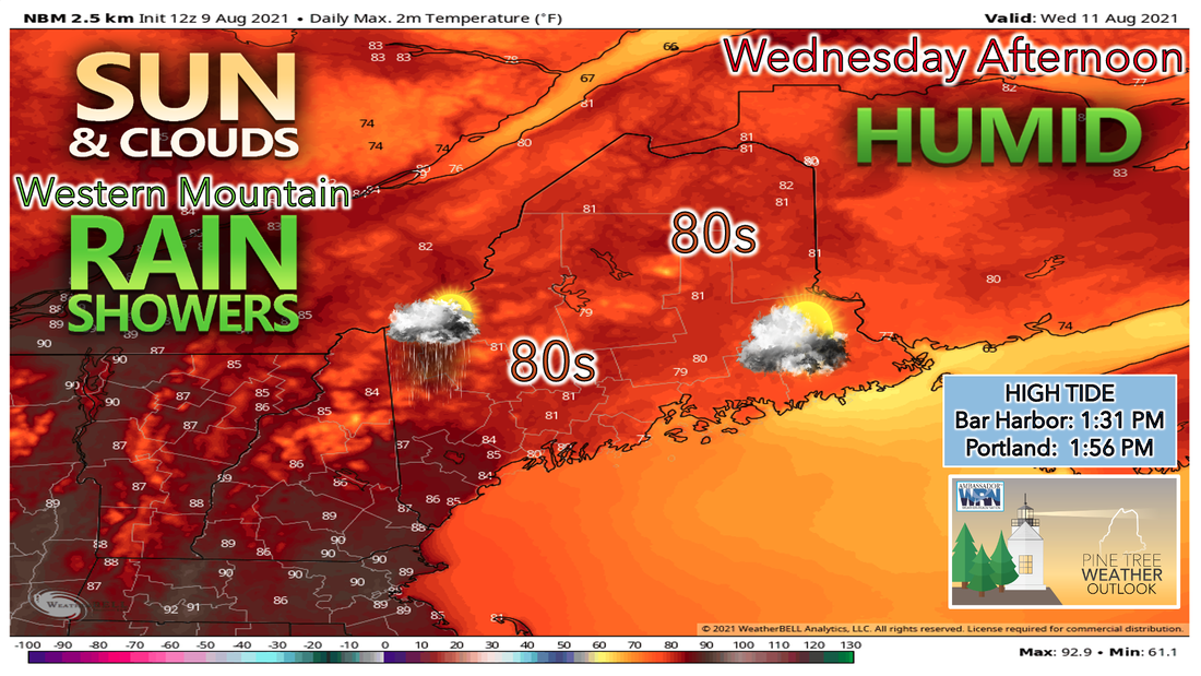 Wednesday will likely be another nice day with a mixture of sunshine and clouds throughout the day. The best chance of seeing any showers will likely be in the western Maine mountains and far northern parts of the state. High temperatures will likely be warmer than they were during the day on Tuesday with much of the state climbing into the lower to mid 80s. This time southern areas will likely be warmest as places in interior southern Maine are likely to climb into the upper 80s with a few spots getting close to the 90 degree mark. While actual air temperatures are likely to only be in the 80s, the humidity will help to make it feel like a lot of the area is in the lower to mid 90s. Just make sure to limit any strenuous outdoor activity and take frequent breaks if working outside in the heat and humidity. 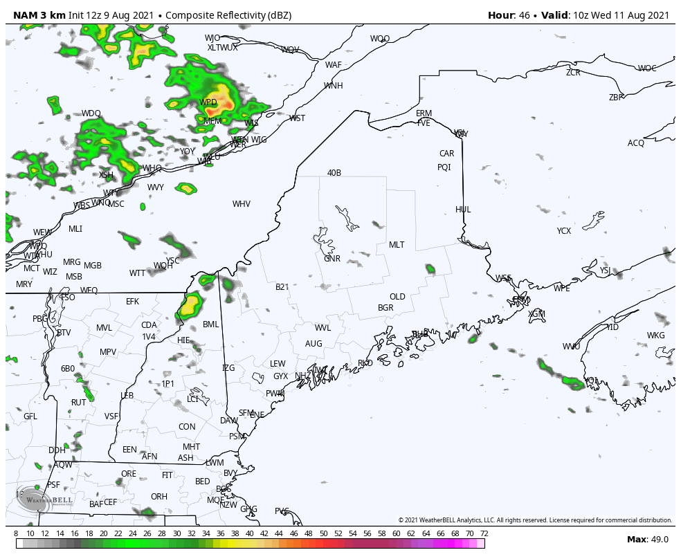 While this is still a couple of days out, the NAM does a good job of showing the scattered shower activity during the day on Wednesday. Again the best chance for these showers and storms will likely be over the western Maine mountains and far northern parts of the state. I can't rule out any of these showers being on the stronger side, resulting in a few isolated storms, but at this point that threat appears to be confined to northern areas. We'll continue to monitor this as we get closer and bring you any updates if the threat turns severe. Dew points continue to climb through the end of the work week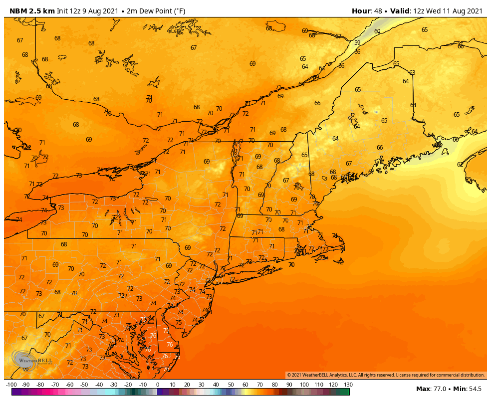 The high dew points remain in the forecast through the end of the work week and into the first part of the weekend. With dew points remaining in the upper 60s and lower 70s even through the overnight hours, Low temperatures will struggle to cool off, only adding to the uncomfortable air mass. Dew points in the lower 70s is crossing over into the oppressive heat and humidity, as the only sign of relief comes in the form of a cold front moving through the region slowly Friday and into Saturday. 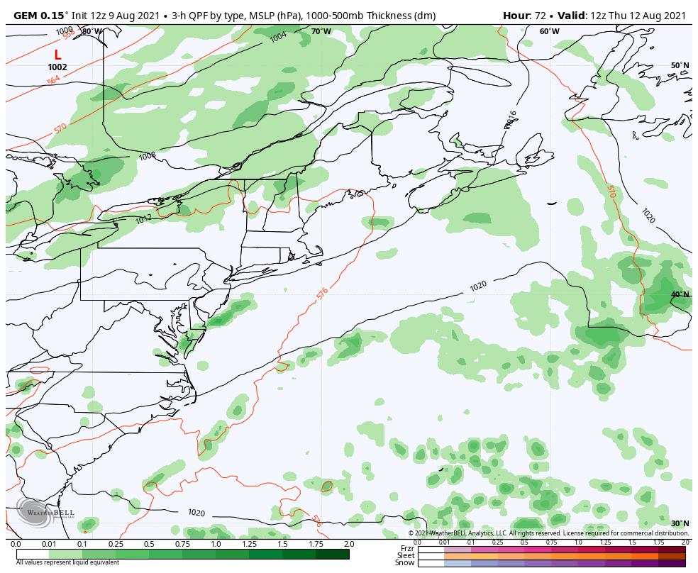 As the cold front approaches, moisture out ahead of the front likely brings shower chances to the forecast Thursday, with more widespread shower activity heading into Friday. This shower activity is still out ahead of the cold front itself, as models are indicating it slowly makes it way through the area Friday and into Saturday. Northern parts of the state will be the first to see the relief from the humidity with more widespread shower and storm activity heading through the afternoon on Friday. The southern part of the state looks to miss out on this activity, and remain humid into the day Saturday before getting a taste of scattered showers and storms during the afternoon then. 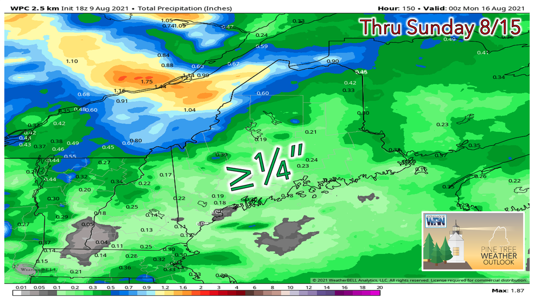 Throughout the rest of the week rain chances remain low, as there really isn't any organized systems moving our way to bring us a soaking rain. Scattered showers and storms through the end of the week and into the weekend likely bring isolated higher amounts of rain to some places, however overall the majority of the state is look at less than or close to a quarter of an inch of rain through the evening on Sunday. Keep in mind some areas across the state are still in a drought and could really use the rain. Sadly that doesn't look likely at least over the next week. Thunderstorms can escalate quickly Thunderstorms and squall lines can quickly turn clear skies dark. Stay Weather-Ready by having a way to get weather alerts on your phone and stay safe by immediately going inside when the skies turn threatening. weather.gov/safety/thunderstorm Tropical Update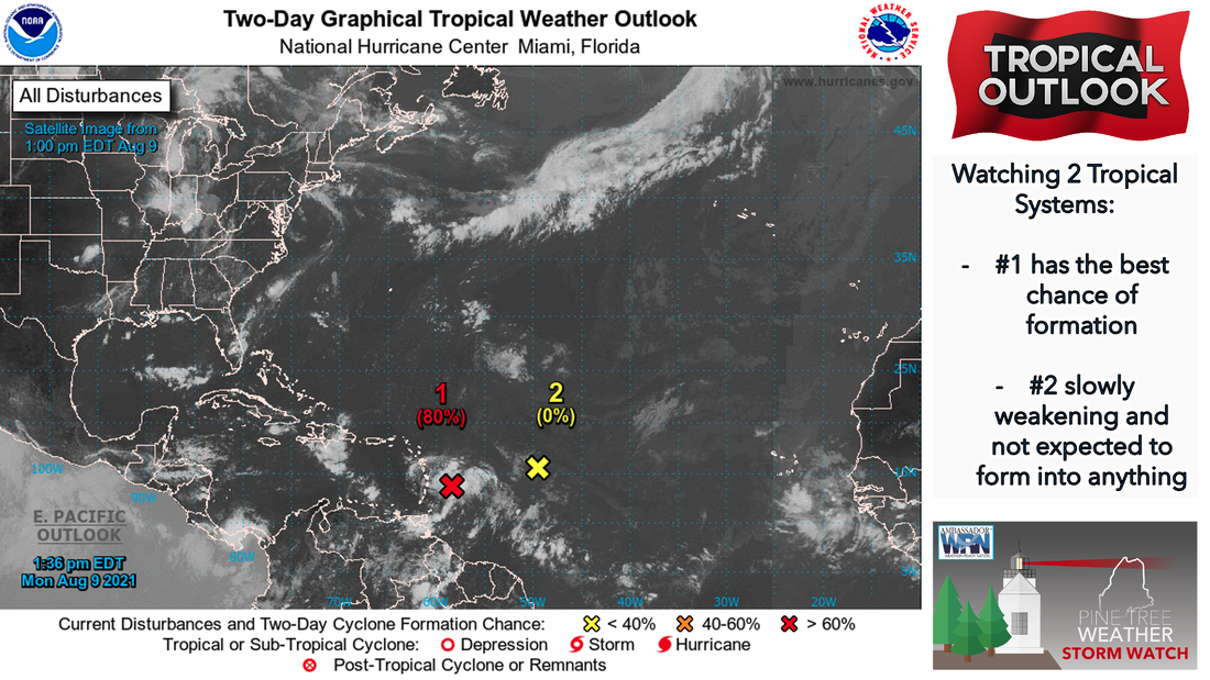 The National Hurricane Center has been watching two areas in the Atlantic that showed the possibility of developing into tropical systems. Area of potential #1 is looking the most likely to develop into a tropical system over the next 48 hours as it continues to make its way towards Puerto Rico. Area of potential #2, while did have a slight chance of developing over the weekend, has lost the energy it would need to develop into a tropical system and will likely continue to weaken as it continues to push west. The Atlantic is starting to become more active as we head into the second half of the hurricane season, so we'll be keeping an eye on any tropical systems that begin to make their way closer to the United States. Temperature outlook through SundayWe're finally seeing a return to summer this week in the temperature department. High temperatures through the end of the week likely remain in the 80s for much of the region. Northern parts of the state will be especially warm as highs climb into the upper 80s during Thursday and Friday, similar to the heat seen in southern parts of the state during this time. Again the bigger story is the low temperatures during this period, as by the time we get to the end of the work week lows will struggle to fall into the lower 70s in a lot of areas. If you have an air conditioner that hasn't gotten a lot of use this summer, this week will definitely be the week to use it and enjoy the cool air from it. For those who don't have air conditioning please stay safe and make sure to drink plenty of water during this humid stretch. 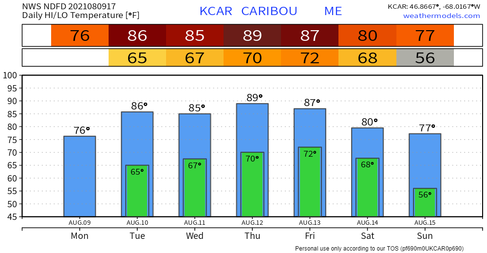 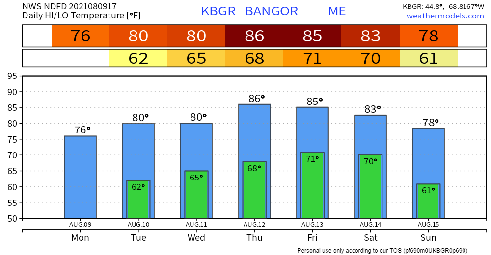 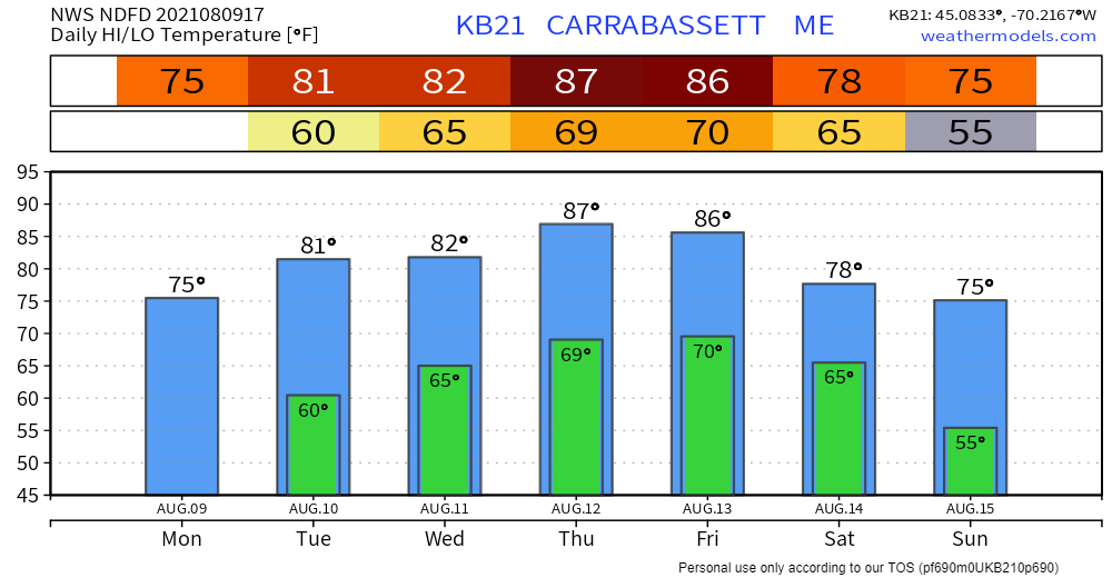 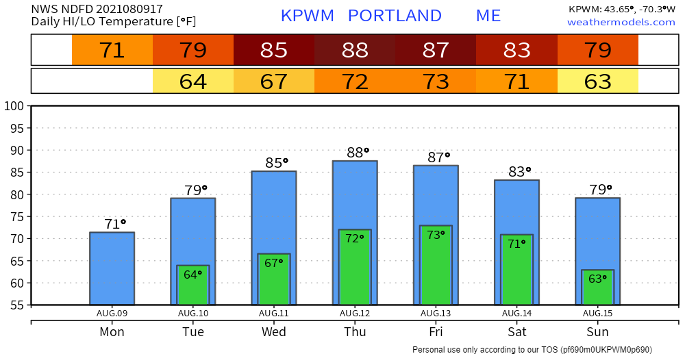 Be prepared to receive alerts and stay updated!
For more information in between posts, please follow Pine Tree Weather on Facebook and Twitter.
Thank you for supporting this community-based weather information source which operates by reader supported financial contributions. Stay updated, stay on alert, and stay safe! |

Mike Haggett
|