Another wicked hot day Tuesday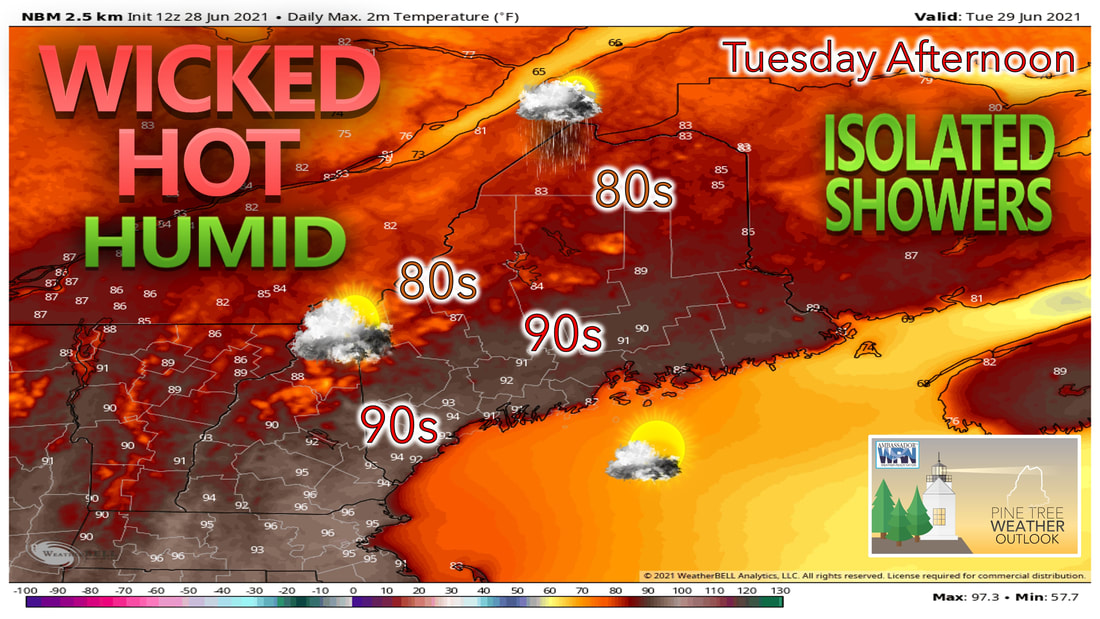 The heat and humidity sticks around for Tuesday, as a chance for some isolated showers remains in the forecast. The better chance of showers and thunderstorms looks to be Wednesday, with unsettled weather remaining throughout the end of the work week. A weak front over the area on Tuesday gives us the best chance for any shower activity over the northern part of the state. Meanwhile the rest of the state likely sees temperatures climb into the upper 80s and lower 90s with sun and clouds mixing throughout the day. Dew points remain in the upper 60s and lower 70s across much of the state on Tuesday, so it will once again be another humid day. The immediate mid-coast has the best chance of escaping the heat Tuesday, with temperatures there kept cooler thanks to the sea-breeze during the day. Marginal risk for storms Wednesday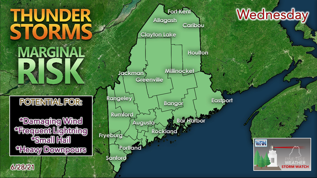 The storm prediction center has put us under a marginal risk for storms heading into the day Wednesday. This is thanks to an upper-level trough that likely works its way into our area on Wednesday. This, combined with an unstable air mass at the surface will set the atmosphere up for the potential of severe weather heading into the afternoon Wednesday. With dew points once again likely in the upper 60s and lower 70s, it won't take much in the way of daytime heating to provide the fuel needed to spark off some of these showers and storms. At this point, the greatest risks appear to be damaging winds and small hail, while the risk for tornadoes appears to be low.  The storms likely move into northern parts of the state during the mid-morning hours. It's not until the early afternoon that the storms likely begin to impact the western Maine mountains, before making their way through the foothills and coastal plain by late afternoon. The best chance of seeing activity along the coast appears to be late afternoon into the early evening hours. We'll have a better idea of the timing of these storms as we get closer, so make sure to check back here or on our Facebook page for the latest information. Unsettled weather continues through the end of the week Heading into the second half of the week, the overall pattern appears more unsettled. This is thanks to an upper-level trough and closed upper-level low that likely sits to our west during the early part of the weekend. This upper-level trough will help to give us a break from the heat and humidity, but that comes at a cost.  Shower chances remain in the forecast as we head throughout the remainder of the week, as weak areas of low pressure continue to form of the coastline and move northeast. While it doesn't look like any of these days are complete washouts, the chance of showers remains in the forecast through at least the mid-morning hours of Saturday. Right now the models show a weak area of high pressure trying to back into the region from the east for Sunday, which would help to keep us dry for the 4th.  Northern parts of the state are the first to see relief from the humidity Thursday evening as winds likely shift into the northeast during the afternoon. This will continue across much of the state on Friday, allowing those lower dew points to work into the central part of the state. The southern part of the state is likely the last to hang onto the humidity through Friday evening. By the time Saturday morning rolls around, the entire state likely finally sees a break from the humidity, just in time for the holiday weekend. Pet Heat Safety Animals can die of heatstroke within 15 minutes, and cracking the car windows doesn’t help. NEVER leave your pets in parked vehicles. weather.gov/safety/heat-children-pets Seven-day temperature outlookWhile much of the state remains warm over the next few days, we likely see temperatures cool down heading into the second half of the week. This is thanks to the increased cloud cover and rain chances, as well as a shift in wind direction by Thursday. Heading into the holiday weekend, temperatures likely remain slightly below average as clouds linger into Saturday afternoon. Sunday looks to be the drier of the two weekend days, so temperatures likely have a better chance of being warmer versus Saturday. 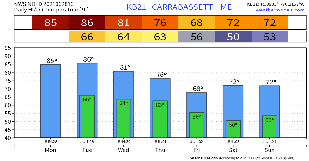 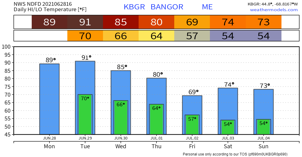 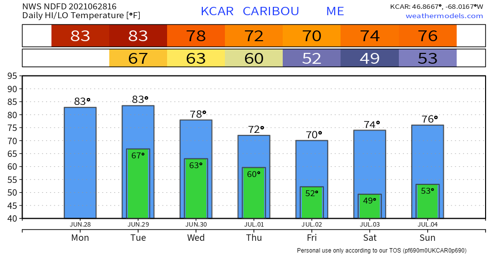 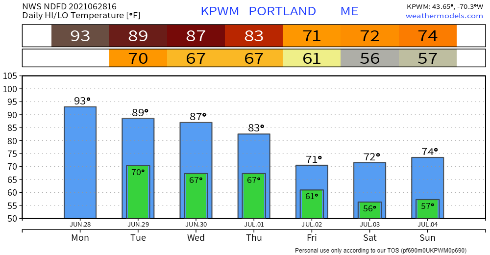 Be prepared to receive alerts and stay updated!
For more information in between posts, please follow Pine Tree Weather on Facebook and Twitter.
Thank you for supporting this community-based weather information source which operates by reader supported financial contributions. Stay updated, stay on alert, and stay safe! |

Mike Haggett
|