
Stay on alert for rapidly changing conditions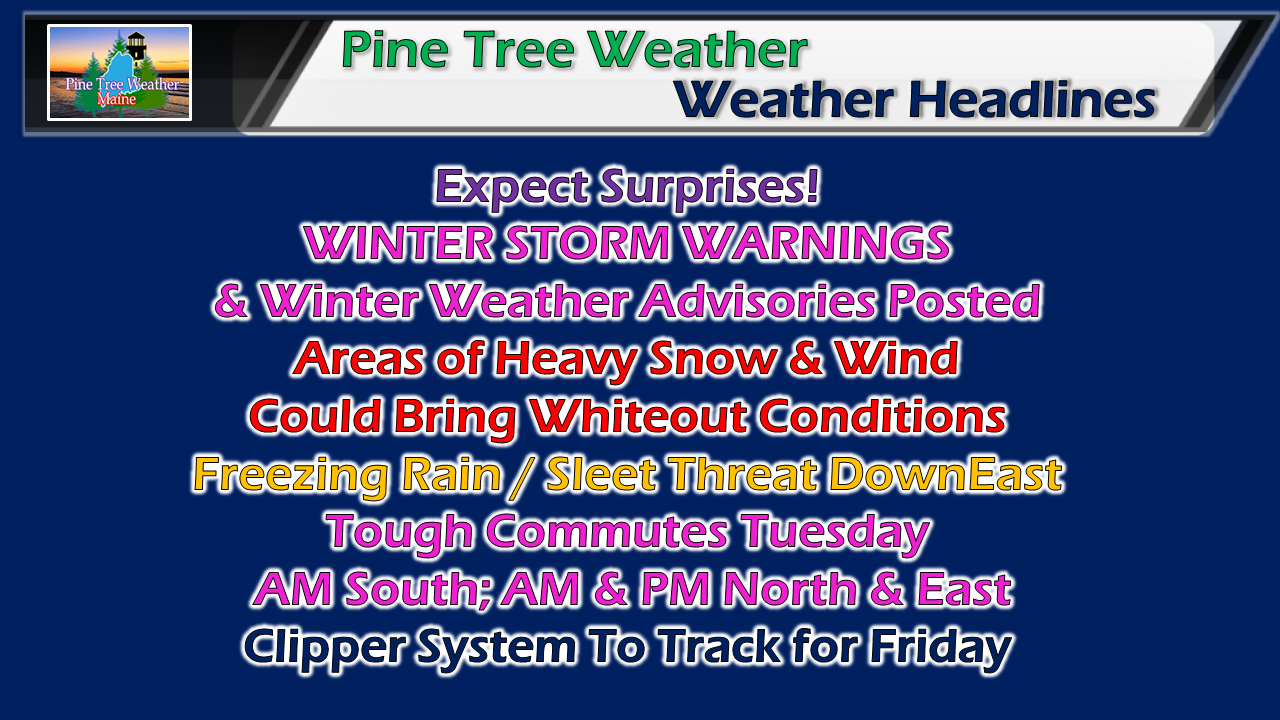 For those that are travelling around the state today, expect a slow go of it. Heavy bands of snow along with gusty wind will make getting around a challenge in areas. Make sure you have storm essentials packed in your vehicle, cell phone charged, and water in case you get caught in a situation where roads may be impassable, or if you go off the road. The storm gets its act together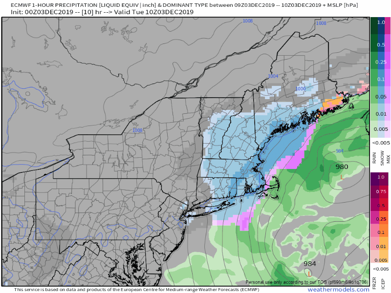 I mentioned here yesterday the difficulty in forecasting the Monday part due to mid level low pressure areas being scattered. As of 5 AM. most of those pieces have come together. The upper low (500 mb) gets finished capturing the surface low, it's game on. This is when the heavy bands begin to form, and the wind begins to crank. 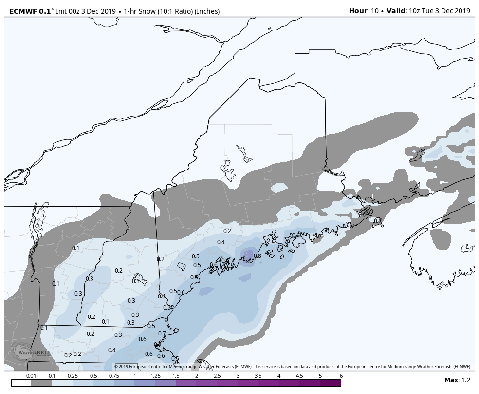 While the heavy deformation bands are difficult to predict their formation, guidance hints at their potential. With the upper low pulling the surface low to the north-northeast, the idea is that areas from Portland east have the best chance to see snowfall rates in excess of 1" per hour or more in time through the morning through mid to late afternoon. Any slight jog of the storm track to the west or east will have impact on how this plays out. It is wise for everyone in the area to note this potential. 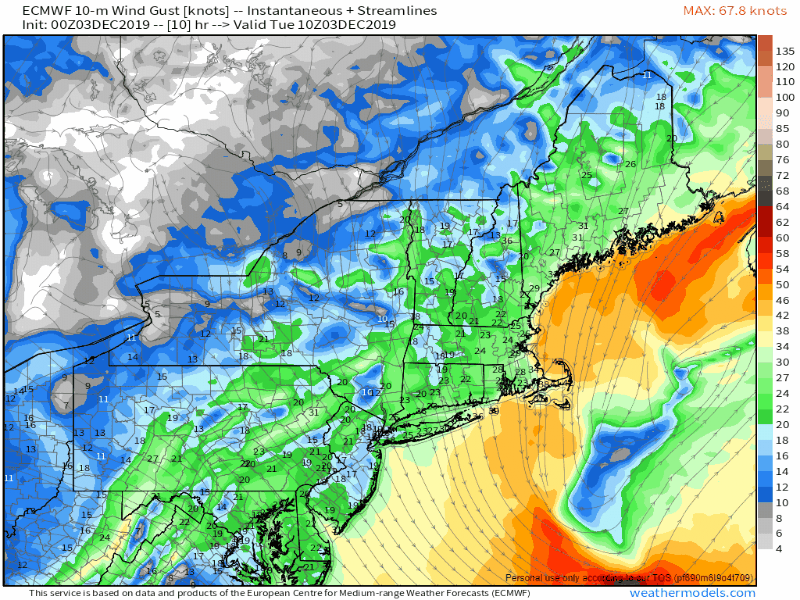 Along with the heavy snow bands comes gusty winds, which have potential to cause whiteout conditions. After the snow ends, the blowing and drifting of snow continues Tuesday night into Wednesday, with the wind settling out as high pressure moves in by Wednesday night. 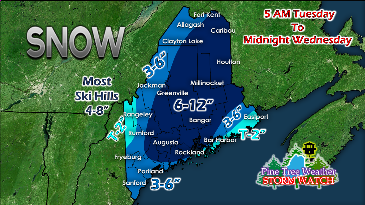 I expect sleet and freezing rain will keep totals down for the DownEast shorelines. I expect the bulk of the snow to come hard and fast. Given the wind continuing overnight, it may be best to wait to move the snow in drift prone areas until you absolutely have to. This will be a high ratio snow for most, and will be fairly easy to move. A clipper to watch late week High pressure takes over for Wednesday and Thursday, giving the region a break. A weak disturbance may bring snow showers to the western mountains Thursday. A clipper system moves into southern area Friday afternoon, and will bring the next chance for snow into Saturday morning. High pressure then returns for the weekend. After a long period of below normal temperatures, that trend appears to change heading into next week. Guidance is in agreement for a potential rain event statewide early next week. Time will tell if that will stay that way. ► ► For the latest official forecasts, bulletins and advisories, please check in with the National Weather Service in Gray for western and southern areas, or Caribou for northern and eastern parts of Maine. Please #mPING Today!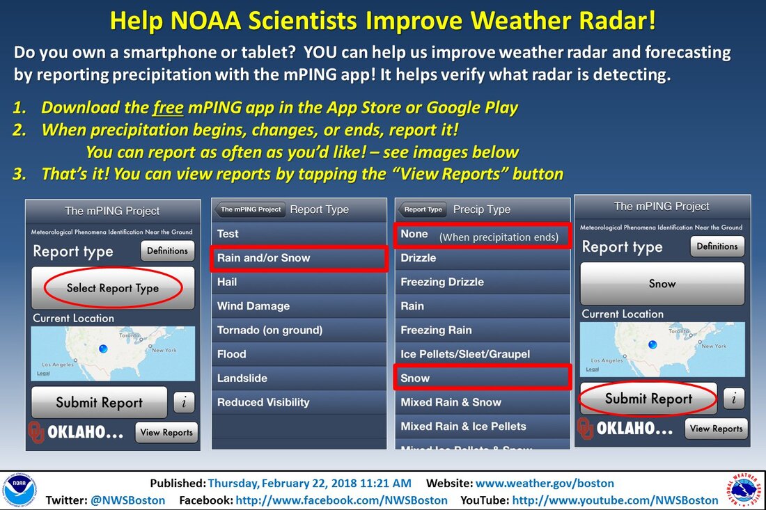 Maine needs mPing support from residents to better assist weather forecasters during storms. It's simple, easy, anonymous, and a totally free way to report weather conditions ► http://mping.nssl.noaa.gov Thank you for your assistance! Please support Pine Tree Weather on Giving Tuesday! ► ► $610 shortfall for the year ahead! You can help keep Pine Tree Weather going with a donation of any amount now through VENMO @PineTreeWeather, a monthly donation on Patreon or messaging me on Facebook or Twitter to send a check in the mail. Thank you for your support!
For more information from me, please check the Pine Tree Weather Facebook page as well as my Twitter feed. Always stay weather aware! - Mike |

Mike Haggett
|


