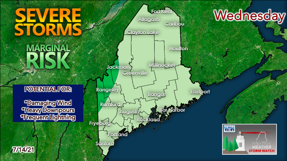
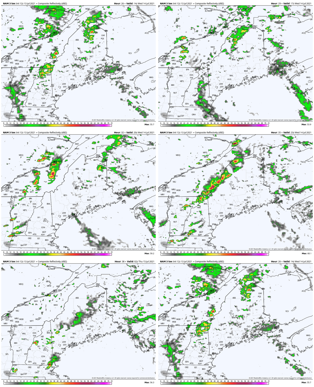
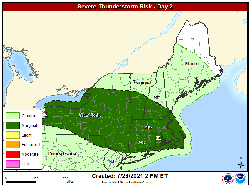
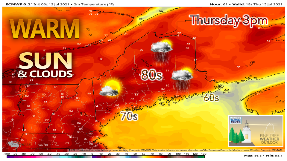
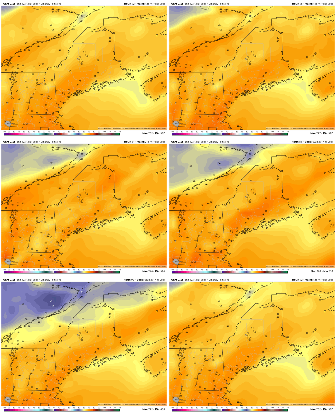
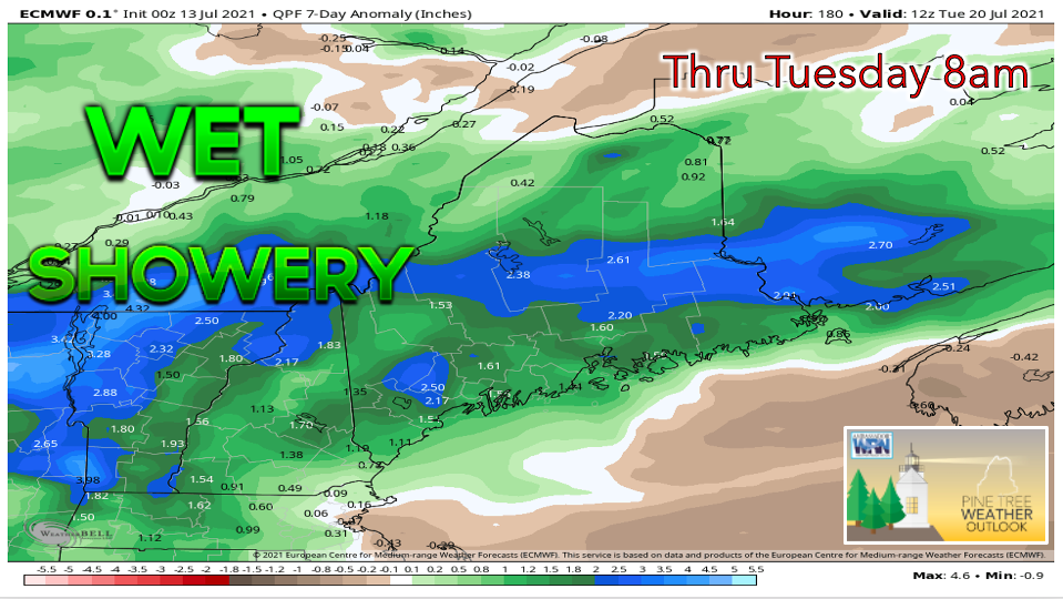
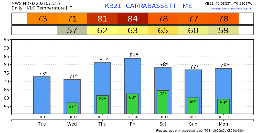
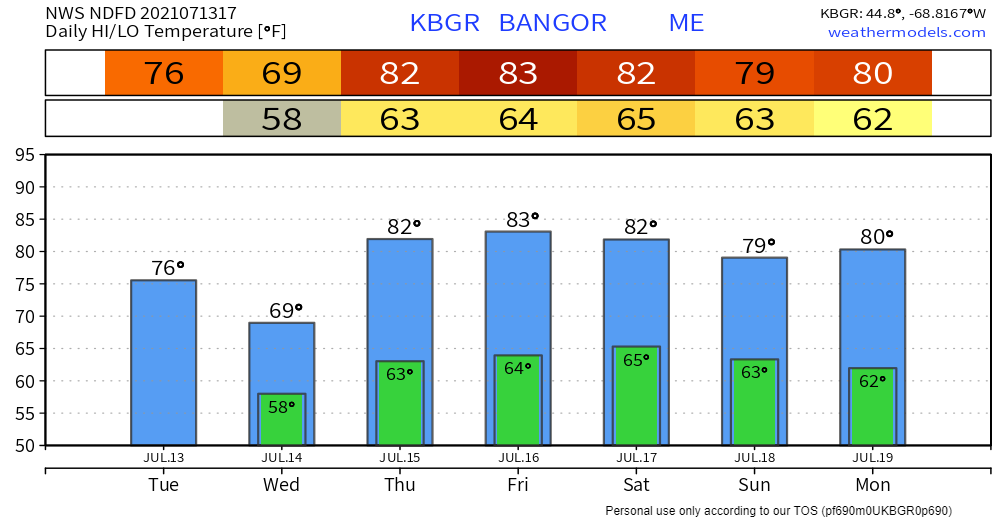
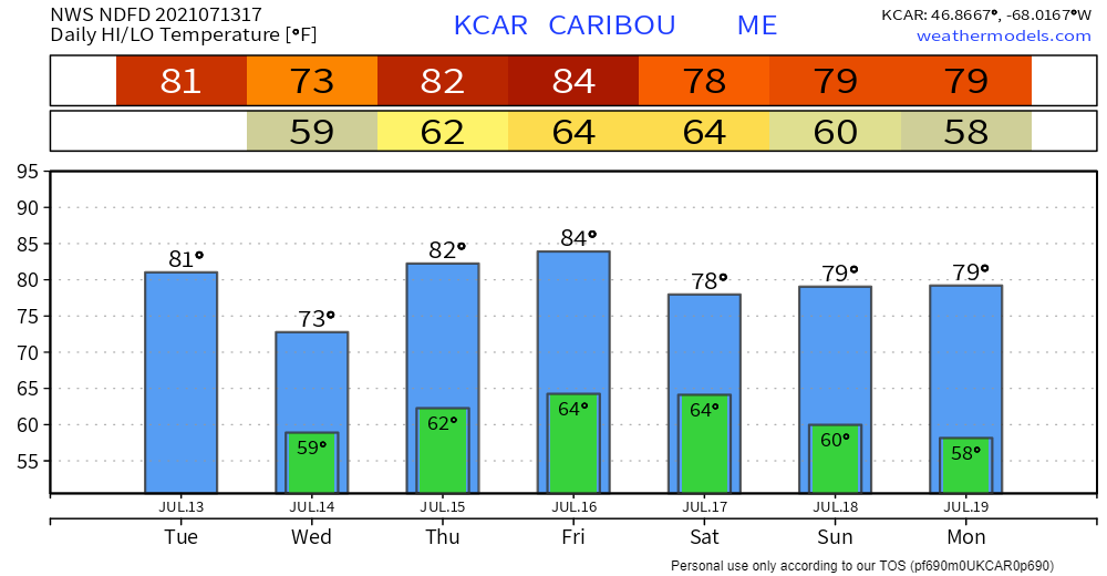
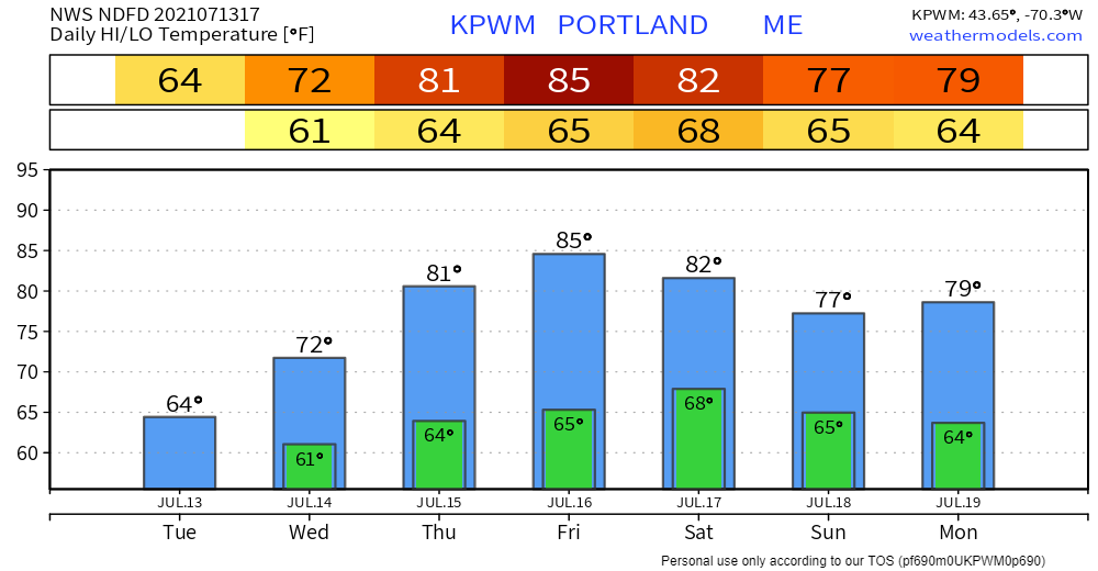
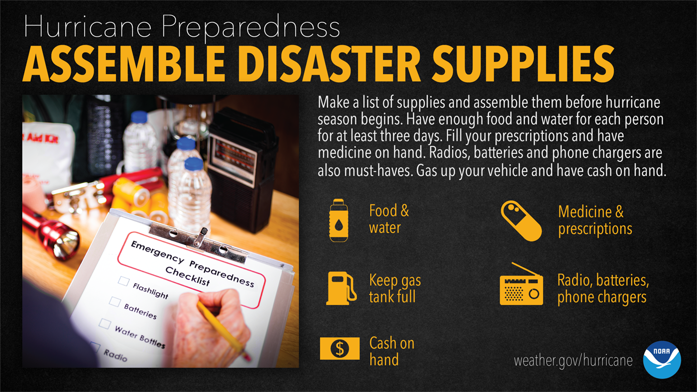
Thunderstorms to develop Wednesday afternoon, strong winds and torrential downpours possibleMorning showers are possible across northern regions on Wednesday, along with some chances of spotty rain and drizzle in the south. The bulk of the precipitation, however, is expected to arrive later in the day. An upper-level disturbance coupled with a weak cold front will likely provide a spark for convective activity. Widespread severe weather appears unlikely, although the SPC does have far western Maine under the MARGINAL risk category. This means that a potential exists for isolated, short-lived severe thunderstorms to roll through that area. Given the humid air mass settled over the state, heavy downpours are the major risk with these storms. Certain regions may also see some gusty winds as the atmosphere becomes more unstable. Small hail and the isolated tornado are unlikely but cannot be ruled out in the event of a severe thunderstorm. As far as timing goes for Wednesday storms, this model shows showers tracking across northern Maine during the late morning to early afternoon hours. It is not until approximately 6pm when a strong line of thunderstorms develops across the western mountains and tracks eastward. Keep this in mind if you are planning to be outdoors tomorrow afternoon and evening. Seek shelter immediately if you hear thunder or see lightning. Here is another look at the convective outlook on Thursday, extending into the northeast US. The dark green indicates regions under a marginal risk for severe thunderstorms. Above-average temperatures on Thursday, mugginess persistsThursday is looking to be a warm day for most, with the exception of the coastline. While areas inland likely reach the lowers 80s for a high temperature, coastal areas stay cooler thanks to the sea breeze. Morning fog should dissipate by the early afternoon as sunshine increases. Showers are possible on Thursday, primarily in northern and eastern Maine. This is due to a low-pressure system passing over the Canadian Saint Lawrence River Valley. Otherwise, skies appear partly sunny. The humidity is projected to last through Friday as dew points reach the upper 60s and lower 70s. This air mass will feel quite sticky and uncomfortable. Friday highs appear to be a few degrees warmer than Thursday, adding to the discomfort. Showers and thunderstorms may arrive on Saturday as a cold front provides some lift, although models disagree on how quickly the front passes through the state. Relief from the humidity looks to arrive by Monday as a dry air mass works its way into the region. Check back for updates over the course of this week as forecast confidence grows and we can provide more clarity on timing. Showers and thunderstorms will be possible on several instances throughout the week, providing some much-needed rainfall. Most of the precipitation appears to be scattered and not widespread, so some areas may not receive much relief from the dry conditions. The above model indicates a particularly wet week, but other models favor a drier outlook, so some uncertainty exists. It will be interesting to see whether the rainfall from Elsa has significant impact on the drought situation. Check back on Thursday once the U.S. Drought Monitor has been updated. Temperature outlook through MondayWednesday features slightly below-average temperatures before a warm-up occurs on Thursday and Friday. Highs appear fairly seasonable through the weekend and into early next week. Hurricane Preparedness Week - Assemble Your Disaster SuppliesJust having enough supplies to make it through a hurricane isn’t enough. You need plenty to make it through what could be a LONG recovery period too. Water and electricity could be out for a week or more. Have enough non-perishable food, water, and medicine to last each person in your family for a MINIMUM of three days. Also make sure you have extra cash, a battery-powered radio, flashlights, and a portable crank or solar powered USB charger to charge your cell phone. ready.gov/kit Be prepared to receive alerts and stay updated!
For more information in between posts, please follow Pine Tree Weather on Facebook and Twitter.
Thank you for supporting this community-based weather information source which operates by reader supported financial contributions. Stay updated, stay on alert, and stay safe! |
Mike Haggett
|

