
|
It will be the tale of two Maines weather wise over the next couple of days as cold front that dipped into the region Saturday has stalled out over central areas. To the north, a FLOOD WATCH has been issued by NWS Caribou for heavy rain potential for The County and Baxter State Park regions through tonight. To the south, a HEAT ADVISORY is in effect for York County as issued by NWS Gray along with other points to the south and east. For those like myself who dwell in the region, we're looking at potential for day five of this heatwave, and with the temperature reading 75° at 2:45 AM when I began this day, I'd say we have a good chance achieving it. The pattern through midweek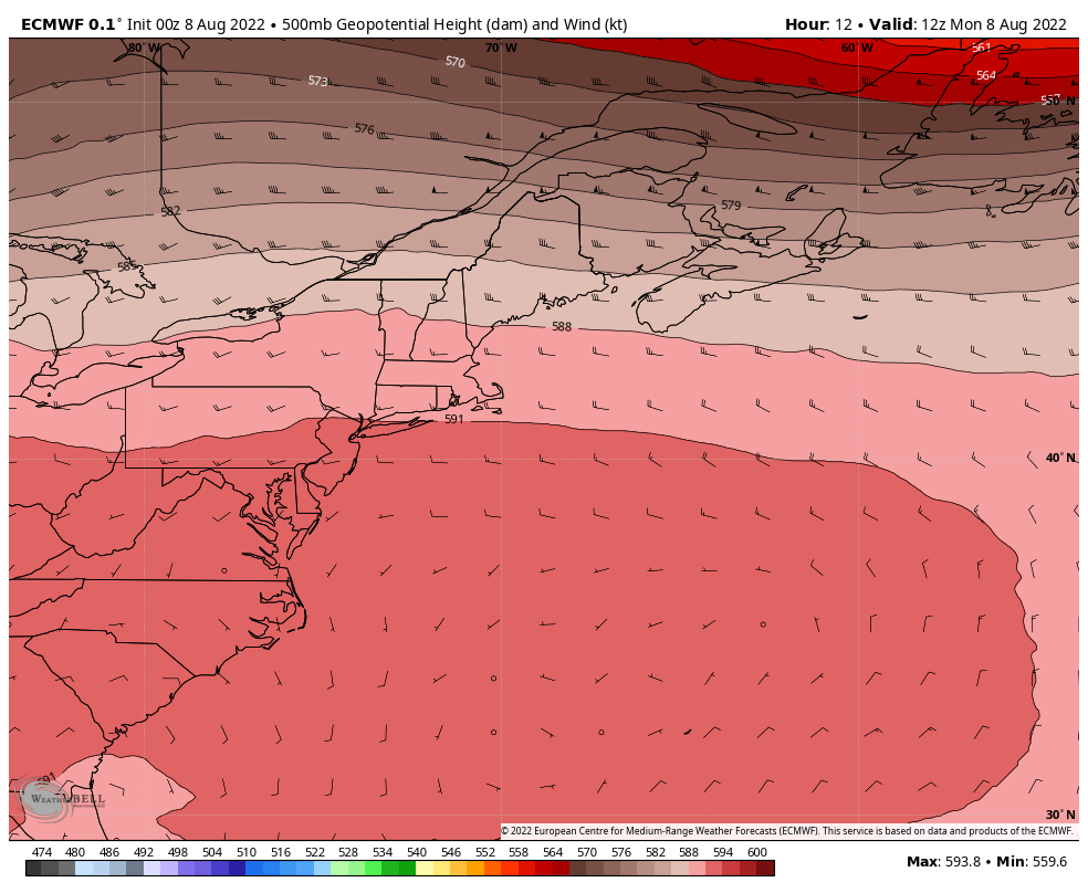 Monday 8 AM to Wednesday 8 PM - Our old annoying friend, Bermuda High, has been pushed south a bit thanks to the frontal boundary over the state, but isn't going anywhere until later in the week. It puffs itself out to show those affected by it who is boss. For those curious about what "zonal flow" means, this is textbook Exhibit A from the European model 500mb (altimeter ~20,000 ft) steering level. West to east flow with not much movement in the height pressure. In this case, it is a stalled front scenario. 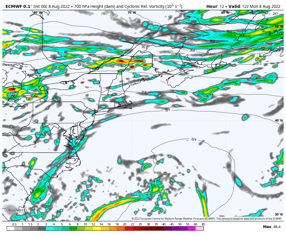 Monday 8 AM to Wednesday 8 PM - Adding upper-level energy to the 500mb loop shows a series of disturbances riding along the stalled front, which translates into rain chances. The stronger wave passing through Monday afternoon into the overnight is what has raised the flood concerns for the north. Precipitable water values are expected to reach 2"+ which means torrential rain that will cause flooding. In an area of the state that has received a surplus of rain so far this year, it will continue to fill their reservoirs up, while those in the south stand on street corners panhandling for a shower with a rain bucket. 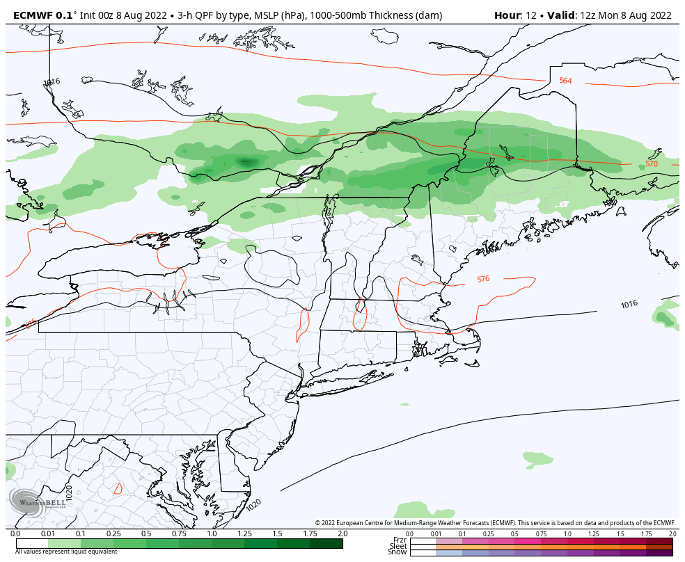 Monday 8 AM to Wednesday 8 PM - The main charge of rain passes through the region through early Tuesday. The stationary front dips to the south just enough to end the heat and humidity over southern areas, but close enough to where showers and storms remain in the forecast as weak disturbances pass along it. 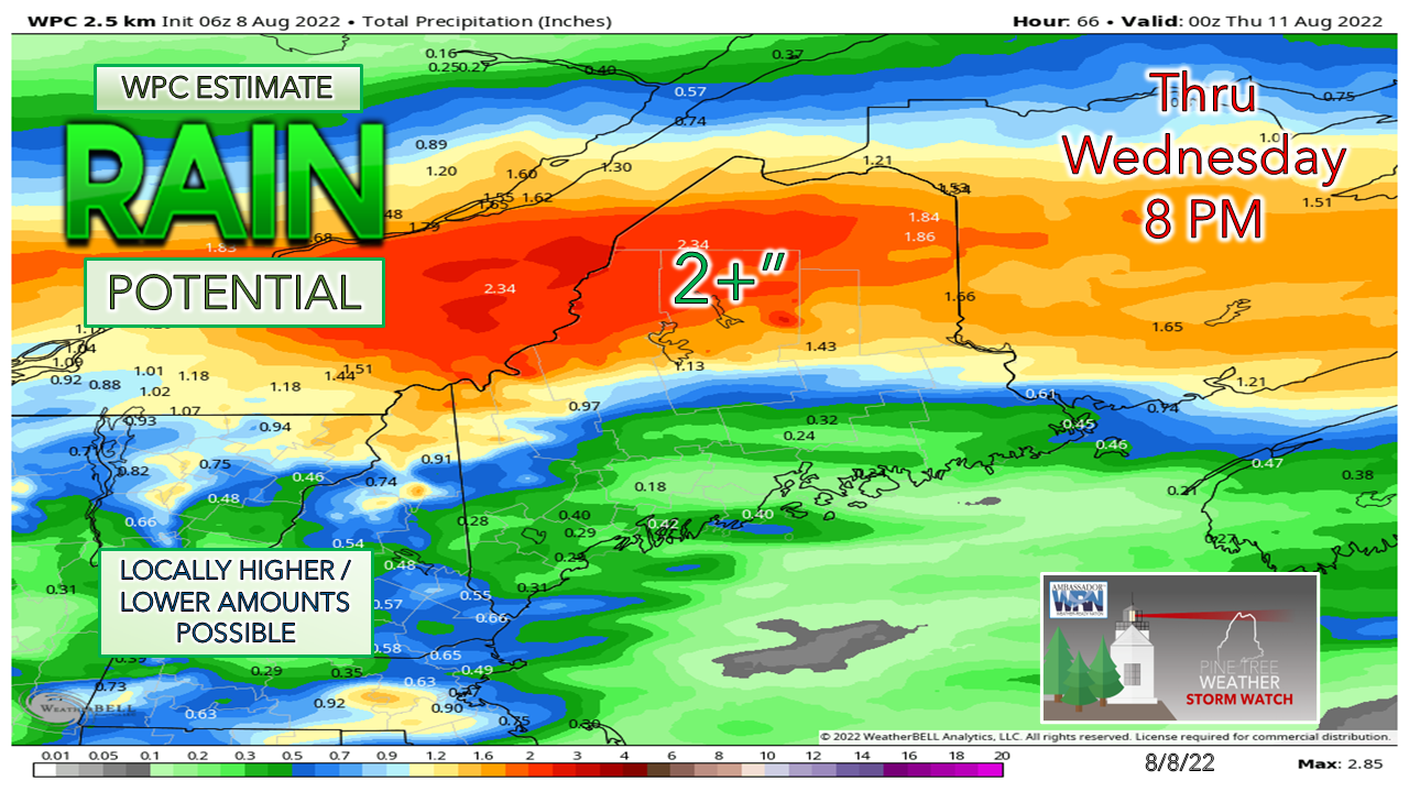 Looking at this rainfall estimate by the Weather Prediction Center is kind of an insult to those in the drought region. It's like a cruel tease. Potluck shower season continues for the coastal plain for those lucky enough to get them. How Monday plays out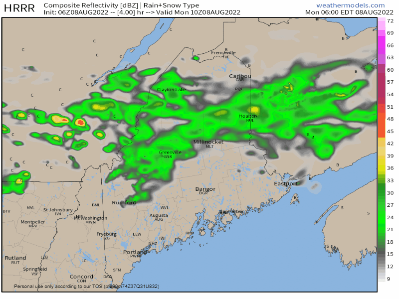 Monday 6 AM to 6 PM - The HRRR idea here shows the split of the front between the south and north rather well. The cooler side gets the best chance for rain, while the warmer side continues to fry and may pick up an isolated shower or storm. Important to note, if the front sags south a bit, that brings the risk of shower chances further south as well. I suspect given the heat to the south and energy that is aloft southern areas may see similar shower and storm chances as seen on Sunday. 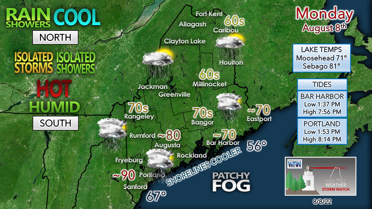 It will be a 10/10 beach day for those going to southern areas. Tides are perfect for a long day along the shorelines, but keep in mind a shower or storm may cause a mass evacuation on short notice. Water temperatures for the coast and the lakes are at peak warmth. Wind varies in direction, with areas to the north seeing it from the north / northeast and southern areas out of the south / southwest. MidCoast areas pick up the breeze from the southeast. Rain continues overnight in the north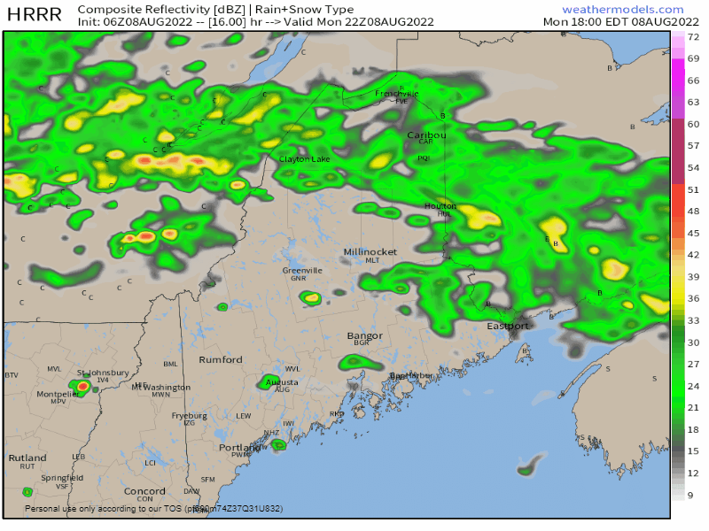 Monday 6 PM to Tuesday 6 AM - Showers with perhaps a few embedded rumbles of thunder are expected overnight into Tuesday morning. Expect the steady rain over northern areas to taper to scattered showers by mid-morning. Where rain falls, expect areas of patchy fog which could be locally dense in spots Humidity takes a bit of a break south by Wednesday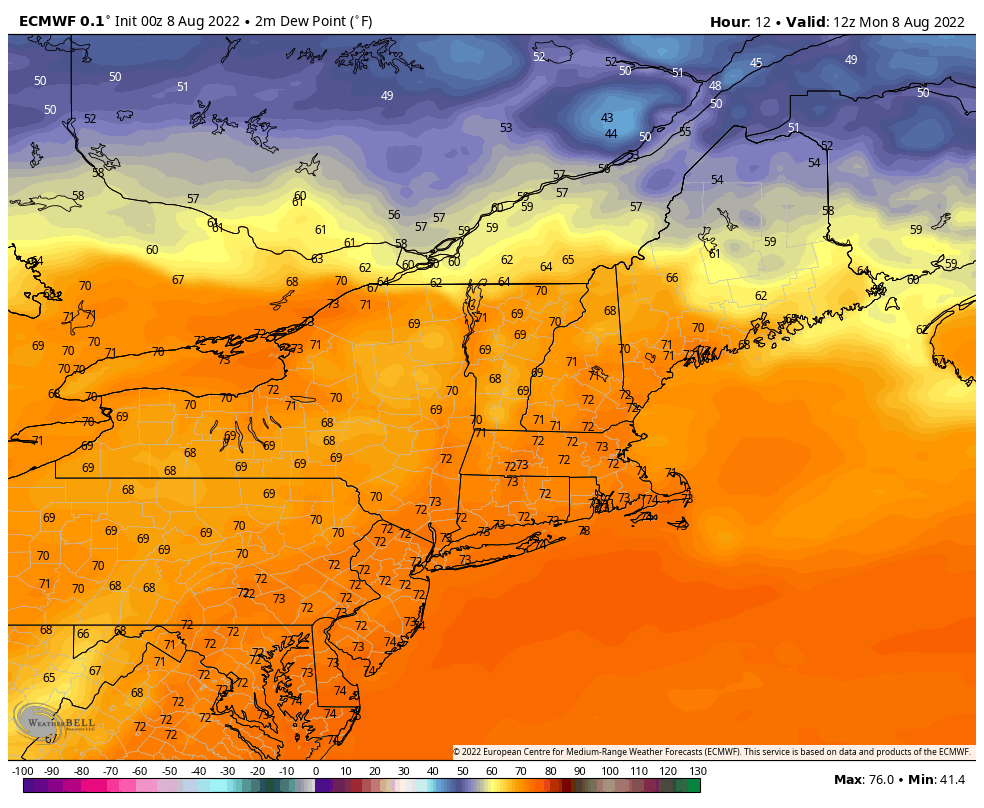 Monday 8 AM to Wednesday 8 PM - This sped up loop of surface dew points shows the front moving to the south enough to relieve southern areas of the swampy conditions Tuesday night into early Wednesday. The humidity is expected to rise once again on Thursday as an upper-level trough approaches. The associated cold front appears sharp enough to send the Bermuda High packing, but at this point appears to lack moisture. Dew points levels are expected to fall into the upper-40s to low 50s everywhere by Friday. Temperature outlook through Saturday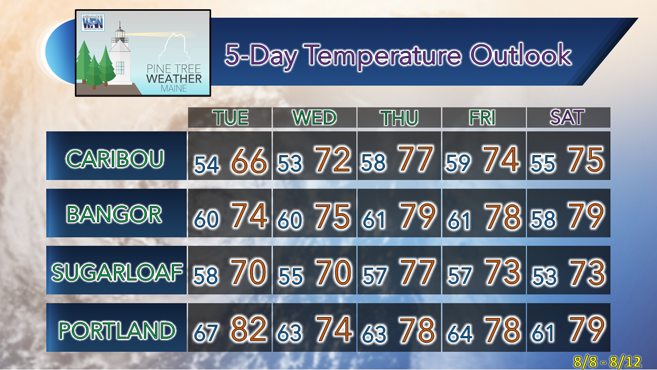 Thank you for supporting this community-based weather information source which operates by financial contributions from people like you. Stay updated, stay on alert, and stay safe! NEXT UPDATE: TUESDAY - Mike NOTE: The forecast information depicted on this platform is for general information purposes only for the public and is not designed or intended for commercial use. For those seeking pinpoint weather information for business operations, you should use a private sector source. For information about where to find commercial forecasters to assist your business, please message me and I will be happy to help you. |

Mike Haggett
|


