
Snow pack on track to take a hit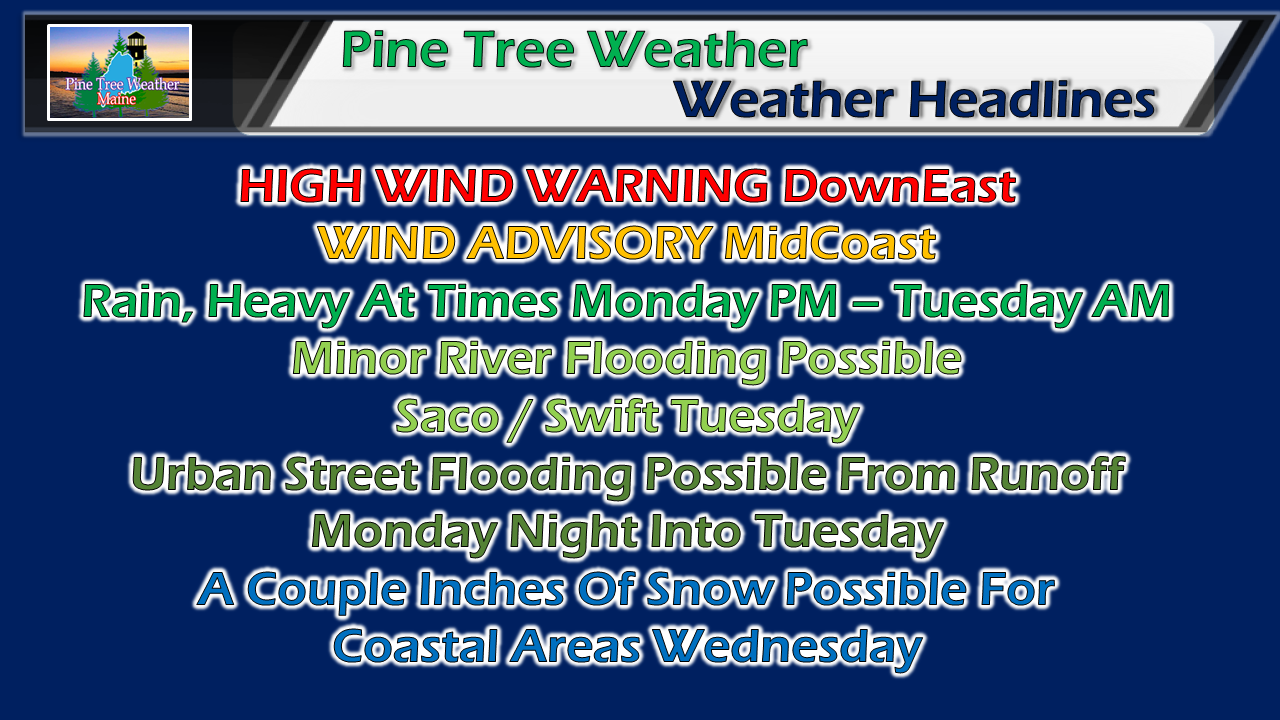 This is not what skiers, snowmobilers and other winter outdoor enthusiasts are looking for. The snowpack is going to take a hit with this system, and it may happen again over the coming weekend. For now we will deal with what is in front of us, and that is rain. If your driveway is snow covered, make sure you have sand and salt around to treat it. All of this rain will turn everything into a skating rink on Wednesday. Snow / mix turns to all rain by Monday night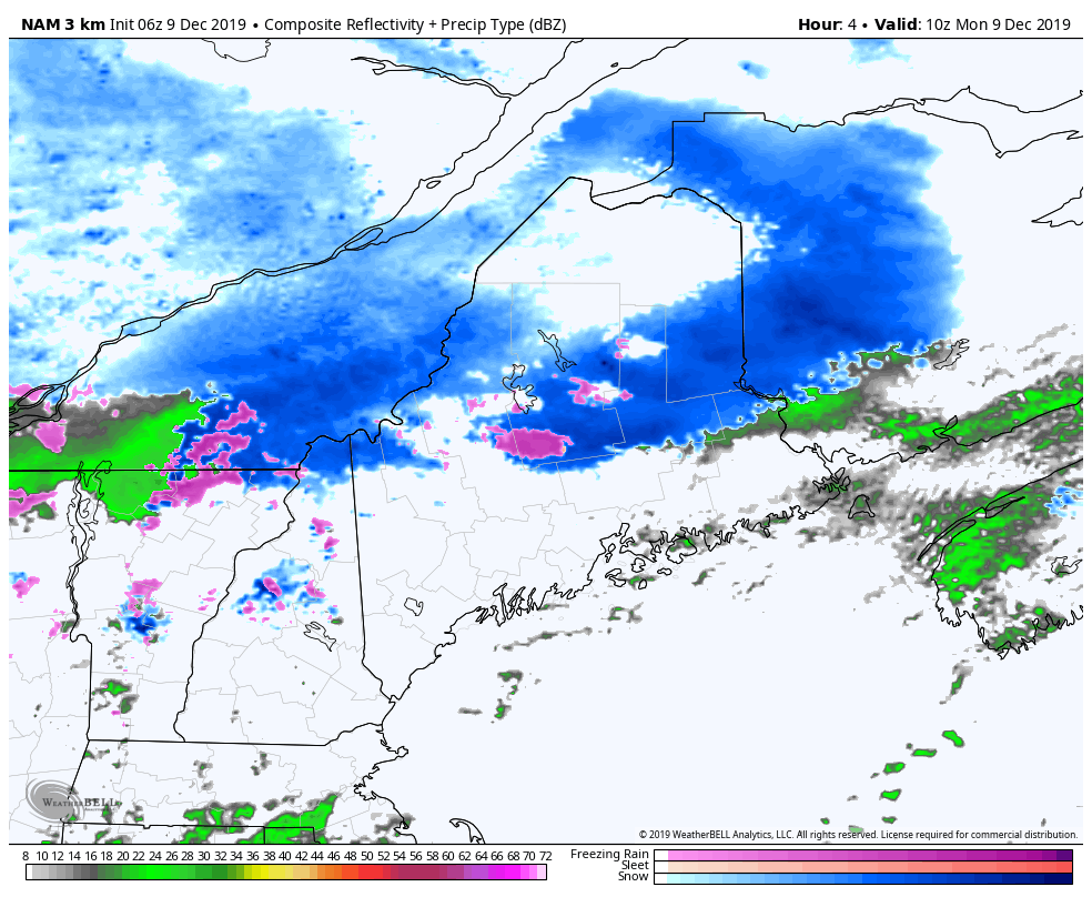 I suspect cold air damming may be a bit stubborn over pockets of interior areas Monday morning, so be on the lookout for areas of freezing rain if you are travelling through midday. By this afternoon, all areas should be above freezing and this will turn into an all rain event. Rain could be heavy at times through the night, especially along the coastal plain. Not only is there some minor flooding concerns, but fog will be an issue for travel, and it could be locally dense into Tuesday morning. With the steadier rain ending by Tuesday morning, the rest of the day could feature some pockets of light showers, perhaps drizzle and fog, 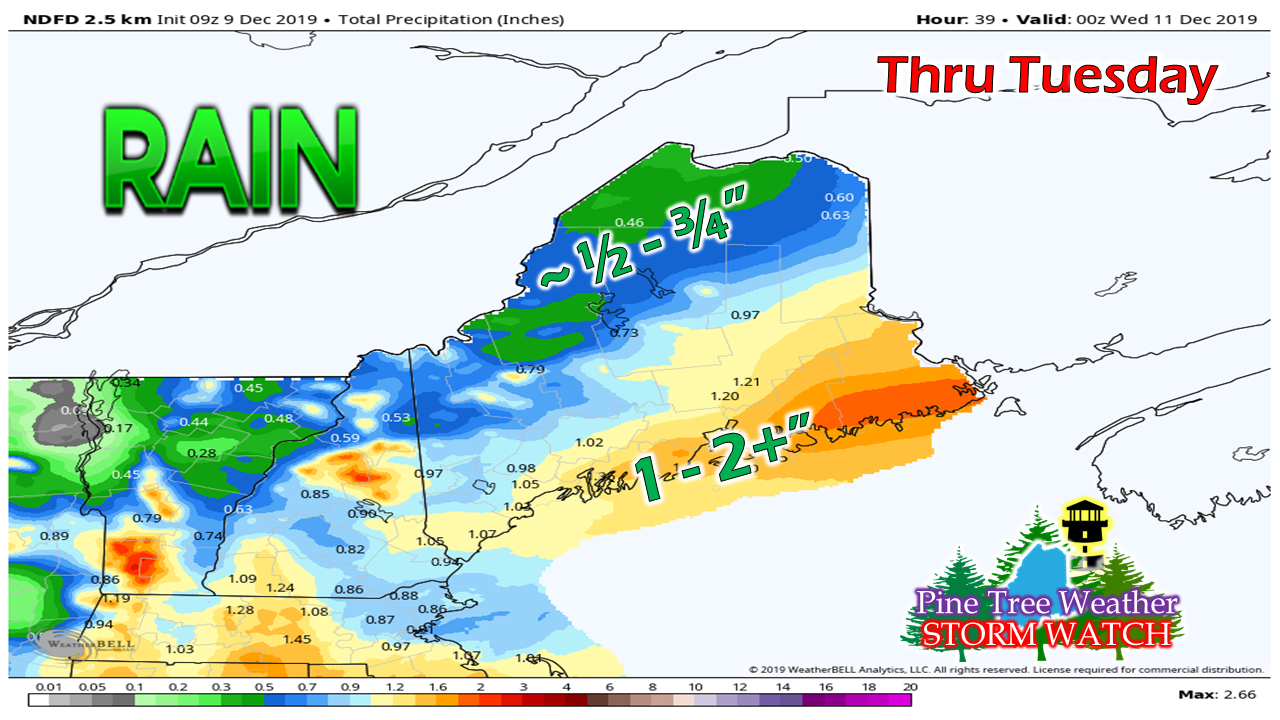 A general 1-2" of rain is possible for the coastal plain and east facing mountains, with lesser amounts to the north. 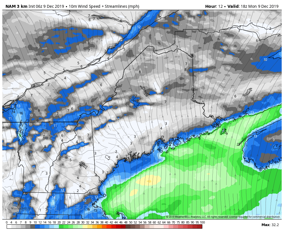 Wind is the big concern for this one for coastal areas, especially MidCoast and DownEast. Sustained wind shown here could reach 25 - 35 mph with gusts up to 60 mph. This is strong enough for potential power outages overnight into early Tuesday. The stronger gusts settle Tuesday morning, but the breeze will continue through the day and into Wednesday. Storm ends with some snow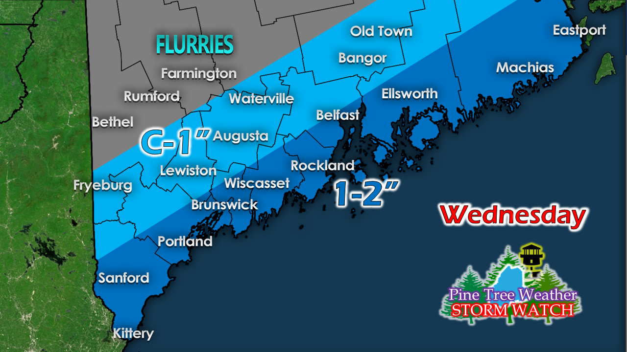 A cold front sweeps through the area Tuesday night into Wednesday. I am concerned about an impulse wave that may flare up along it as the front moves through the Gulf of Maine, which could bring a bit more snow than this. With the falling temperatures, any standing water will freeze, then and some snow on top of it could make for a slow commute Wednesday morning. I will update on this. ► ► For the latest official forecasts, bulletins and advisories, please check in with the National Weather Service in Gray for western and southern areas, or Caribou for northern and eastern parts of Maine. Your financial support is needed! ► ► $450 shortfall for the year ahead! You can help keep Pine Tree Weather going with a donation of any amount now through VENMO @PineTreeWeather, a monthly donation on Patreon or messaging me on Facebook or Twitter to send a check in the mail. Thank you for your support!
For more information from me, please check the Pine Tree Weather Facebook page as well as my Twitter feed. Always stay weather aware! - Mike |

Mike Haggett
|


