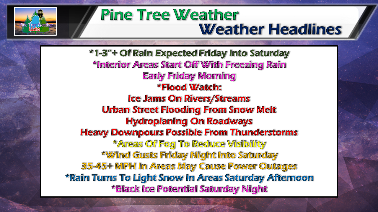
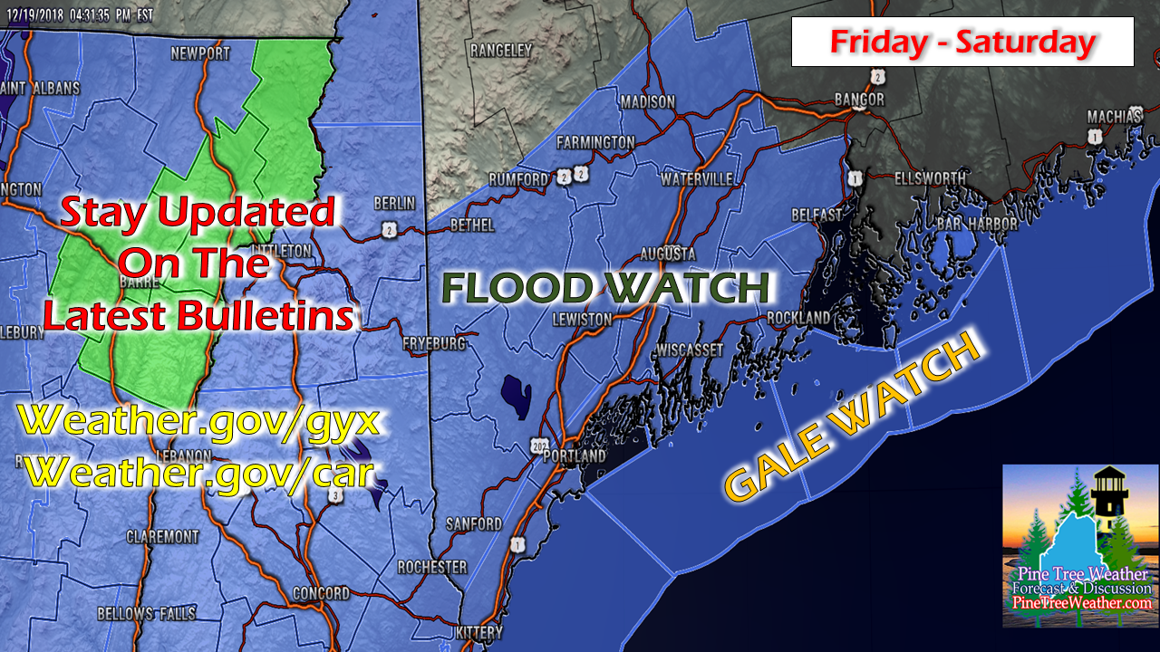
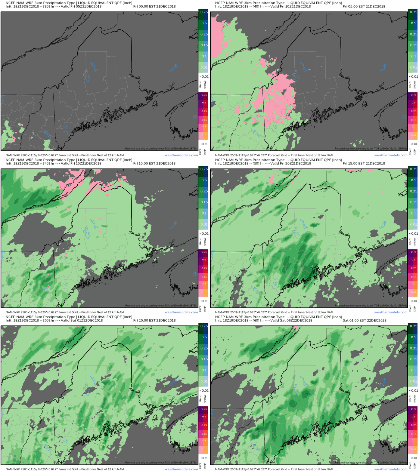
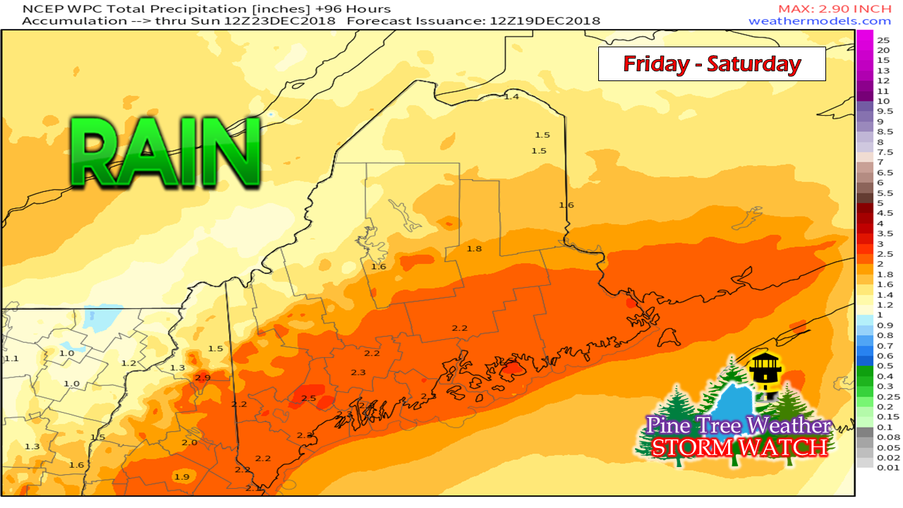
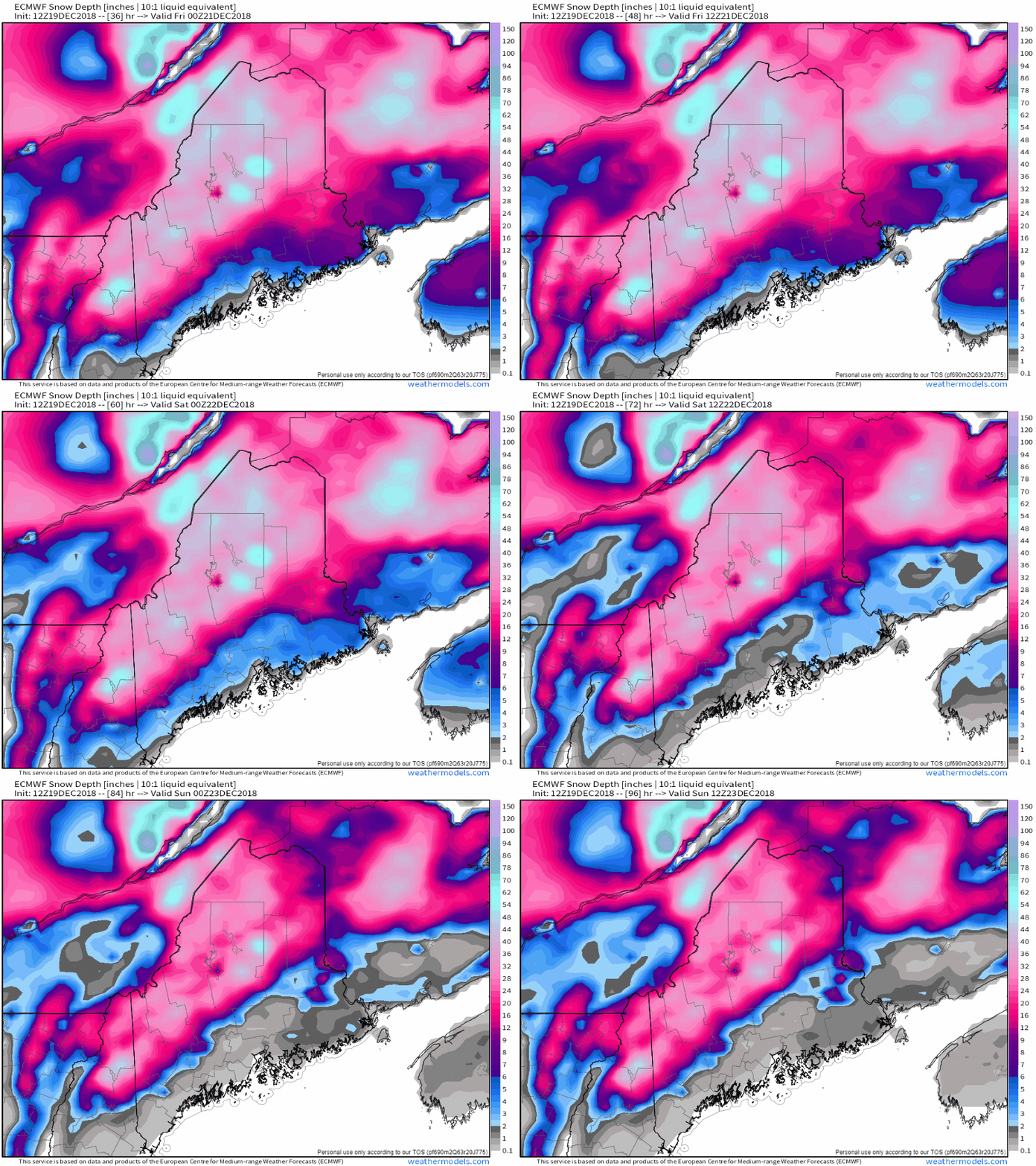
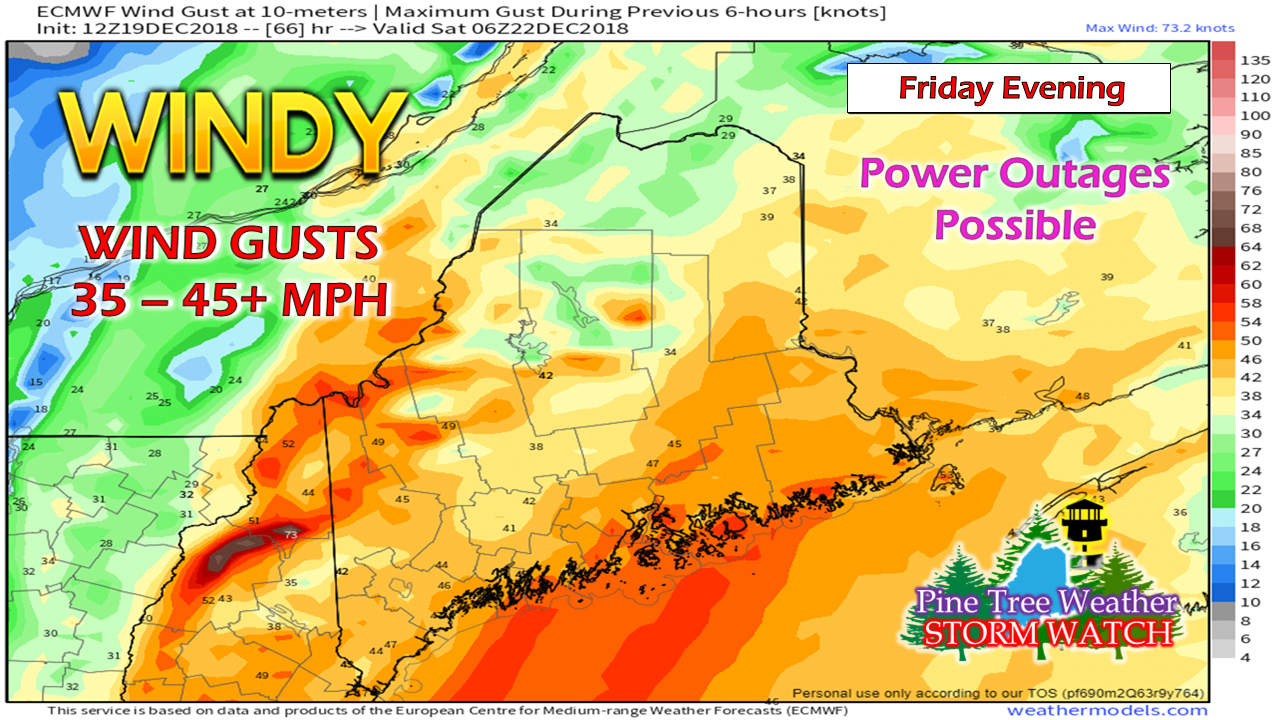
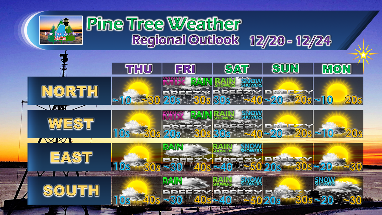
This is going to be a messThere is a lot going on here as the headline banner suggests here. It will be a rough start to the holiday travel period, and it could cause problem areas all around the state. A flood watch has been posted for the foothills to the coast for the western half of the state by NWS Gray. Due to timing, I suspect NWS Caribou will also issues flood and possibly a high wind watch or advisory for eastern parts of the state, at least. PLEASE stay updated on any and all bulletins posted by the NWS office for your region. Timing and rain impactsThursday night may be dry in western areas in time for the third shift to get to work and the second shift gets home. It appears the wee hours of Friday could be hazardous over interior areas due to the likelihood of freezing rain with perhaps a bit of sleet. Cold air damming will not win this even as the air column is very warm and tropical in nature, so the change over to warm rain should happen as the morning unfolds. Rain could be heavy at times during the day Friday and into Friday night. Thunderstorms delivering tropical downpours are possible over the coastal plain. This is going to make driving hazardous due to poor visibility, urban street and road flooding from snow melt, heavy rain and areas of dense fog. Hydroplaning is also a concern on the speedier roads and highways. The snow pack is going to take a hit due to the liquid involved. While the forecast may call for 1-3" of rain, the melting of snow could make it act like a 3-5" rain event. Many of the rivers and streams over the interior are iced up. This amount of rain, melting and runoff could cause ice jams which could flood roadways. Remember, if you come across a flooded roadway, turn around, don't drown. It's the holidays... make sure you are present for them. Then there is the wind...A combination of heavy rain and strong gusty wind will make travel Friday evening very difficult, if not dangerous at times for much of the state as well as eastern areas of Southern New England. A High Wind Watch has been posted for Cape Cod and the Islands by NWS Boston / Norton. At the time of this post Wednesday evening, our Maine National Weather Service offices have yet to post any advisories or watches as of yet, but that could change as the event comes closer. Travel Friday evening is discouraged by either high profile trucks or passenger vehicles due to the rain, wind, and reduced visibility. Conditions for travel improve Saturday morning. Also as a result of the wind potential, power outage potential is possible as well. Stay tuned for the latest bulletins. Outlook through Christmas EveAfter all of this, a cold front sweeps through the state Saturday afternoon into the evening which may bring some snow showers along with colder temperatures. With all of this water, black ice is likely for Sunday morning. There is a slight chance for some snow shower activity for Christmas Eve for southern areas with little accumulation expected at this time. For the latest official forecasts, bulletins and advisories, please check in with the National Weather Service in Gray for western and southern areas, or Caribou for northern and eastern parts of Maine. Your financial donation would be appreciatedPine Tree Weather is now 90% funded to get through October of 2019. My anticipated current deficit now stands at $380 remaining to be raised to reach my goal.
I am sincerely blessed and humbled by your financial contributions, cards, and messages of encouragement. It's been an amazing journey over the past 7 years, and to see my efforts appreciated by those that follow is a wonderful reward for my work. My request is for $1 per month / $12.00 per year through my Patreon page or by sending me a message on Facebook or Twitter to mail a check. The popular contribution has been $5 per month / $60 per year on Patreon, and the check donations average out to same amount as well. For those who have already donated, I sincerely thank you. For those who have yet to, I would sincerely appreciate your support in order to be fully funded by the end of the year. For more information from me, please follow the Pine Tree Weather Facebook page and my Twitter feed. Always stay weather aware, and thank you for your support! - Mike |
Mike Haggett
|

