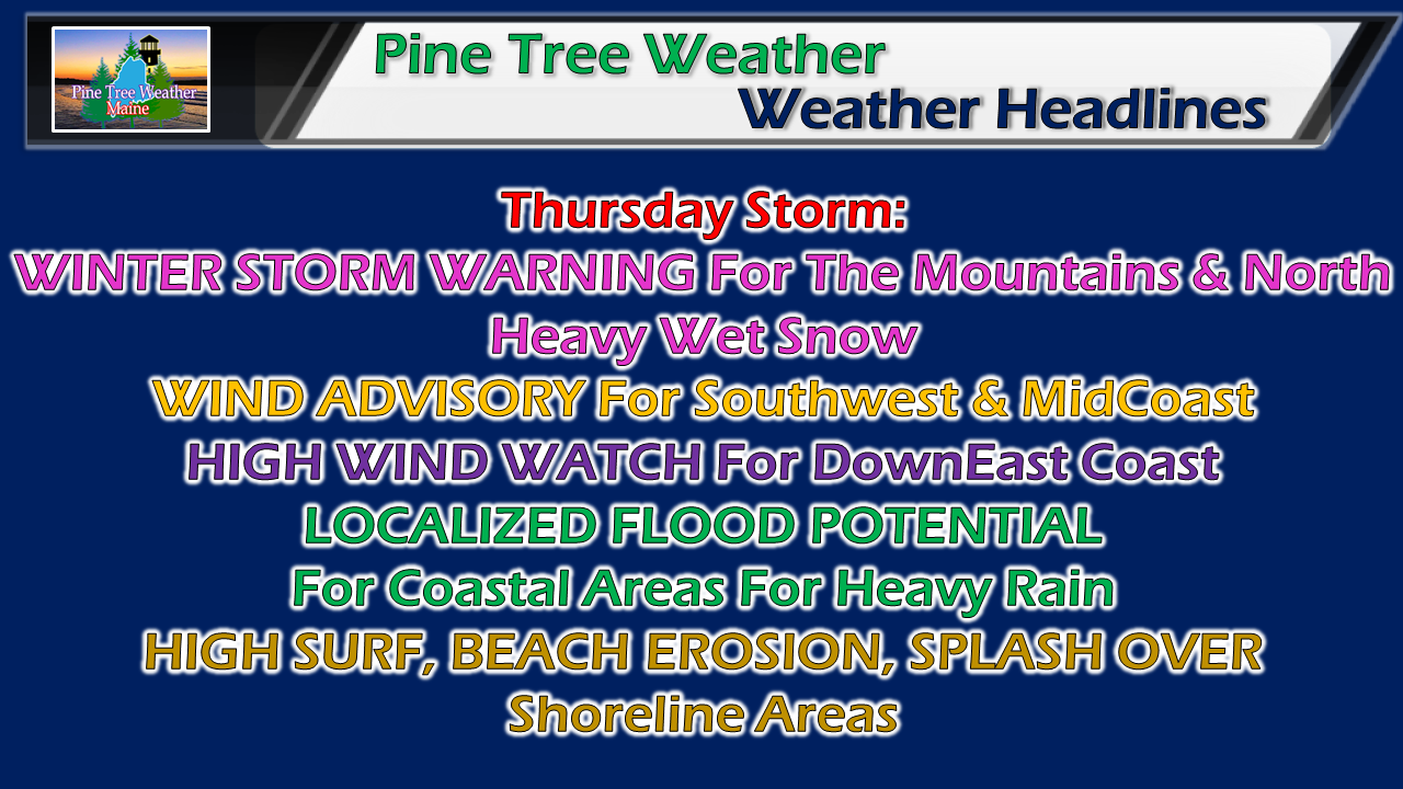
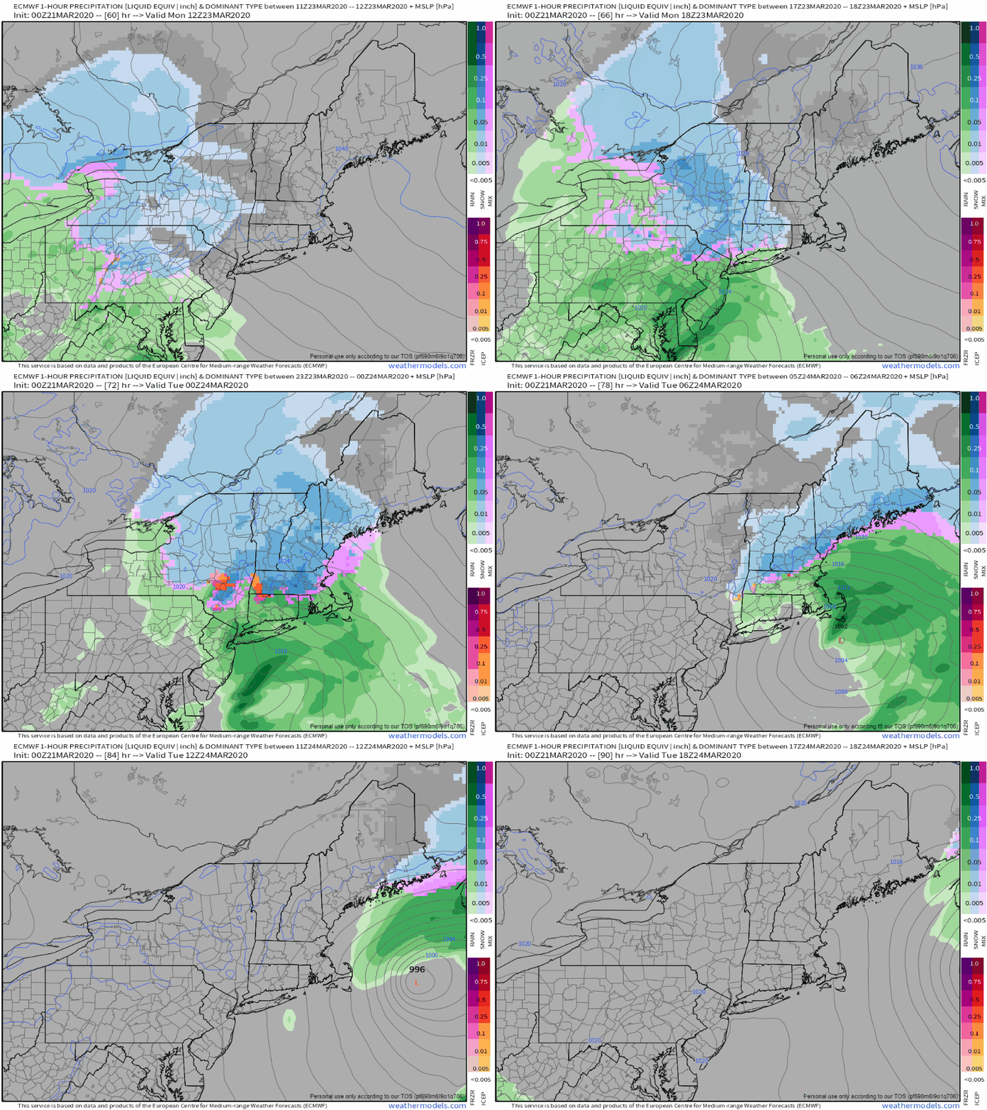
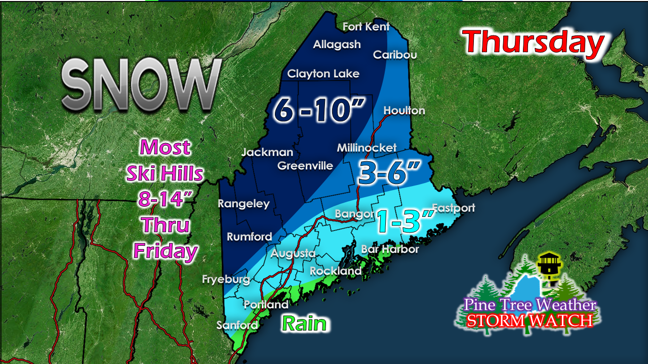
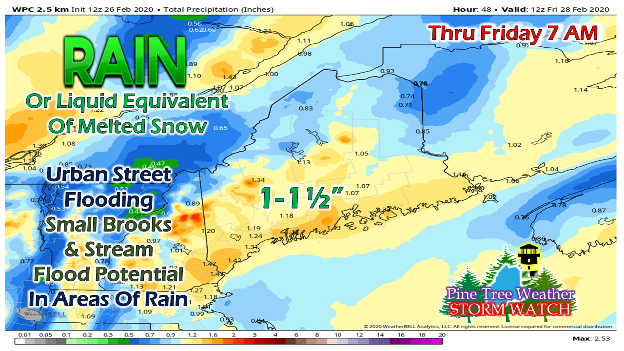
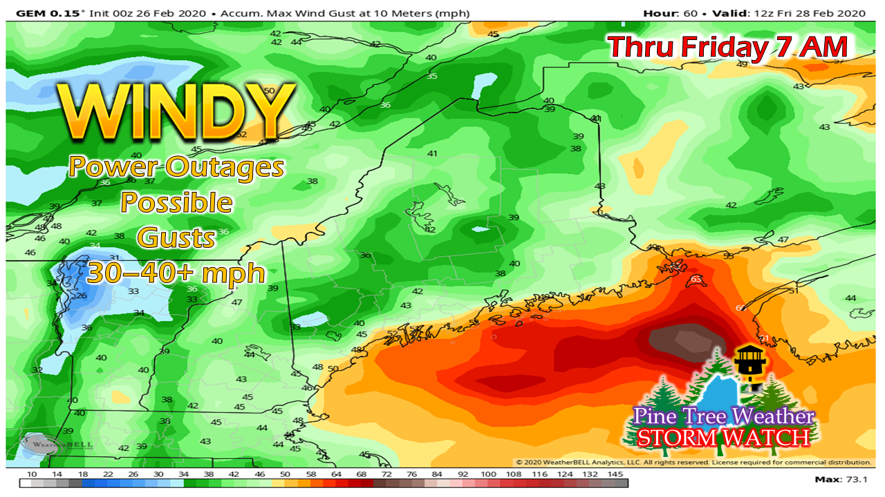
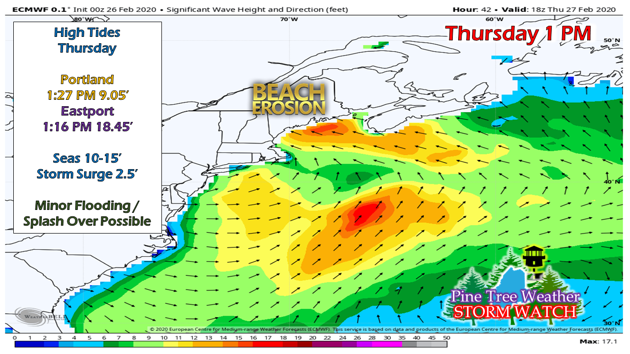
Spring type storm to bring impacts to the regionWinter storm watch areas have been upgraded to warnings. A wind advisory is posted west of Penobscot Bay, and a high wind watch has been issued for the DownEast coast. This is going to be mess no matter where you are. If you don't have to shovel it, you may have to pump it. This will cause problems with the commutes, either with slick roads or hydroplaning. Expect a slow go of it, and plan accordingly. We're almost to March, and this storm is similar to what we see in mid-March. Spring is likely to come early this year. Snow lovers, enjoy it while you have it. All areas could see rain next week. A fast moving, but potent stormA strong Great Lakes low hauls in moisture from the south and spins off a secondary low that cuts through Maine. This roughly a 24 hour storm for most, 48 hours for the western mountains. The action starts in the wee hours of Thursday over western and southern areas, and expands into northern and eastern areas by mid-morning. Heavy snow tapers to snow showers over western mountains by Thursday evening. The faucet shuts off over southern areas by late afternoon. Eastern areas see the last of their potpourri of precipitation by early evening. The last of the steady snow exits northern Maine in the wee hours of Friday morning. As I said in the update posted here Tuesday afternoon, the snow gradient is going to be sharp. I have good confidence for a solid snow in the mountains up through the Allagash. South and east of that, it's maybe or maybe not. This will be a lot of slop to deal with. Heart attack level. Take your time moving it. This will freeze up, but warmer weather comes early next week. Flood potential for areas that get rain. How's your sump pump? May want to check on it. It could be running steady. Basements prone to flooding... if you have one, you are on notice. Hydroplaning potential on the speedier roads, reduced visibility from heavy rain and fog. With the strong low, comes gusty southeast winds. Power outage are possible, especially along the shorelines, areas that get heavy wet snow, and higher elevations. And last but not least, our shorelines will feel it, too. Battering waves in the 10-15' range along exposed coastlines. Ferry disruption possible for Penobscot Bay. Thankfully astronomically high tides have passed. Regardless, I expect splash over and perhaps some minor flooding from the 2.5' storm surge around high tide Thursday afternoon.
Buckle up. ► ► For the latest official forecasts, bulletins and advisories, please check in with the National Weather Service in Gray for western and southern areas, or Caribou for northern and eastern parts of Maine. You can help keep Pine Tree Weather going into the future with a donation of ANY amount now through VENMO @PineTreeWeather, a monthly donation on Patreon or messaging me on Facebook or Twitter to send a check in the mail. Thank you for your support! Always stay weather aware! - Mike |
Mike Haggett
|

