
Winter Storm Watch for most of the state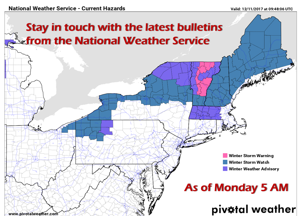 A mess on the way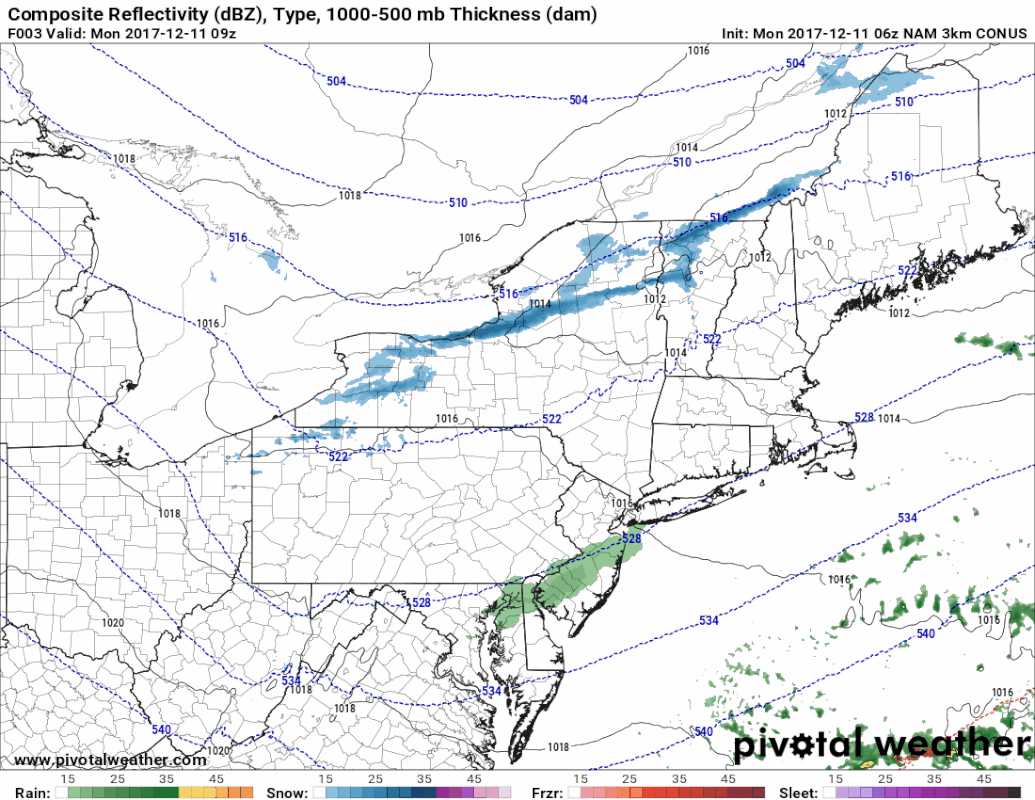 This is the 06z (1 AM) NAM WRF model in three hour steps from 4 AM Monday thru 1 PM Wednesday to give you a rough idea on the timing of all of this. The Monday overnight hours appear free from precipitation, but that changes an hour or two before daylight. Make no bones about it, it will be a tough morning for travel over western and southern areas the state Tuesday morning. All areas start off with snow. The shorelines and coastal interior see a change over to all rain which will help improve road conditions during the day, but for the mountains and north, it will be rough getting around all day. Given the convective idea that the model is presenting, there is a chance for a clap of thunder out of this for the coastline. Thunder snow is unlikely for the interior, but cannot be ruled out. Precipitation outlook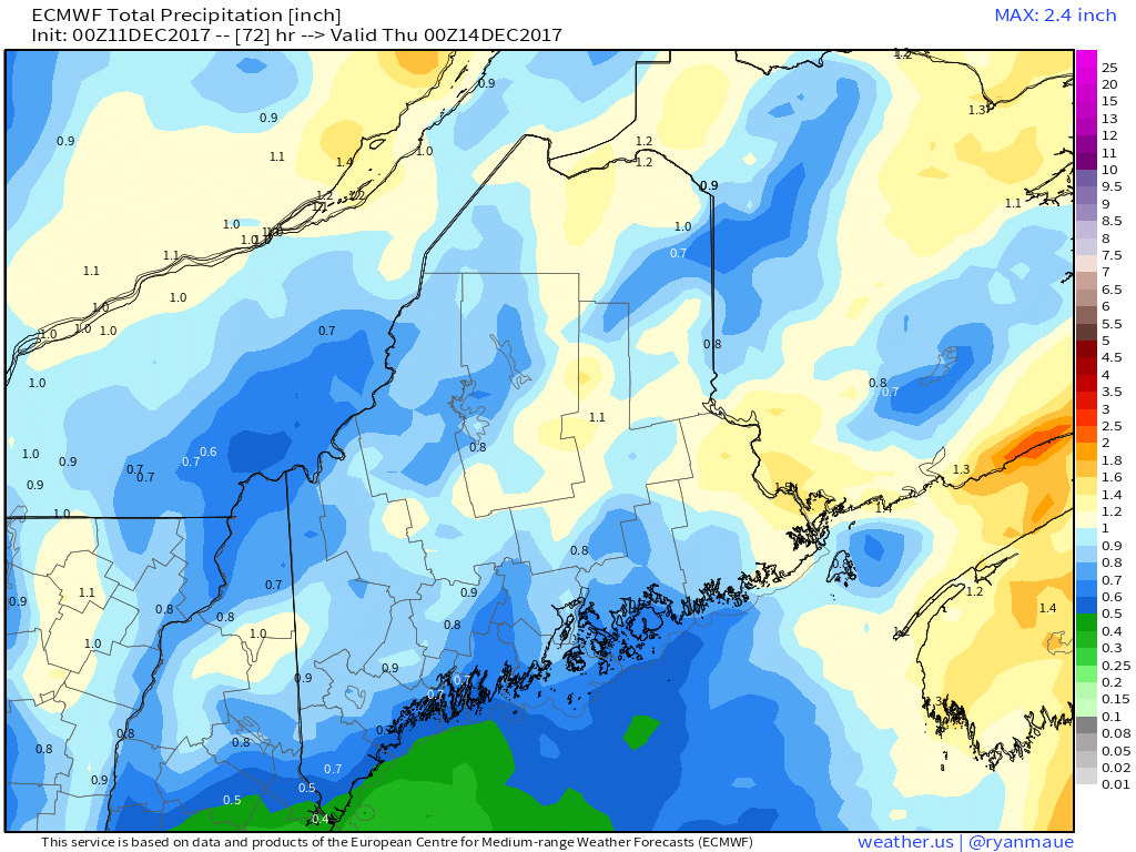 Using the model chart from the 00z (7 PM Sunday) European suite, the state is likely to see roughly 1" of water out of this storm. How it lands will be in different forms, pending on region. What is concerning about this amount of moisture is the ground has frozen for the most part. Urban street flooding could be an issue for the coastal plain. 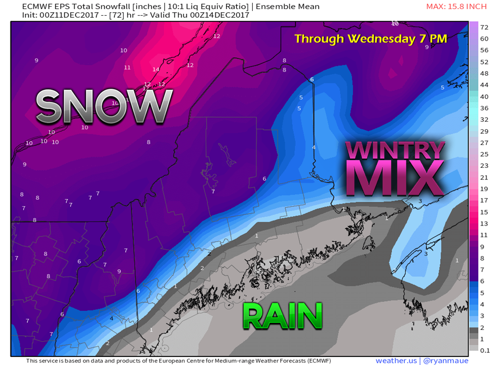 Using the European ensemble run from 00z (7 PM Sunday) for discussion purposes, the heaviest snow (6-9") will fall over the north country. Given the fact this snow will feature high water content, this will be problem to move it around. Slushy, pasty snow will cling to everything, which will make getting around treacherous. Blue shaded areas will have a rough time also. Snow could change to sleet and/or freezing rain before the change to all rain Tuesday afternoon (west) and evening (east). Don't let the gray areas along the coast fool you... I expect a "Body Shop Special" for the morning commute. It will be just enough snow to fool careless drivers, unless folks decide to behave themselves. Important to note here that this may not be the final answer. Models have a tendency to overdo the warming. The track of the low along the front will dictate how this ends up. It will be later today before the picture becomes clear. The is still some wiggle room, and only a slight jog to the southeast brings heavier snow closer to the shorelines. And then there is the wind...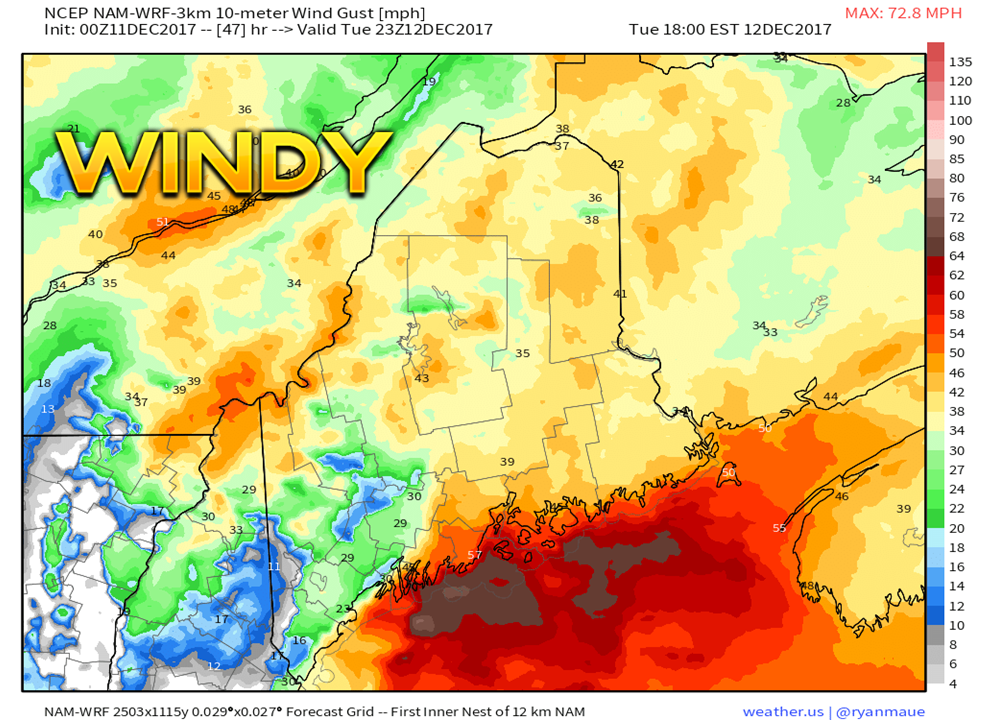 With the heavy wet snow combined with wind gusts roughly 35-45 mph, that means potential power outages are a part of the discussion. The wind peaks Tuesday evening and ever so slowly diminishes overnight into Wednesday. The storm will be intensifying as it heads into Eastern Quebec. This keeps the strong breeze in the weather picture for the mountains and north into Wednesday morning. Temperatures drop Tuesday night into Wednesday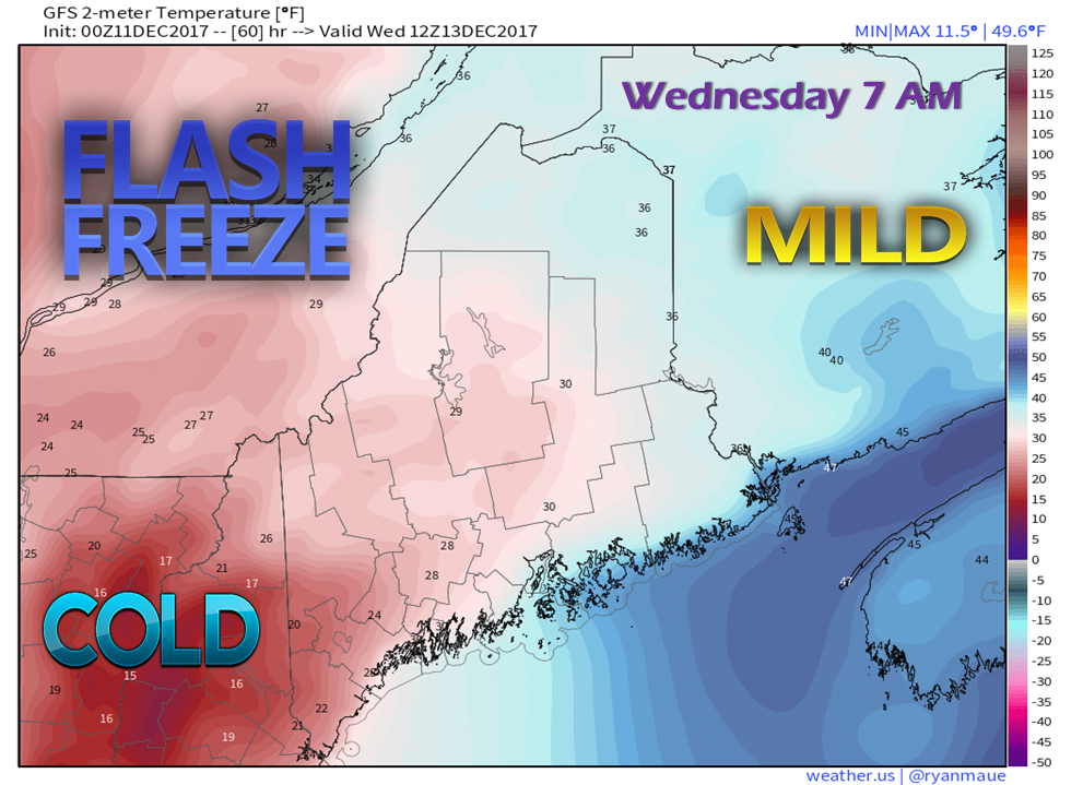 With the roughly 1" of liquid equivalent precipitation falling statewide in various forms in combination with falling temperatures, this creates problems also. Given the deep cold as of late, the ground is frozen. The new rainfall for coastal areas is going to have a tough time with absorption, which means ice will form, and could form very quickly Tuesday night into Wednesday morning. As the cold front passes through, wind shifts from the northwest and ushers in the coldest air of the season thus far. 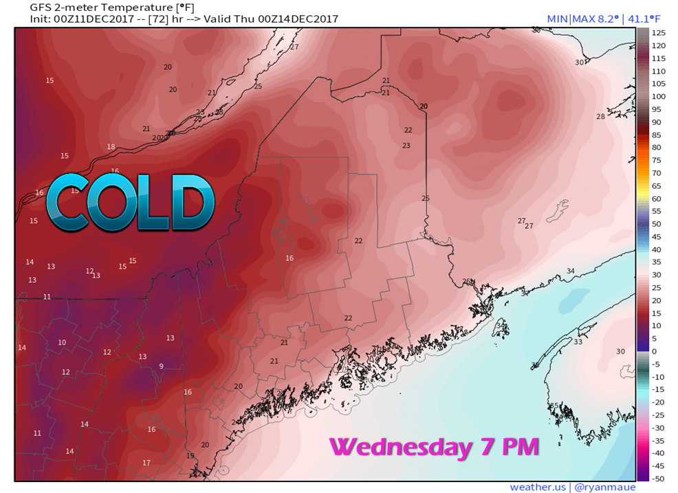 By Wednesday evening, all areas will be well below freezing and anything that was liquid will be froze up tight. With no real warming in sight, what precipitation falls in whichever form isn't going anywhere. Move the snow while you can, and make sure the sand and salt supplies are well stocked. Bitter wind chill to start of Thursday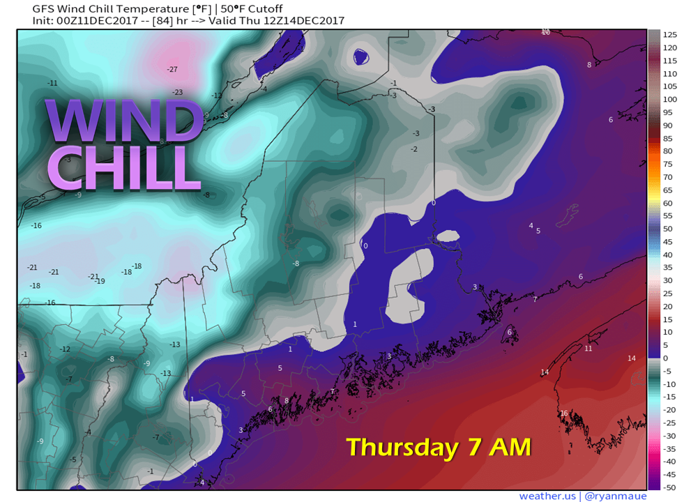 The region does not appear to reach "freezer burn" windchill criteria, but it gets close. A widespread area is likely to have a real snap in the air to start the day on Thursday, with indices within fingers reach of zero, plus or minus. Next storm possible late week This one will be one to keep tabs on for Friday into Saturday. This is a similar pattern with an upper level low over the Great Lakes which drag the frontal boundary closer to the coast.
What was once a quiet pattern has turned volatile. Stay tuned. - Mike |

Mike Haggett
|


