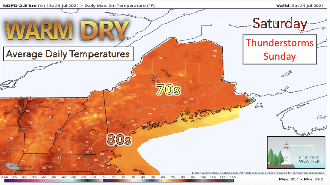
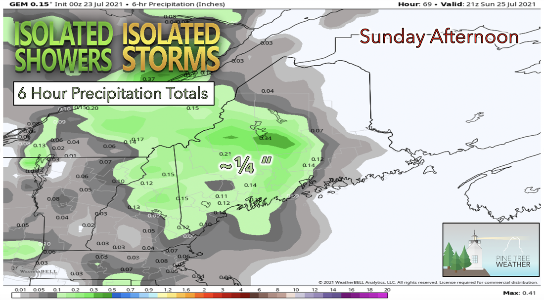
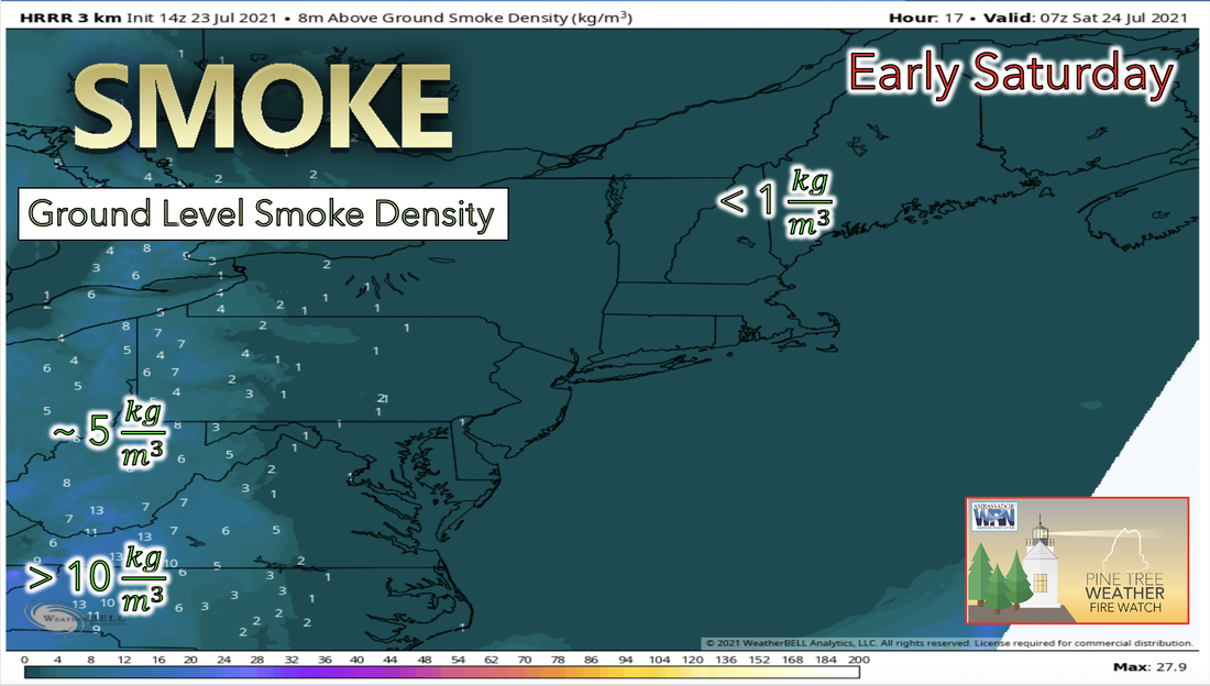
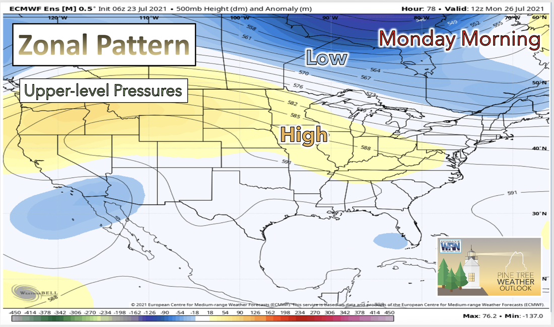
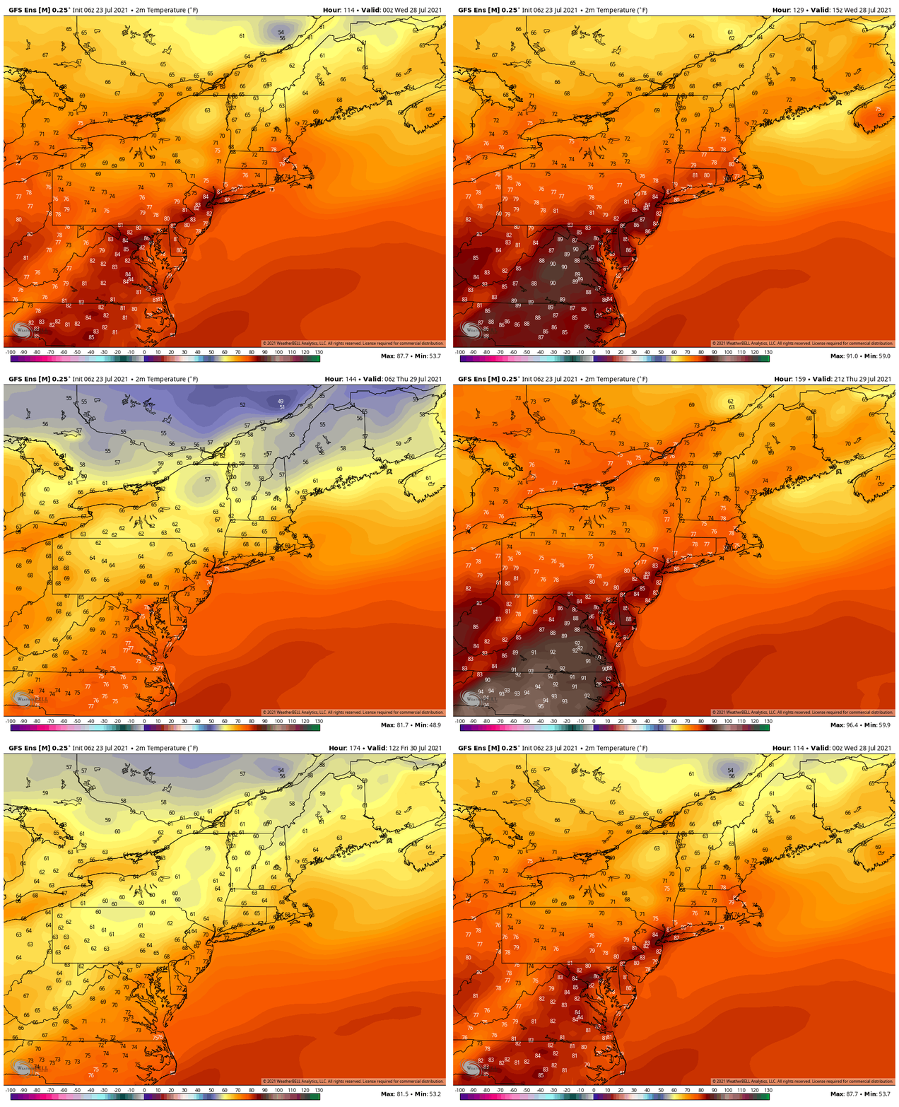
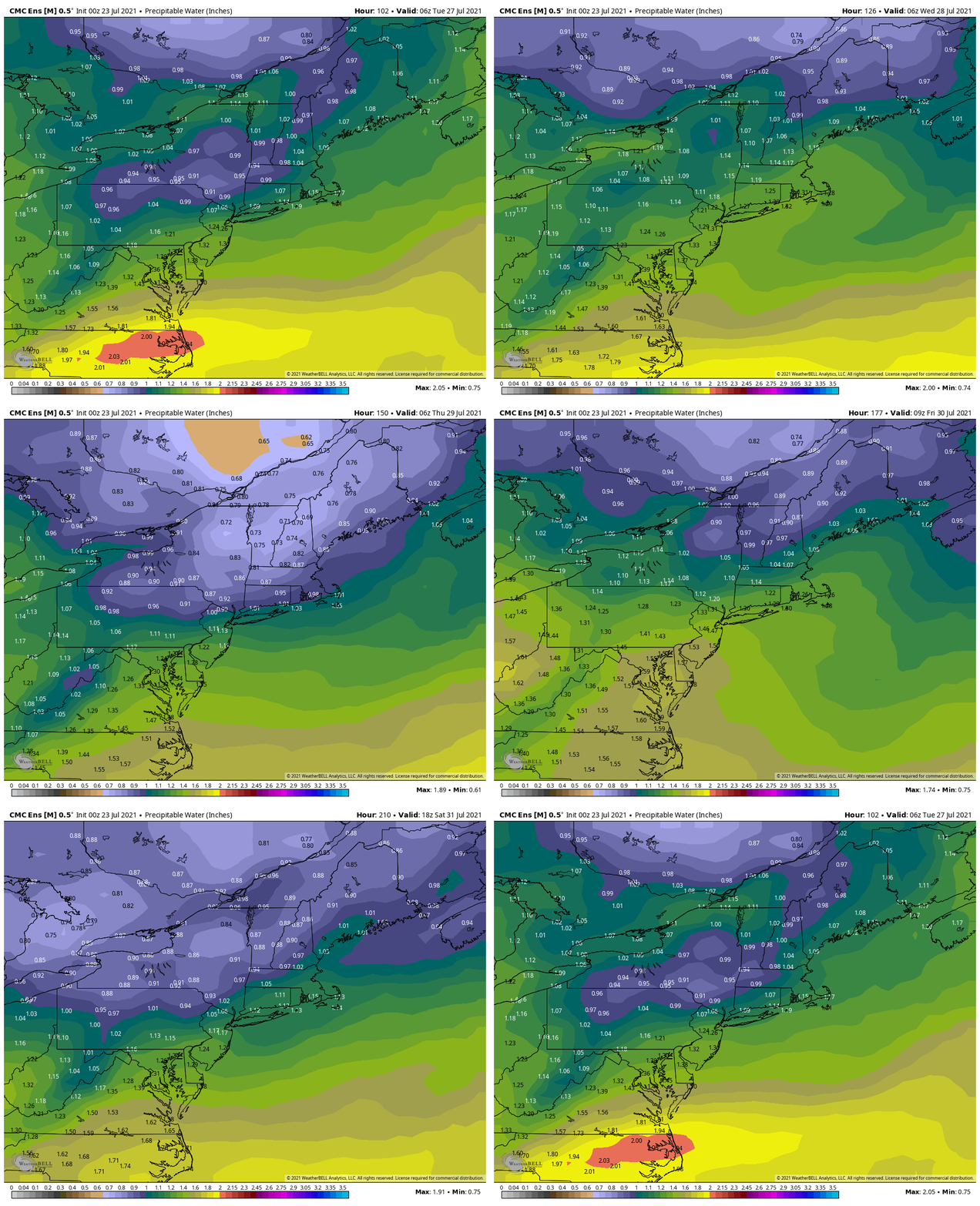
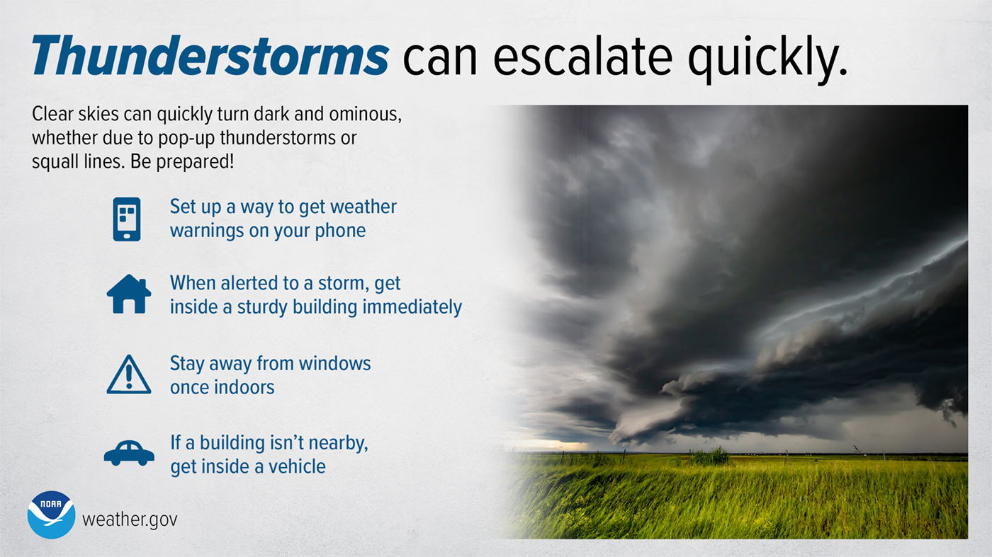
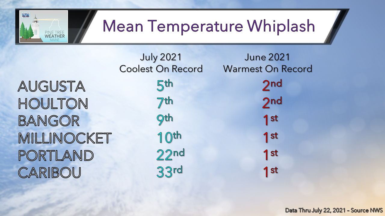
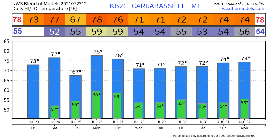
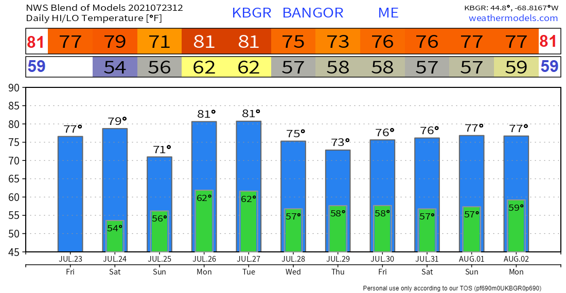
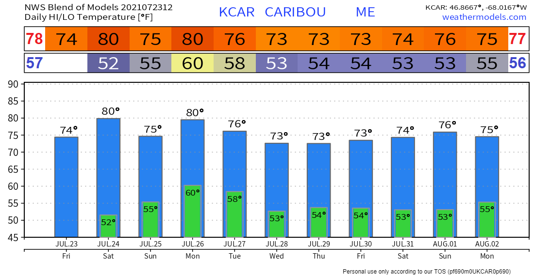
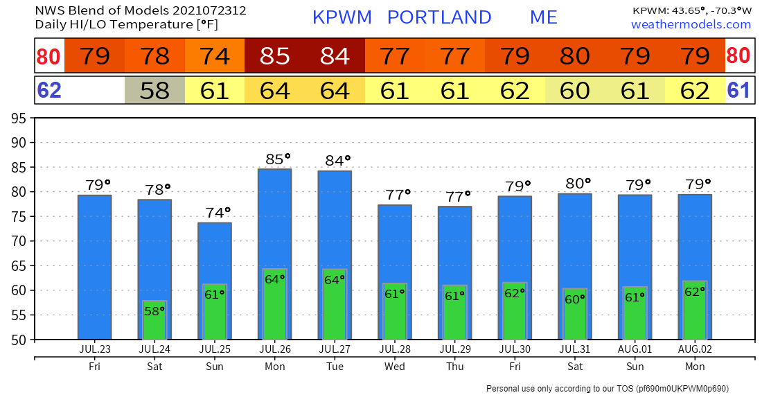
Finally Sunny!After a long week of rainy weather Saturday is expected to nice and sunny. A perfect day to sneak in those outdoor activities! As Friday evening rolls around a high pressure system will make its way into the area and last throughout the day Saturday. With this high pressure anomaly we will likely see clearing skies starting early Saturday and sunny skies continuing throughout the day. Temperatures will be relatively warm due to radiational heating at the surface allowed by cleared skies. High temperatures for Saturday are expected to be on the upper end of the 70s and work their way into the near 80s in the south. An onshore flow is likely to develop throughout the day causing temperatures along the coast to be slightly cooler than they are forecasted to be farther inland. Dew points should remain in the 50s this Saturday making the air feel hot and dry for the day. Enjoy the sun and don't forget your sunscreen! Showers and thunderstorms SundaySunday morning is forecasted to be calmer with showers and isolated storms possible as the afternoon approaches. As precipitation associated with a warm front clears in the west Sunday morning the potential for storms ramps up. The likelihood of thunderstorms by Sunday afternoon in the south will be dependent upon how much clearing and daytime heating can occur by midday. Models currently look to be favorable of these conditions therefore it is likely that we will see a few scattered storms this Sunday. As for the north a frontal system is expected to move across the region and so, a round of showers is forecasted for the afternoon. Rain showers and scattered storms Sunday afternoon will likely prevent temperatures from climbing significantly and so high temperatures for the day will be in the low to mid 70s across the state. Air quality to decrease SundayKeep and eye out for hazy skies and be aware of declining air quality this upcoming Sunday as smoke is expected to reach the area this day based on the current flow pattern. As the upper level flow becomes more and more zonal smoke from wildfires on the west coast is given the perfect mode of transport and will likely move into Maine by the end of this weekend . Smoky air can be quite dangerous to your lungs and especially to those who already have difficulties breathing. It would be prudent to wear a mask outdoors as smoke coverage escalates and to keep an eye on the path of this incoming smoke cloud. Long wave trough sets up weather pattern MondayA zonal upper level pattern combined with an unsettled pattern at the surface will bring more rain to the region beginning Monday. This weather pattern for Monday is expected to be the catalyst for the pattern in the week ahead. The surface level trough forecasted to pass by throughout the day Monday will bring the potential for showers and storms for most of the day. In the upcoming week we can expect much of the same as little to no change is expected for this weather pattern. Low pressure will dominate the region this week bringing with it the potential for rain and storms each day. As a result high temperatures will remain on the lower end and humidity levels are expected to remain low as well. Cooler with less humidity through next weekTemperatures this week are forecasted to remain relatively low compared to the previous week as rain and storms are possible for each day in the week to come. High temperatures each day are expected to struggle to reach the 80s as they previously have been. Most days temperature will fluctuate in the 70s and reach the upper 70s at the most. Low temperatures for the upcoming week will likely be limited as well. These lows are expected to hover within the 50s and only reach the 60s at a maximum. Moisture in the air is also expected to be more limited this upcoming week as a result of the incoming pressure pattern. Precipitable water levels in the atmosphere will likely remain below one inch for most of the state with areas along the coast only reaching slightly above this number. Higher moisture levels may only occur as a result of rainy weather and will likely be elevated along the coast due to onshore flow from the gulf of Maine. ThunderstormsThunderstorms and squall lines can quickly turn clear skies dark. Stay Weather-Ready by having a way to get weather alerts on your phone and stay safe by immediately going inside when the skies turn threatening. weather.gov/safety/thunderstorm Temperature OutlookTemperatures through the end of July are expected to take quite a dip and give us some of the coolest temperatures on record for the season. As mentioned above daily temperatures leading out the upcoming week will be significantly lower as compared to the norm for this season. As the temperature charts below show, high temperatures for the upcoming week are forecasted to barely skim the 80s in most places and hover in the mid 70s. Daily lows will dip into the mid 50s for most areas and reach the low 50s in some places to break records. Be prepared to receive alerts and stay updated  BE PREPARED WITH A NOAA Weather Radio. For $20-$40, it could provide vital information to you when you need it. The weather bands are standard on most public safety scanners, and newer scanner models. Weather radios can be programmed for auto alert. Click here for more information.  ► ► For the latest official forecasts, bulletins, and advisories, please check in with the National Weather Service in Gray for western and southern areas, or Caribou for northern and eastern parts of Maine.  Thank you for your support! Madelyn will have the morning update on Facebook tomorrow. - Angelina Find me on Twitter! |
Mike Haggett
|

