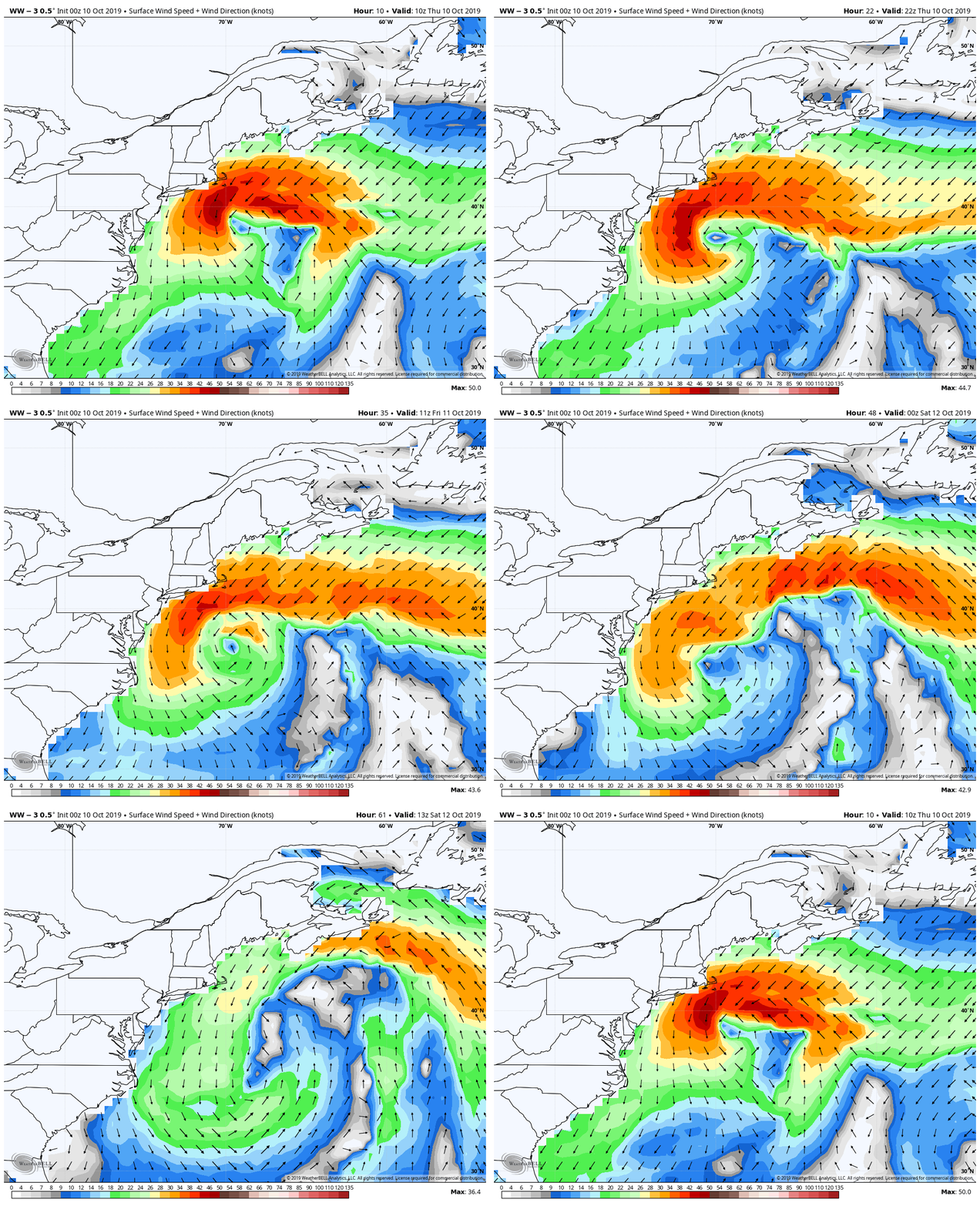
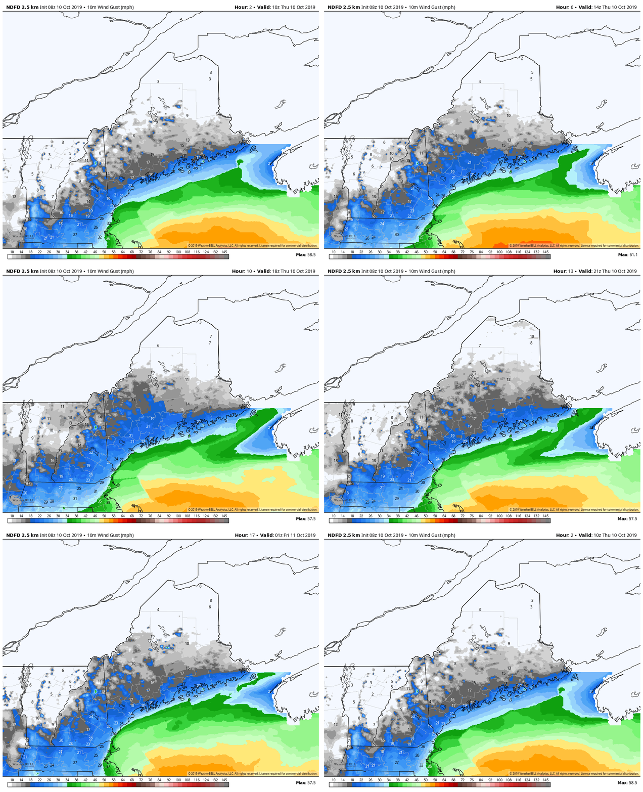
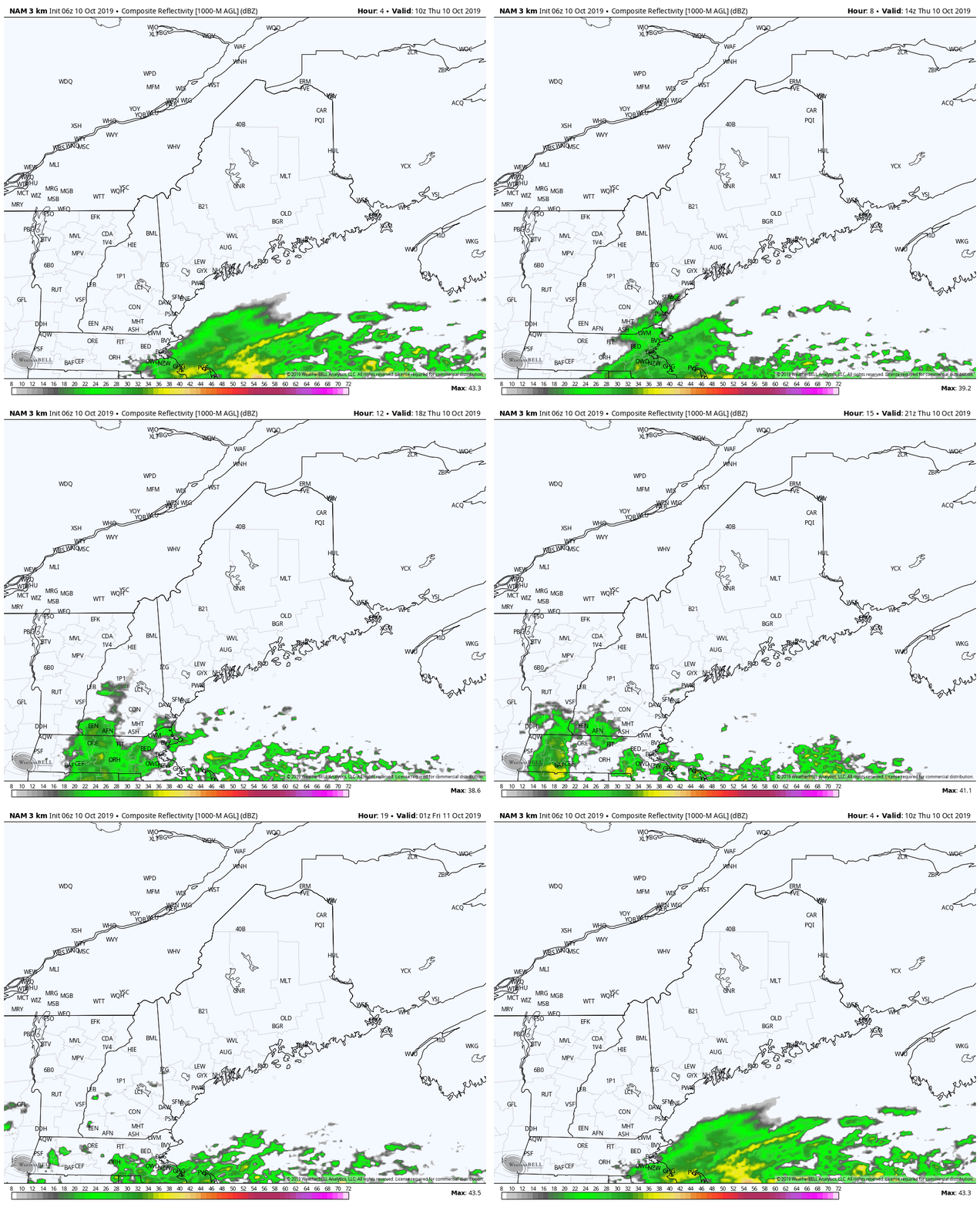
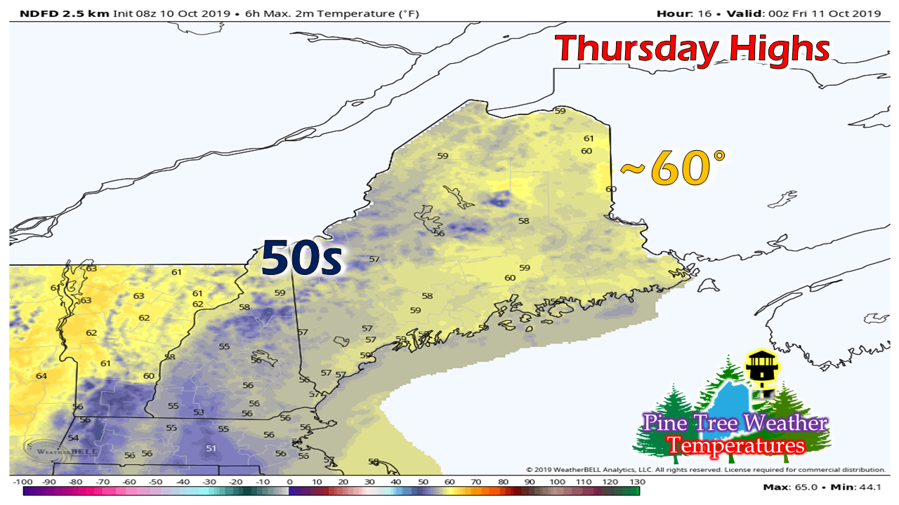
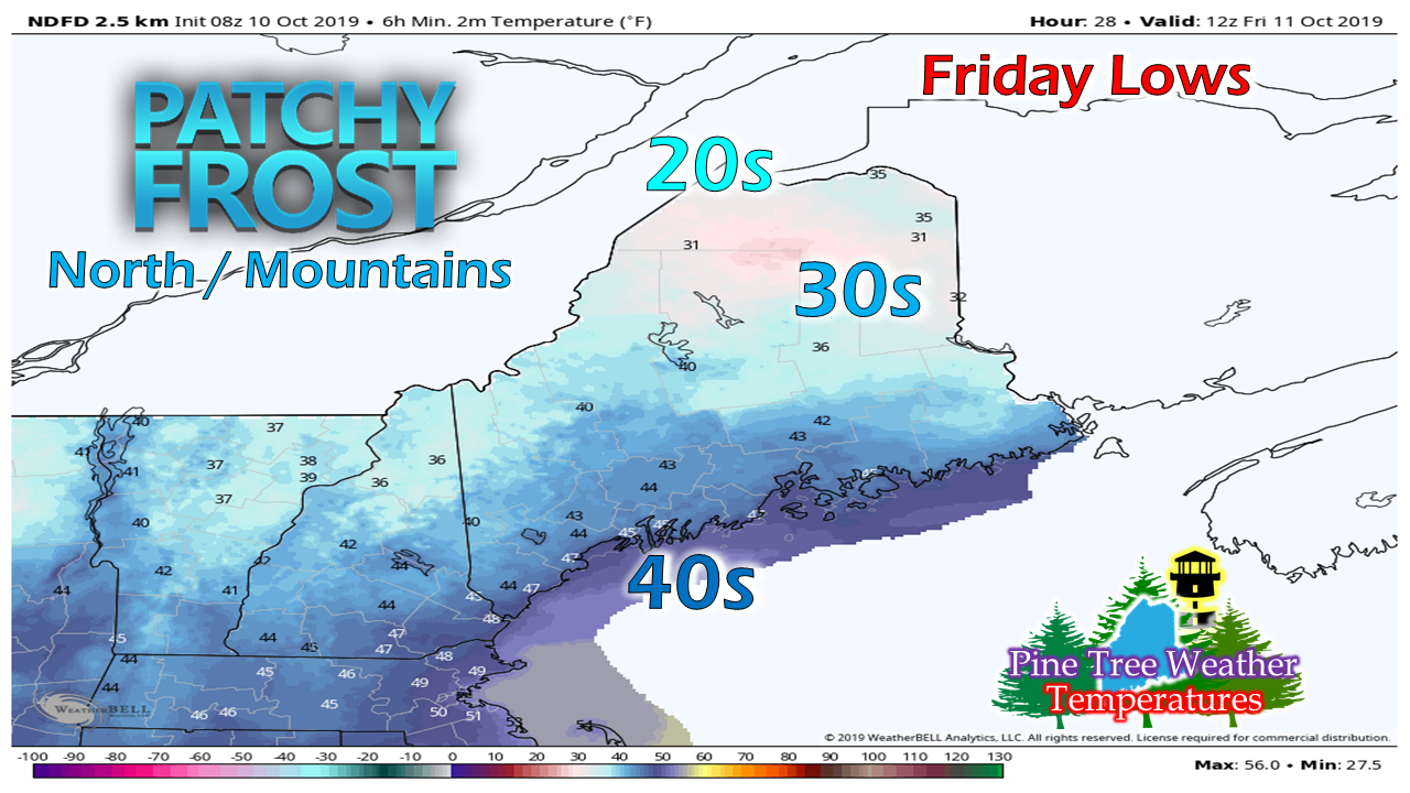
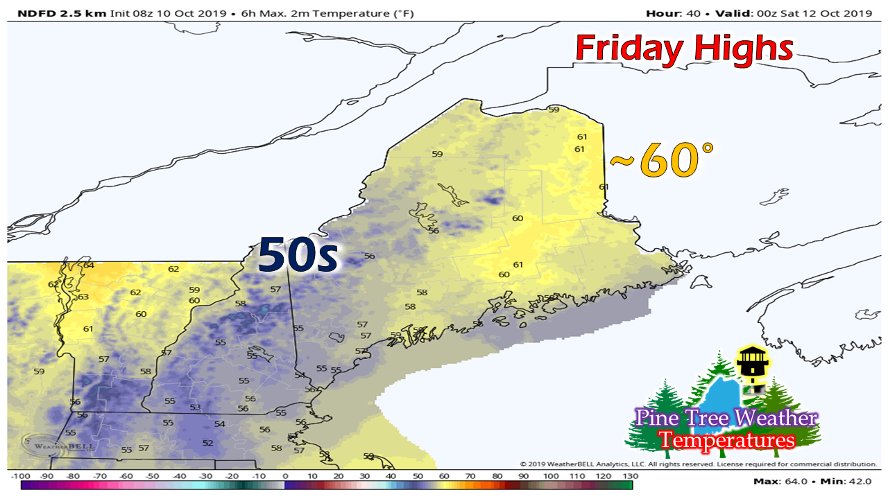
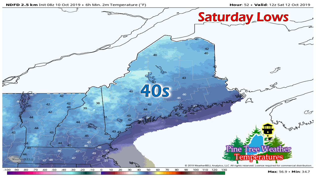
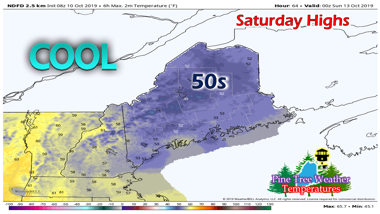
Ocean to stay churned into the weekendThe ocean storm to the southeast of New England will retrograde westward and intensify on Thursday. Waves from the storm will begin to impact the Maine coast today. Waves in the 5 - 8 foot range are likely to cause dangerous rip currents, minor beach erosion and splash-over around high tide near the 10 AM and PM hours Thursday. While it is always impressive to view wave action, it's important to respect the ocean and watch from a safe distance. Breezy for the shorelines ThursdayAs the storm intensifies, the northeast wind will pick up along the shorelines. The higher gusts in the 20-30+ mph range will be along the York County coast through the day and into the evening. The wind gusts reduce slightly on Friday as the storm meanders to the east. The bulk of the rain stays over southern New England. York County may get a shower or two if the dry air doesn't eat it up before making landfall. This pattern repeats on Friday. Eastern areas likely the warmest in the state with high temperatures around 60°, with the rest of the state in the mid to upper 50s. Friday outlook a virtual carbon copy to ThursdayFolks in the north will want to cover the mums and any other plants of importance as frost is likely by morning. Eastern areas are likely the warmest again on Friday with temperatures topping out around 60°. Raw, somewhat damp & chilly day SaturdayWith an approaching frontal boundary to the west bringing clouds to the region Friday night, overnight lows appear to be in the 40s, although protected valleys may see some 30s. Some shower activity is expected Saturday as the front passes through and taps into moisture from the ocean storm. The front and the storm will depart the region Saturday afternoon.
Sunday is the pick of the weekend with sunshine and 50s and 60s for high temperatures. ► ► For the latest official forecasts, bulletins and advisories, please check in with the National Weather Service in Gray for western and southern areas, or Caribou for northern and eastern parts of Maine. ► ► DONATION DRIVE UPDATE - $1020 shortfall for the year ahead! You can help keep Pine Tree Weather going with a donation of any amount now through VENMO @PineTreeWeather, a monthly donation on Patreon or messaging me on Facebook or Twitter to send a check in the mail. Thank you for your support! For more information from me, please check the Pine Tree Weather Facebook page as well as my Twitter feed. Always stay weather aware! - Mike |
Mike Haggett
|

