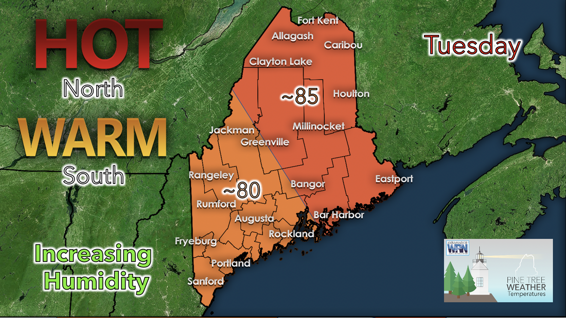
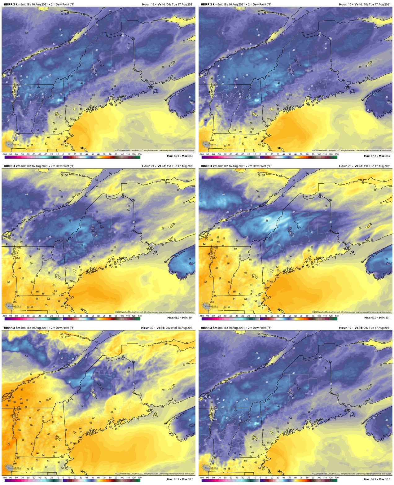
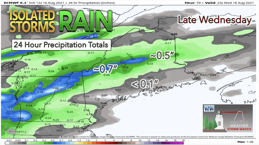
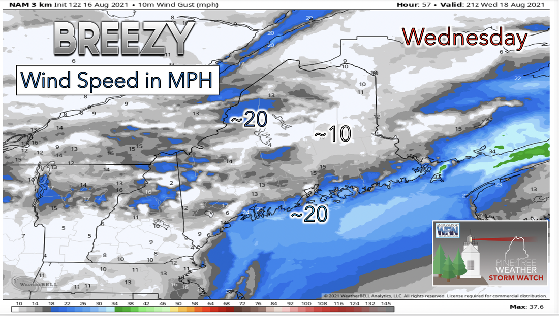
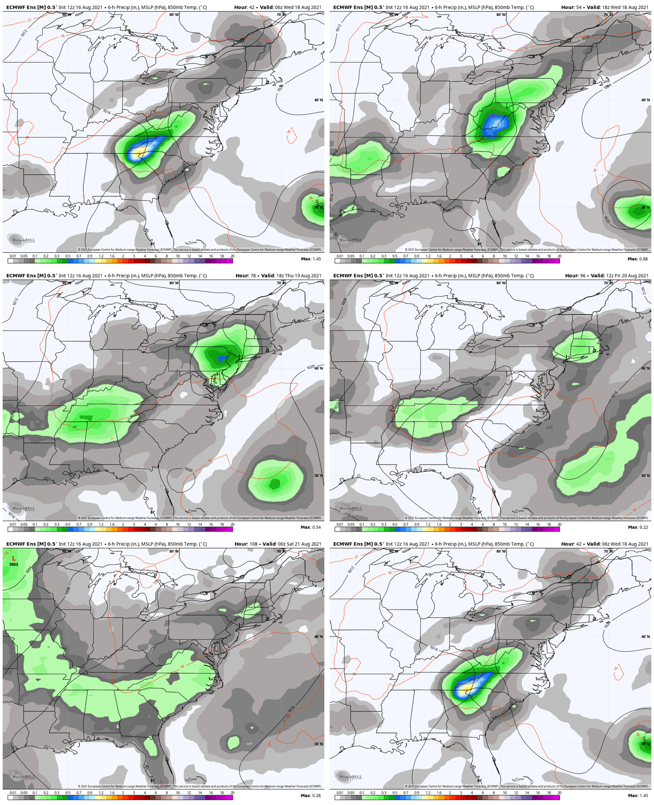
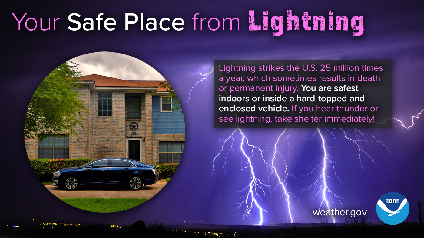
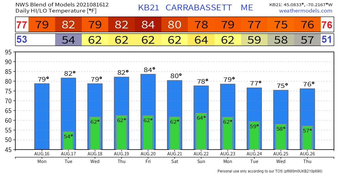
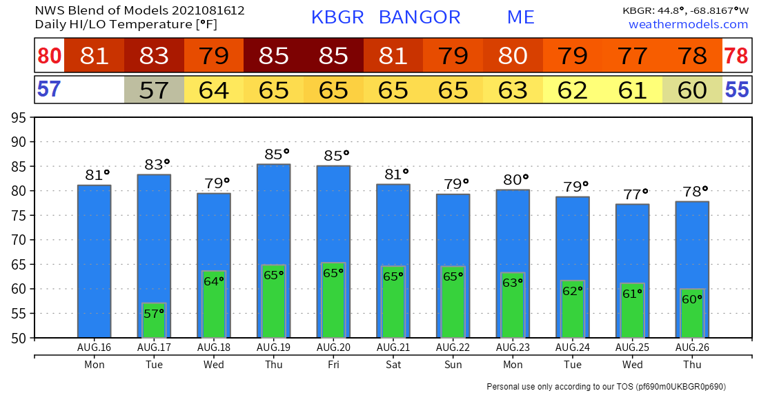
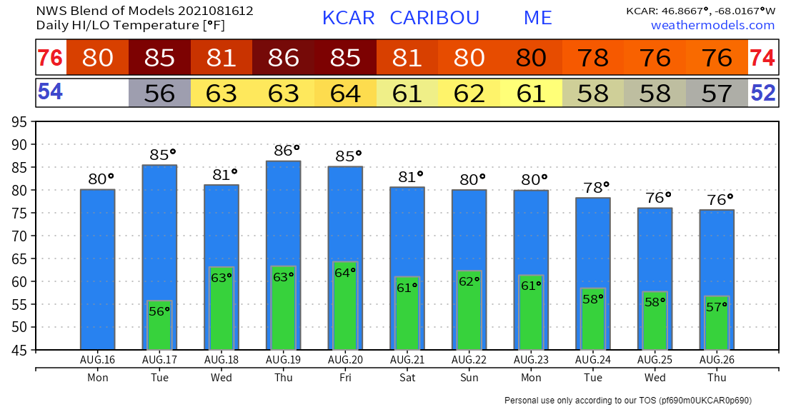
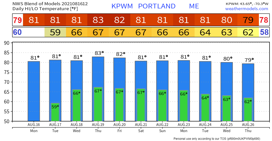
Heat and Humidity on the riseAs a result of the lasting high pressure over the region that began early this week, Tuesday is likely to be another sunny day with even higher temperatures than compared to Monday. The previously mentioned warm front that is expected to near to the south of Maine overnight will likely continue to lift toward the area on Tuesday. Therefore, it is expected to be noticeably more humid south on Tuesday. As shown in the graphic above dew point temperatures are forecasted to rise throughout the day Tuesday causing them to reach into the 60s south and along the coast and remaining in the 50s north. High temperatures will likely reach the lower to mid 80s for Tuesday. The main cause for this rise in temperature will likely be the movement of a warm front coming from the south and moving northeast toward the area. Wet and windy on WednesdayWednesday looks to be a relatively rainy day with a potential threat for thunderstorms by afternoon as moisture from the retreating high pressure system's return flow and an upper level disturbance approaches from the west. Significant loud coverage is expected across most of the region for Wednesday also as a result of the previously mentioned conditions. Rain totals from the day on Wednesday currently show the most accumulation in the southwest corner of the state nearing 1 inch and steadily decreasing totals moving southeast and northeast. Winds are expected to be relatively gusty as well for Wednesday as a result of the incoming weather systems from the west. Wind speeds will likely pick up during afternoon showers and storms blowing out of the southwest and peaking at up to 20 miles per hour in the south and along the coastline as well as to the west in the highlands. Remnants of tropical storm FredAs for the end of the workweek, more rain and thunderstorms will be likely each day especially by afternoon. As tropical storm Fred continues up the country moving northeast it will likely push its remnants along with a warm front into the state. The remnants of the tropical storm coupled with the likelihood of another low pressure system coming in from the west will likely cause rainy conditions to last through the end of the week and into the weekend. Your Safe Place from Lightning Lightning strikes the U.S. 25 million times a year, which sometimes results in death or permanent injury. You are safest indoors, or inside a hard-topped enclosed vehicle. Stay Weather-Ready and learn more about lightning safety: weather.gov/safety/lightning Temperature OutlookTemperatures through next Thursday are likely to maintain a relatively stable range reaching the high 70s to low 80s each day and continuing to do so into next week. Dew point temperatures for the rest of this week and into the weekend stay above 60 degrees starting Wednesday which makes for a more humid second half of this week. Be prepared to receive alerts and stay updated  BE PREPARED WITH A NOAA Weather Radio. For $20-$40, it could provide vital information to you when you need it. The weather bands are standard on most public safety scanners, and newer scanner models. Weather radios can be programmed for auto alert. Click here for more information.  ► ► For the latest official forecasts, bulletins, and advisories, please check in with the National Weather Service in Gray for western and southern areas, or Caribou for northern and eastern parts of Maine.  Thank you for your support! Check on Facebook tomorrow for a morning update from Aidan! -Angelina Find me on Twitter. |
Mike Haggett
|

