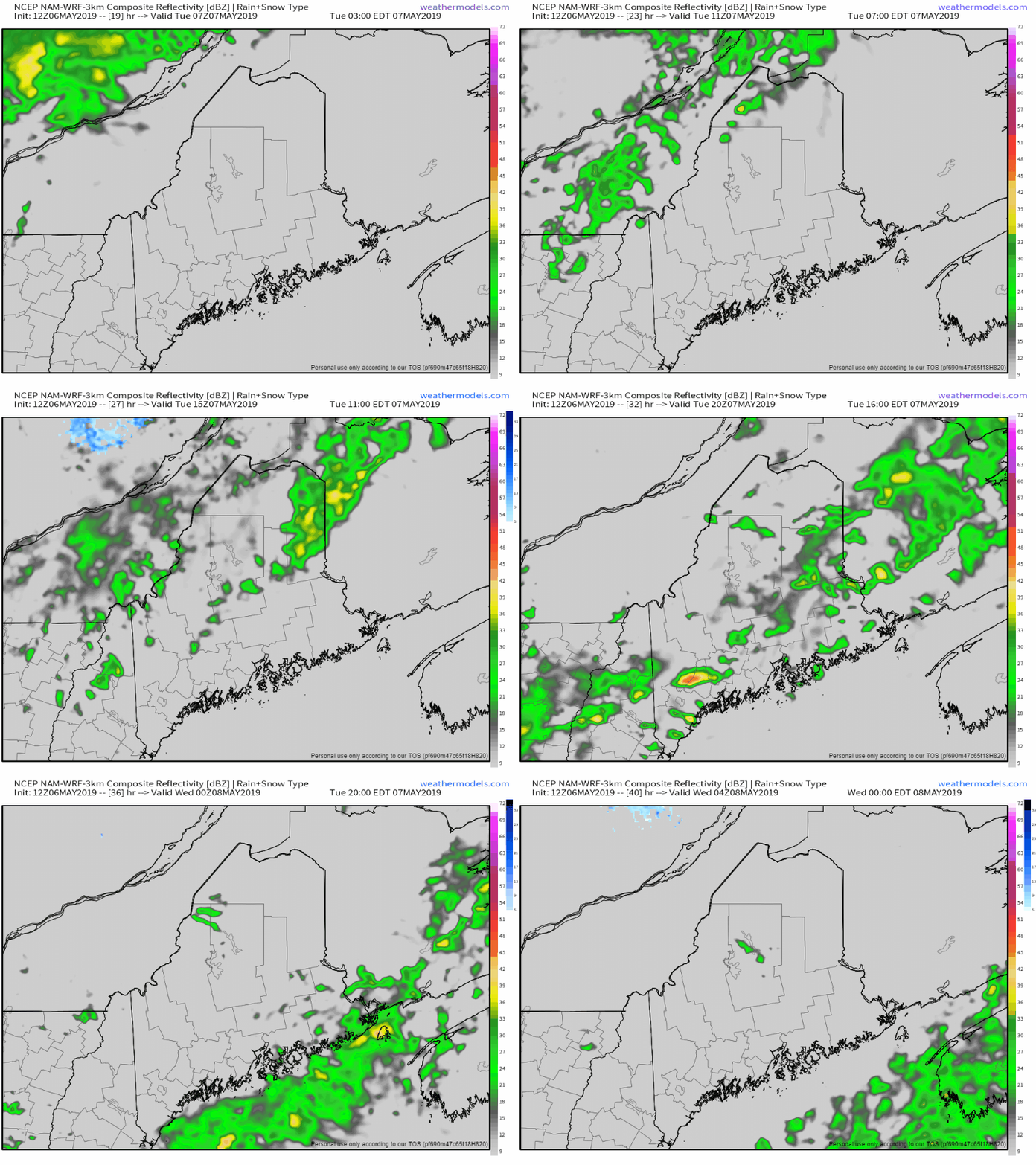
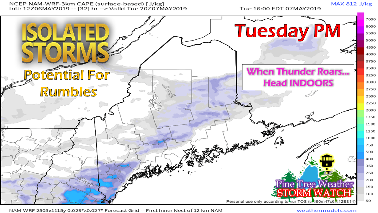
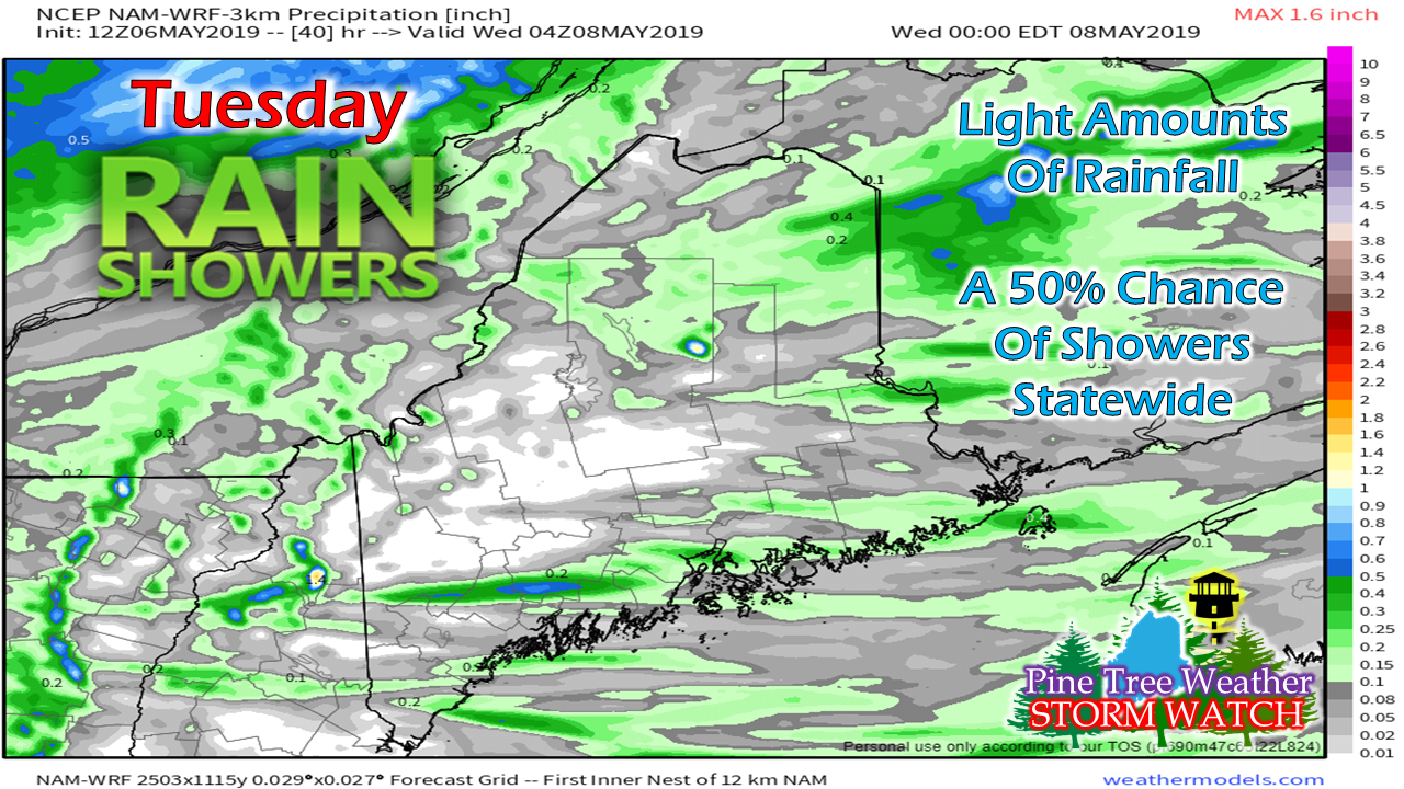
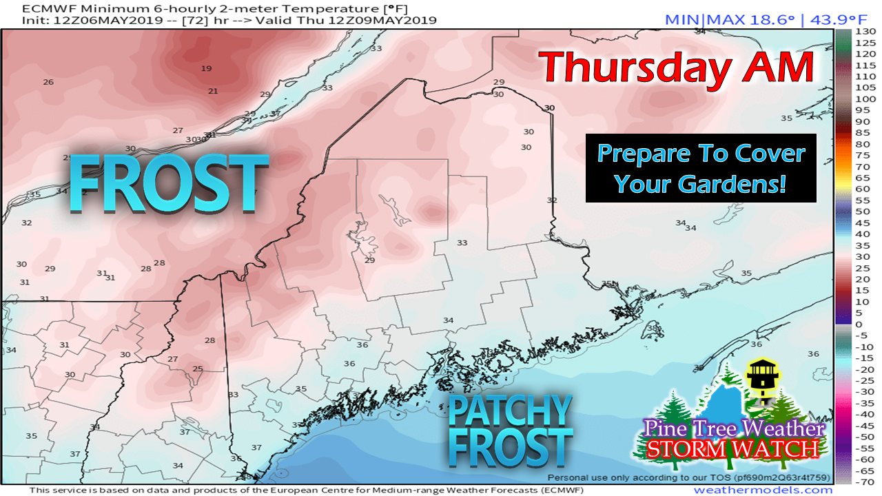
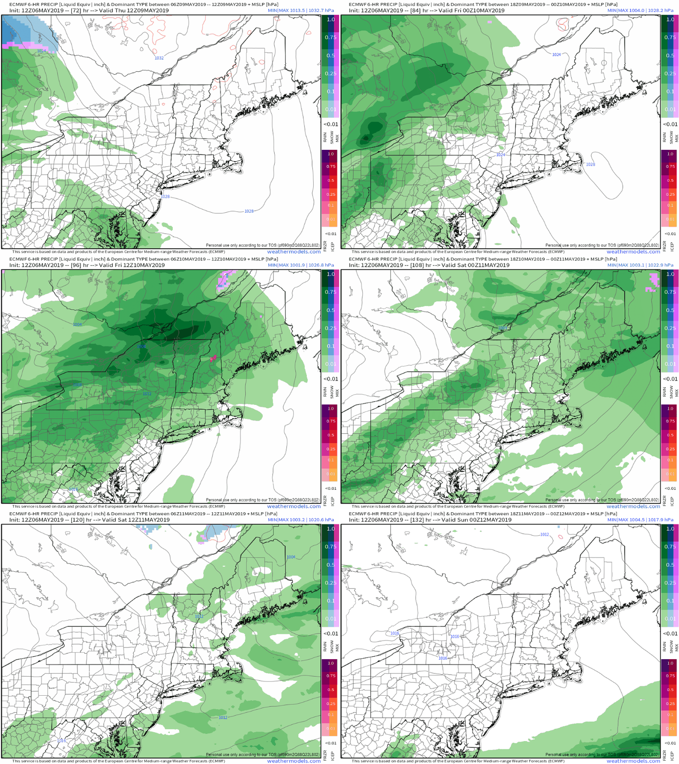
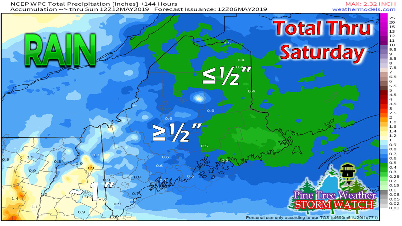
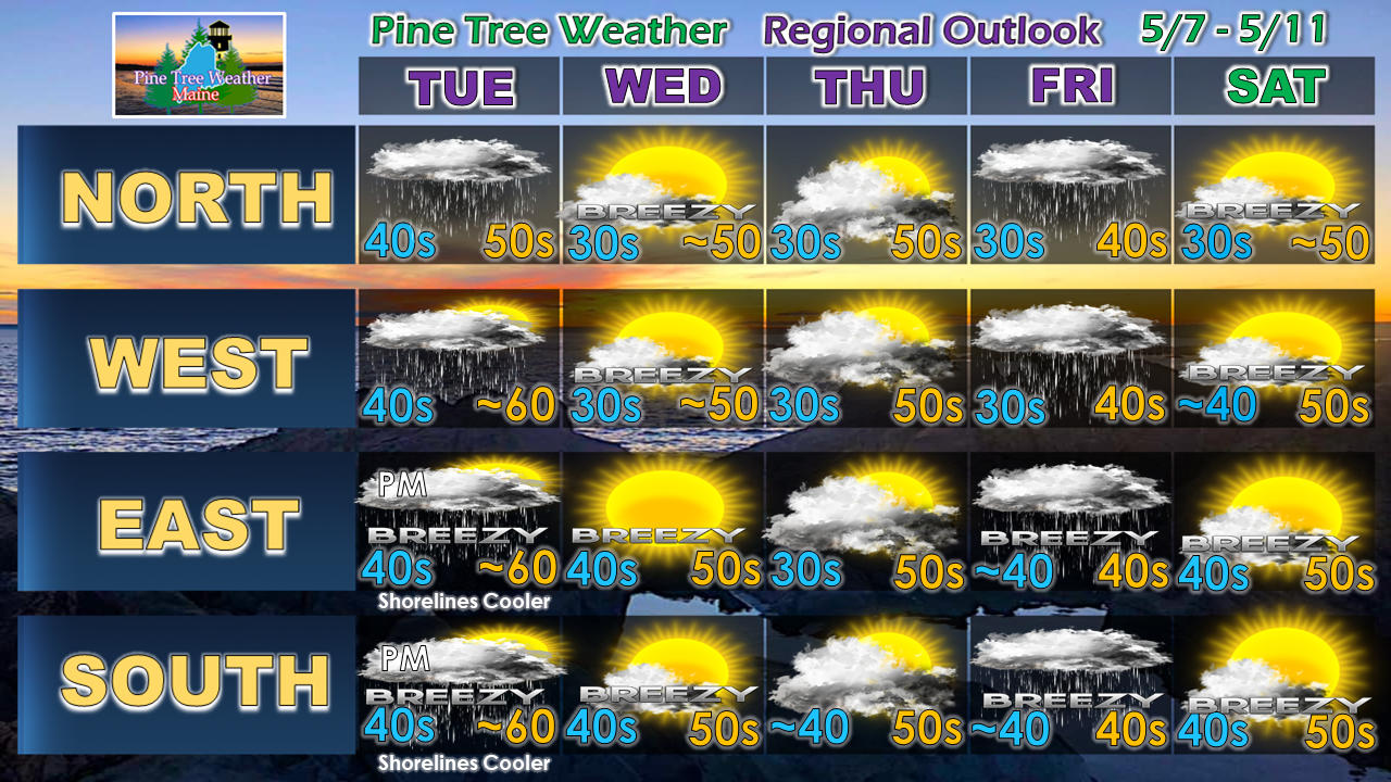
A cold front approaches the regionNorthern and western areas see shower develop in the morning, southern and eastern areas by the afternoon. Certainly not a soaker, but a few areas may see a period of steady rain for a time. Shower activity ends from northwest to southeast and will be over most everywhere by late evening. With spring athletics and construction in high gear, it's now the time to pay attention to the clouds and listen for potential thunder. I don't expect anything in the manner of severe storms, but there is enough convective energy around to support of few rumbles, especially for southern areas Tuesday afternoon. Remember, when you hear thunder, it's time to seek shelter immediately until the threat is over. All in all, not a whole lot of rain associated with this. Isolated areas may pick up as much as a 1/2", other areas may not get any measurable rain at all. For most, it may be enough to be annoying, and that is about it. Cold air returns for late weekWednesday will be a breezy day statewide as Canadian high pressure builds into the area. The breeze settles Wednesday night, making frost possible for areas away from the coast. For those who got a jump on spring planting last weekend, you'll want to be prepared to cover any plants Wednesday night. Only areas exempt from this would be along the immediate shorelines and the islands. Another round of rain FridayPardon me if you've seen this movie several times before this spring. Another long wave frontal boundary is in the forecast as we wrap up the work week. For now it appears the timing will be Thursday night for western areas, overspreading the state by Friday morning, and ending in the wee hours of Saturday morning. Combined totals of both the Tuesday and Friday rain events range from a half inch or less in the north and east to around an inch for southwestern areas. There is no concern for flooding of any type as it appears for now. Regional outlook through SaturdayBelow normal temperatures and slightly above average rainfall continue to be the main ideas in the pattern through the middle part of May. The pattern has already shifted to a drier one, with showers every third day. The weekend appears dry, with the next chance for rain possible early next week.
► ► For the latest official forecasts, bulletins and advisories, please check in with the National Weather Service in Gray for western and southern areas, or Caribou for northern and eastern parts of Maine. ► ► Your financial donations are much appreciated to keep this site funded and for further development. I sincerely appreciate your support not only financially, but also in sharing my efforts with others. For more information from me, please check the Pine Tree Weather Facebook page as well as my Twitter feed. Always stay weather aware! - Mike |
Mike Haggett
|

