
Summertime Hot and Muggy Temperatures for Friday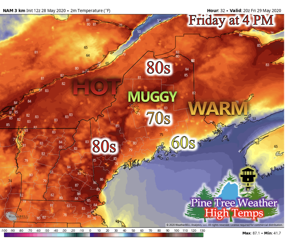 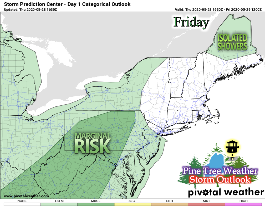 Maine still remains under a warm and humid air mass, resulting in the hot and muggy temperatures that are felt when you walk outside. Northern and western Maine can expect temperatures in the lower- to mid-80s, with isolated areas having potential to reach into the mid- or even upper-80s. Central Maine is expected to have temperatures in the mid- to upper-70s, and coastal areas in the mid- to upper-60s and low-70s. Onshore flow keeps the coastal and immediate inland regions of Maine cooler. Cloud cover will increase as a low pressure system moves closer to Maine, and by Saturday, this system will be just north of Maine. As Friday progresses, wind direction shifts from southerly to more southwesterly/westerly, bringing the inland temperatures from New Hampshire. Increased heating in the lower-levels creates instability. Mixed with the approaching frontal system, the chance for some isolated showers is possible for northern Maine. Storm Outlook for Saturday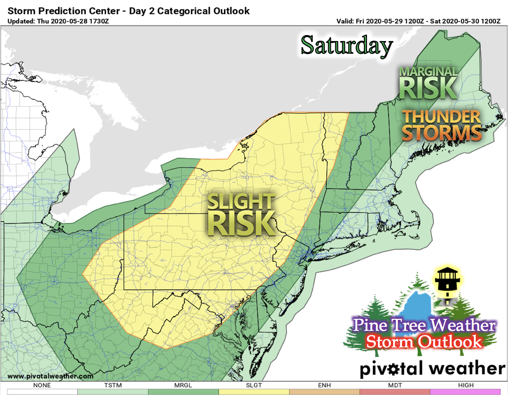 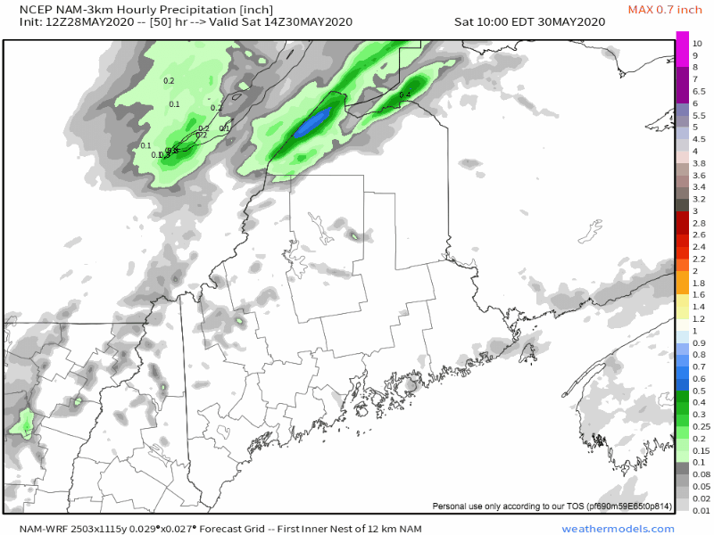 The Storm Prediction Center issued parts of northern and western Maine to be under "marginal risk" for severe storms on Saturday. As the low pressure system moves easterly, it positions itself over north Maine and pushes a cold front into the state from the west. With this front, cooler temperatures and thunderstorms are very likely. Conditions such as fast wind gusts, hail, and tornadoes are associated with the formation of severe storm weather. Flash flooding is also another dangerous aspect that storms can produce. The GIF shows hourly precipitation amounts expected as this front moves through Maine on Saturday. After this front moves through, cooler temperatures for Saturday night and into Sunday are expected. Cooler Temperatures for Next Week: Frost Potential for Monday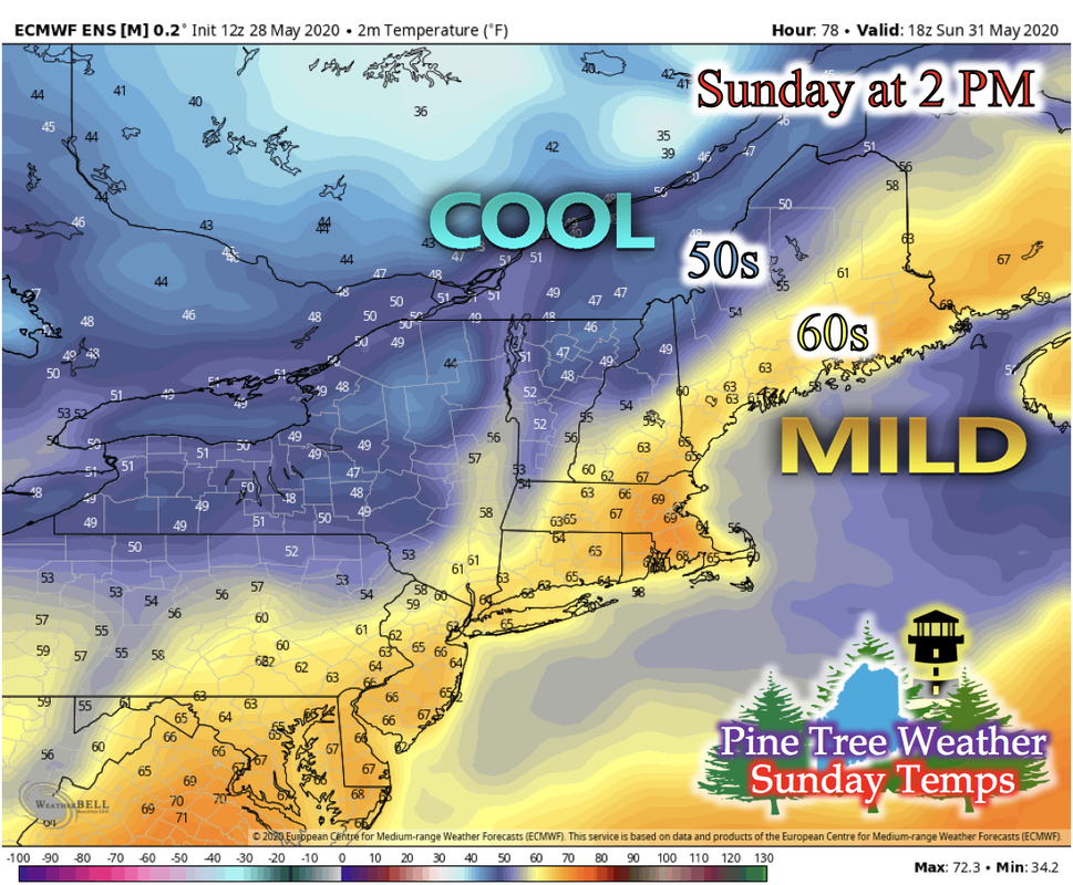 After the passing of the low pressure system, we see a flip in the north-south temperature gradient on Sunday. Northerly winds bring colder air from Canada down into the state, and offshore flow keeps the coastal areas warmer than inland Maine. Northern and parts of western Maine will likely be in the 50s and more central Maine and coastal areas will be in the 60s. 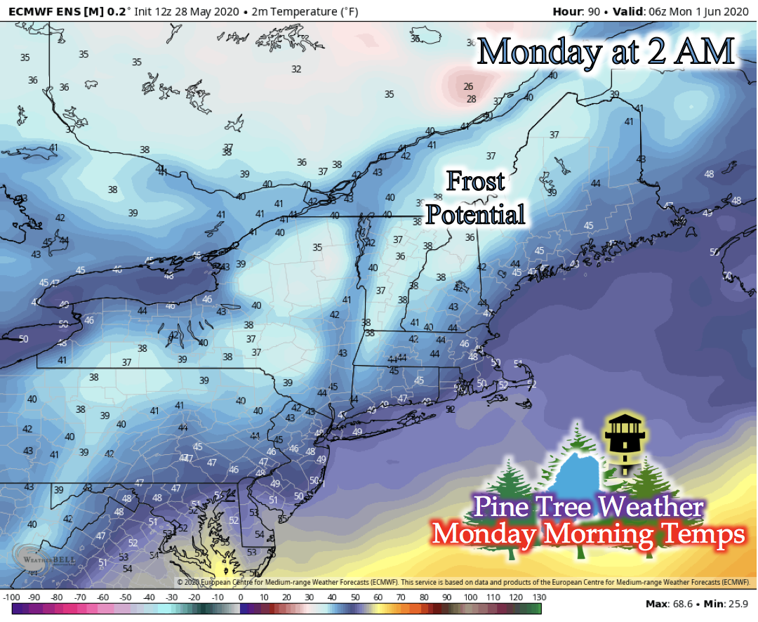 With the new cooler temperatures brought on by the northerly winds, nighttime temperatures are likely to drop as well. The central northwest region of Maine looks to have temperatures in the low- to mid-30s on Sunday night into early Monday morning, giving potential for frost. Absence of cloud cover and light/calm winds may aide in the drop in temperatures Sunday night. Make sure to cover any sensitive plants on Sunday night! Flash Flood Safety Reminder: Turn Around, Don't Drown!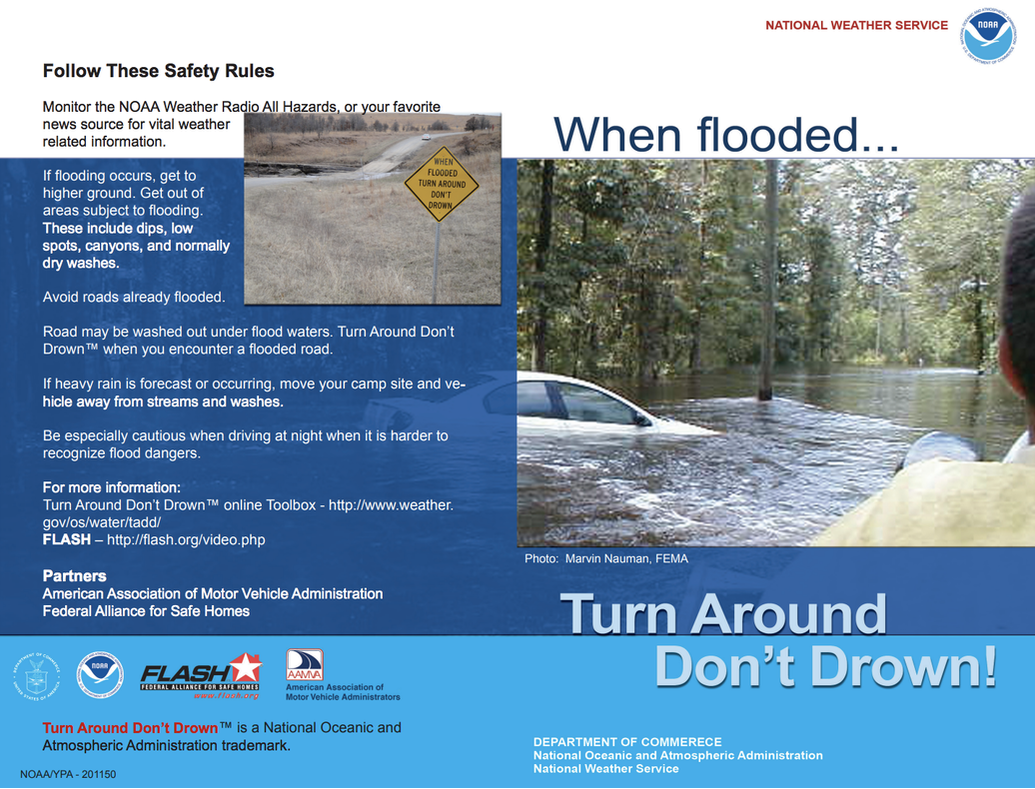 As severe weather season progresses, Maine is not immune to what these severe storms can bring. One of the many dangers is flash flooding, where 1 to 3 inches of rain falls in an hour. If you have to commute via vehicle during a storm, and you see a road flooded, turn around immediately and seek a different route. It only takes 12 inches of water to sweep a car away, and only 6 inches of water to sweep you off your feet if you were to try and wade through it. When you see a flooded road, turn around, don't drown! Stay informed!
For more information, please follow Pine Tree Weather on Facebook and Twitter.
Thank you for supporting this community based weather information source that is funded by your financial contributions. Stay on alert, stay updated, and stay safe! Have a great rest of your week! - Kaitlyn |

Mike Haggett
|


