Pine Tree Weather
  • DISCUSSIONS
  • DONATE
  • MAPS
  • NWS BRIEFINGS
  • SATRAD
  • MARINE
  • SNOW / ICE OUTLOOK
  • RAIN OUTLOOK
  • CPC OUTLOOK
  • Kennebunk
  • OBSERVING WEATHER
  • Who We Are
  • My Photography
  • DISCUSSIONS
  • DONATE
  • MAPS
  • NWS BRIEFINGS
  • SATRAD
  • MARINE
  • SNOW / ICE OUTLOOK
  • RAIN OUTLOOK
  • CPC OUTLOOK
  • Kennebunk
  • OBSERVING WEATHER
  • Who We Are
  • My Photography

Hot and muggy next few days, thunderstorms on Thursday

7/28/2020

Comments


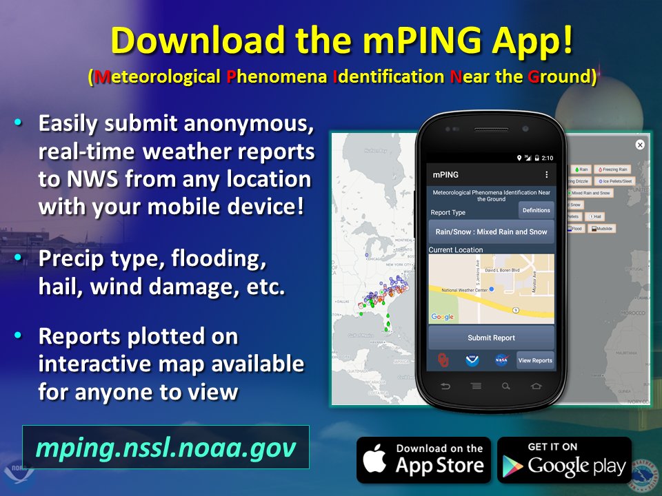
Wednesday: Hot and muggy, isolated thunderstorm potential

Picture
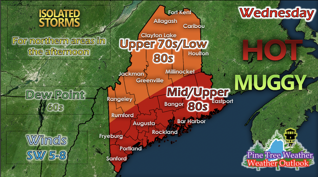
After the recent low pressure system to the north passes, and its cold front pushes through Maine, the chance for isolated storms for the northern regions of Maine is still possible in the afternoon as instability increases due to daytime heating. Temperatures are pretty similar to the past few days; northern and some central and western areas in the upper 70s to low 80s, and southern and coastal areas in the mid to upper 80s. Winds continue from the southwest and ranging from 5 to 8 mph. Dew points stay pretty high in the 60s statewide, and the air may feel a bit uncomfortable and sticky when you step outside.

Thursday: Thunderstorms possible statewide, slightly cooler temperatures

Picture
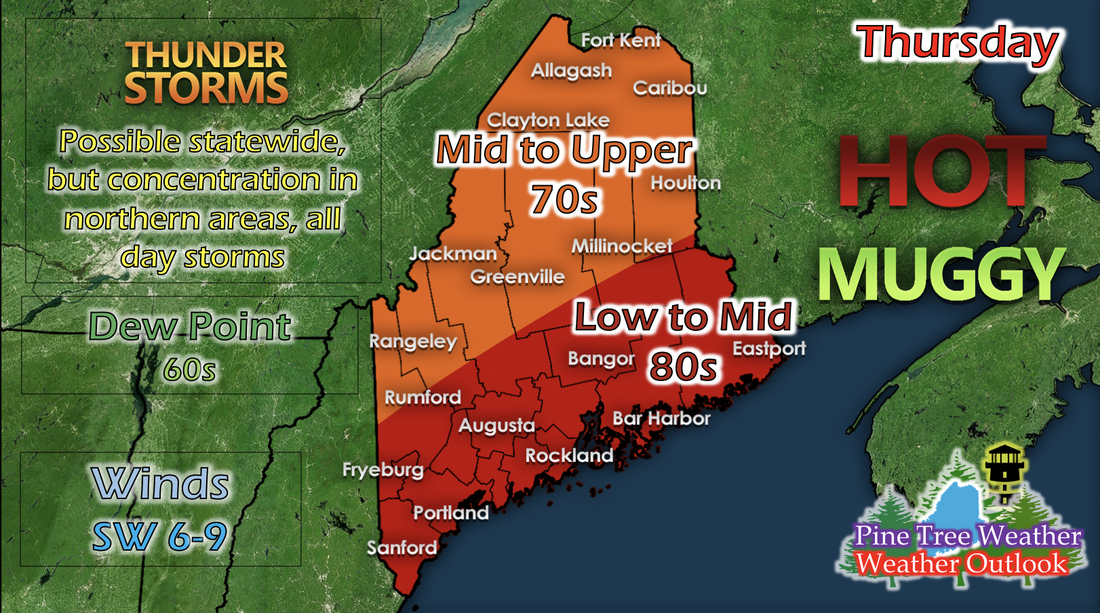
Another low pressure system following the previous one from Tuesday is approaching Maine, and its cold front will pass through from the west overnight Wednesday and into Thursday. This will result in slightly cooler temperatures statewide; northern and some western and central regions in the mid to upper 70s, and southern and coastal regions in the low to mid 80s. Another result of the incoming cold front is the potential for statewide thunderstorms all day on Thursday. The concentration of thunderstorms looks to center in the northern areas of the state, but isolated thunderstorms and showers may impact any where in the state. 
Picture
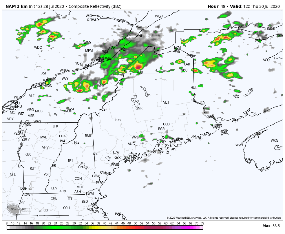
The GIF above runs from 8 AM to 8 PM on Thursday, and shows reflectivity from a short-range model. This particular model can sometimes predict some storms being overly strong, but gives a good indication of where these storms are likely to occur. The main concentrations centers in the northern portions of the state, but some thunderstorms have potential to initiate any where in the state, thanks to the incoming cold front bringing a humid air mass, and some ~1000 surface-based CAPE values (energy in the atmosphere) in the northern portions of the state.

Heat Safety

Picture
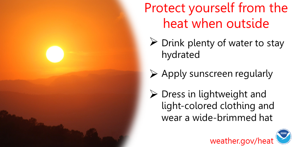
The summer heat is in full swing, and with it comes some danger to the body if not properly protected. It's important to apply sunscreen regularly when exposed, especially in the afternoon hours, where the sun's strength is at its peak. It's equally important to drink plenty of water to stay hydrated and dress in lightweight and light-colored clothing, with some sort of hat to protect your face. Stay safe in the summertime heat and practice heat safety!

​​​​Help forecast verification, and stay informed!

Picture
mPINGers Wanted! Report your weather anywhere anytime anonymously and help improve forecast verification. No special training required. Download the mPING app and start reporting what you see from any location.  For more information, check out the mPing site.

Picture
Hiking, camping or boating this summer?
BE PREPARED WITH A
 NOAA Weather Radio.

​For $20-$40, it could provide important information to you when you need it. The weather bands are standard on most public safety scanners, and newer scanner models and weather radios can be programmed for auto alert.  Click here for more information.

Picture
► ► For the latest official forecasts, bulletins and advisories, please check in with the National Weather Service in Gray for western and southern areas, or Caribou for northern and eastern parts of Maine.

​For more information, please follow Pine Tree Weather on Facebook and Twitter. 

Thank you for supporting this community based weather information source that is funded by your financial contributions. 

Stay updated, stay on alert, and stay safe!

Thank you so much for all of your continued support!
This is my Venmo if you'd like to contribute: @Kaitlyn-Lardeo

Have a great day!
​- Kaitlyn
Comments
    Picture

    Mike Haggett
    Kennebunk, ME

    Certified Weather
    Forecaster
    Penn State '21

    American Meteorological Society

    National Weather Association

    Weather-Ready Nation 
    Ambassador
    ​
    ​SKYWARN-CWOP

    Matthew 19:26


    Support
    Pine Tree Weather

    DONATE

    Picture

    Picture

    Picture

    Picture

    Picture

    Picture

    Picture

    Picture

    Picture

    Picture

    Archives

    January 2023
    December 2022
    November 2022
    October 2022
    September 2022
    August 2022
    July 2022
    June 2022
    May 2022
    April 2022
    March 2022
    February 2022
    January 2022
    December 2021
    November 2021
    October 2021
    September 2021
    August 2021
    July 2021
    June 2021
    May 2021
    April 2021
    March 2021
    February 2021
    January 2021
    December 2020
    November 2020
    October 2020
    September 2020
    August 2020
    July 2020
    June 2020
    May 2020
    April 2020
    March 2020
    February 2020
    January 2020
    December 2019
    November 2019
    October 2019
    September 2019
    August 2019
    July 2019
    June 2019
    May 2019
    April 2019
    March 2019
    February 2019
    January 2019
    December 2018
    November 2018
    October 2018
    September 2018
    August 2018
    July 2018
    June 2018
    May 2018
    April 2018
    March 2018
    February 2018
    January 2018
    December 2017
    November 2017
    October 2017

    RSS Feed

Proudly powered by Weebly