Pine Tree Weather
  • DISCUSSIONS
  • DONATE
  • MAPS
  • NWS BRIEFINGS
  • SATRAD
  • MARINE
  • SNOW / ICE OUTLOOK
  • RAIN OUTLOOK
  • CPC OUTLOOK
  • Kennebunk
  • OBSERVING WEATHER
  • Who We Are
  • My Photography
  • DISCUSSIONS
  • DONATE
  • MAPS
  • NWS BRIEFINGS
  • SATRAD
  • MARINE
  • SNOW / ICE OUTLOOK
  • RAIN OUTLOOK
  • CPC OUTLOOK
  • Kennebunk
  • OBSERVING WEATHER
  • Who We Are
  • My Photography

Hot for Friday, a damp start to the holiday weekend

7/1/2022

Comments

 
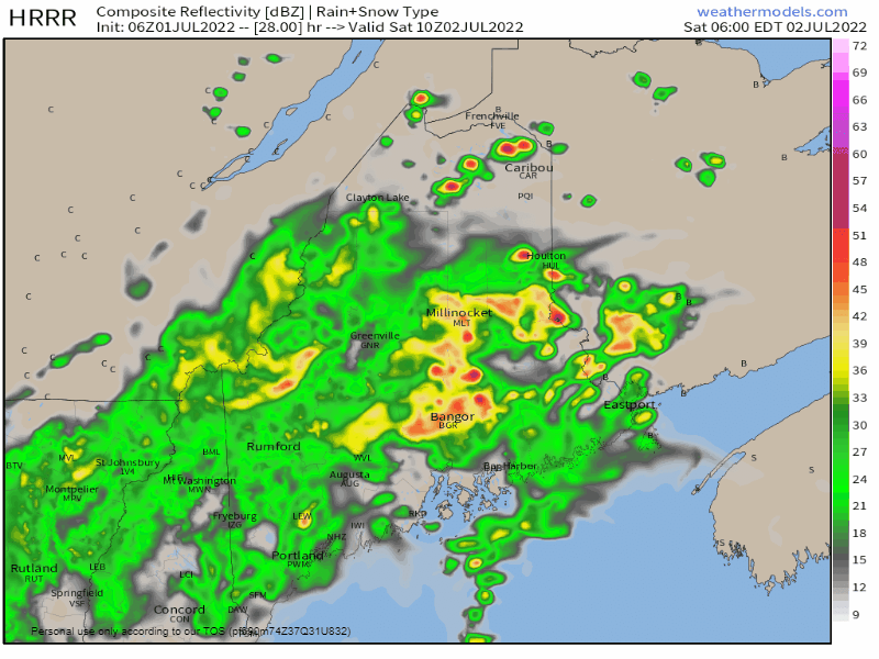
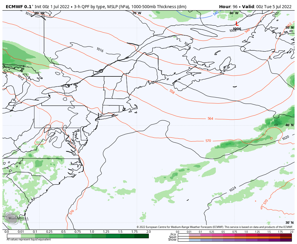
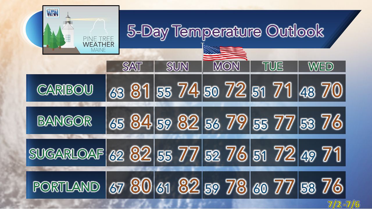
Just a heads up that my family and I are heading to western foothills for a few days to unplug, have some fun, rest, relax, and recharge. My next planned update is expected Thursday, July 7th. I hope everyone has a wonderful weekend and has a chance to enjoy some great outdoor conditions once we get through the rain on Saturday. 

There are several pages on this website that can help you piece together the forecast, along with direct links to the National Weather Service offices that cover our region. 

Warm front moves in for Friday

Picture
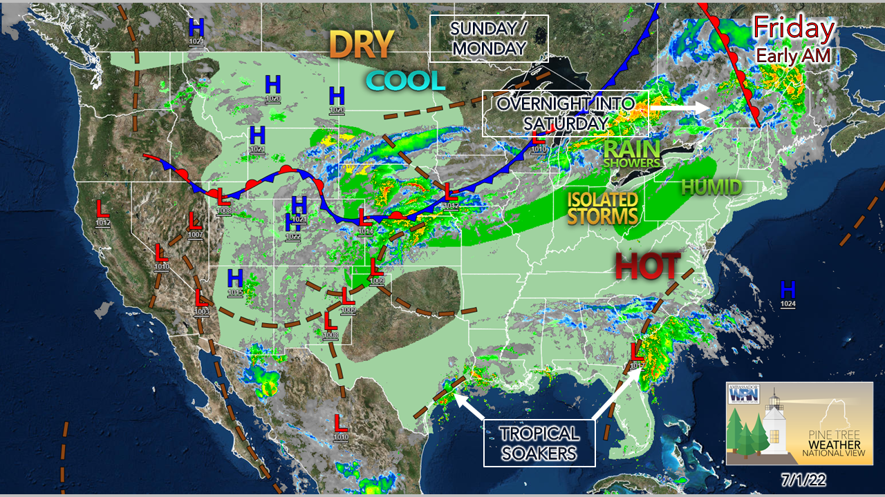
A warm front passes through the region Friday morning. Once that happens, a south / southwesterly wind pumps heat in for all, along with humidity into a good portion of the state. This blast of uncomfortable conditions appears short-lived, and by Sunday morning, comfortable dew points will arrive for most. 
Picture
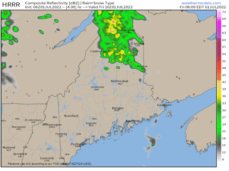
Friday 6 AM to 6 PM - With the warm front maxing out northeast progression, northern areas end up on the fringe of it. As a result, isolated showers with a chance for a thunderstorm are possible for The County and the North Woods / Baxter State Park region. Any storm that form appears may bring downpours and some wind. The chance of severe storms is very low but can't be ruled out. 
Picture
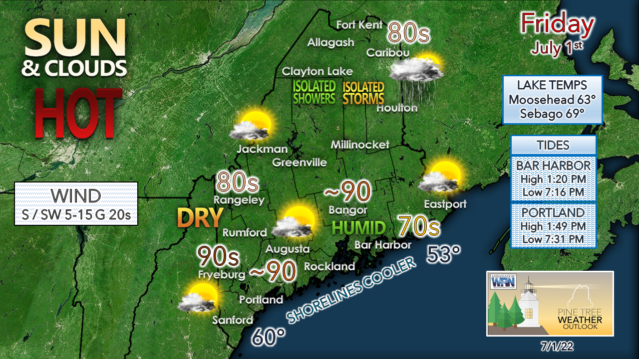
Western areas may escape the humid conditions through the daytime. but see dew points rise overnight into Saturday. Coastal and eastern areas are likely to notice increased humidity by the height of the day in mid-afternoon. For those headed to an oceanside beach, it would be wise to go early as the tide comes in this morning and pick your spot accordingly. 

Showers and storms move in overnight into Saturday

Picture
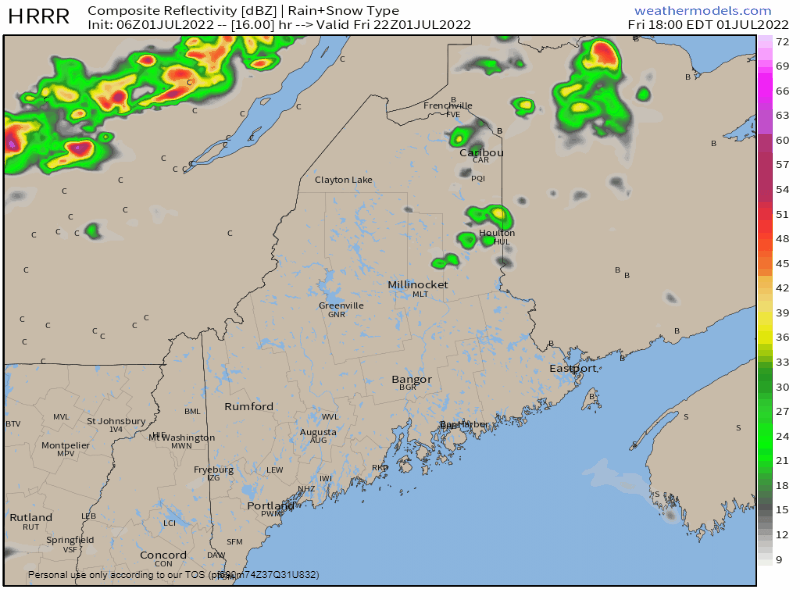
Friday 6 PM to Saturday 6 AM - A cold front approaches the region. An amped southwest flow aloft pumps more moisture into the area and all areas have a sticky feel by morning from the humidity and the rain. Early morning travelers can expect areas of downpours along with areas of fog. There could be some rumbles of thunder embedded in the shower activity which may disturb overnight rest. For those camping out, make sure you are prepared for a deluge. There is a low chance for localized flash flooding in any area where torrential rain occurs. 

Steady rain passes through Saturday morning,
​isolated showers and storms possible in the afternoon

Picture
Saturday 6 AM to 9 PM - By noon, most areas are expected to see the main threat for showers and storms end. The wind shifts from the southwest to the west in the afternoon. The air column may dry out fairly quickly over the north and mountains bringing relief from the humidity there. A pop-up shower in the afternoon is possible for the coastal plain on up through the eastern interior to the coast as the moisture from the morning rain and humidity takes its time to depart.  There is a slight chance for an isolated overnight shower over the north through early Sunday. Drier air reaches the coastline for most areas in the same timeframe. Expect a northwest breeze for Sunday. 

Next rain chance: Tuesday

Picture
Monday 8 PM to Wednesday 2 AM - While the ridge associated with the heat from Friday collapses to the south, the region remains on the fringe of it. Disturbances ride along it, and one potentially arrives on Tuesday. For now, I am not expecting any severe concerns, but it is early to say for sure. For an area that could use a soaking rain, one can hope for some decent hydration. Time will tell. 

Temperature outlook through midweek

Picture

Thank you for supporting this community-based weather information source which operates by financial contributions from people like you. 

Stay updated, stay on alert, and stay safe!

​Have a great holiday weekend! 

- Mike

​NOTE: The forecast information depicted on this platform is for general information purposes only for the public and is not designed or intended for commercial use. For those seeking pinpoint weather information for business operations, you should use a private sector source. For information about where to find commercial forecasters to assist your business, please message me and I will be happy to help you.

Comments
    Picture

    Mike Haggett
    Kennebunk, ME

    Certified Weather
    Forecaster
    Penn State '21

    American Meteorological Society

    National Weather Association

    Weather-Ready Nation 
    Ambassador
    ​
    ​SKYWARN-CWOP

    Matthew 19:26


    Support
    Pine Tree Weather

    DONATE

    Picture

    Picture

    Picture

    Picture

    Picture

    Picture

    Picture

    Picture

    Picture

    Picture

    Archives

    January 2023
    December 2022
    November 2022
    October 2022
    September 2022
    August 2022
    July 2022
    June 2022
    May 2022
    April 2022
    March 2022
    February 2022
    January 2022
    December 2021
    November 2021
    October 2021
    September 2021
    August 2021
    July 2021
    June 2021
    May 2021
    April 2021
    March 2021
    February 2021
    January 2021
    December 2020
    November 2020
    October 2020
    September 2020
    August 2020
    July 2020
    June 2020
    May 2020
    April 2020
    March 2020
    February 2020
    January 2020
    December 2019
    November 2019
    October 2019
    September 2019
    August 2019
    July 2019
    June 2019
    May 2019
    April 2019
    March 2019
    February 2019
    January 2019
    December 2018
    November 2018
    October 2018
    September 2018
    August 2018
    July 2018
    June 2018
    May 2018
    April 2018
    March 2018
    February 2018
    January 2018
    December 2017
    November 2017
    October 2017

    RSS Feed

Proudly powered by Weebly