Hot, humid and stormy on Monday Temperatures on Monday will be in the 80s throughout most of the state, with even a few 90s in southwestern regions. It will also be humid, with dew points lingering around 70 degrees. The heat and humidity will help fuel some afternoon thunderstorms, some of which could be strong or severe. The main threat with these storms would be heavy rain and damaging winds. Overnight is looking very warm and muggy, with temperatures in the 70s and upper 60s throughout the state. Scattered showers and storms will continue to pass through the region through the early morning hours. Hot, humid and stormy again with a cold front passage on Tuesday Tuesday will be another hot and humid day with temperatures still lingering in the 80s and 90s, with dew points near 70. A cold front will pass throughout the day and will act as a forcing for scattered showers and thunderstorms. The Storm Prediction Center (SPC) has most if Maine in a marginal (level 1 out of 5) risk for the day. After the cold front passage, drier air will move in overnight. A break from the heat and humidity for the rest of the week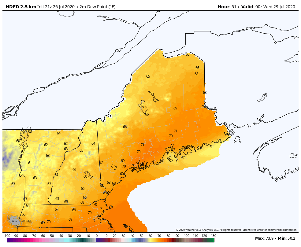 NWS Dewpoint forecast from Tuesday at 8pm to Friday 5pm Both temperatures and dew points will drop as the week progresses. Dew points will be back in the 50s and low 60s with temperatures around 80. There is a chance for those summertime afternoon showers and storms each day, but nothing too significant. High pressure will build in for Friday, making for a nice start to the weekend. Help forecast verification, and stay informed!
For more information, please follow Pine Tree Weather on Facebook and Twitter.
Thank you for supporting this community based weather information source that is funded by your financial contributions. Stay updated, stay on alert, and stay safe! Thank you so much for all of your continued support! This is my Venmo if you'd like to contribute: @Alex-Hatfield-7 Have a great week! - Alex :) |

Mike Haggett
|