Hot and muggy Father's Day with a chance for isolated storms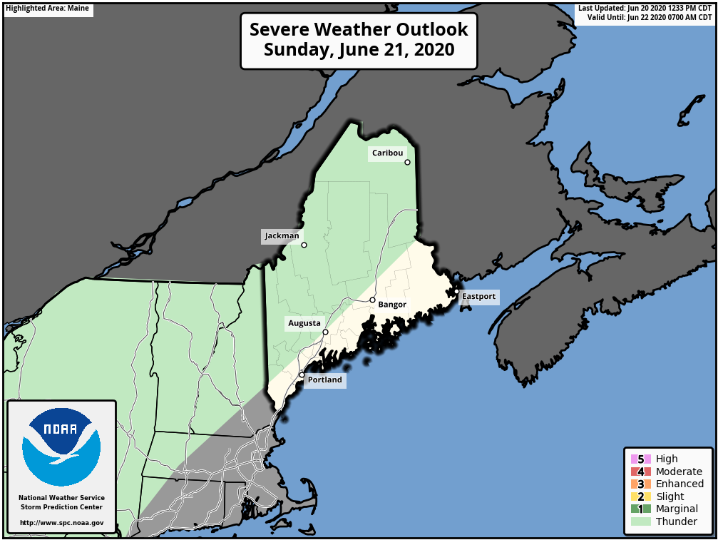 Storm Prediction Center Outlook for Sunday, June 21st Most of the state is in a general thunderstorm risk for tomorrow, which may be the main story over the next few days as well. Hot, moist air will continue to feed into the region over the next few days, helping to fuel thunderstorm development. A weak stationary front is draped over the northern portions of Maine, so there is not much in the way of forcing to get thunderstorms to pop-up. Any thunderstorms that do form will be isolated and mainly confined to around the mountainous regions and foothills, due the mountains acting as a forcing mechanism (air going up the mountains and triggering thunderstorm formation!). That's not to say however that some storms won't form in other regions of the state. Make sure to keep an eye on local news and radar for the latest information! 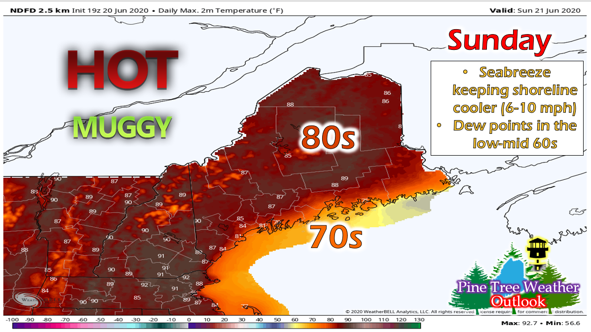 Temperatures will will be slightly cooler tomorrow than in past days with temperatures in the 80s. Most of the state will see upper 80s, but temperatures will decrease as you move closer to the coast due to the onshore flow. It will also be pretty muggy, with dew points in the mid 60s throughout most of the central/southern regions and low 60s north. The heat and humidity will linger into the night, with temperatures and dewpoints both in the mid-low 60s. Fog will be likely along the coast and in higher elevation/valley regions. Similar conditions through Tuesday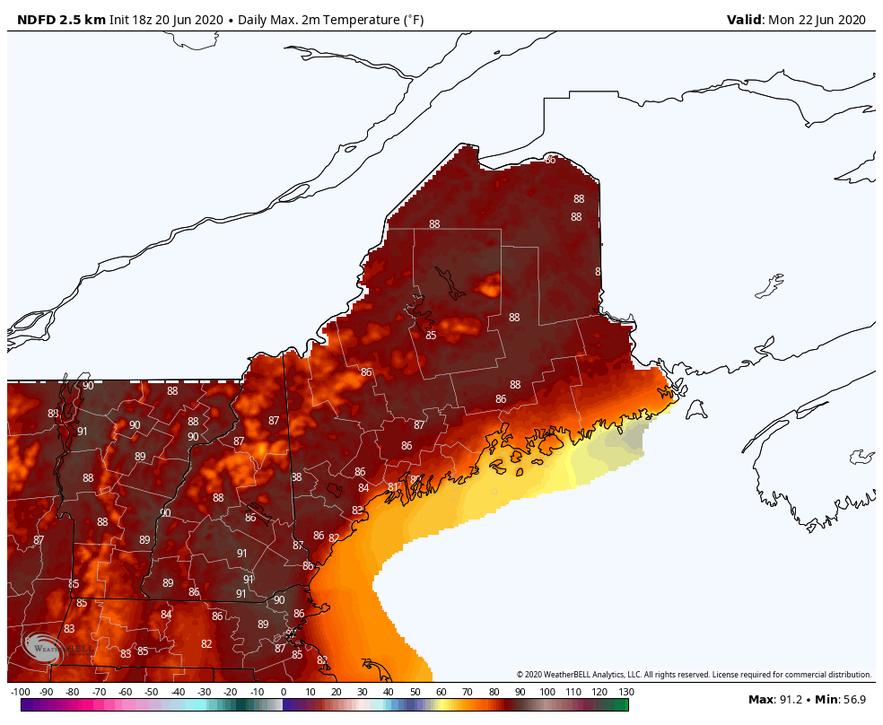 High Temperature Forecast for Monday 6/22 and Tuesday 6/23 Both Monday and Tuesday will continue the hot and humid trend. Both days will feature temperatures in the mid-upper 80s across the state with upper 70s along the shoreline and dew points in the low-mid 60s. Isolated thunderstorms are possible again on Monday, however the threat slightly increases on Tuesday as low pressure system begins to approach the area. Shortwaves will most likely eject out of the system and make their way into Maine, enhancing the thunderstorm threat slightly. Monday and Tuesday night will both mainly feature temperatures in the low 60s throughout the state, however Tuesday night could see some isolated mid-upper 60s near the border of New Hampshire and some upper 50s Downeast. Fog is likely along the coast for both nights. Cold front approaches for Wednesday, then a cool down for the end of the week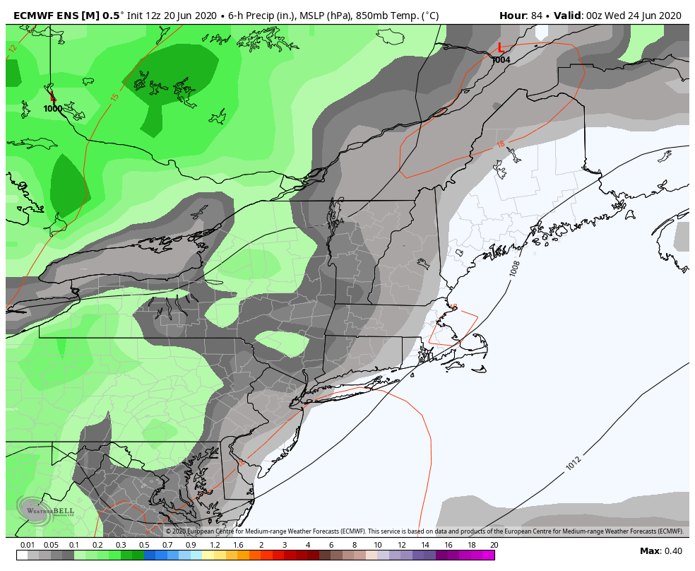 European Ensemble Model Precipitation Forecast from Tuesday Night through Thursday Night The slow moving low pressure system will approach the region on Wednesday, with the associated cold front swinging through Wednesday evening into Thursday. A line of thunderstorms could be associated with the cold front. 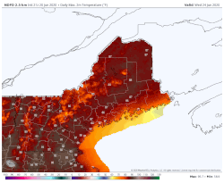 By the end of next week, we'll begin to see a cool down into the low 80s and upper 70s, with dew points dropping well into the 50s. The end is in sight for the hot and muggy weather, soon enough, the dry and warm will move in and take over. Lightning Safety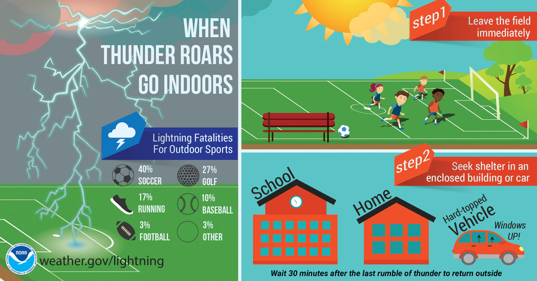 You've probably heard this about a million times by now, but with a stormy week coming up, don't forget that when thunder roars go indoors! This upcoming week with it's heat and humidity will probably deter many people from spending time outdoors (unless you enjoy this kind of weather), but if you find yourself outside and hear thunder, remember to take shelter somewhere safe. As I always say, stay up to date with the weather via whatever means you like best, whether it be local news or weather apps. Help forecast verification, and stay informed!
For more information, please follow Pine Tree Weather on Facebook and Twitter.
Thank you for supporting this community based weather information source that is funded by your financial contributions. Stay safe, hydrated and alert! Have a great week :) -Alex |

Mike Haggett
|