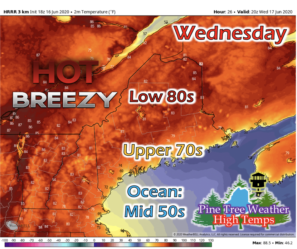
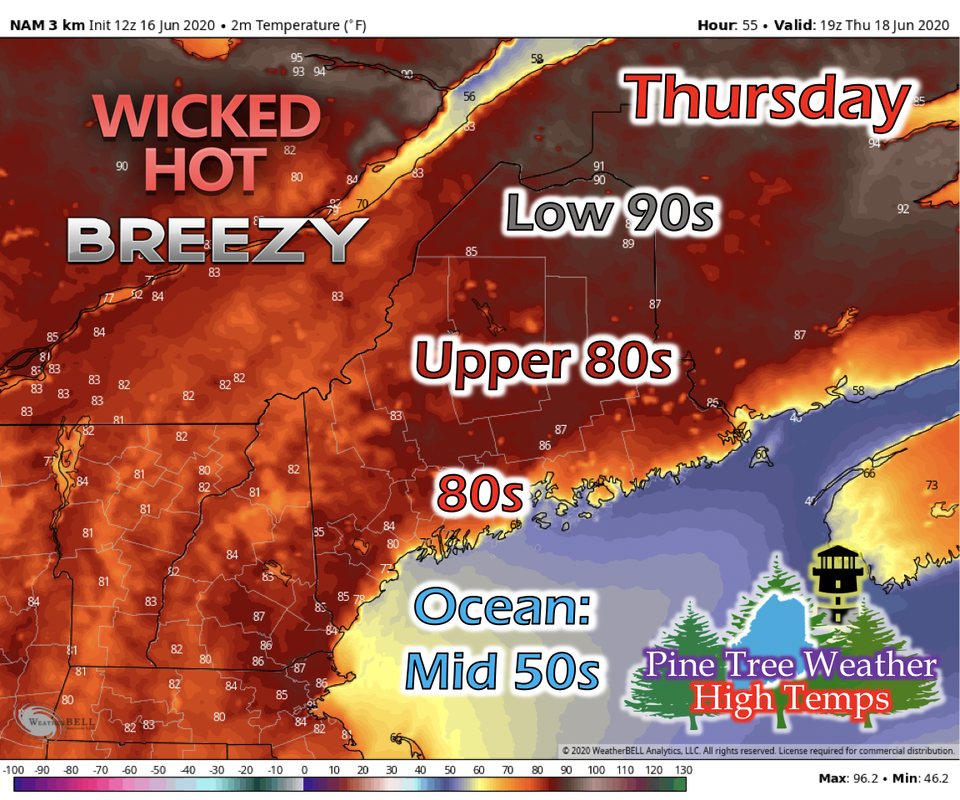
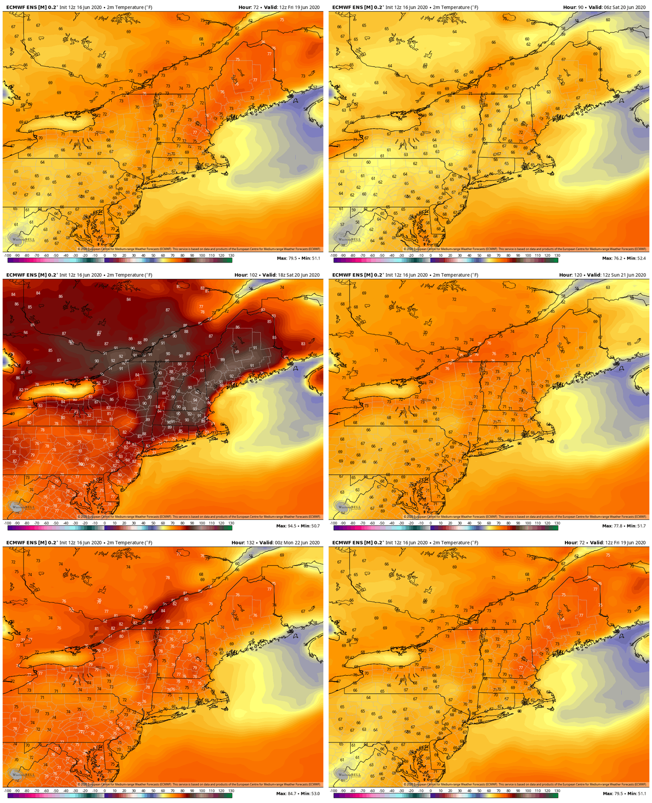
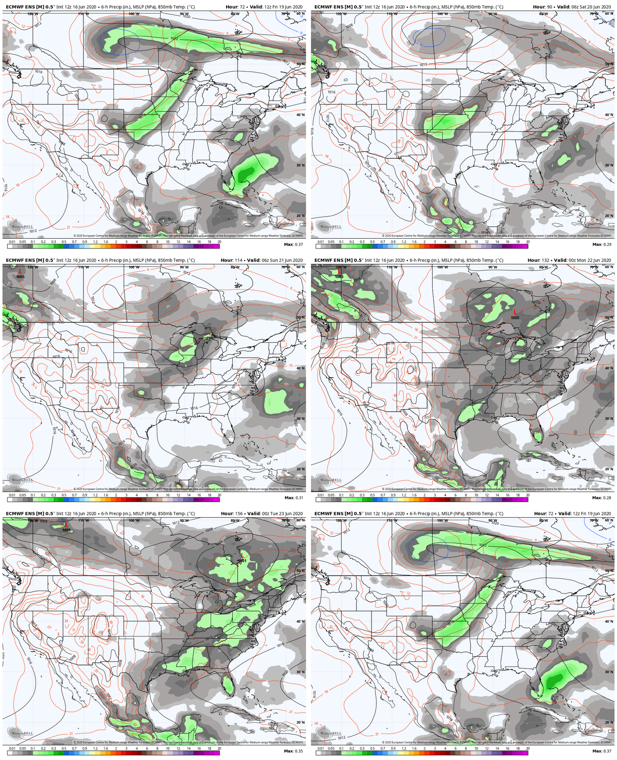
Wednesday: Hot Temperatures and Breezy WindsThe increasing temperature trend continues through today and into Wednesday. Most of the state will get high temperatures in the low 80s, with some pockets of mid 80s in the Caribou area. Down East, Mid Coast, and Portland coastal areas will feel cooler temperatures in the mid 70s down to upper 60s due to the ocean breeze from the southwest winds Maine will be feeling in the afternoon. Wednesday afternoon gets a little breezy for the non-mountainous regions of Maine; winds ranging from 7 to 12 mph are expected in the afternoon. Overnight temperatures for northern and western Maine are mild and in the low 60s. Most of central Maine will have low temperatures in the upper to mid 50s. Down East, Mid Coast, and Portland areas along the coast will cool down much more than inland Maine, due to being in proximity to the cool ocean waters (currently in the mid 50s) and the high pressure residing over the Gulf of Maine has winds coming off of the cool ocean waters and onto the shorelines. Thursday: Hotter than Wednesday, Same Breezy AfternoonThe increasing temperature trend stabilizes on Thursday as the high pressure system from earlier in the week has settled into the Gulf of Maine. Northern and Caribou regions will be feeling temperatures in the upper 80s and low 90s. The rest of the state with exception to coastal regions will feel in the mid to upper 80s. Areas along the coastline will feel slightly cooler temperatures in the mid to upper 70s. Winds are similar from Wednesday; southwest winds, and non-mountainous areas having an afternoon breeze ranging from 7 to 12 mph. Overnight temperatures are similar to Wednesday's, except along the coastline. Low temperatures along the coastline will be warmer, in the low 50s, as the high pressure system moves away from the Gulf of Maine. Temperature Outlook for the WeekendThe GIF above runs from 7 AM Friday to 7 AM Monday, June 22nd. Friday temperatures will be as hot as Thursday's, but a cool-down begins to happen as a low pressure system originating from Canada and north of North Dakota approaches Maine on Sunday and into the beginning of next week. Rainfall Outlook for Next WeekThe GIF above runs from 7 AM Friday to 7 AM Tuesday, June 23rd. The approaching low pressure system, according to the long-range models, is depicted to impact Maine on Tuesday. The models have been pushing this system's arrival time further and further back, so further information on arrival time and locations to be impacted by rain will be forthcoming. Cold Water SafetyOcean and lake temperatures for Maine are 50s and 60s respectively. Warm air temperatures doesn't necessarily mean warm water temperatures. Cold water drains body heat up to 25 times faster than cold air. When cold water makes contact with your skin, cold shock causes an immediate loss of breathing control. This dramatically increases the risk of sudden drowning even if the water is calm and you know how to swim. Practice cold water safety by staying out of waters below 70 degrees! Help forecast verification, and stay informed!
For more information, please follow Pine Tree Weather on Facebook and Twitter.
Thank you for supporting this community based weather information source that is funded by your financial contributions. Stay updated, stay on alert, and stay safe! Have a wonderful rest of your week! - Kaitlyn |
Mike Haggett
|

