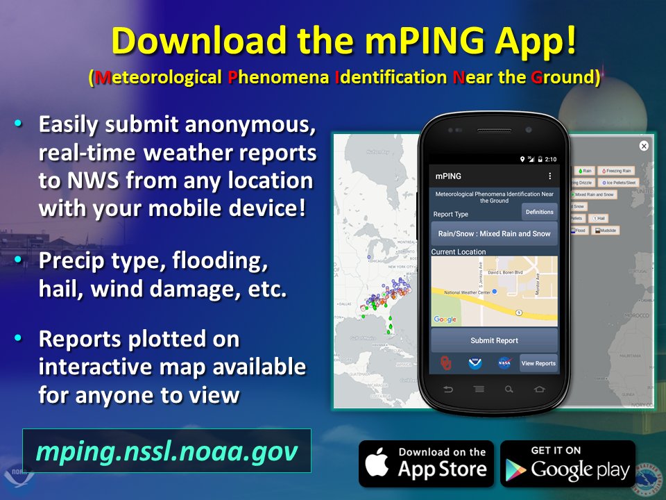
Monday: Scattered storms and hot temperatures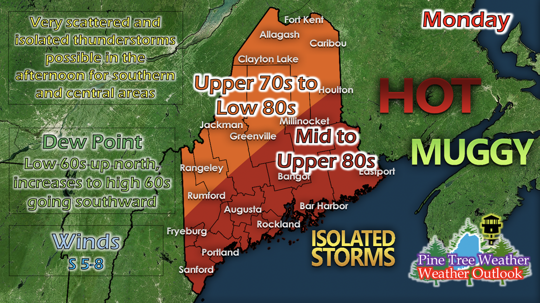 Monday will be another prime example of a hot summer day: High temperatures, humidity, and potential for afternoon storms. These storms look scattered according to short-range models, and seem to concentrate in the southern and central areas of Maine. Besides these storms, it'll be another typical summer day. If storms do occur, they're likely to be short-lived, weak, and small. They may have potential for a very short-lived medium-to-heavy rain period, but it's not very likely and the area it may hit will be very small. Tuesday: Increase in temperatures and humidity, more potential for afternoon storms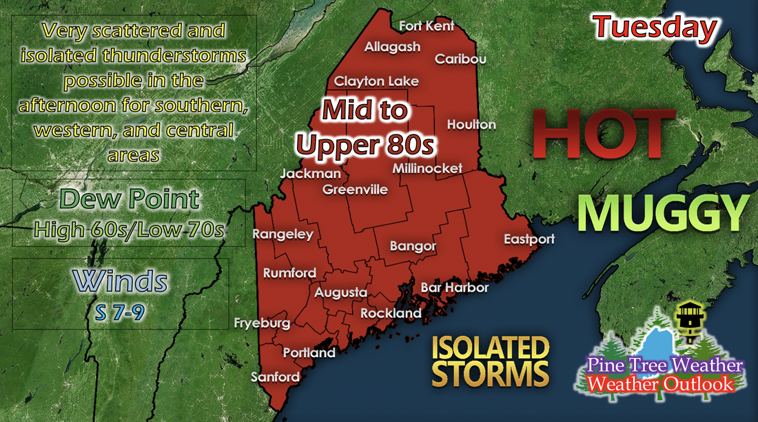 The increase in temperatures and humidity may be associated with a low pressure system that is traveling far north of Maine, as the warm sector of a low pressure system exists on the right side, and often is associated with warmer temperatures, higher moisture, and winds from the south. These newer conditions help enhance the likelihood of afternoon storms along a bigger area. Scattered and isolated storms are possible for southern, western, and central areas of Maine in the afternoon. Temperatures are expected to be in the mid to upper 80s statewide, with some areas maybe only in the low 80s, and some reaching 90 possibly. Max temperature anomaly trend for this week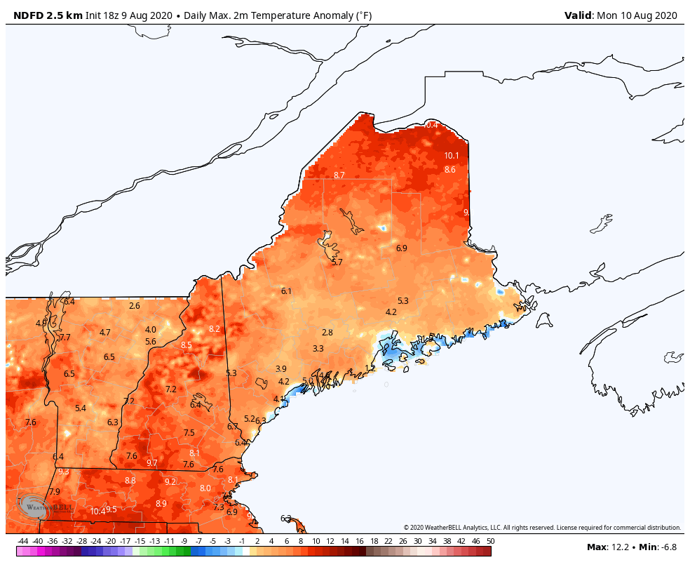 The GIF above runs from Monday to Saturday and shows maximum temperature anomaly trends by a short-range model. These past few weeks have been nothing short of hot and muggy. Maine may not be under an extensive heat wave as it is under drought conditions, but overall maximum temperatures have been higher than normal for this time of year. This week alone is a good example of it. Monday and Tuesday show an increase in positive temperature anomalies, and as a cold front from the low pressure traveling far up north pushes into Maine on Wednesday, positive temperature anomalies decrease slightly, but still remain above average for most of the state the rest of the week. Looking at yesterday's model run from the discussion yesterday involving the high temperatures for this week, temperatures stay well above in the 80s for most of the week, where the average high temperatures across the state are in the mid to upper 70s, with some spots having an average in the extreme low 80s. Depending on if summers for Maine continue in this pattern, average temperatures in the summer may increase in a few years. Mid-level pattern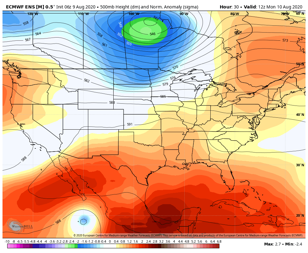 The GIF above runs from 8 AM Monday to 8 AM Thursday and shows 500 mb (mid-level in the atmosphere) height anomalies by a long-range model. This pattern has been similar most of the summer, and shows Maine under a positive height anomaly, suggesting higher temperatures for the state and surrounding states in New England. As the area of negative anomaly grows and dies far north of Maine (associated with the surface low pressure system that will give Maine a cold front on Wednesday), the small ridge that New England is under stays put and only weakens slightly before building back up again. Heat safety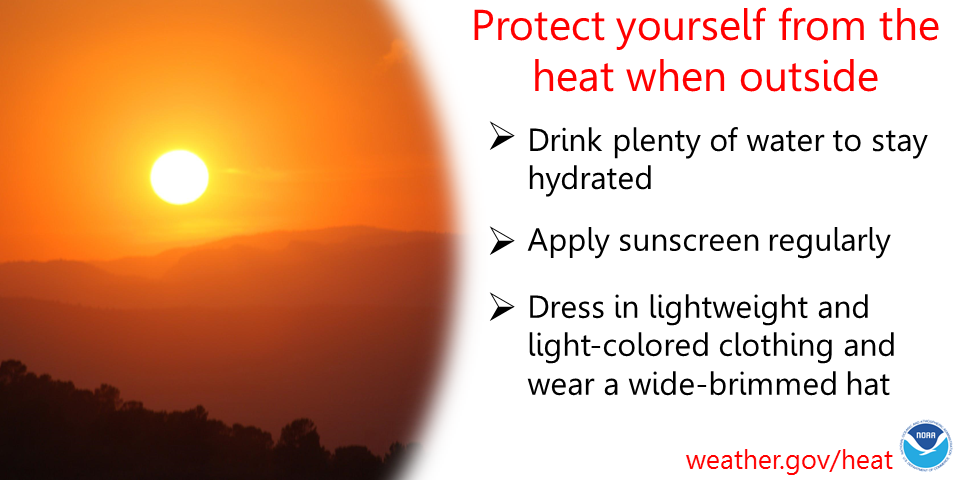 The summer heat is in full swing, and with it comes some danger to the body if not properly protected. It's important to apply sunscreen regularly when exposed, especially in the afternoon hours, where the sun's strength is at its peak. It's equally important to drink plenty of water to stay hydrated and dress in lightweight and light-colored clothing, with some sort of hat to protect your face. Stay safe in the summertime heat and practice heat safety! Help forecast verification, and stay informed!
For more information, please follow Pine Tree Weather on Facebook and Twitter.
Thank you for supporting this community based weather information source that is funded by your financial contributions. Stay updated, stay on alert, and stay safe! Thank you so much for all of your continued support! This is my Venmo if you'd like to contribute: @Kaitlyn-Lardeo Have a great day! - Kaitlyn |

Mike Haggett
|