Pine Tree Weather
  • DISCUSSIONS
  • DONATE
  • MAPS
  • NWS BRIEFINGS
  • SATRAD
  • MARINE
  • SNOW / ICE OUTLOOK
  • RAIN OUTLOOK
  • CPC OUTLOOK
  • Kennebunk
  • OBSERVING WEATHER
  • Who We Are
  • My Photography
  • DISCUSSIONS
  • DONATE
  • MAPS
  • NWS BRIEFINGS
  • SATRAD
  • MARINE
  • SNOW / ICE OUTLOOK
  • RAIN OUTLOOK
  • CPC OUTLOOK
  • Kennebunk
  • OBSERVING WEATHER
  • Who We Are
  • My Photography

Humid and warm start to the week, then a mid-week slight cool-down with rain

7/11/2020

Comments


Sunday: Humid, warm, and a chance of isolated afternoon showers

Picture
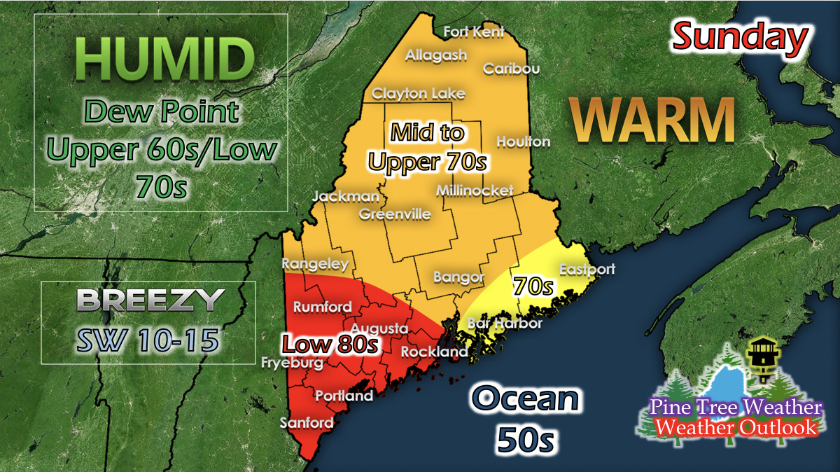
An occluded front will be pushing into Maine from the west on Sunday. With this front will come isolated thunderstorms and showers, with a slightly more concentrated portion in the northern areas. Southwesterly winds will keep the Portland, Maine areas in the low 80s and central, western and northern areas in the mid to upper 70s. Southwesterly winds off of the ocean will keep Down East and parts of Mid Coast in the low to mid 70s for Sunday. Dew points range from the upper 60s to low 70s, making the air feel soup-like when you go outside. The morning will be mostly cloudy to overcast, but as the front pushes through and moves past Maine, skies should clear up.

Monday: A little less humid, warm, and afternoon thunderstorms in the Portland area

Picture
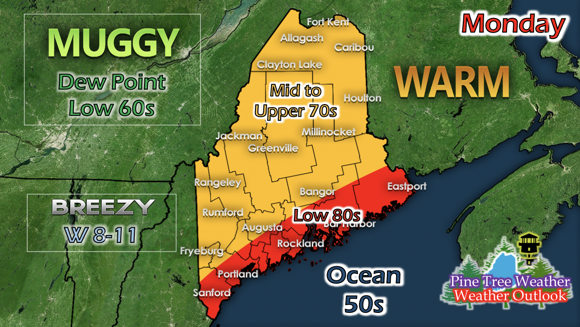
As the low pressure moves away, winds shift westerly and bring in some drier air from the west, causing dew points to drop slightly while temperatures remain warm. The coast gets a chance to heat up with slower wind speeds and winds coming off of the land and not the ocean. The faster wind speeds is concentrated in the northern portions of the state. In the afternoon, some pop-up afternoon thunderstorms may impact the Portland areas. 

Mid-Week Rain

Picture
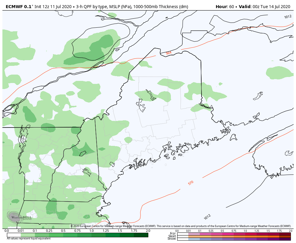
The GIF above runs from 8 PM Monday to 8 AM Wednesday and shows 3-hour liquid precipitation. A low pressure riding up the East Coast will push into southern Maine on Tuesday. A secondary low pressure system rides west to east north of the state, and its cold front will come behind the first low pressure system. With this combination, rain is expected for the central areas of Maine on Tuesday. Whether it'll be widespread or isolated is still up in the air and will be addressed when more information becomes available.

 Slight Temperature Cool-down for Tuesday and Wednesday

Picture
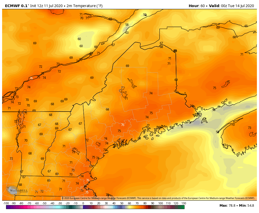
A mid-level trough begins to move over Maine on Tuesday, and while it brings a low pressure system and rain, it also brings a temperature cool-down. This mid-level trough is weak and rather short-lived, and temperatures are expected to rise again as a ridge builds and strengthens over the New England area. 

​Help forecast verification, and stay informed!

Picture
mPINGers Wanted! Report your weather anywhere anytime anonymously and help improve forecast verification. No special training required. Download the mPING app and start reporting what you see from any location.  For more information, check out the mPing site. ​

Picture
​Hiking, camping or boating this summer?
BE PREPARED WITH A
 NOAA Weather Radio.

​For $20-$40, it could provide important information to you when you need it. The weather bands are standard on most public safety scanners, and newer scanner models and weather radios can be programmed for auto alert.  Click here for more information.

Picture
► ► For the latest official forecasts, bulletins and advisories, please check in with the National Weather Service in Gray for western and southern areas, or Caribou for northern and eastern parts of Maine.

For more information, please follow Pine Tree Weather on Facebook and Twitter. 

Thank you for supporting this community based weather information source that is funded by your financial contributions. 

Stay updated, stay on alert, and stay safe!

Have a good rest of your weekend!
- Kaitlyn
Comments
    Picture

    Mike Haggett
    Kennebunk, ME

    Certified Weather
    Forecaster
    Penn State '21

    American Meteorological Society

    National Weather Association

    Weather-Ready Nation 
    Ambassador
    ​
    ​SKYWARN-CWOP

    Matthew 19:26


    Support
    Pine Tree Weather

    DONATE

    Picture

    Picture

    Picture

    Picture

    Picture

    Picture

    Picture

    Picture

    Picture

    Picture

    Archives

    January 2023
    December 2022
    November 2022
    October 2022
    September 2022
    August 2022
    July 2022
    June 2022
    May 2022
    April 2022
    March 2022
    February 2022
    January 2022
    December 2021
    November 2021
    October 2021
    September 2021
    August 2021
    July 2021
    June 2021
    May 2021
    April 2021
    March 2021
    February 2021
    January 2021
    December 2020
    November 2020
    October 2020
    September 2020
    August 2020
    July 2020
    June 2020
    May 2020
    April 2020
    March 2020
    February 2020
    January 2020
    December 2019
    November 2019
    October 2019
    September 2019
    August 2019
    July 2019
    June 2019
    May 2019
    April 2019
    March 2019
    February 2019
    January 2019
    December 2018
    November 2018
    October 2018
    September 2018
    August 2018
    July 2018
    June 2018
    May 2018
    April 2018
    March 2018
    February 2018
    January 2018
    December 2017
    November 2017
    October 2017

    RSS Feed

Proudly powered by Weebly