Humidity increases with scattered storms possible Wednesday An area of high pressure that has been anchored over New England the past several days that has provided us with seasonable temperatures and low humidity will move well offshore on Wednesday. On Wednesday, expect mostly cloudy to overcast skies across most of the state as more humid air gets pulled northward into Maine on the back side of a departing high pressure system. High temperatures on Wednesday will likely range from the lower 70's for the coastal locations and higher terrain across the state to the lower 80's in NE Maine where there will likely be less cloud cover.  There will be some atmospheric instability available for scattered showers and thunderstorms to develop across primarily the southern part of the state as an upper level trough approaches the state from the west for Wednesday afternoon and evening. The thunderstorms that do develop are likely to be below severe criterion with the main threat being locally heavy rainfall given high precipitable water values across the state ahead of the remnants of Fred. Wednesday night will likely be warm and muggy across much of the state with ample cloud cover. This widespread cloud cover will limit radiational cooling across the state with overnight lows ranging from the mid 60's to the lower 70's across most of Maine. There will be some scattered showers possible for the overnight which would be favored over Downeast Maine. Remnants of Fred approach Maine on Thursday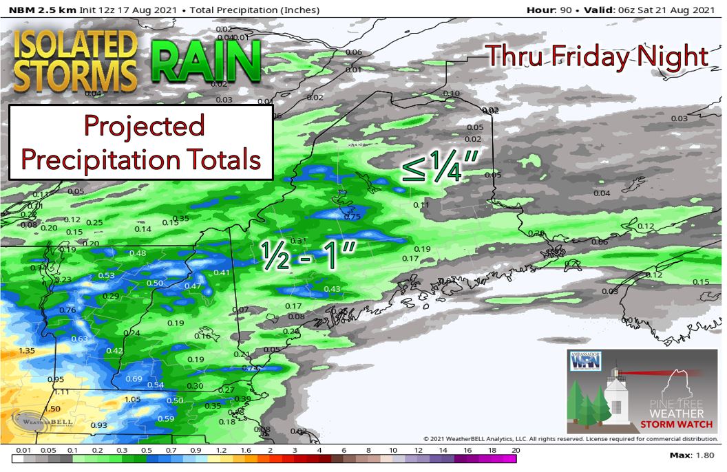 For Thursday, we watch as the remnants of Fred approach Maine. There is some disagreement on the exact track of the remnants of Fred between the weather models which will determine how much rain we receive across Maine. High temperatures on Thursday will range from the lower 70's across SW Maine where there will likely be overcast skies with periods of rain to the mid 80's across NE Maine where skies will be partly to mostly sunny with a southerly flow helping to further boost temperatures there. Using a blend of model guidance, we can expect moderate rain with embedded downpours across southwestern and western Maine from the afternoon and into the overnight hours from the remnants of Fred. Up to an inch of rain or locally more could fall over this part of the state. Farther east, we can expect mainly scattered showers with less than a half an inch expected for most areas. In fact, NE Maine may see little to no rainfall from the remnants of Fred. For Friday, we can expect very warm temperatures as the remnants of Fred move out of our area. High temperatures will range from the lower 70's for the coastal locations with the sea breeze to the upper 80's across the interior of the state. There will also be a chance for isolated showers and thunderstorms across the state on Friday. Long range pattern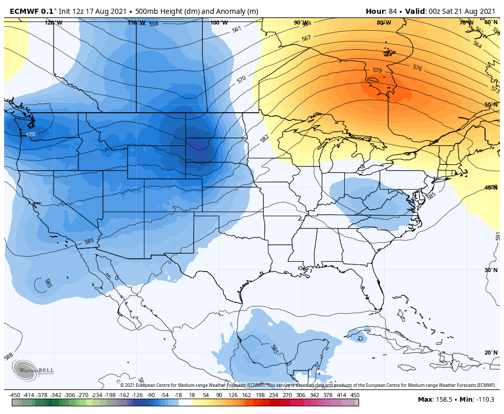 We will be on the periphery of an upper level ridge in the western Atlantic heading into the weekend and into early next week. This will likely contribute to slightly above average temperatures and a humid airmass that will remain in place across the state. There will be daily chances for showers and thunderstorms this weekend and into early next week with the best chance for widespread storms at this time looking like Monday when an upper level shortwave will approach our area.  Beach Lightning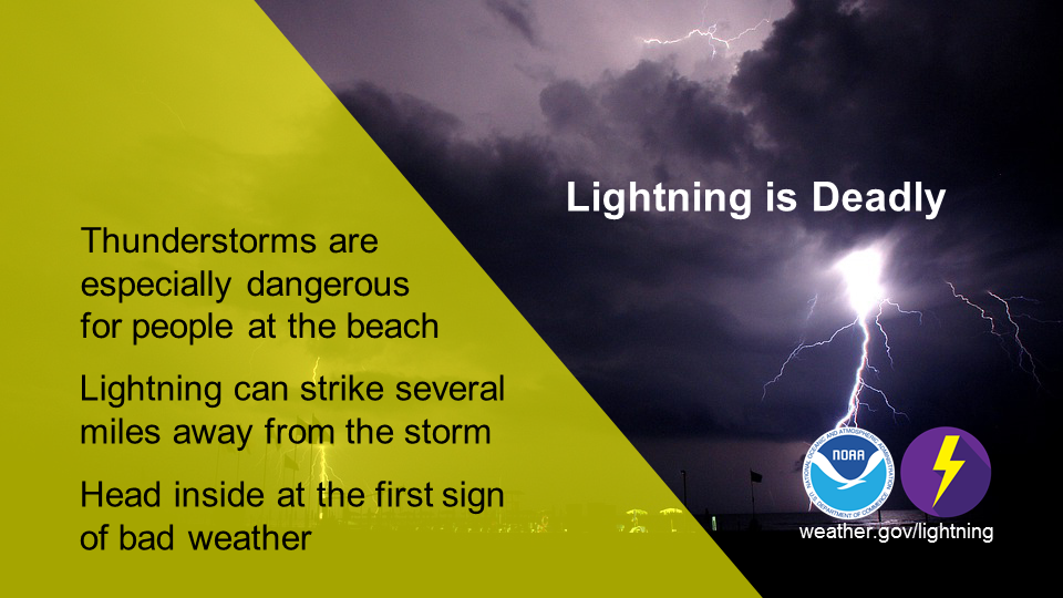 Whether you’re spending the day at the beach or an afternoon at the pool, at the first sign of a storm, you should gather your things and seek shelter. By the time you hear thunder or see lightning, you’re already in danger. When Thunder Roars, Go Indoors! weather.gov/safety/lightning Temperature outlook through late AugustThe plots below show the trend of the daily high and low temperatures for Carrabassett, Bangor, Caribou, and Portland over the next week and a half. As we head into the weekend, we will be on the periphery of an upper level ridge in the western Atlantic that will begin to nudge westward into our area. This will keep our area in a warm and humid southwesterly flow bringing slightly above average temperatures and chances for daily showers and thunderstorms. 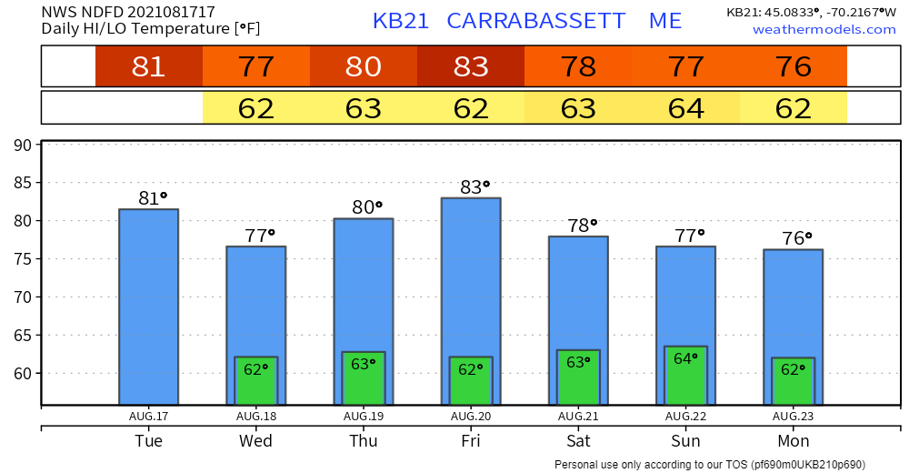 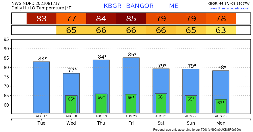 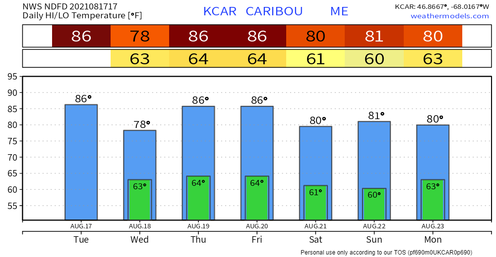 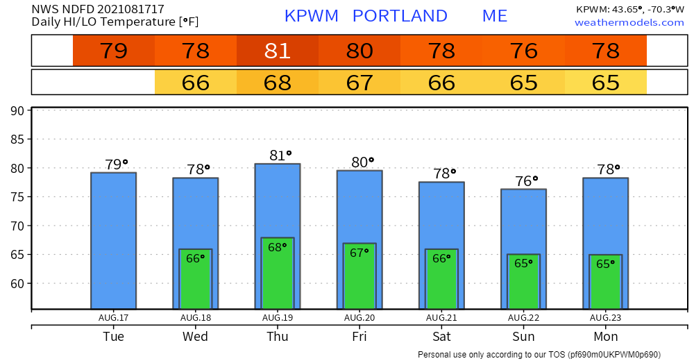 Be prepared to receive alerts and stay updated!
For more information in between posts, please follow Pine Tree Weather on Facebook and Twitter. Thank you for supporting this community-based weather information source which operates by reader supported financial contributions. Stay updated, stay on alert, and stay safe! |

Mike Haggett
|