
A quick update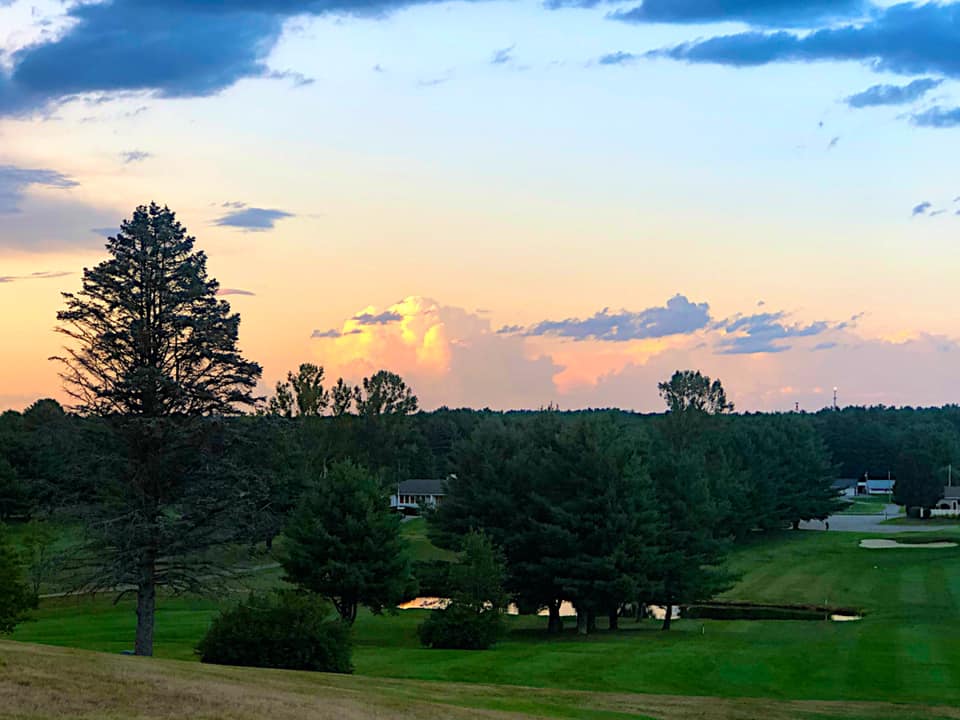 Thunderstorm in the distance. Dutch Elm Golf Course, Arundel 8/9/19 - Mike Haggett I've had a lot going on this week with work, and I am also preparing to leave Friday morning for a weekend in the White Mountains. This will be my first weekend away that will not have anything to do with work, moving, funerals or burials in nearly two years. I need this break. While we have warmer weather on the way, time is ticking down on summer. Labor Day is in about two weeks and schools will start up soon. I am a bit late launching fundraising efforts. I've had a few folks send messages for my address, and have sent checks, which I appreciate. This will be the 9th winter of forecasting on the way. So long as I stay funded, I will keep going. You can click on the DONATE tab or button on the right to get more information. Sticky weather returns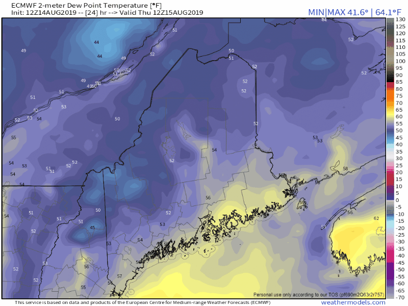 Thursday appears the last comfortable day for the humidity level for at least a week. On Friday the dew point temperatures begin to move upward. It will be noticeable for much of the region on Saturday, and by Sunday it will be "weather you can wear" that will continue well into the work week, perhaps longer. With the rise in humidity will come the chance for early morning fog, with some areas becoming locally dense. With showers around, early morning fog becomes a better bet into the weekend. Showers & storms possible through the weekend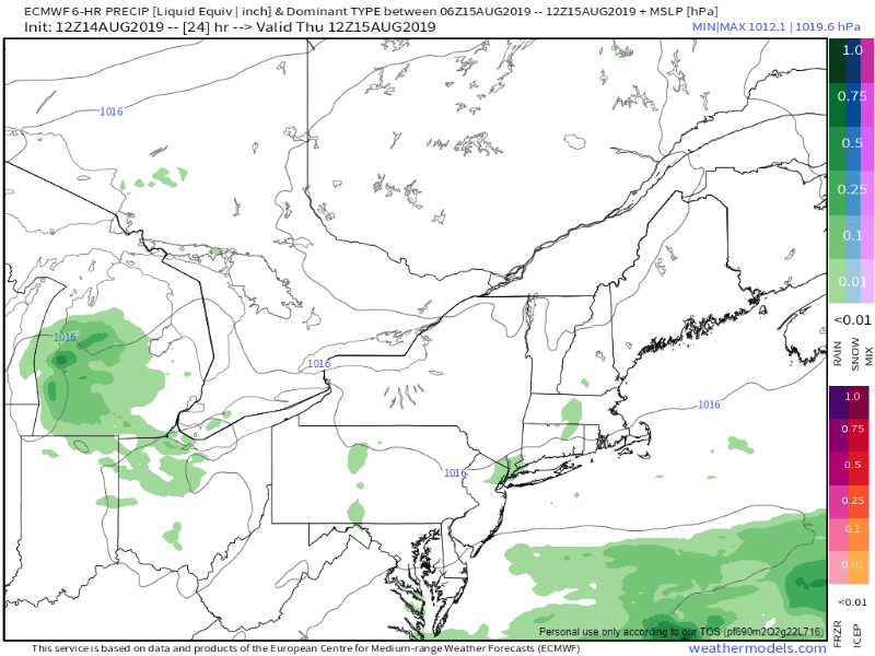 As the southwest flow brings in the humidity, it will also bring the chance for showers and thunderstorms. Thursday will be dry. Isolated showers are possible for the north country on Friday. Saturday and Sunday appear to feature hit and miss showers for the coastal areas, with a better chance for activity for the mountains and north. This will continue into Monday. As far as severe weather is concerned, Saturday and Sunday will both be days to keep watch, and as humidity continues to build, the potential for storms continue into early next week. Rain outlook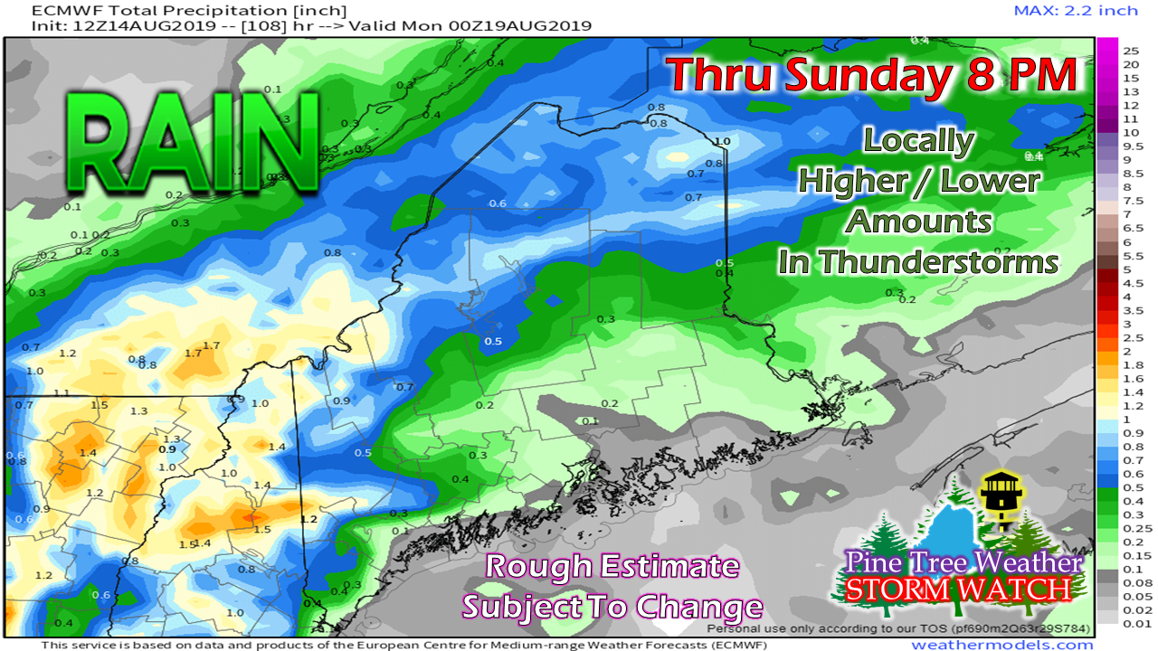 Guidance at this point appears focused on the mountains and north to be the primary beneficiaries of rain. The further south and east, chances become lower. It's a bit early in the forecast to get into too many specifics, but the general idea is there for upslope conditions to favor the higher elevations.
With the rise in humidity, the atmosphere becomes more saturated, thus presenting the idea of flash flood potential in areas of downpours. If you are camping this weekend, please pick your spot safely away from brooks, streams and rivers, as well as valleys that may see water rise quickly from runoff. Remember... when thunder roars, head indoors! ► ► For the latest official forecasts, bulletins and advisories, please check in with the National Weather Service in Gray for western and southern areas, or Caribou for northern and eastern parts of Maine. Please consider supporting Pine Tree Weather ► ► Your financial donations are much appreciated to keep this site funded and for further development. FUNDRAISING FOR 2020 BEGINS SOON! I sincerely appreciate your support not only financially, but also in sharing my efforts with others. For more information from me, please check the Pine Tree Weather Facebook page as well as my Twitter feed. Always stay weather aware! |

Mike Haggett
|


