
Muggy weather returns Thursday sees the humidity gradually increase during the day and into the evening. High pressure keeping the region cool and dry appears to be a bit stubborn in departure, which may keep the sultry air away from most of the region until after night fall. Friday will certainly be a sticky affair, but it will only be for a day as drier air returns on Saturday. Storm threat for Friday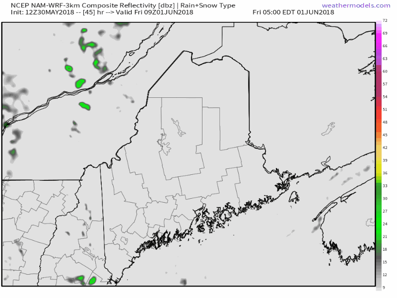 This loop here is from the NAM-WRF model starting at 5 AM Friday until 7 PM. This is rough idea of what to expect for timing and type. As time grows closer, a few things can be ruled out. Tornadoes and damaging wind do not appear to be factor. These storms appear of a pulse variety, which with little upper air wind means what storms form will likely move slow and cause flash flood potential rain in isolated areas. As discussed in yesterday's update, there will be plenty of moisture, along with convective energy and cooler temperatures aloft that will touch off showers and thunderstorms, mainly in the afternoon into the wee hours of Saturday morning. There could be a few isolated showers around daylight along the coast, but those appear short lived and the region will clear out during the day. I am not going to rule out severe potential just yet. Anytime there is tropical air with cold air bearing down on the region, there is the threat for strong storms. Stay tuned for updates. The bowling balls continue to roll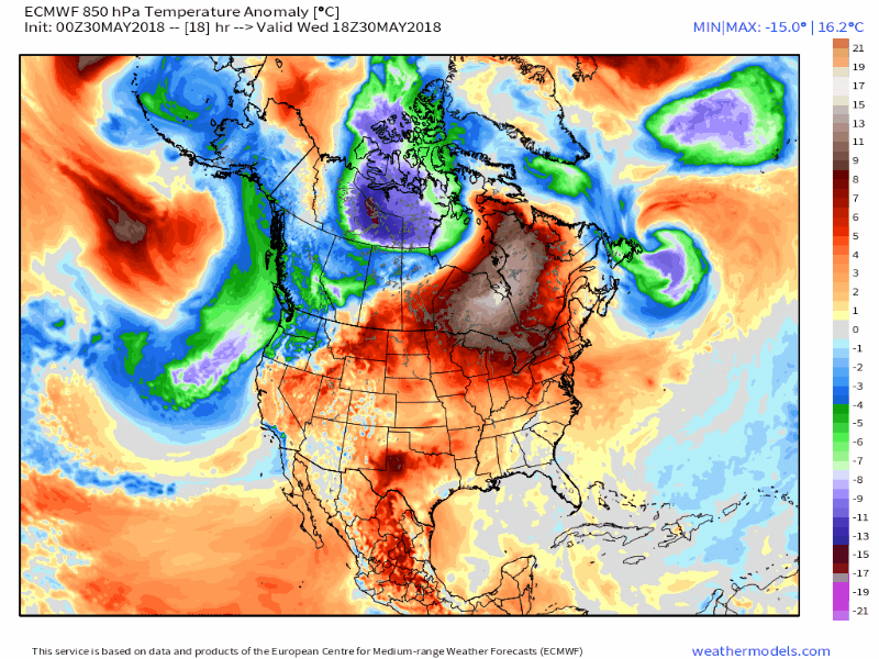 After the warm up late week and cool down over the weekend, it appears that even cooler air is likely to start off in June. While it is early to tell, the gardeners and farmers will want to pay attention to frost threats in the middle part of next week. After that, a ridge appears to build in to warm the region for the second full weekend of June. Drought concerns rising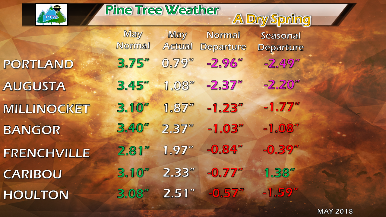 Without question it has been a very dry spring for western and southern areas, and abnormally dry for eastern areas of the state. Northern Maine is down on rainfall for the month, but for the season is only off fractionally or in the case of Caribou, showing a surplus. All areas of the state are running below average for May, and it will end that way as the month closes out on Thursday. Numbers not shown in the graphic but worth noting, our neighbors in New Hampshire are feeling the effects from the dry conditions, also. Manchester has only recorded 0.77" of rain for May and is down 2.97" from it's monthly average of 3.74". Concord has received slightly more at 1.01" for the month, off 2.39" of its average of 3.40". Seasonally (since March 1st) Manchester is down 4.29" and Concord is off 2.17" from normal. This information, along with the deficits for Portland and Augusta indicate the lack of rain is affecting much of southern New Hampshire, and is a regional problem for central New England. 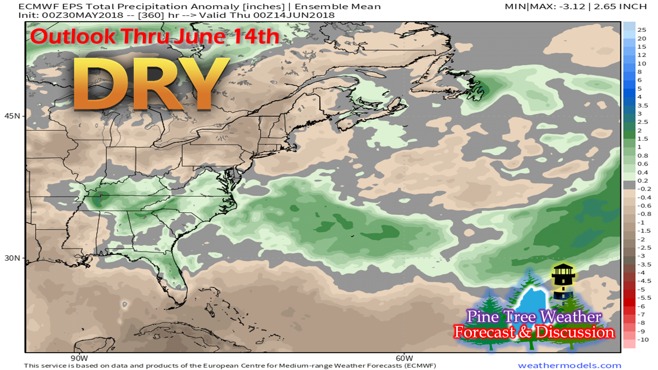 The outlook for the first couple weeks of June aren't showing much relief from the drought conditions, either. For those who depend on well water, you should be conserving supply if you have not already. For the hikers, campers, those who want to burn off brush or have a bonfire, you need to stay in touch with the Maine Forest Service and local fire departments for permits and information. Wildfire concerns will persist until meaningful rain comes, and that could be awhile. Outlook through Monday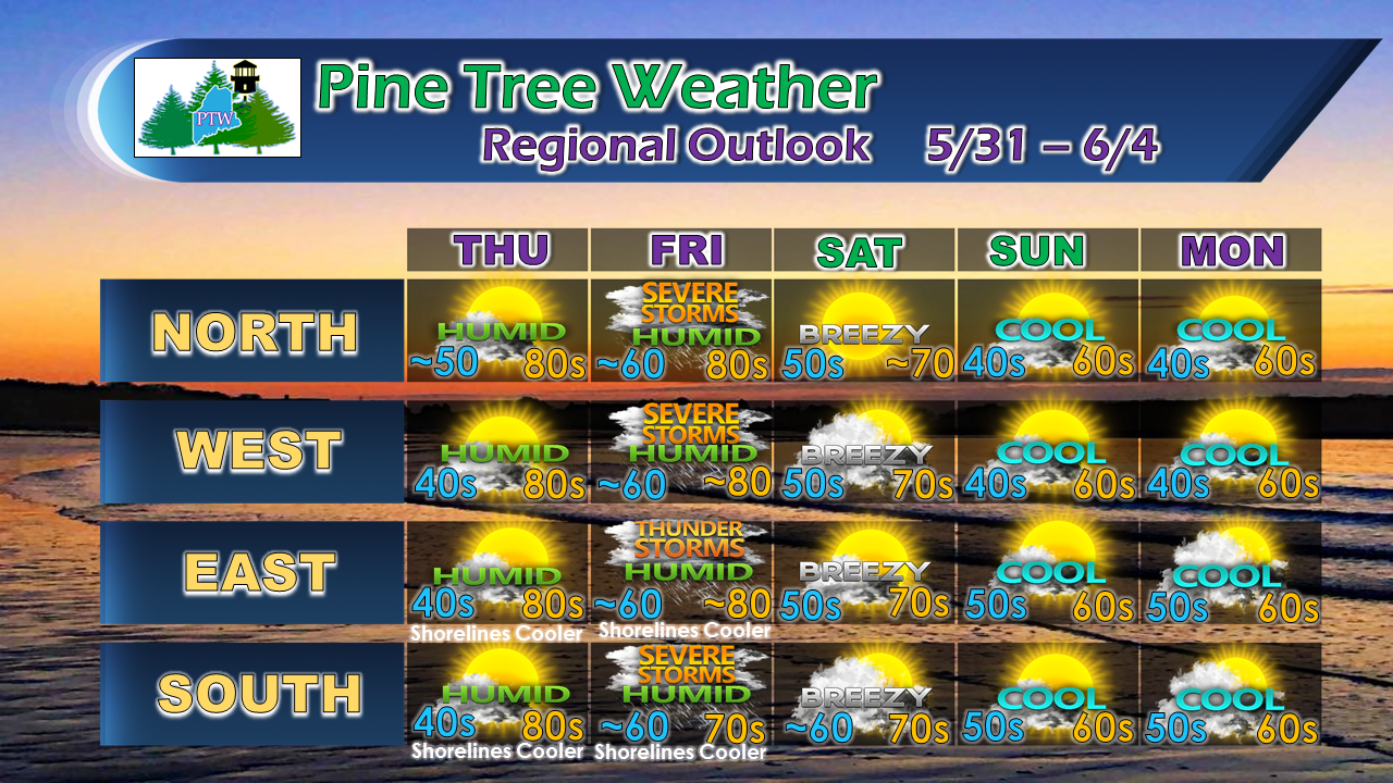 Outside of a couple of minor adjustments to temperatures, the forecast hasn't changed much heading into the weekend. With the increased humidity, fog could be a concern for coastal areas Friday morning. I will keep the threat for severe storms in the forecast and may alter that in my update tomorrow pending on overnight data and review of conditions to the west.
As always, stay in touch with NWS Caribou for northern and eastern Maine and NWS Gray for western and southern Maine for official forecasts, bulletins, and information. You can follow Pine Tree Weather on Facebook and Twitter for more information from me. As always, thank you for your shares, comments, and support! - Mike |

Mike Haggett
|


