
The big picture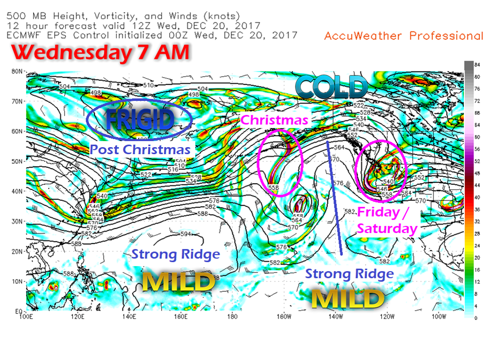 In order to get a perspective on how the weather pattern will play out for Maine over the next week, the activity in the Pacific holds the key. A look at the upper level energy shows the players better than any surface map. The first hurdle will be for Friday afternoon through Saturday night. That energy is over the Pacific northwest of the United States. That will flatten out and tap into moisture from the south, and create an inside runner system that will impact the beginning of the weekend. Christmas Eve Sunday continues to appear to be the best day of the weekend with varying amounts of clouds that are on track to increase in the afternoon. Effects from the energy south of Alaska Wednesday morning arrives in Maine around the time Santa arrives overnight. Christmas Monday is on track to be a cold and snowy one, tapering from southwest to northeast in the afternoon into the evening. A big blast of Siberian cold shows up for Boxing Day on Tuesday. Friday / Saturday Concerns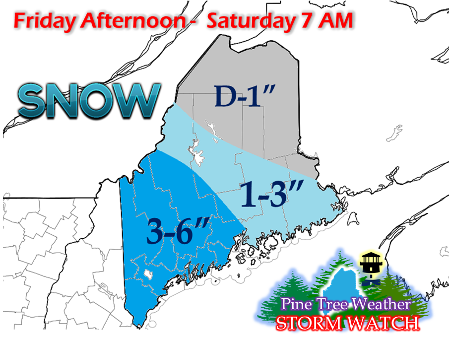 Travel Friday afternoon into Saturday morning could be rather greasy for a good portion of the state, and it does not appear to improve much during the day. 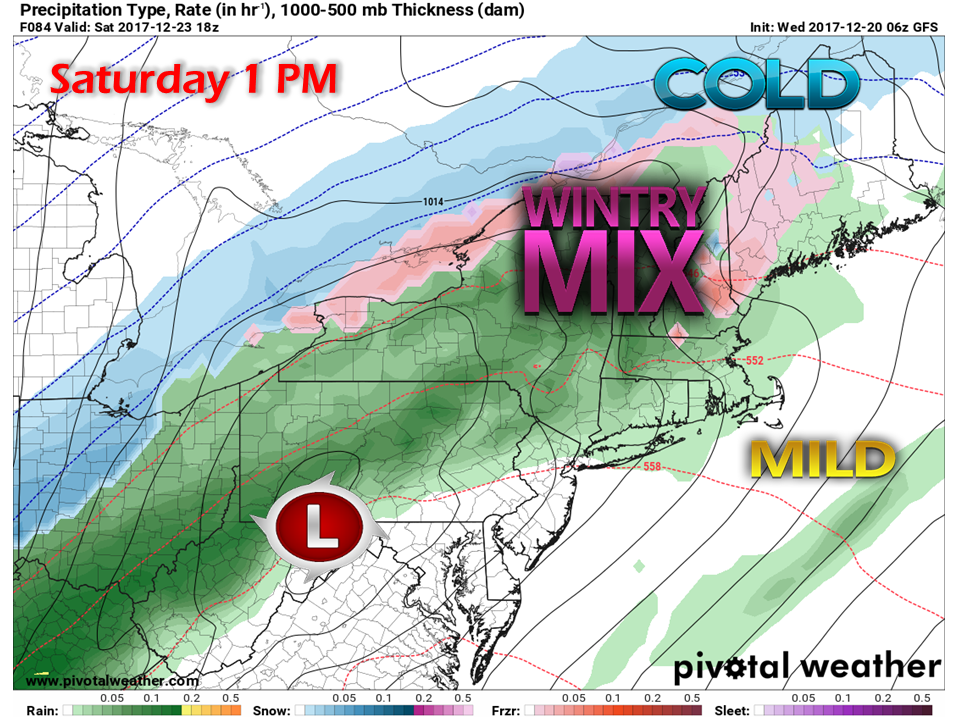 If you happen to be in an area that shows green on the forecast chart here, don't bet on it being rain. With cold air damming likely to play a factor, a mix of sleet, snow and freezing rain is likely to impact much of the region. This is likely to make travel even more difficult. Given the cold air mass that takes over Thursday into Friday with temperatures near to below zero for overnight lows, the cold air is likely not going to cooperate. Precipitation is expected to continue into Saturday night, with conditions improving for Christmas Eve Sunday. A White Christmas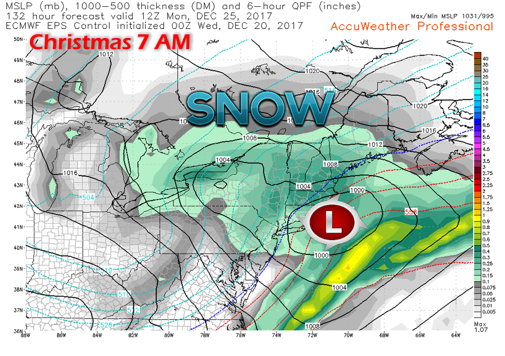 With cold air restoring its grip over the region Christmas Eve, that sets the table for what now appears to be a widespread snow event for Monday. It is a bit early to get into specifics on accumulations, but a 6"+ event is possible for at least the mountains and north. Track will be key as for now appears close to the 40°N / 70°W benchmark point. It will also be dependent on how firmly entrenched the cold air will be over the state. There is wiggle room as there always is this far out in the forecast. For those traveling for Christmas, it would be wise to get to where you want to go on Christmas Eve and if you can, stay there until Boxing Day on Tuesday. The Siberian Express Arrives Midweek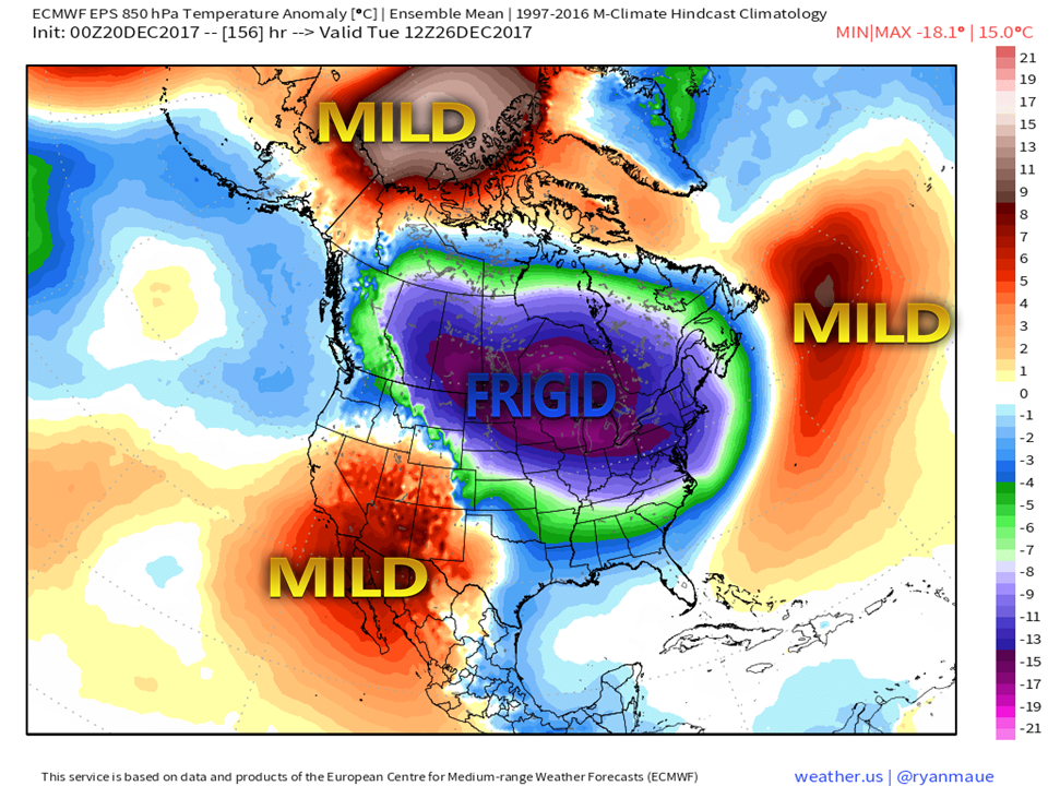 This is the kind of cold that is likely going to hurt. High pressure is on tap to settle in during the day on Tuesday. Temperatures that day appear to stay above zero. For Wednesday, temperatures may struggle just to get to zero over southern areas, and -10° for a high may be a struggle for the mountains and north by the middle part of the week.
NOTE: I am still taking life day-by-day due to health issues with my father-in-law. I will do my best to continue to update when I can. Thank you for your continued prayers and comments of support. The 5-Day Outlook page has been updated through Christmas Monday. Click on the link above to get you there for the forecast for your region. NOTE: The forecast has been updated. Please click on the DISCUSSIONS tab above for the latest information. - Mike |

Mike Haggett
|


