
Cold air damming, explained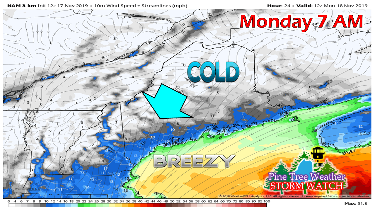 The update is going to be a short and quick one due to family activity, but there are a few things to keep in mind with this system working into the region early Monday through the day. First is the cold. I do not care what the garbage weather phone apps say. I do not buy what some models are selling. The reason being is wind direction. A north-northeast wind does an excellent job holding in cold air, which is known as cold air damming. 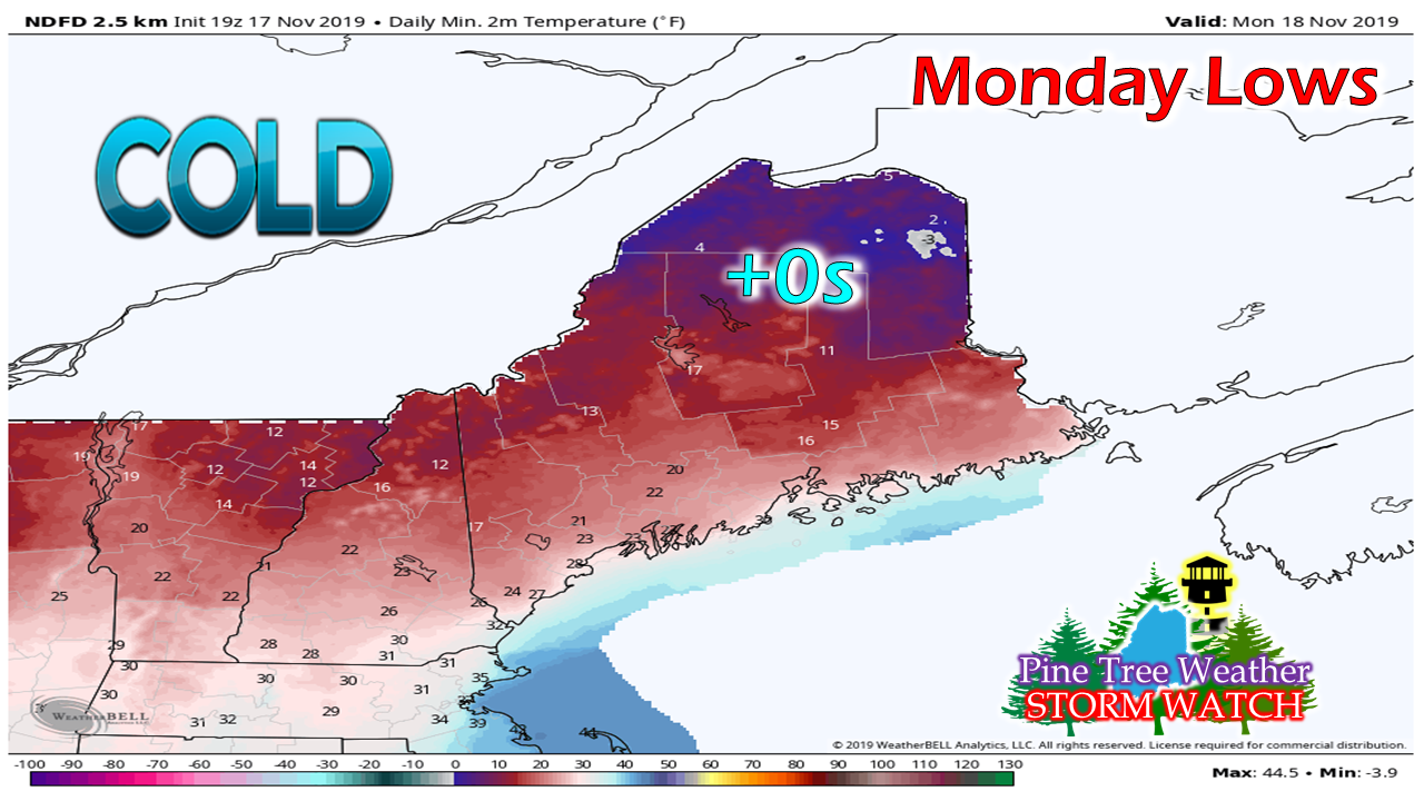 A couple years back we had a similar set up where temperatures were around 0° in northern areas, Models were moving warm air in along the coast like butter melting on toast in that situation, and the forecast was abruptly changed in hurry. I am going to get out ahead of this one right off, and call the models bluff. I do not buy that cold surface air will go away without a fight. As noted by one of my astute Twitter followers Sunday morning, Mount Washington was warmer than any area below the summit. That will be the case for Monday. Warm air will override the cold aloft. This is where sleet and freezing rain become the more dominant precipitation type. Sleet is more likely over interior areas, and freezing rain will be a concern away from the shorelines as warm air intrudes even lower in the atmosphere. Most areas statewide have a chance for at least glaze ice out of this. The southwest coast could see icy conditions to start off Monday as low level convergence comes into play. I have a web page set up specifically on this site to cover for me when I get into situations such as today which gives you snow and ice outlooks piped in from the local National Weather Service offices and Weather Prediction Center. You can click on that link highlighted to get you there. 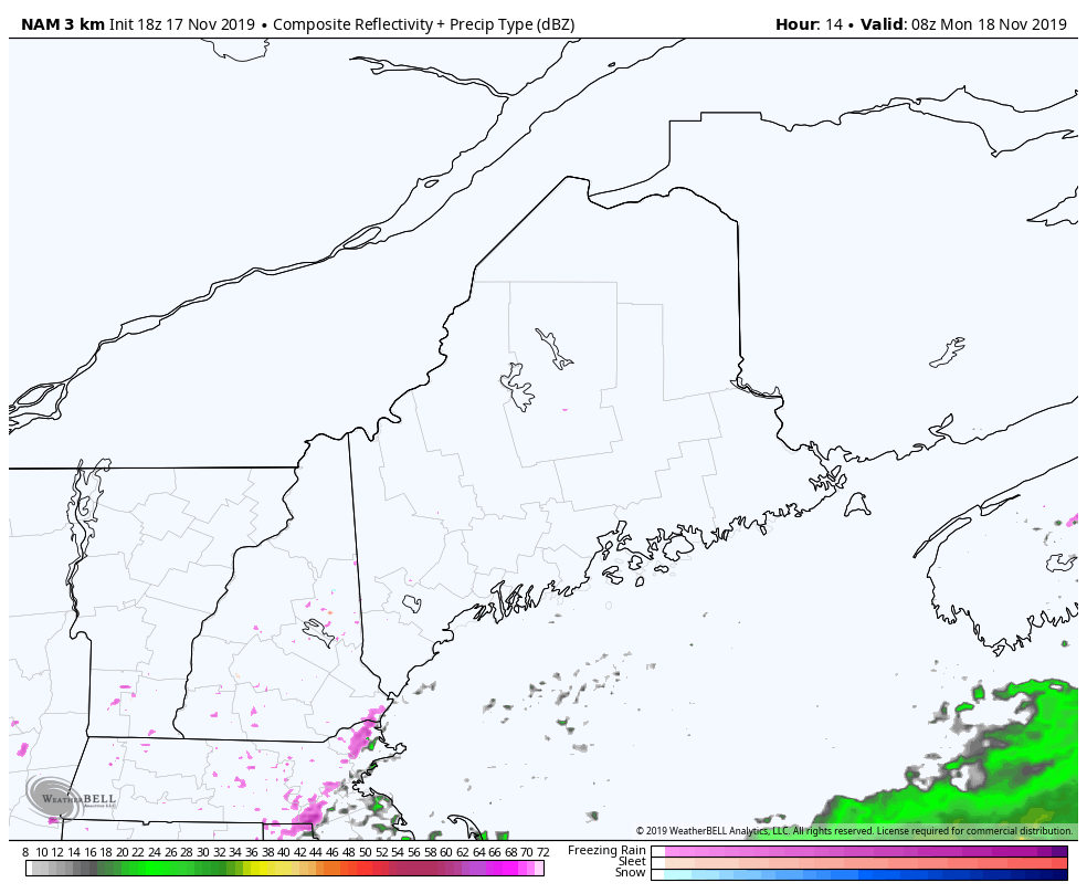 This is presented to give you a rough idea on timing. We'll have the initial wave on Monday, followed by a trailing secondary low which will slide through on Tuesday. DO NOT LET THE COLORS FOOL YOU. What precipitation depiction the suggested radar may present may be totally different once it makes landfall. What you need to plan for is SLICK driving conditions, sidewalks, and parking lots. Remember to TAKE 5° OFF YOUR VEHICLE THERMOMETER. With the recent cold, the surface is likely to be at least that much colder than the thermometer reads. Don't get fooled by cold air damming. Travel safe whether by legs or by wheels. ► ► For the latest official forecasts, bulletins and advisories, please check in with the National Weather Service in Gray for western and southern areas, or Caribou for northern and eastern parts of Maine. Your help is needed to keep this site going! ► ► DONATION DRIVE UPDATE - $640 shortfall for the year ahead! You can help keep Pine Tree Weather going with a donation of any amount now through VENMO @PineTreeWeather, a monthly donation on Patreon or messaging me on Facebook or Twitter to send a check in the mail. Thank you for your support!
For more information from me, please check the Pine Tree Weather Facebook page as well as my Twitter feed. Always stay weather aware! - Mike |

Mike Haggett
|


