
The junk storms continue to roll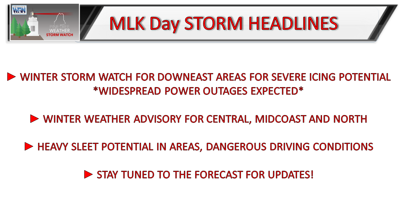 For those faithful followers and donors in DownEast areas, your notice is short here and you need to get on the stick to prepare for this one NOW. Gas up your vehicles, get fuel for your generators if you have one, get food and supplies, charge batteries and buckle up. This is likely to be a bad storm for you. You could be without power for several days. Looking at what is coming in the pipeline, it would not surprise me to see some folks there without power for more than a week, if not longer. For those located west of Penobscot Bay in the MidCoast, Capital District, and Bangor areas, you should prepare as well. It may not look to be "that bad" as compared to DownEast, but if trends continue to push west, you'll get in on this mess also. Everyone else needs to stay tuned as well. The forecast is very fluid and could change for the worse as it has for the past three days now. Breaking it all downThe frontal boundary that has stalled offshore is in the process of going through rapid development. An inverted trough set up out ahead of it is going bring moisture in from the southeast. The parent low developing due south of Nova Scotia is expected to generate hurricane force gusts near its core, well away from Maine. It's got a solid moisture hose attached to it, so it will have plenty of moisture to throw at the region. All of that gibberish means we're getting an offshore NorEaster. 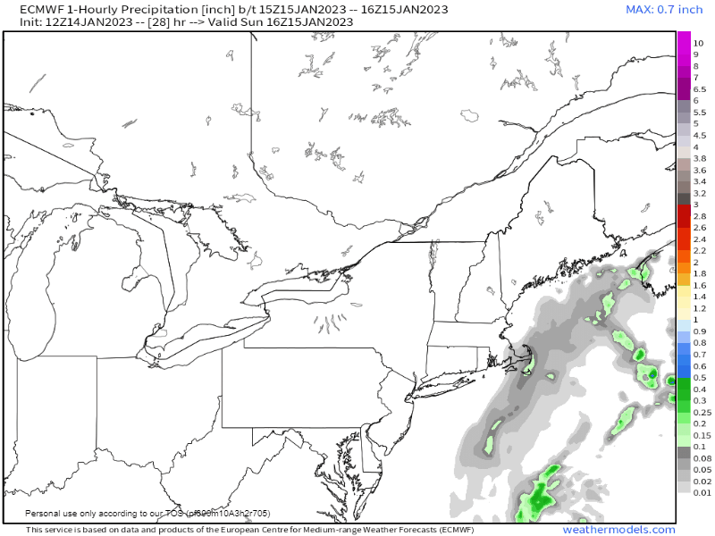 Sunday Noon to Monday 11 AM - Folks up and down the coast can expect snow showers to break out in the afternoon. Heavier precipitation moves in overnight, bringing snow and sleet to the west and south, sleet and freezing rain for the east, and snow and sleet taking turns over the north. The bulk of the precipitation appears down by Monday morning for the south. but don't hold me to that just yet. 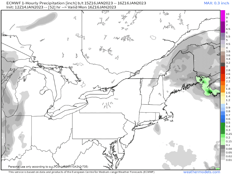 Monday Noon to Tuesday Noon - The mixed mess continues over the west, east and north through Monday afternoon and begins to taper off Monday night into Tuesday morning, finally exiting by midday on Tuesday. NOTE: This is subject to change. 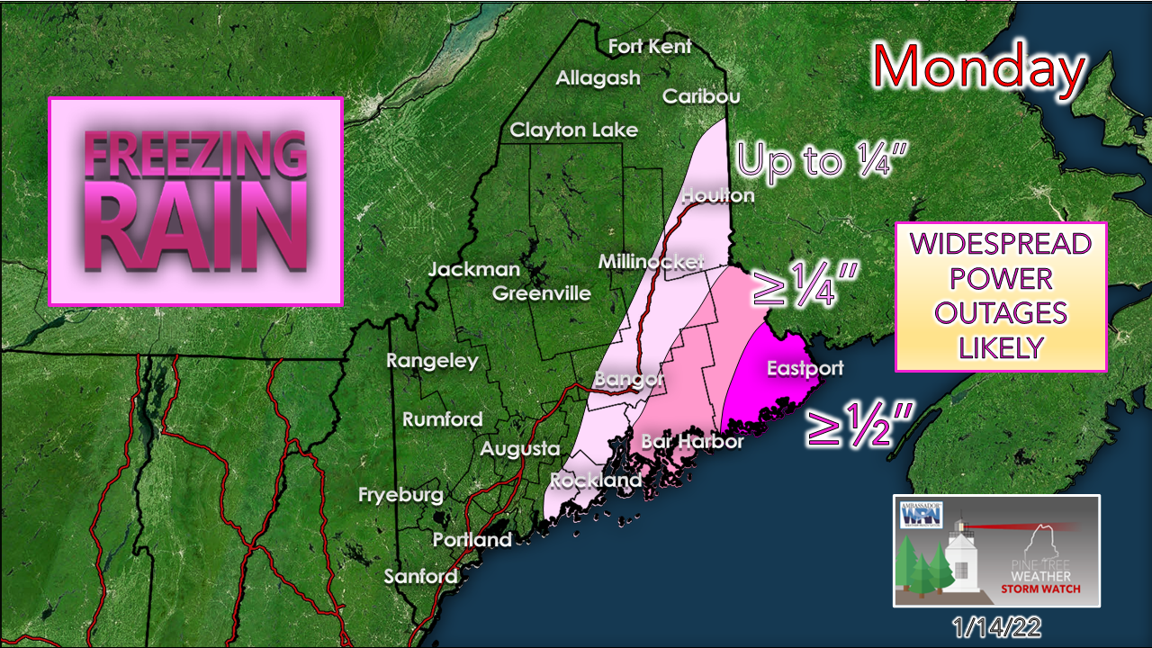 DownEast areas are getting a full-on ice storm, and a bad one. Any shift in track to the west, which I will mention again is the trend, pushes all of this to the west also. Portland, Lewiston, Augusta... stay tuned. Bangor and Rockland... you could get more ice. Let's hope the shift west is over. 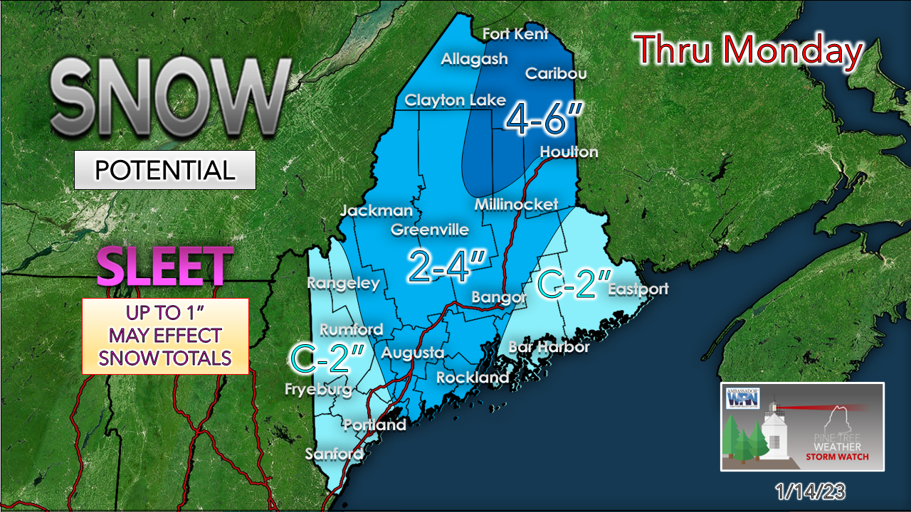 SLEET is going to be an issue here across the region. If the thermodynamics hold up, there will be a lot of frozen buckshot falling from the sky, and if you go out into, you may want a helmet with ear plugs. It could be heavy. Nothing is more dangerous than driving or walking in sleet. Just brutal. Sleet busts snow totals, too, but this is fair estimate for now. 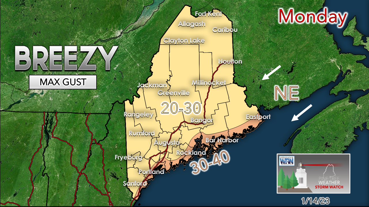 While wind is not expected to be an issue, it's a BIG problem for DownEast areas with the freezing rain on the way. Anytime there is ½"+ of ice and wind 30-40 mph, it's bad. The wind settles down Monday night. We'll get a warmup Tuesday and Wednesday to get this ice off the trees and power lines, thankfully. That needs to happen with a potential storm on the way Friday. Stay tuned... This may not be the final answer. 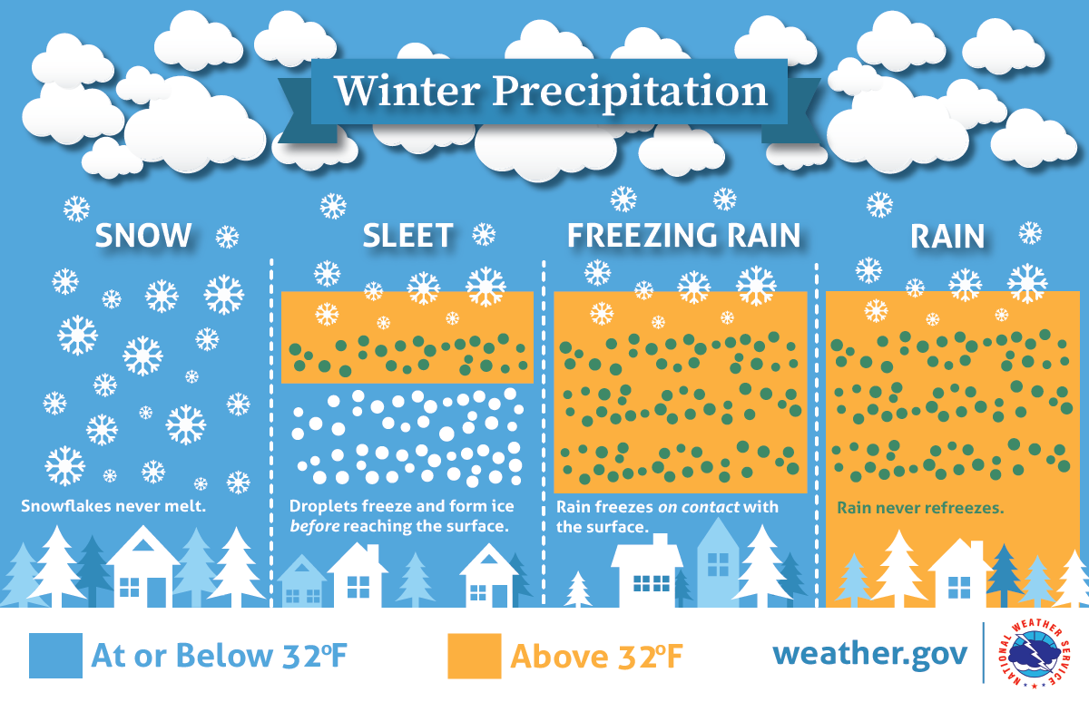 Thank you as always for your support! You may not like the weather, but I hope you like what I do! Please hit the like button on Twitter and Facebook, and share! Financial donations to fund what I do are always appreciated! Stay updated, stay on alert, and stay safe! - Mike NOTE: The forecast information depicted on this platform is for general information purposes only for the public and is not designed or intended for commercial use. For those seeking pinpoint weather information for business operations, you should use a private sector source. For information about where to find commercial forecasters to assist your business, please message me and I will be happy to help you. |

Mike Haggett
|


