Freezing rain for interior areas on Wednesday, rain for the coast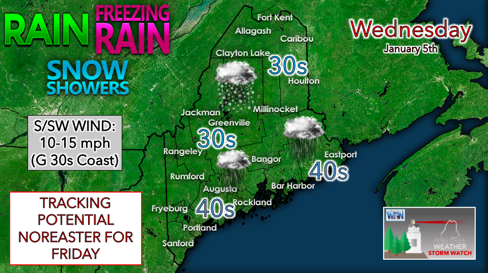 A warm front moves through the area on Wednesday, bringing wintry precipitation along with it. Periods of freezing rain are possible during the morning for the southwest interior, before changing to all rain as temperatures climb into the 40s. The north and mountains are more likely to see some snow showers to start with freezing rain possible later on as warmer air spreads into the region. Accumulations of about an inch of snow is projected for areas of higher terrain, with a glaze of ice further south. The National Weather Service has issued a Winter Weather Advisory for much of southwestern Maine due to the freezing rain potential. Roads and surfaces may be very slippery this morning, so use caution while driving or walking. The advisory is in effect from 7am to 1pm Wednesday. 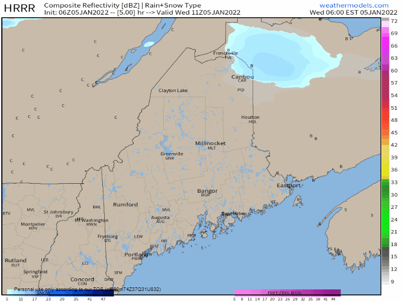 Wednesday 6 AM to Thursday 12 AM - Precipitation begins in the southwestern portion of the state Wednesday morning before spreading north and east. Rain and snow showers may linger into the overnight hours, with low temperatures expected to be well above average. The main threat with this system is icing in areas that see freezing rain, otherwise this appears to be a relatively low impact event. The coast is expected to receive all rain, although breezy conditions are expected for the afternoon and evening. A quick round of snow showers on Thursday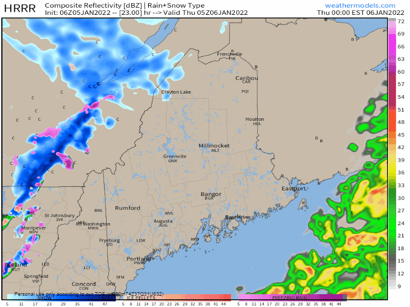 Thursday 12 AM to Noon - A cold front along with a few weak waves of energy aloft bring the chance for scattered snow showers for northern areas on Thursday. The southern half of the state appears to stay mostly dry with partly sunny skies. Temperatures are expected to reach the mid to upper 30s, a few degrees above normal for this time of year. Friday storm track offshore but close enough for snow Friday 1 AM to Saturday 7 AM - With all of the upper air ingredients now on the continent, consensus on the main idea on timing and storm track is narrowing itself down. Given the projected track just to the south of Nova Scotia, this makes this an all-snow event for the coast. The storm is a quick hitter, with most of the snow falling over the region in roughly 12 hours from start to finish. Expect impacts for the morning commute for southwestern and MidCoast areas, and slick conditions for the evening drive for the Bangor / DownEast region. Snow ends from west to east Friday evening over the south and west, and in the wee hours of Saturday for the north and east. With the track to the south, wind affects appear minimal during the day. As the storm moves east and the wind shifts from northeast to northwest, some blowing and drifting of snow is possible Friday night into early Saturday morning. 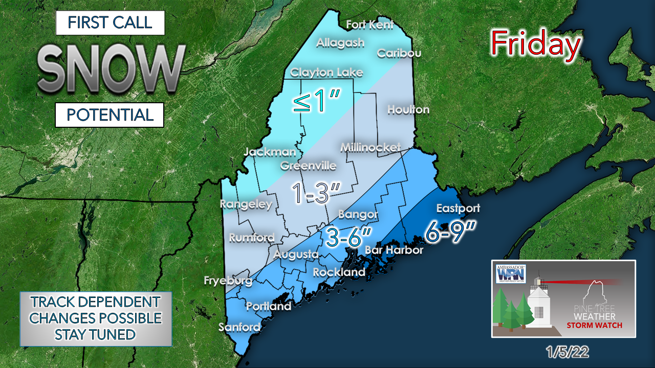 Timing and intensification are everything as far as which areas get what for snow amounts. Confidence in DownEast areas receiving the most snow from this event has been a solid signal in recent model runs. With the potential track to the south, which puts the region on the fringe, and a sharp cut-off in snow amounts is possible for the mountains and north. Any early formation or delay in storm development, along with any jogs in track to the north or south could alter the final tally, but this is a fair idea for what to expect, with updates to come. Weekend outlook a 50/50 split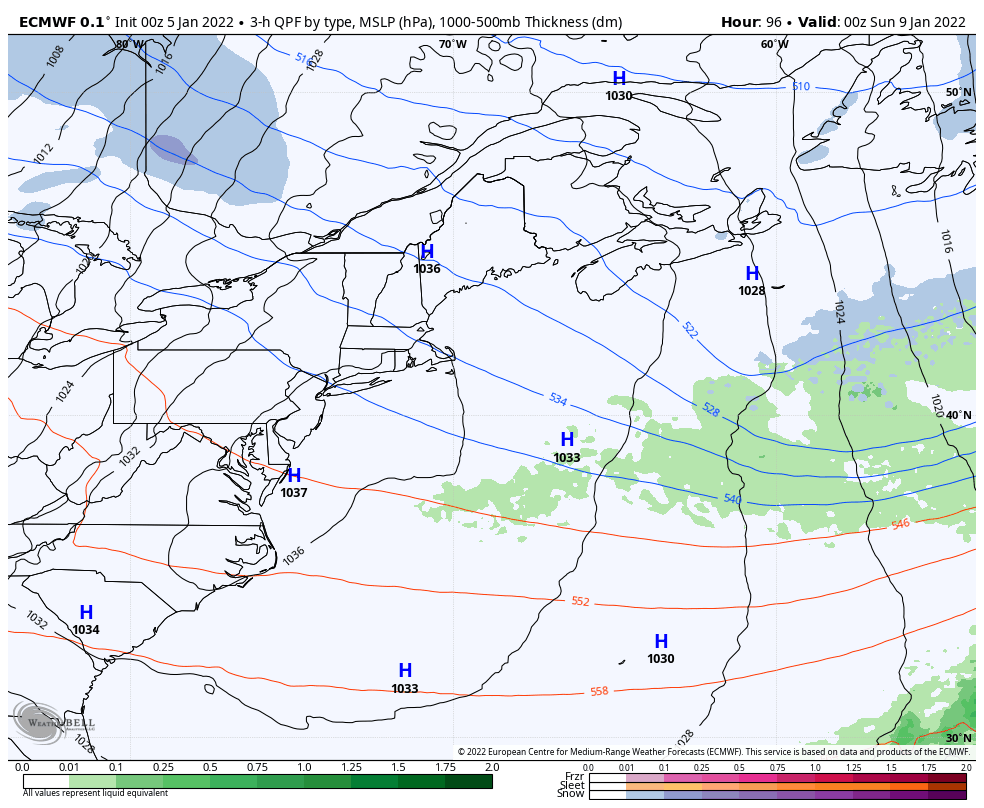 Saturday 7 PM to Monday 1 PM - High pressure, a mainly clear sky and cooler than normal temperatures are expected for Saturday. Clouds increase Sunday night as the high shifts to the east and a warm front moves in from the southwest. It appears to be another mixed bag event with snow, sleet, ice and rain all possible to wrap up the weekend Temperature outlook through MondayAfter the frontal passage on Sunday night, an arctic front passes through on Monday which sets up a prolonged period of bitter cold temperatures that appear to hang on through next week. The appears to be the coldest prolonged period of temperatures the region has seen in a couple of years. Make sure your home heating oil / K1 tanks are filled, and if you have issues with freezing pipes, you are now on notice to prepare now. 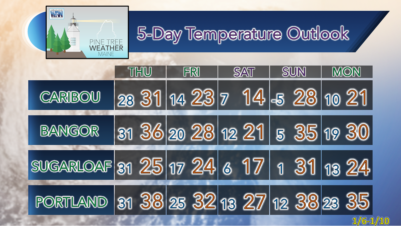  Rain with a temperature near freezing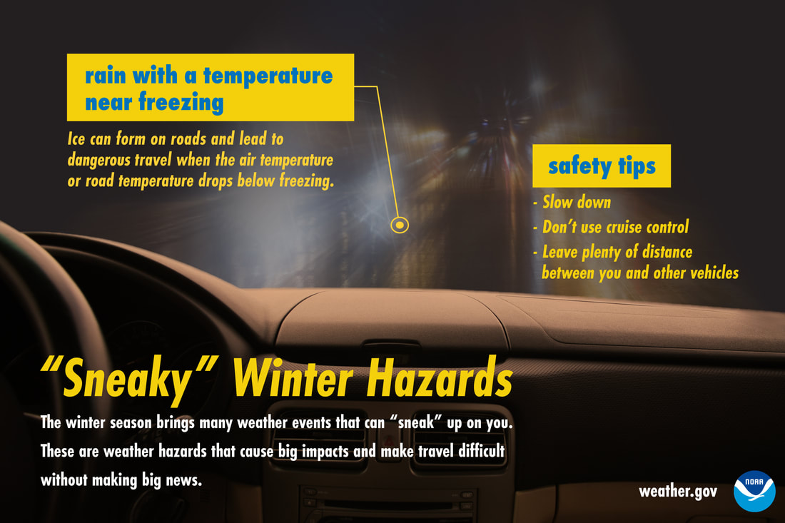 Rain may appear less of a winter driving hazard than snow, but when temperatures are near freezing, that’s not the case. Ice can form quickly and make roads slick. In these conditions, slow down, don’t use cruise control, and keep plenty of distance between you and other vehicles. Don’t let this winter hazard sneak up on you! Be prepared to receive alerts and stay updated!
 For more information in between posts, please follow Pine Tree Weather on Facebook and Twitter. Thank you for supporting this community-based weather information source which operates by reader supported financial contributions.
|

Mike Haggett
|