|
Before I get into the discussion, I just wanted to pass along well wishes and gratitude for Thanksgiving. This has been a year unlike any other. We've all been impacted by the pandemic. We've had to make major sacrifices. Our quality of life has changed, and it may never be completely what is was before. We've had to deal with being isolated, and in some cases being alone. Some have dealt with the illness, and unfortunately in cases did not make it. Our character has been tested in a much different way. What was important back in January may not even be on our radar screen at the moment. While there appears to be light at the end of the tunnel, life continues to be day-by-day, with change that could occur at a drop of a dime. All we have is today. A twenty-four hour period that we have some control over. While we may not be able to share the holiday with friends and family the way we normally would, there is still much to be grateful for, and celebrations to look forward to. The struggles of today, whether financial, relationships, loneliness, mental health, or job security, are only temporary. Everything works itself out in time. It always does. Hang in there. Better days are coming. Watching the thermometer for Thanksgiving Day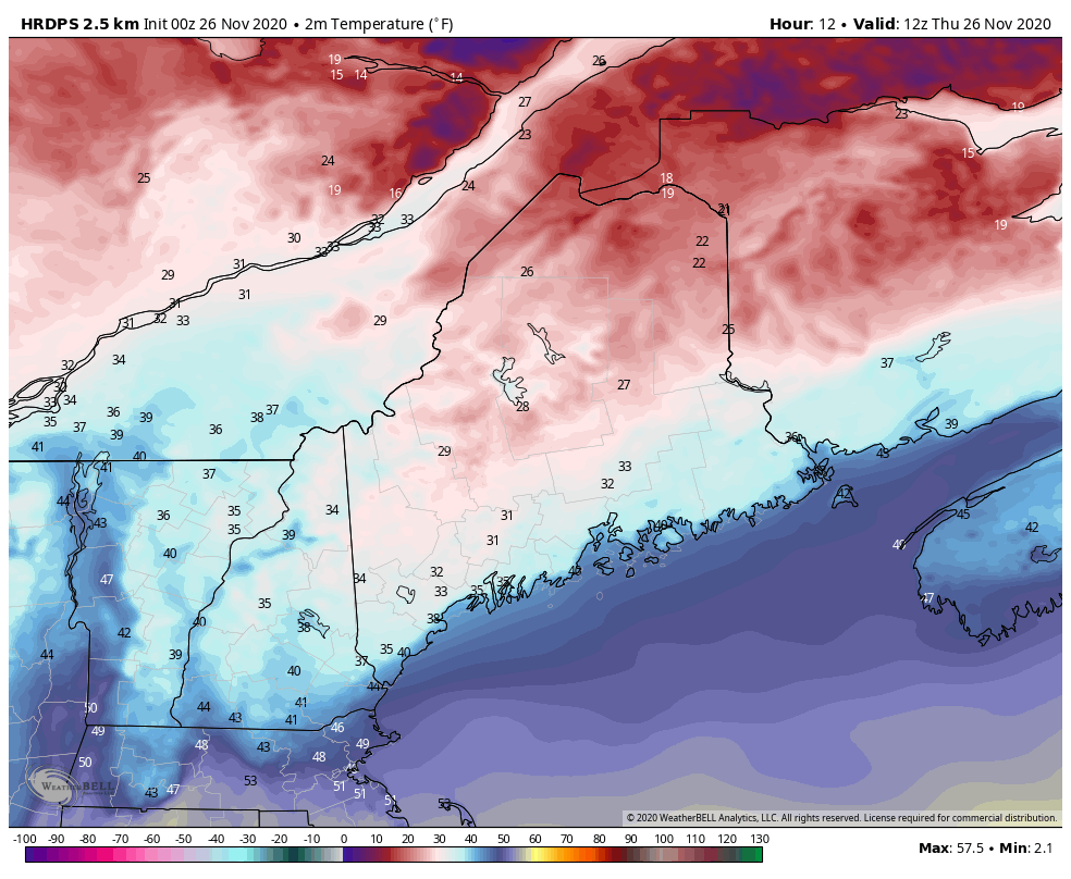 The key for the day will be temperature. Cold air damming has made many a forecast blow up over the years in these parts. The scenario painted on my update here yesterday still rings true. High pressure to the north near the Gaspé Peninsula holds the cold in place. How quickly that moves east will dictate when above freezing air will move in. Temperatures will rise from this point onward. A coastal front boundary moves in along the shorelines which will help raise temperatures for the southwestern shorelines, and work inland over the MidCoast and eastern areas. This loop shows the typical cold air damming scenario eloquently for southwestern areas. While it is annoying to have to deal with it, it never ceases to fascinate me. Warm air will win out eventually, but it may take a while. For western and southern areas, it may be early afternoon. For the north, it may be tonight. Most areas appear above freezing to start Friday. 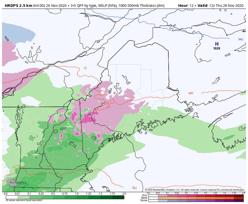 Southern and western areas see precipitation taper off mid to late afternoon. For northern and eastern areas, it may be mid to late evening. 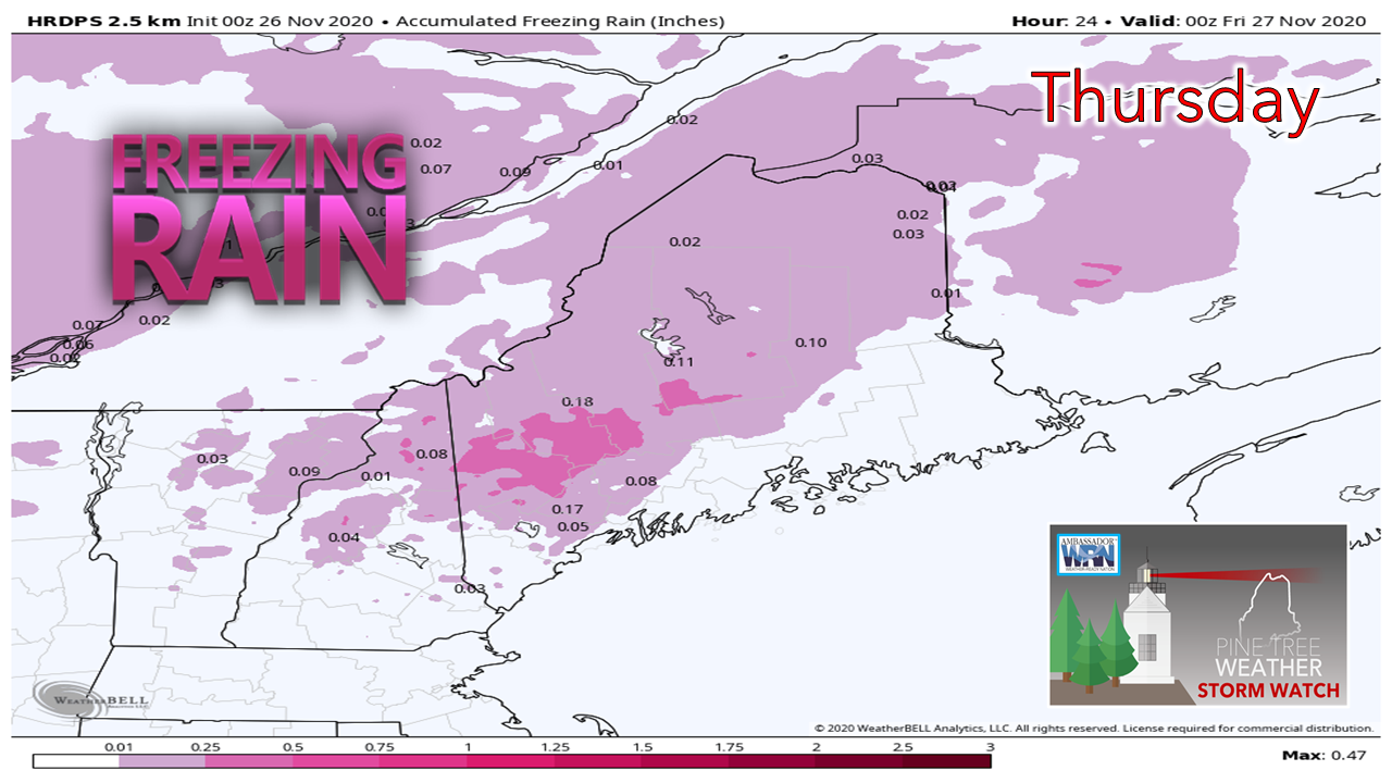 This chart may be overdoing it a bit as far as potential ice accretion goes, but the idea of the cold hanging tough over western areas is the main point of this. It will be enough to slick the roads, sidewalks and any other untreated surfaces. How much accretion occurs will depend on the temperature. This will all melt as the thermometer climbs. 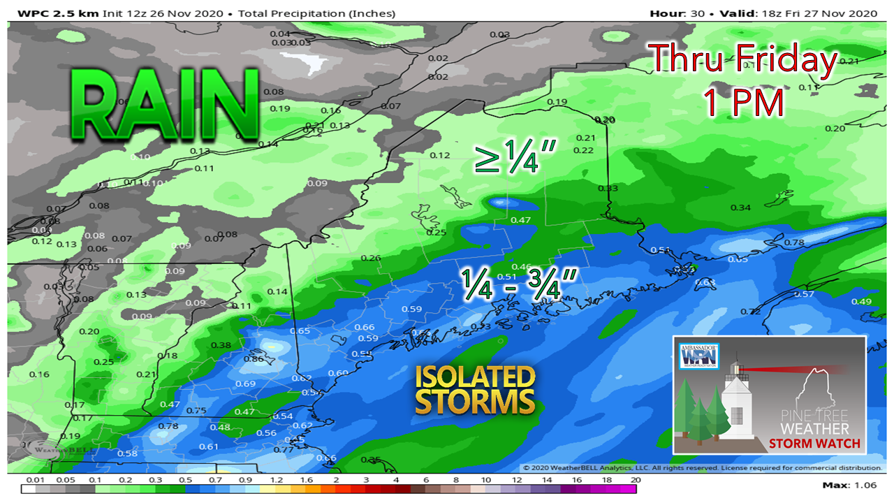 Another decent amount of rain for the coastal plain, with lesser amounts for the mountains and north through Friday morning. With the coast front, there is a chance for a rumble of thunder into the evening, The best chance for that is MidCoast and DownEast. Western areas may see some pokes of sun later in the day, perhaps in time for sunset.  Weekend update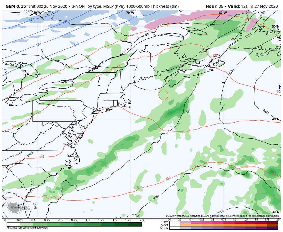 Sunshine will be tough to have for any amount of time through Saturday. A cold front passes through Friday, which may bring an isolated shower during the day and a flurry to the mountains Friday night. A weak area of low pressure passing through northern Quebec brings another cold front through on Saturday, which could bring another round of snow showers to the mountains and north. High pressure and the sun returns on Sunday. Potential for a drought buster early next week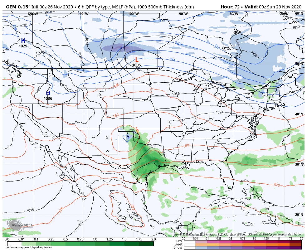 I am usually reluctant to get into too much discussion of storms more than a couple of days out due to changes in ideas, but the potential for this one has plenty of support from guidance. Watch the low to the north over the Canadian Prairies and the moisture over the south. The polar jet phases with the subtropical jet and form a strong storm south of the Great Lakes and tracks up into southern Ontario. Blocking to the north, east and west keeps the storm around through the middle part of the week, and the effects of it continue into late week. 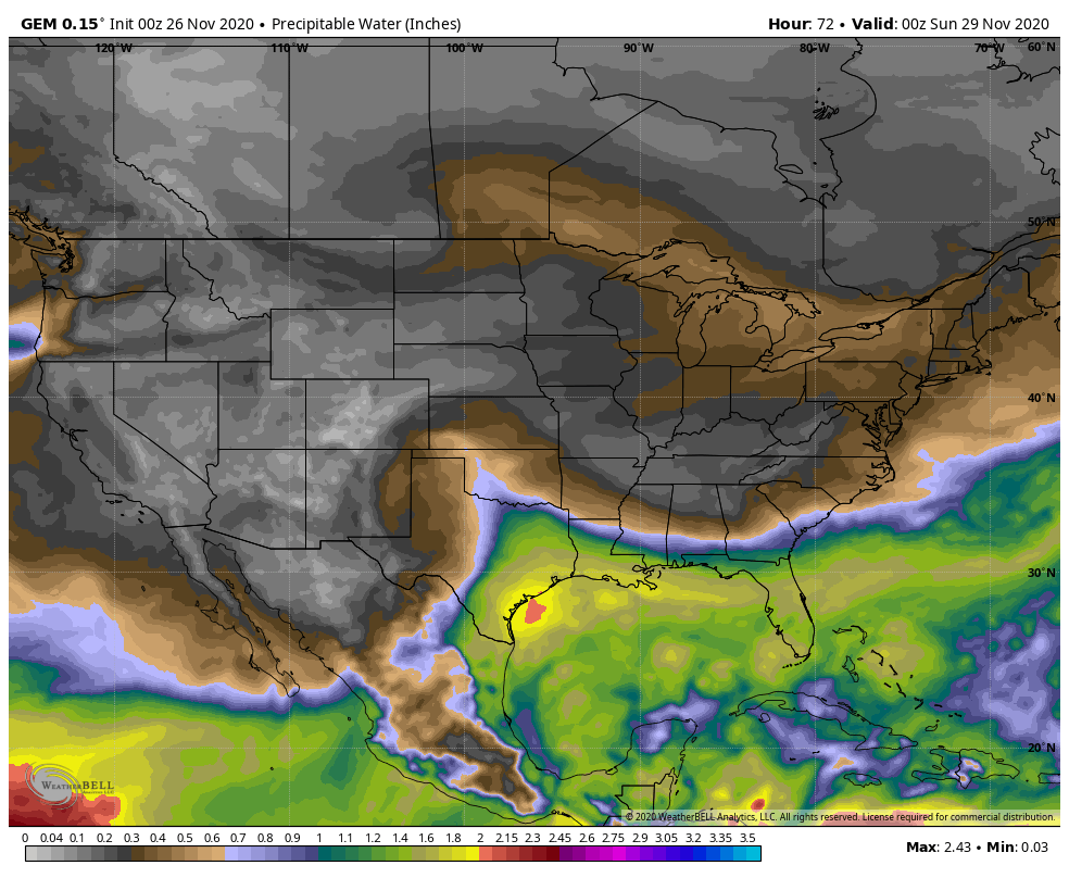 For December, it is rather odd to see the surge of moisture from the south of this magnitude. We had a similar storm of this amount of potential water about a year ago. The precipitable water values shown here are typical for a late August / early September event. 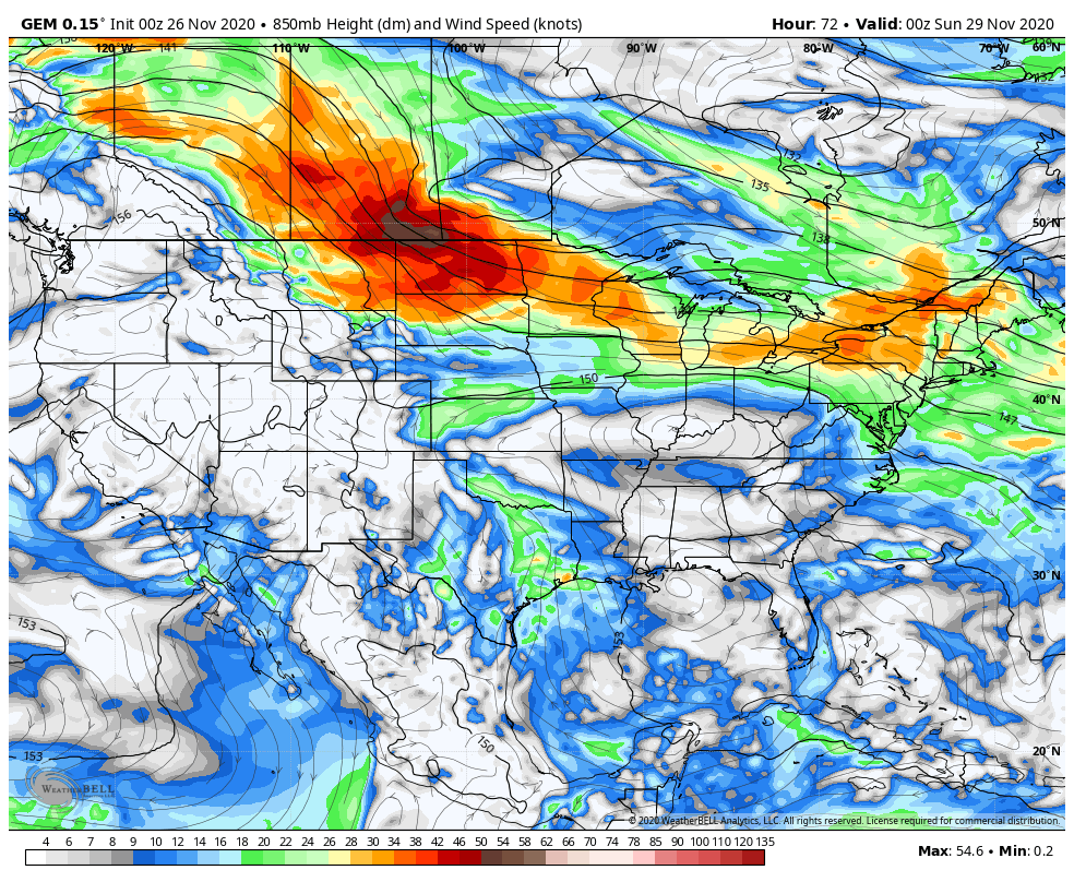 Important to note here that this is wind speed at roughly 5000 feet. The combination of this wind field and moisture could bring heavy amounts of rain, roughly 2-5" worth, and potential for damaging wind along with it. Our shorelines could have a rough time with this scenario. It's a bit early to get into too many details, but it is something to stay updated on. Wind could be a feature in the forecast through the end of next week. After you get done with your Thanksgiving meal, you may want to check your storm supplies and make notes of what you may need to pick up over the weekend. Temperature outlook through WednesdayAbove normal values will be the rule through midweek. Temperatures gradually get cooler as we head into next weekend. 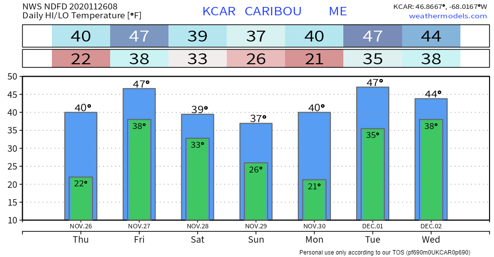 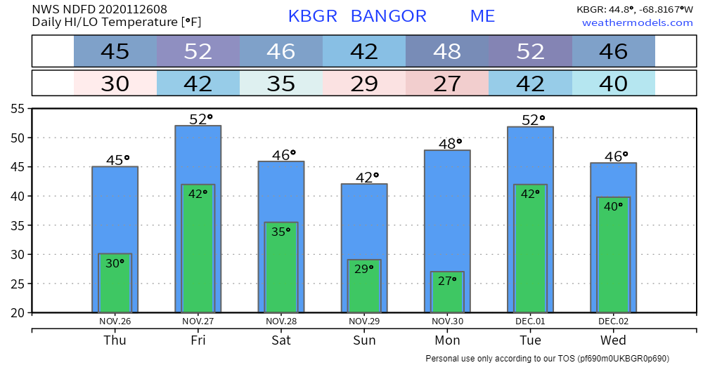 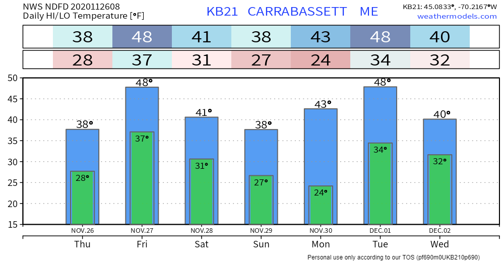 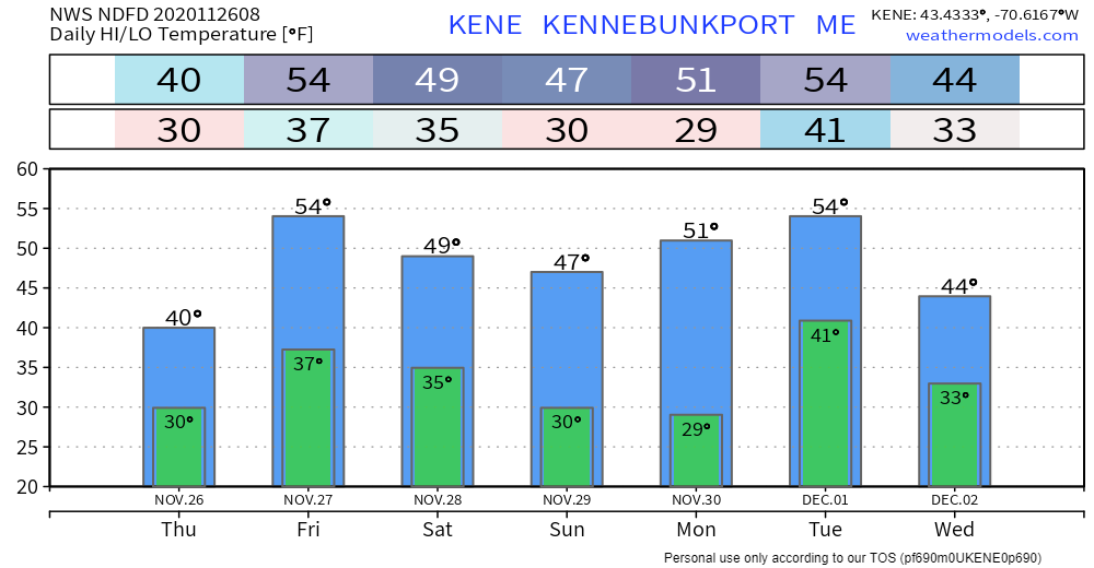 Citizen scientists needed! The NOAA National Severe Storms Laboratory and The University of Oklahoma's Cooperative Institute for Mesoscale Meteorological Studies needs your help with severe weather research! The Meteorological Phenomena Identification Near the Ground project (mPING) needs you, the Citizen Scientist, to watch and report on precipitation. mPING is looking for volunteers of all ages and backgrounds to make observations - teachers, classes, families, everyone, and anyone! This app is your portal for providing observations to researchers at NSSL. Your reports will help them develop and refine algorithms that use the newly upgraded dual-polarization NEXRAD radars to detect and report on the type of precipitation that you see falling. To do a good job, we need tens of thousands of observations from all over the US. We can succeed only with your help. Participation is completely anonymous. For more information, check out the mPING website! Be prepared to receive alerts and stay updated!
For more information, please follow Pine Tree Weather on Facebook and Twitter.
** FUNDING NEEDED FOR 2021 ** Thank you for supporting this community based weather information source that is funded by your financial contributions. Stay updated, stay on alert, and stay safe! - Mike |

Mike Haggett
|