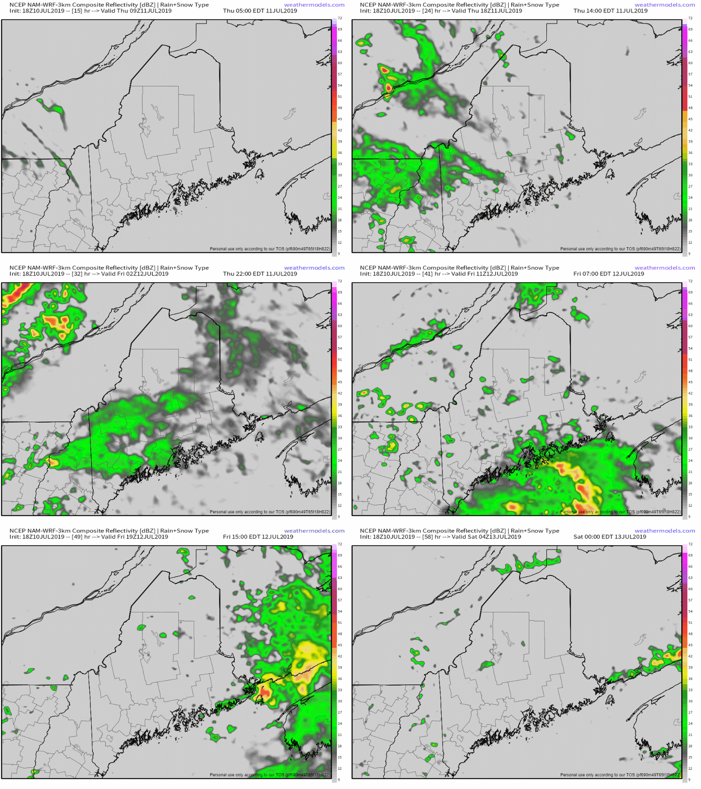
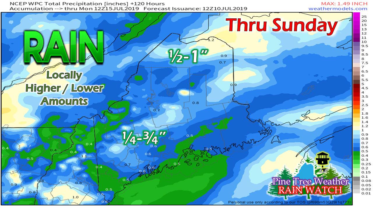
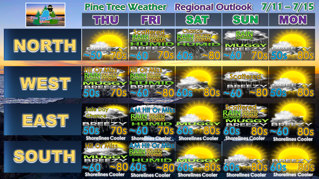
Showers and thunderstorms possible through FridayAt this point, western areas appear to have the better chance for showers and storms during the day. It appears hit or miss for southern areas, and will arrive in eastern areas later in the day. Northern areas get in on the rainfall along with everywhere else Thursday night. With the amount of convective energy around, thunderstorms are possible in the overnight hours leading into Friday morning. Showers end from west to east during the morning on Friday. A few isolated pop up showers / storms are possible for the western mountains and central highlands Friday afternoon into the evening. Any storms that form could see tropical downpours, frequent lightning, potential for damaging wind gusts, and hail. Stay on alert for potential isolated severe storms. While this idea from the Weather Prediction Center shows a bit less in the way of rain accumulation, I will stress the "locally higher / lower amounts" due to the high humidity values. Some places will get dumped on. Others may miss heavier showers. Folks camping the remainder of the week should be mindful of where they pitch their site due to potential flash flooding, whether water tributaries or runoff from the hills. Regional outlook through MondayThe weekend continues to appear mixed pending on region. The north may catch a shower or thunderstorm Saturday. The north, west and east appear to deal with showers and possibly thunderstorms Sunday. All areas start off dry with low humidity to start next week. Coastal areas should be mindful of early morning fog potential with the humid conditions. Sugarloaf Region NOAA Weather Radio Offline Until FallThe NOAA Weather Radio frequency Sugarloaf Mountain service area (Oxford, Franklin, Somerset Counties) is 162.450 MHz. The National Weather Service has two other frequencies for use while the tower is replaced. The Mount Washington tower frequency at 162.500 MHz is the first one to try. The other is the Greenville tower frequency at 162.425 MHz. Most recently produced NOAA Weather Radios and public safety radio scanners are equipped to receive transmission from any available NOAA frequency via their internal scan mode, so manual adjustments are not needed. For older models, they may have to be manually entered. If for some reason neither of the two alternate frequencies work, you can always check the National Weather Service Gray website for forecast information and severe weather bulletins. Stay on alert for forecast updates!► ► For the latest official forecasts, bulletins and advisories, please check in with the National Weather Service in Gray for western and southern areas, or Caribou for northern and eastern parts of Maine.
Please consider supporting Pine Tree Weather ► ► Your financial donations are much appreciated to keep this site funded and for further development. I sincerely appreciate your support not only financially, but also in sharing my efforts with others. For more information from me, please check the Pine Tree Weather Facebook page as well as my Twitter feed. Always stay weather aware! - Mike |
Mike Haggett
|


