
A summer ridge moves in... for a change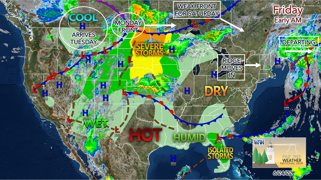 For those longing for the feel of summer warmth, you'll get a couple of days of it this weekend. The humidity stays in check for most areas until Sunday, and it will certainly be noticed on Monday. The upper lows and associated troughs take a break until Tuesday. For those curious about what the weekend of the Fourth may bring, I dropped a quick post into Facebook highlighting potential. On a side note, pray for the folks in the upper Midwest. They are likely to get hammered by nasty storms on Friday afternoon. 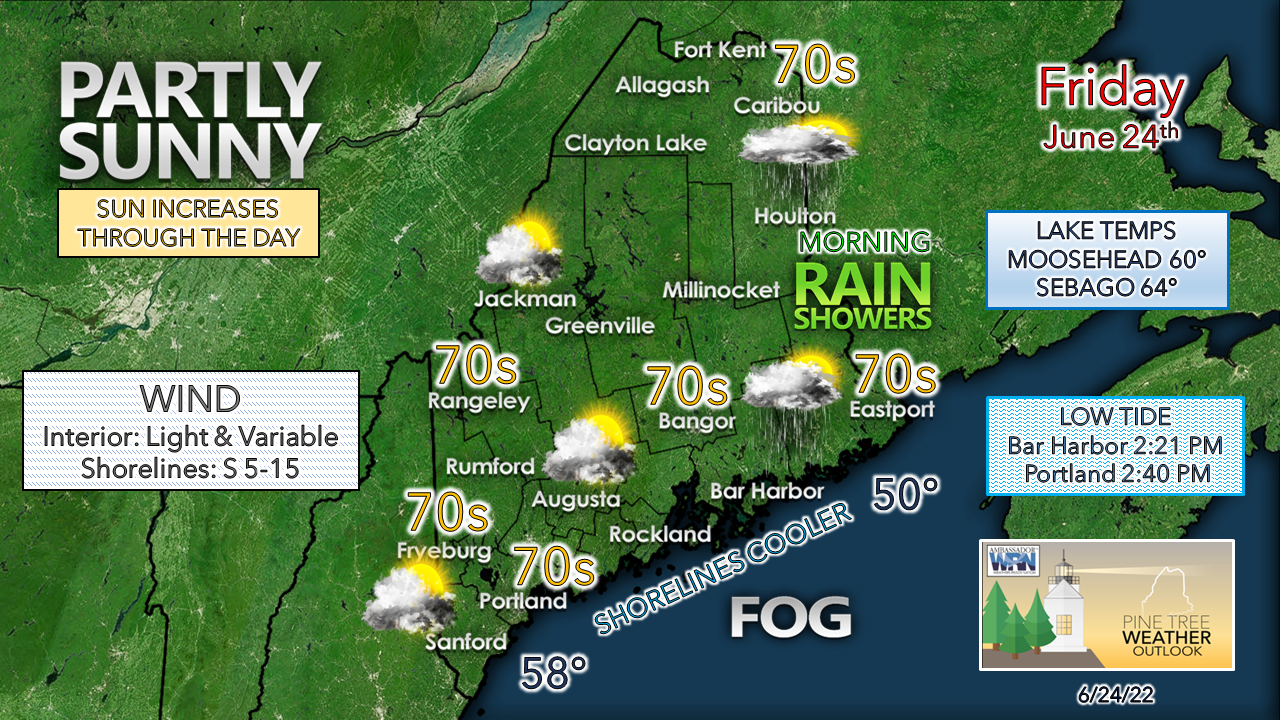 Showers over eastern areas depart by around noontime. The upper low that has been around for days turned into an open wave and is headed northeast for Atlantic Canada. Sun will be hard to come by early, but increase through the day, with the sky clearing out for most by Friday night. A slight uptick in humidity and a southerly flow may bring fog into the coastal plain heading into Saturday morning. Backdoor cold front works into northern areas Saturday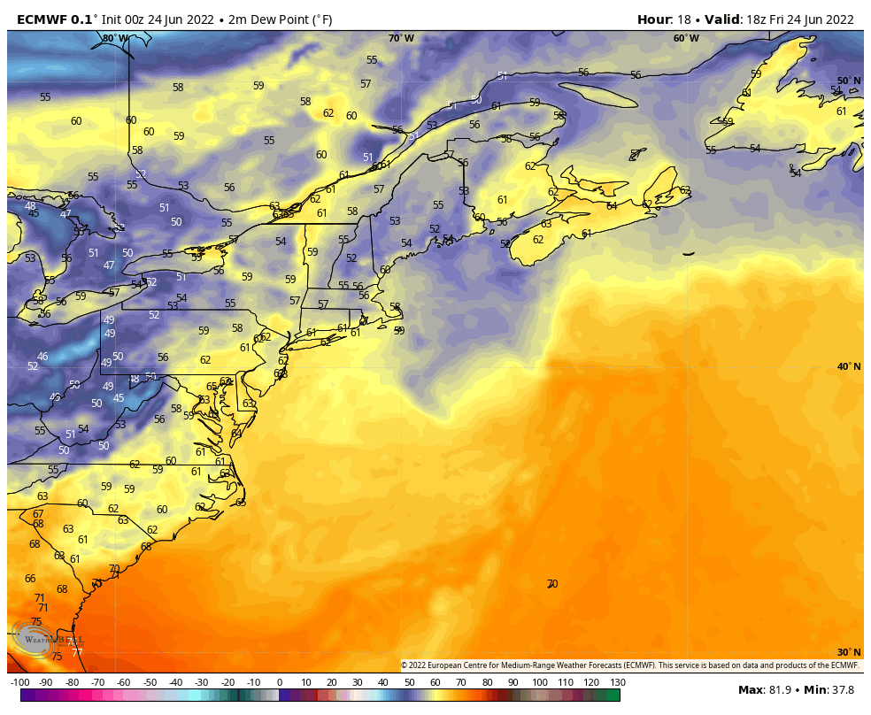 Friday 2 PM to Sunday Midnight - A look at dew points here to show the progression of the weak front that dips down from Quebec. This a dry boundary set up and no rain is expected. Humidity pumps up ahead of the front on Saturday. Northern areas feel the benefit of the passage as the dew points drop to comfortable levels, while the coastal plain feels the muggy conditions into Saturday night. The front washes out as the ridge gains control of it. Areas of fog where the air column is saturated are expected Saturday night into Sunday. Humidity gradually rises in all locales Sunday afternoon as a cold front heads for the region Monday. Timing and impacts for Monday still to be determined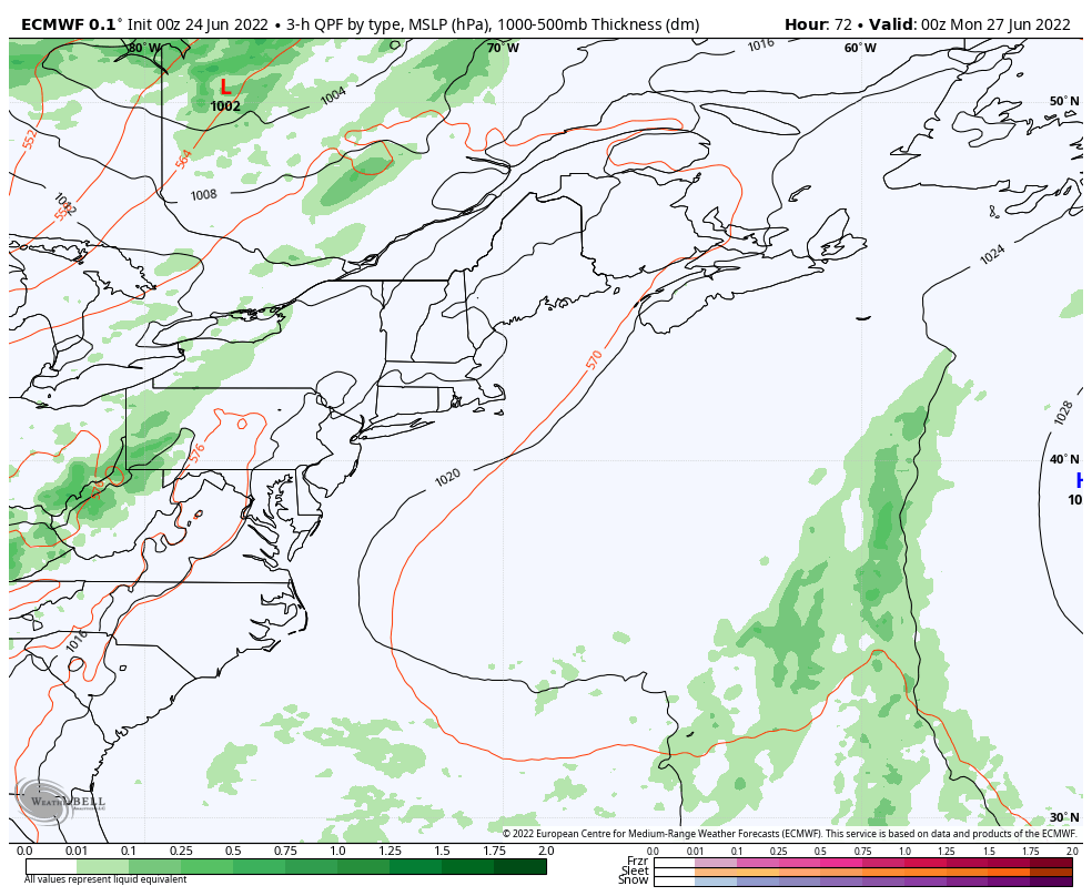 One thing that there is high confidence with the approach of the front is the rise of dew points well into the 60s and may reach near 70° in spots, which means well saturated air. At the very least, the region can expect areas of downpours, if not torrential rain in spots as it passes through. As far as thunderstorms go, it will be cloud dependent. Clouds are expected to increase late Sunday as cold air aloft moves in ahead of the front. Fog once again can be expected, especially along the coast where the dew points are expected to be higher than the ocean temperature. If the sun gets out, look out, is the best way to summarize the threat for storms. With as much humidity around which is gas for severe weather, all it will need is a spark from the sun to ignite. For those camping out, keep the threat of heavy rain and storm potential in the back of your mind as you pick your spots. Make sure you have multiple ways to get weather alerts, including a NOAA weather radio. Outlook through midweekOnce the frontal boundary passes, expect a breezy day on Tuesday as a northwest wind brings drier air into the region. Temperatures are expected to rise later in the week, with the next chance for rain favoring the north and mountains Thursday as a clipper system passes through the area. 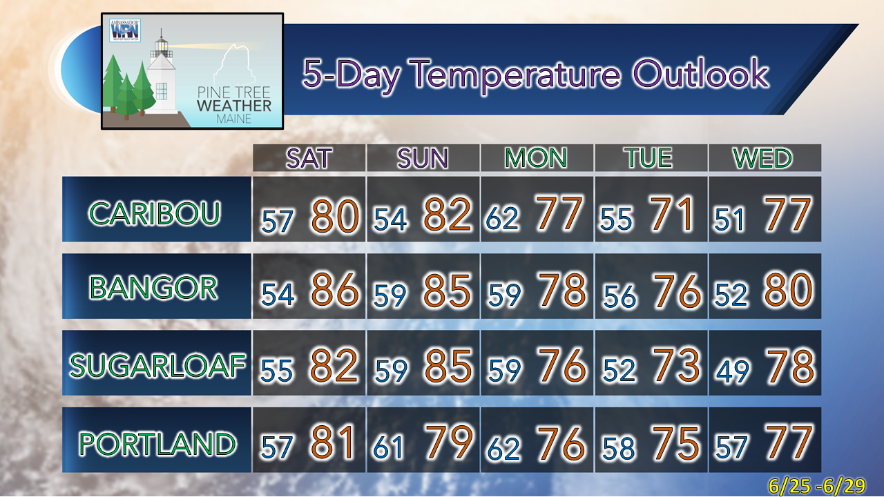 Thank you for supporting this community-based weather information source which operates by financial contributions from people like you. Stay updated, stay on alert, and stay safe! Have a great day! - Mike NOTE: The forecast information depicted on this platform is for general information purposes only for the public and is not designed or intended for commercial use. For those seeking pinpoint weather information for business operations, you should use a private sector source. For information about where to find commercial forecasters to assist your business, please message me and I will be happy to help you. |

Mike Haggett
|


