
But first, a bit of winter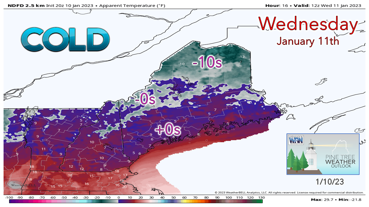 You remember winter, right? As a refresher, part of it is bitter cold air that freezes up the mucus membranes when you first step out of the house in the morning. This is what you are going to get in the morning. This is one of the rare occurrences where you might want to toss an extra log in the stove and grab an extra blanket for the bed. Actual temperatures will be a bit warmer, but a slight breeze will give the air an extra snap. We'll have a day of below normal cold ahead of a whiplash temperature storm for the rest of the week. Oh, and for those snow lovers who are depressed at what winter has been like so far, I might paint a smile on your face by the time this update is over. Let's just get through the storm on the way, first. As far as inside runner storms go, this isn't bad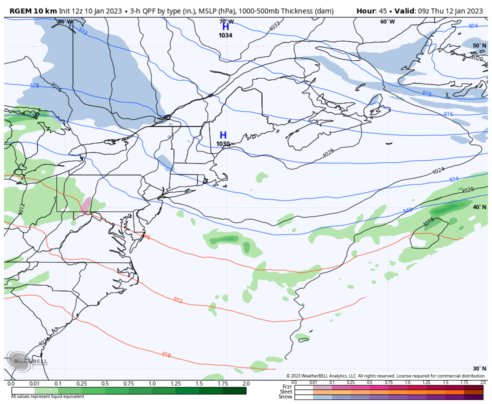 Thursday 4 AM to Friday 7 PM - Unlike the fire hose storms that brought big rain, wind and coastal calamity leading up to Christmas, this one is pretty tame in comparison. While I do expect some freezing rain over the interior to come with this, it's not as junk ridden as ideas once were over the weekend. Some light snow is expected on Thursday, but the main slug of moisture arrives Thursday night along with a surge in temperatures, and continues into Friday, then tapers off from southwest to northeast Friday night. I do expect a period of snow for the interior along with light ice over the foothills and central part of the state before the flip to rain heading into Friday morning. 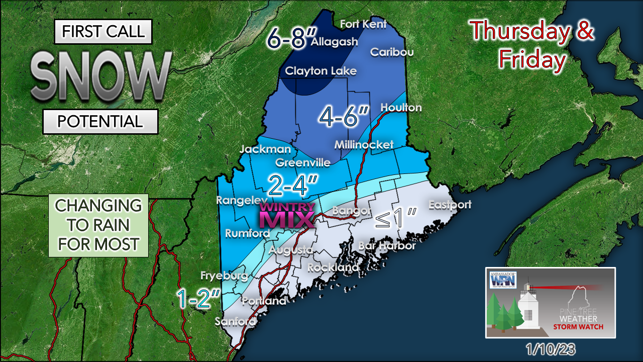 I will say that the idea of cold air damming certainly has my attention, and it is something I will monitor closely over the next couple of days. That area of high pressure over the north is where a certain amount of uncertainty comes into play as far as how much ice comes out of this. If this was a Gulf of Maine tracked event, it would be a big concern. With the south/southeast flow working in as a result of the track closer to the St. Lawrence River and a juicy low-level jet feeding into it, it is just a matter of time before the cold at the surface gets scrubbed out. Expect and icy and slick conditions for the foothills and western mountains Thursday night into Friday morning, and stay tuned for a better read on when the flip to rain comes. Northern areas hold onto the cold the longest, and thus are the snowiest. 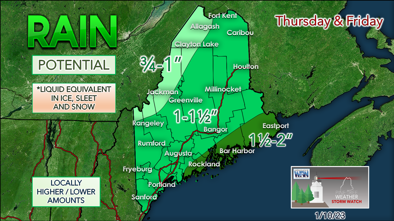 What little snow that is around along the coast is going away with the rain that is on the way. The good news here for the taller ski hills is they may get out of this with little impact on the base, and may sneak out a net positive by the time this is over. Temperatures are likely to warm up for the mountains, but the dew points may hold below 40° for the duration of the above freezing period (roughly 30 hours), which is what you are looking for to minimalize the snow melt. Time will tell if that idea changes, but at this point, it doesn't look too bad. The river levels look good to handle any runoff that may come. The shorelines should be alright as astronomical high tides won't be an issue. There may be some minor nuisance flooding for DownEast areas, but that is about it. 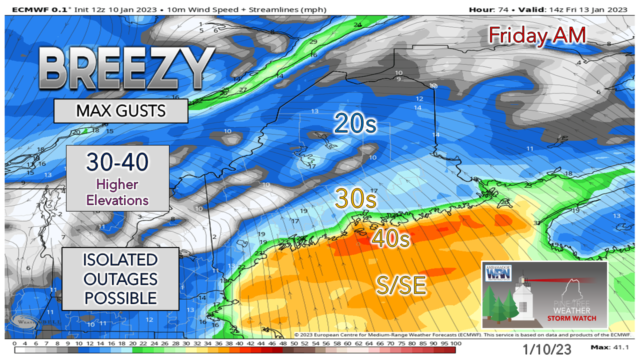 Wind concerns overall appear minor. The strongest gusts work through on Friday and drop once the front passes through Friday night. The gusts Friday night may be a bit snarky along the shorelines and in the mountains with the low-level jet passage. The snow that falls over most of the interior should be off the trees by then. I can't rule out some isolated outages for the MidCoast and DownEast areas, or the mountains completely, but overall, not a big deal. Expect Saturday to be a breezy day as the storm drags cold air in from the northwest, and gradually settle on Sunday. Secondary low potential on the backside to watch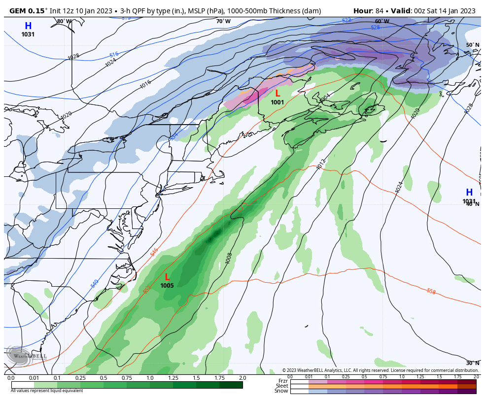 Friday 7 PM to Monday 1 AM - I am going to out in front of this and say this may be model fantasy, but the off and on ideas of a secondary low forming along the frontal boundary has been on again and off again like a light switch in a truck stop bathroom. I can't completely rule the idea out as potential. The Canadian GEM model idea here depicts that potential, and there is some European model ensemble support for it. If the front slows down, it may be game on. Stay tuned for more on what the rest of the weekend looks like once the main event passes through. For those yearning, praying, and begging for snow...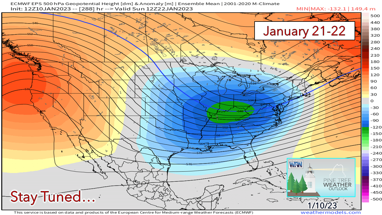 Yes, it's two weeks out, and I am not one to get too far ahead of the horse, but this has been an idea for a few days now. For snow lovers, this is the ideal set up you want. Omega block set up, cold air in place, deep trough over the south. Either this is either a very bad joke or we could be talking about a solid dumper statewide next week. Let's see what happens. Temperature outlook through SundayThe temperature whiplash will likely be noticed more in the mountains and north as temperatures rise and crash Friday into Saturday. For those heading for the ski hills for the Martin Luther King, Jr. holiday, it should be a good one. 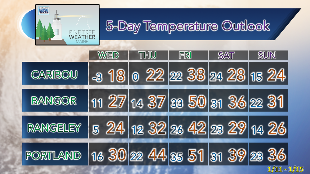 Thank you as always for your support! You may not like the weather, but I hope you like what I do! Please hit the like button on Twitter and Facebook, and share! Financial donations to fund what I do are always appreciated! Stay updated, stay on alert, and stay safe! - Mike NOTE: The forecast information depicted on this platform is for general information purposes only for the public and is not designed or intended for commercial use. For those seeking pinpoint weather information for business operations, you should use a private sector source. For information about where to find commercial forecasters to assist your business, please message me and I will be happy to help you. |

Mike Haggett
|


