
Busier times ahead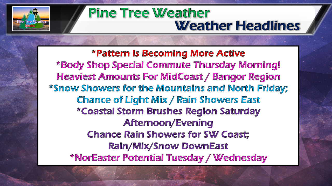 As we head into January, the pattern appears to be more active over the next several days. Thursday will be a mess for most of the state. Friday may see some light accumulating snow showers for the mountains and north. After a close call Saturday, more snow showers are in the offing for the mountains and north Sunday. Next week brings the potential for the first NorEaster of 2019. Body Shop Special is game on Thursday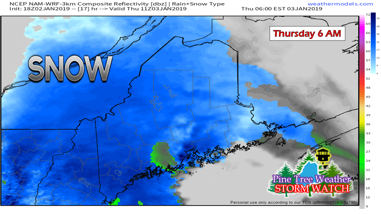 There are no advisories posted by the National Weather Service, so this is a legit "Body Shop Special" which is terminology I use when there is enough snowfall to impact busy commute times. By 6 AM Thursday morning, snow is likely to be falling everywhere, roads are likely to be greasy, and plenty of extra time should be allotted for the morning drive to work. 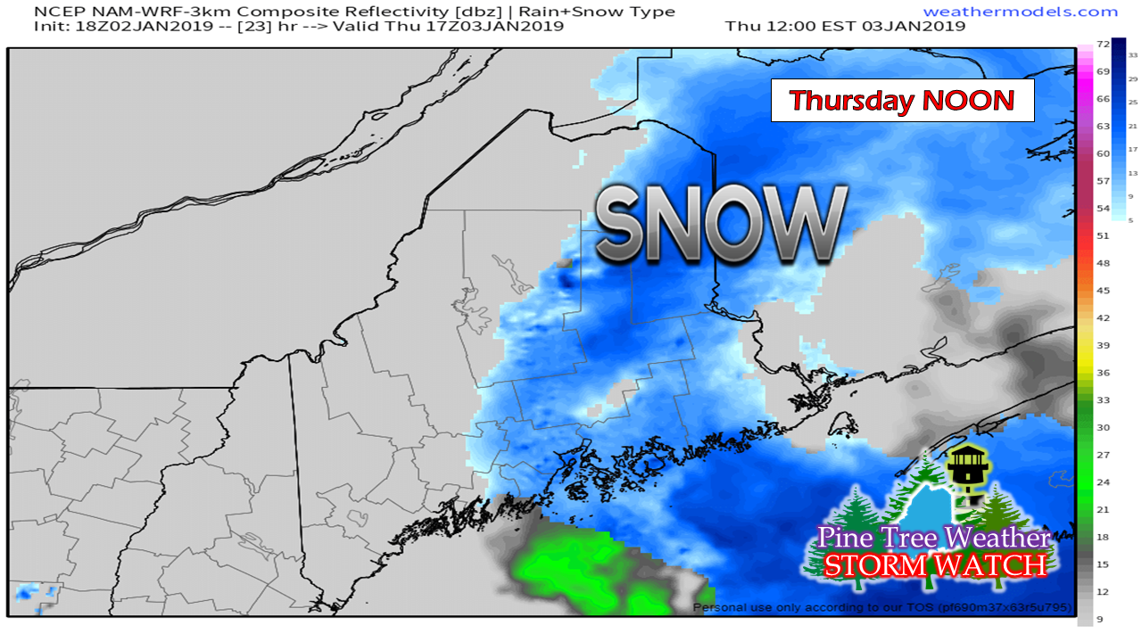 My noon time southern and western areas are likely done from this event, but it is a different outlook for the MidCoast region around Penobscot Bay, DownEast and eastern Aroostook. This is where it potentially could get interesting. A weak low just offshore of the Rockland / Damariscotta area appears to connect with an inverted trough... 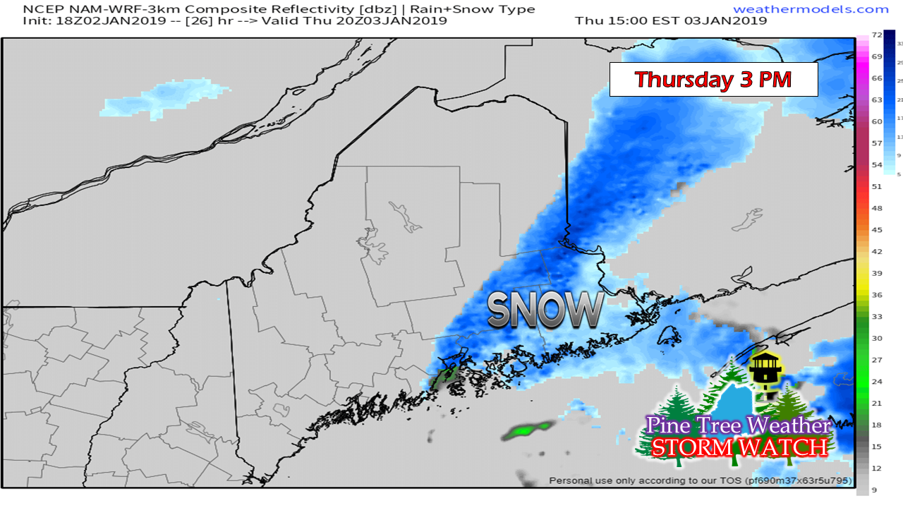 which could bring steady snow into the mid to late afternoon. 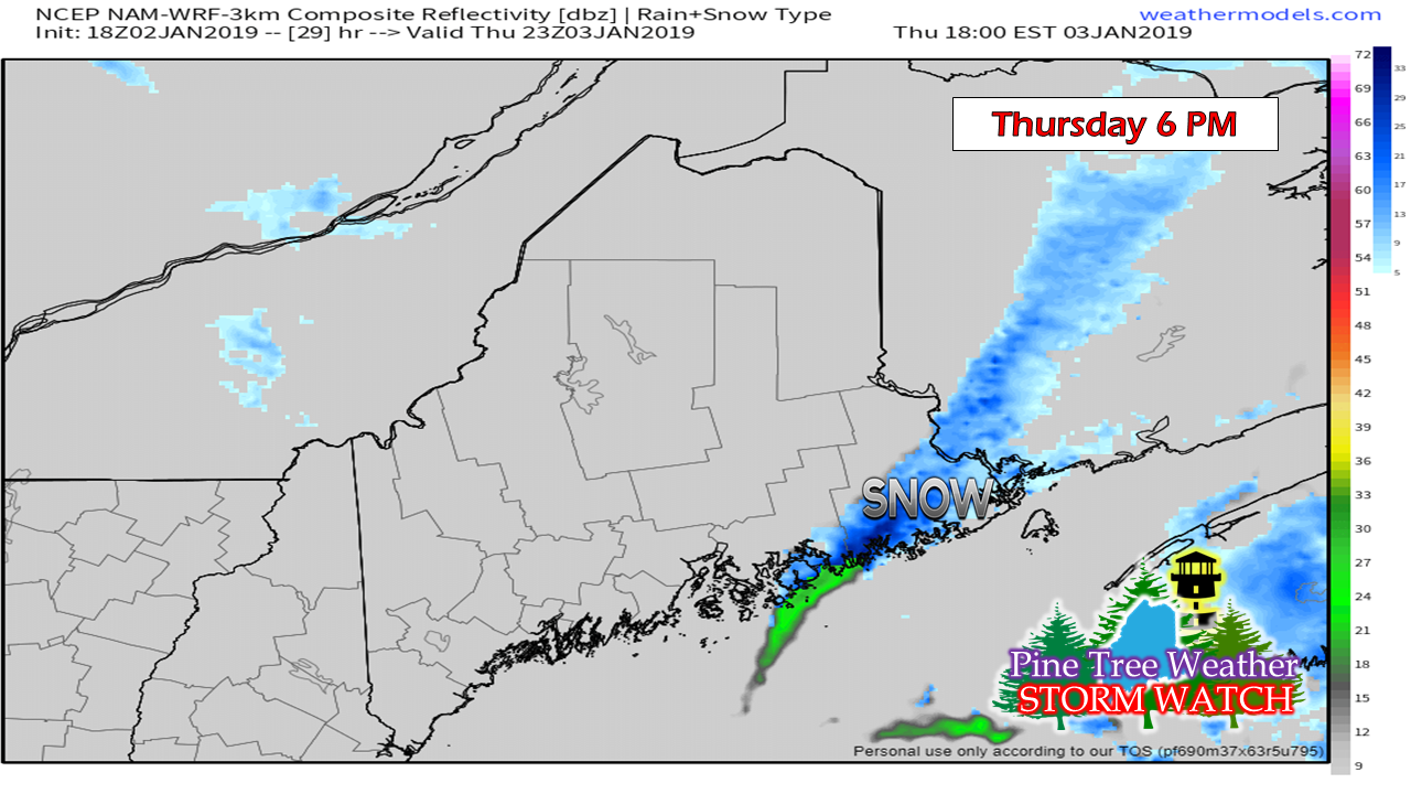 If all goes as forecast, conditions appear to improve somewhat for the Penobscot Bay / Bangor region as the evening commute comes to a close. Snow and any shoreline rain showers appear to end by 8-9 PM Thursday night for areas in Washington County. Snowfall idea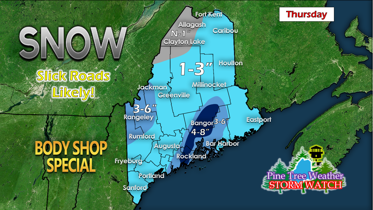 My thinking as of Wednesday evening it that the inverted trough may bring a decent snowfall for the Penobscot Bay and Bangor areas. This event should also bring some fresh inches to the ski hills in western areas. 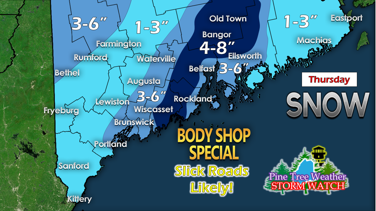 Zooming in a bit more for detail shows the areas likely to be affected. These forecasts are VERY tricky. There is definitely bust potential here. I hate surprises and playing catch up if these inverted troughs blow up. Consider this forecast a worst case scenario. I would rather see you prepared rather than get caught off guard. My honest opinion is that this should be good to verify on the lower amounts. Time will tell how high it will go. A close shave for Saturday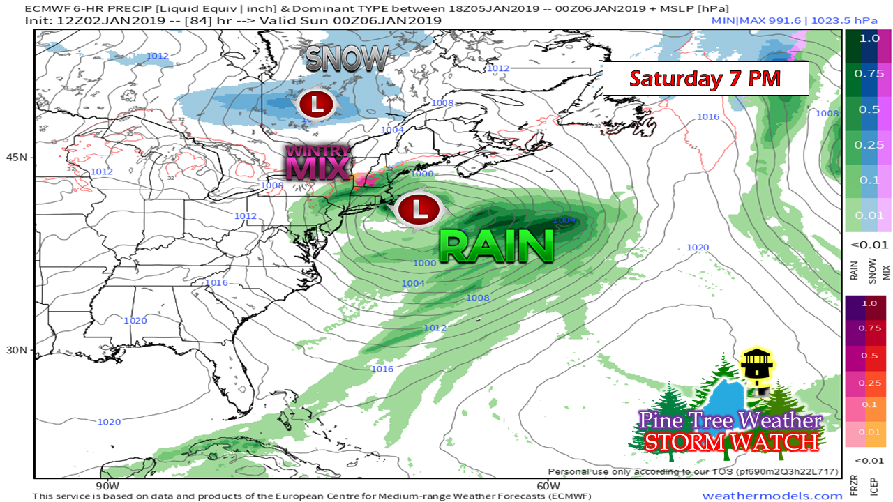 With the northern jet retreating as we head into the weekend, the southern jet appears to miss its connection thanks to a subtle nose of high pressure. For now this appears to shave the coast with rain showers, and may bring a light mix for areas south of the foothills. DownEast areas may see some greasy roads from a light snow/mix Saturday night. More on this over the next couple of days. Potential coastal snow event next week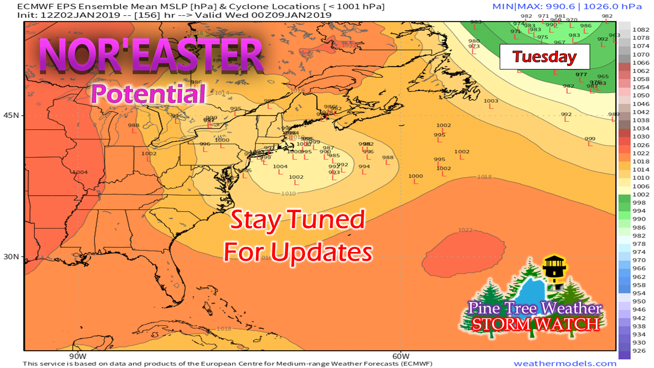 There is some uncertainty on what happens in the Tuesday / Wednesday time period, but there is a fair chance for a statewide snow event to impact the area. I will be upfront and say that models have been rather poor in the day 6 and day 7 range as of late, but it is January and big winter storms do happen. I will track and advise on this in the coming days. Outlook through Monday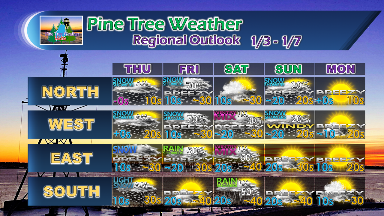 If you are heading to snow country this weekend, it will once again be a breezy affair. Prepare accordingly.
For the latest official forecasts, bulletins and advisories, please check in with the National Weather Service in Gray for western and southern areas, or Caribou for northern and eastern parts of Maine. For more information from me, please follow the Pine Tree Weather Facebook page and my Twitter feed. Always stay weather aware! - Mike |

Mike Haggett
|


