
Warm front to drive humidity levels up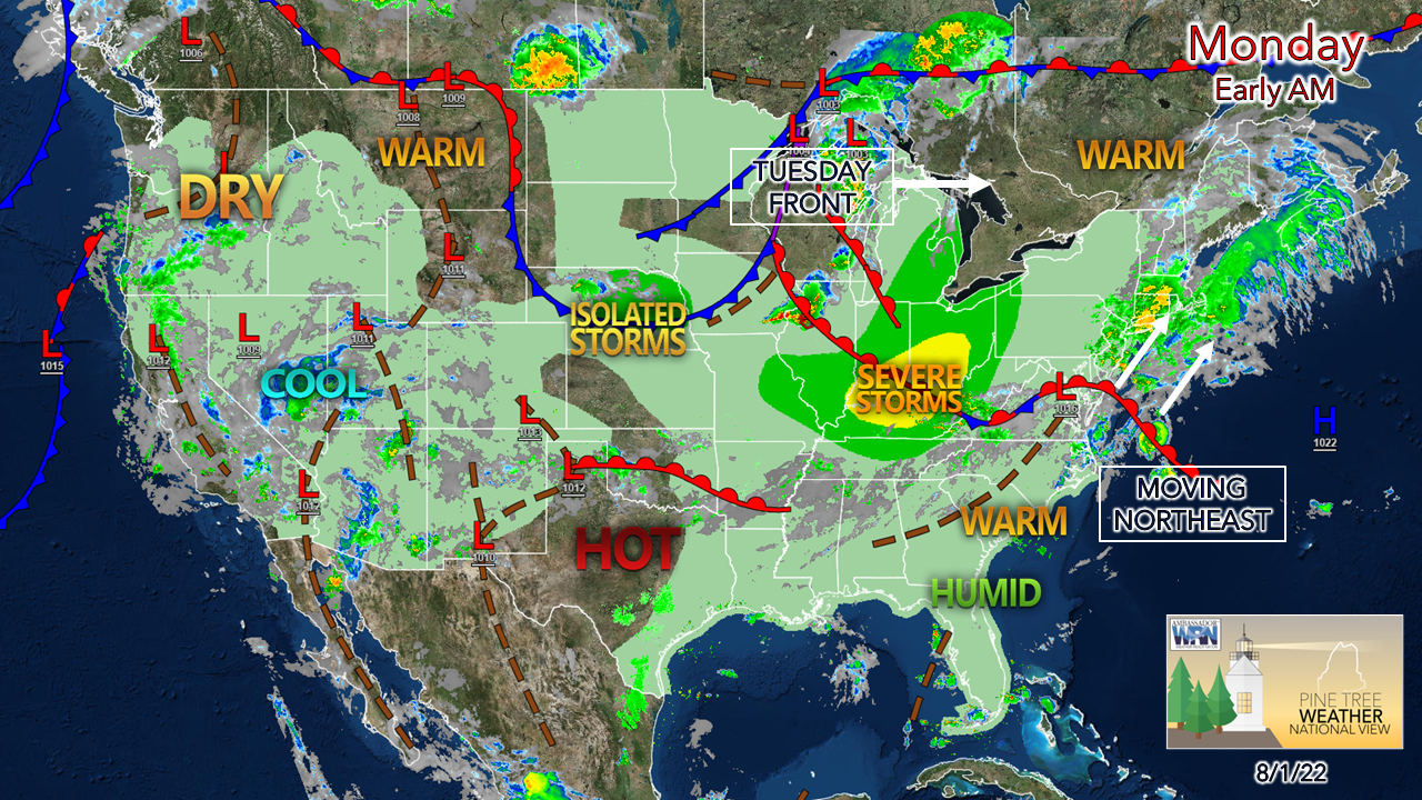 High pressure offshore near Bermuda spins a warm front into the region to start the week. After a weekend with dew point temperatures at reasonable levels in the mid-50s to low 60s, that air mass is moving out to sea. The sticky, uncomfortable air moves in later in the afternoon Monday. While the north and mountains can rest fairly comfortably overnight, the coastal plain is where the dew points are expected to rise into the mid to upper 60s which makes the evening a bit of a balmy affair. With the increase in humidity and a cold front approaching from the northwest, showers and storms are expected, mainly over interior areas, through Tuesday. A few showers around Monday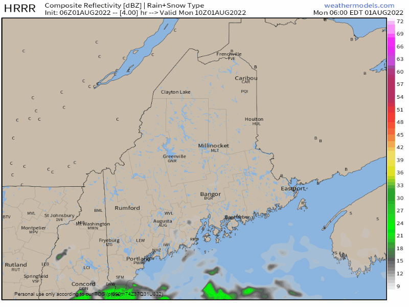 Monday 6 AM to 9 PM - A dissipating area of low pressure offshore may bring a sprinkle or light shower to the shorelines as a parting gift on its way into Atlantic Canada. While the arrival of the warm front later in the day appears mainly uneventful, there is always the risk of a popup shower or thunderstorm that the model idea here may not be showing here. High cirrus clouds and cotton ball cumulous clouds indicate the approach of the warm front, and with the increase in moisture comes the shower and storm risk. A few isolated showers are possible in the overnight hours into Tuesday morning as the warm air mass settles in. 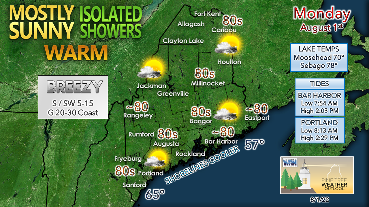 The shorelines see the daily high mark early before cooling down in the afternoon as a rather stiff south / southwest breeze begins to crank up. Temperatures fall there, but the rise in dew points are likely to be noticed later in the day as the breeze pumps moisture in. Folks heading to the oceanside beaches this week need to think of morning visits. The afternoon high tides may cramp available space in the cozier sandy locations. Showers and storms for Tuesday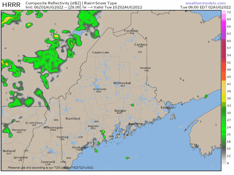 Tuesday 6 AM to Wednesday Midnight - A weak cold front is expected to approach the region. As that happens, dew point temperatures increase due to the southwest flow out ahead of it, which would make it a gross affair for the coastal plain as they reach the upper 60s to low 70s. In conjunction with the humidity also comes the heat, with many interior areas reaching the mid to upper 80s to low 90s. The combination of that creates ample convective fuel for showers and storms to develop as the front passes through Tuesday afternoon into the evening. As of the time of this post early Monday, Storm Prediction Center has the area in a non-severe threat of thunderstorm activity, but I suspect that may change. I suspect the region sees isolated severe storms, with damaging wind, frequent lightning, and tropical downpours which would reduce visibility and cause ponding of water and perhaps localized flash flooding if storms backfill and/or train. This threat will be updated on the Twitter feed during the day Monday and here Tuesday morning. Next chance for rain comes later in the week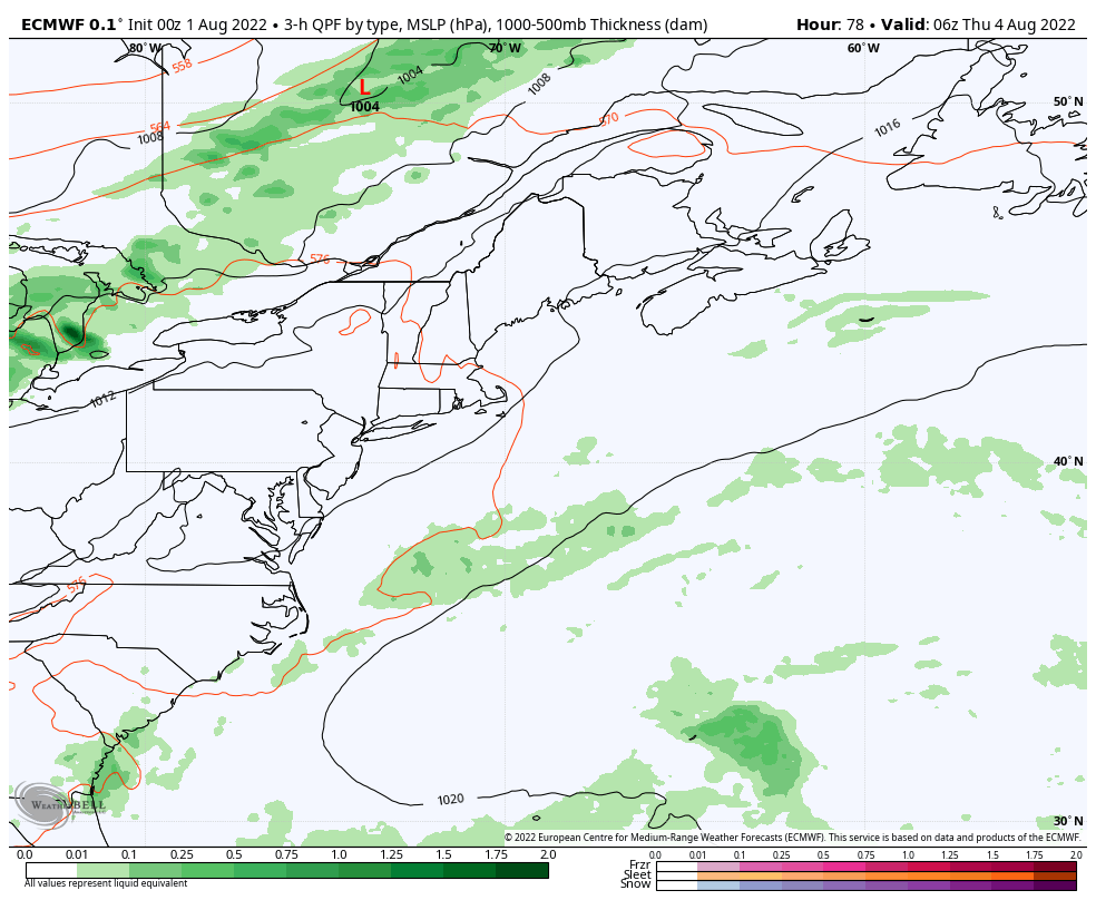 Thursday 2 AM to Saturday 2 AM - The pattern favors weak cold fronts that bring the mountains and north the best chance for rainfall and the parched coastal plain panhandling for a few drops. The hope here is that this passage may be a slow mover, which could enhance rainfall a bit with the chance of a weak low forming along it. Guidance ideas are scattered, so for now the idea is for a chance for potluck showers and storms Thursday, Friday, and perhaps Saturday. Stay tuned for updates on that. Temperature outlook through Saturday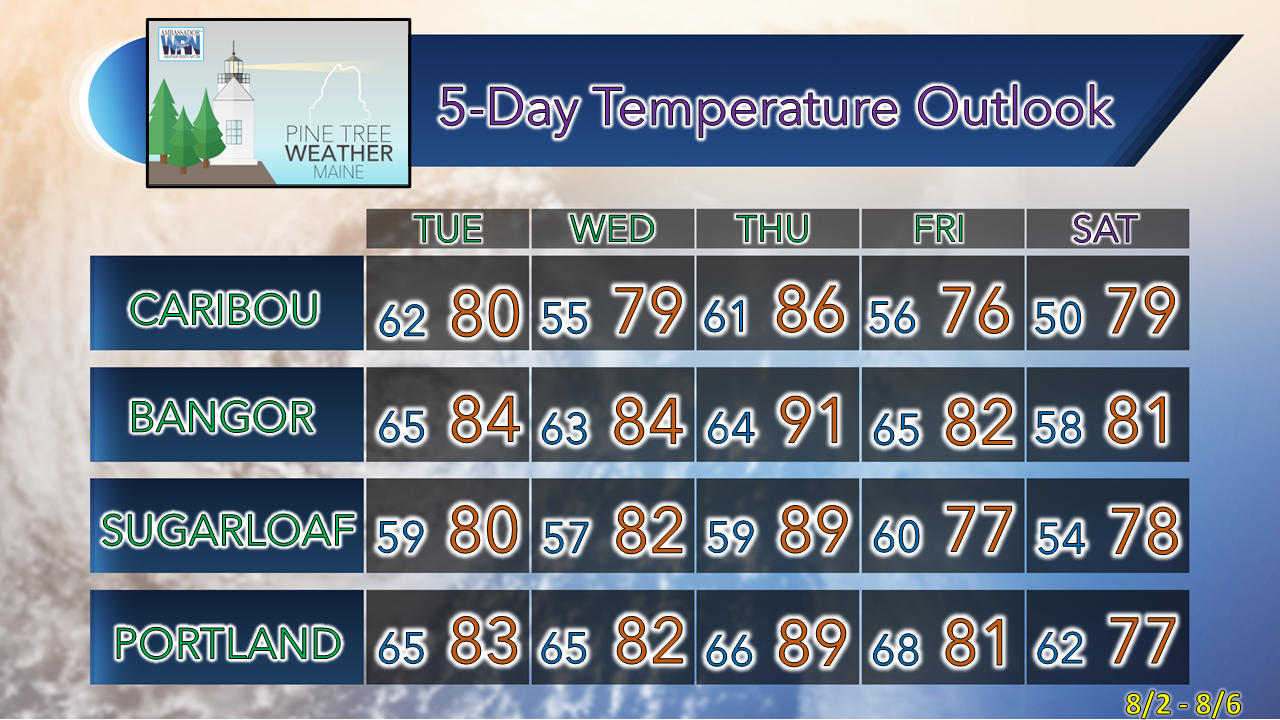 Thank you for supporting this community-based weather information source which operates by financial contributions from people like you. Stay updated, stay on alert, and stay safe! NEXT UPDATE: TUESDAY - Mike NOTE: The forecast information depicted on this platform is for general information purposes only for the public and is not designed or intended for commercial use. For those seeking pinpoint weather information for business operations, you should use a private sector source. For information about where to find commercial forecasters to assist your business, please message me and I will be happy to help you. |

Mike Haggett
|


