
|
A quick personal update to say I am doing well. The leg is about 80% healed, and I am experiencing no symptoms after testing positive with COVID. I have worked here on the website on the various other pages and added a direct link on the side bar on the right for the PC users for the Drought Monitor, which should show some improvement as that is posted around 8 AM on Thursday. There is some really good information on this site that many will find useful beyond the discussion posts, and it is updated 24/7/365. The national view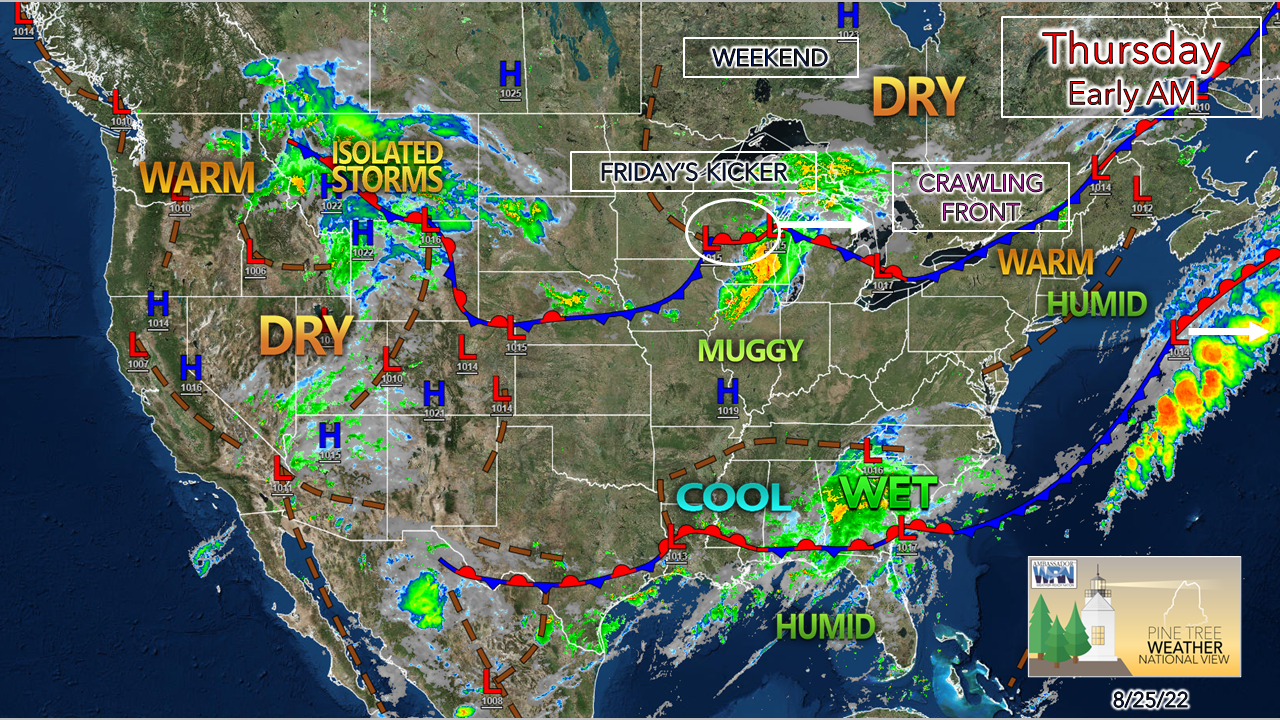 Overall, it is rather quiet across the country. It will be seasonably cool and damp over the southeast, and not much in the way of torching heat, but much of the Midwest and east are dealing with some level of elevated humidity. For those of us in Maine, we have a frontal boundary and a wave of low pressure to come through Friday before we get a break from the sticky conditions heading into the weekend. A few showers and storms around Thursday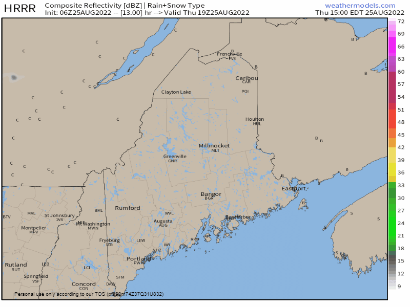 Thursday 3 PM to Friday Midnight - A slow moving cold front drops down from the north and makes it to the western mountains by afternoon. Impulses riding along it may touch off some showers and perhaps a storm or two later in the day. Any activity is expected to be widely scattered with the chance for a puff of wind ahead of a downpour, but otherwise impacts are likely minimal through the evening. 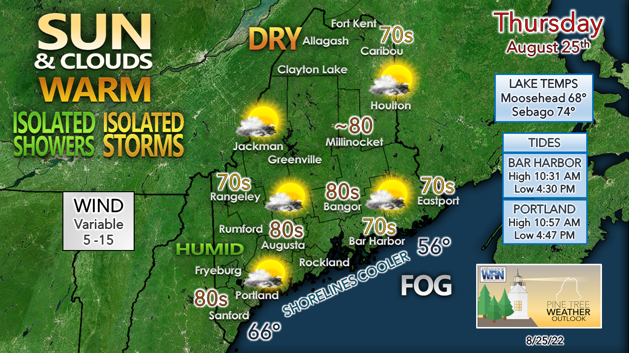 If you are looking to escape the humidity, go north. Dew points are expected to be in the 50s for The County and pending on how far the south the front goes, could drop to the same level in the western mountains by afternoon. Any fog around early is expected to burn off by mid-morning, but is expected to lurk offshore from Penobscot Bay eastward. Another sticky day with dew points well into the 60s if not touching 70° across the foothills and coastal plain, with the higher readings to the southwest. Severe storm threat potential for Friday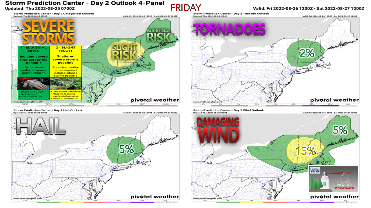 As I mentioned here in the Wednesday morning update, I suspected the Storm Prediction Center might up the ante for the severe threat for Friday, and they have in areas to the west. Seeing guidance from early Thursday morning, there is the potential that they may expand the slight risk area into Maine, which I will get into. There is still time for adjustments on threat potential. 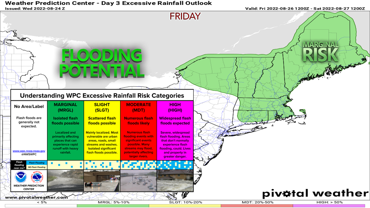 With the cold front that dips south on Thursday being punched northward on Friday as a warm front, the entire region sees dew points climb into the mid-60s to low 70s which sets up the threat for torrential downpours which could lead to localized flash flooding. The Weather Prediction Center has highlighted this threat over the past two days. For those of you that follow my Twitter feed, you will note that these updates have been continuous since Wednesday morning. Such is life with tropical moisture and a strong cold front expected to work through. 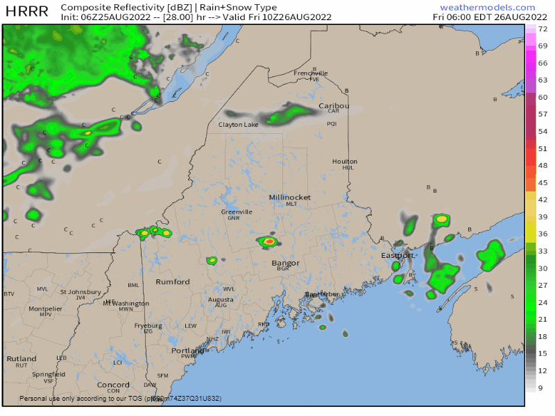 Friday 6 AM to 6 PM - Timing and cloud cover are the keys here to the severe threat. Tracking observations and guidance on Wednesday initially brought some doubt in my mind of the potential, but the ideas have shifted more progressive with the overnight model runs. It could be a rough afternoon across much of the region, with perhaps the best threat for nasty storms south of Jackman and Bangor over the interior. Stay tuned for updates on this. 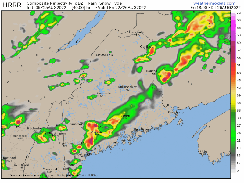 Friday 6 AM to Saturday 2 AM - As the sun sets and the front moves southeast, the severe threat diminishes but there could be a few parting showers around before ending by early Saturday morning.  Temperatures and outlook through TuesdayHigh pressure moves in for the weekend to dry the region out of the humidity. The high slides east on Sunday, and the humidity rolls back in along with the heat to start next week. A cold front is expected to pass through the region Tuesday afternoon which brings the next chance for showers and storms, with cooler and drier conditions returning for Wednesday. 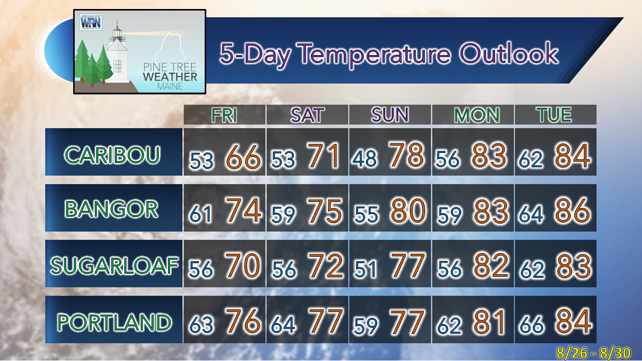 Thank you for supporting this community-based weather information source which operates by financial contributions from people like you. NEXT UPDATE: FRIDAY Stay updated, stay on alert, and stay safe! - Mike NOTE: The forecast information depicted on this platform is for general information purposes only for the public and is not designed or intended for commercial use. For those seeking pinpoint weather information for business operations, you should use a private sector source. For information about where to find commercial forecasters to assist your business, please message me and I will be happy to help you. |

Mike Haggett
|


