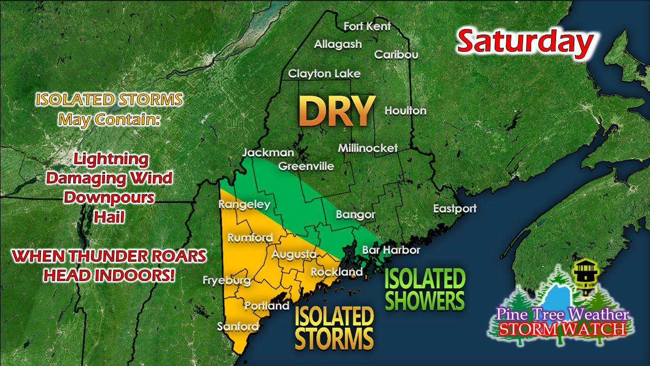
Frontal boundary meanders nearbyFor those with outdoor plans for the afternoon, be aware of potential for isolated shower and thunderstorm activity through early evening. A stationary front draped over New Hampshire and Massachusetts is expected to meander around. With temperatures around 80° over the southwest interior in conjunction with dew points in the 60s, it brings potential for some afternoon convection. For northern and eastern areas, it will be a top 10 summer day, with temperatures in the 70s with comfortable dew points in the 50s with plenty of sun. Saturday night, the front moves northeast which will bring some clouds. Overnight lows range from the upper 40s for the mountains and north to around 60° south. More widespread shower and storm activity appears on tap for Sunday as a cold front approaches. Humidity levels will increase for all areas but the north as dew points climb into the 60s. High temperatures will range from the 70s for the mountains, north and DownEast shorelines from Rockland eastward, with 80s elsewhere. For the latest on the tropics, check in with the National Hurricane Center.
For more information, please follow Pine Tree Weather on Facebook and Twitter.
Thank you for supporting this community based weather information source that is funded by your financial contributions. Stay updated, stay on alert, and stay safe! - Mike |
Mike Haggett
|


