Warm with isolated storms possible Tuesday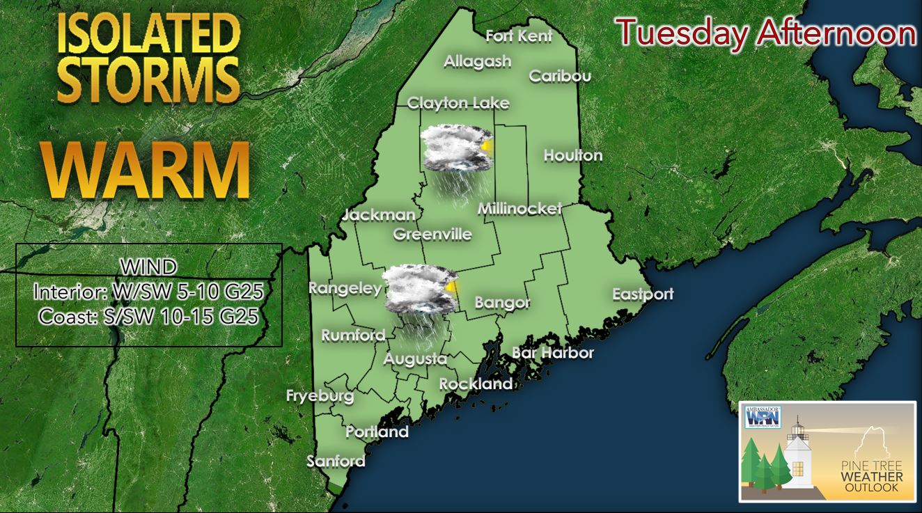 For the overnight, a warm front will likely move through the state progressing from south to north. This should help the marine layer to develop and deepen. This means that areas of fog are likely to be present for many of the coastal locales as well as river valleys on Tuesday morning. These areas of fog may not "burn off" for some of the coastal locales until mid-morning. During the day Tuesday, we should see a chance for isolated thunderstorms to develop across much of the state in the afternoon and evening. For now, it appears that there is little severe threat on Tuesday with the thunderstorms that do develop; however, the Storm Prediction Center has put out a marginal risk of severe weather for areas in southern New England. Therefore, any severe thunderstorms on Tuesday would likely be confined to Massachusetts, New Hampshire, and points south. The main threat with the thunderstorms Tuesday should be gusty winds. High temperatures tomorrow will likely be above average with upper 80's to near 90 possible across SW Maine as well as across parts of the interior. Expect high temperatures to be cooler in the 70's for the coastal locations with the sea breeze as well as the Central Highlands and Aroostook County in the north. Tuesday night, the thunderstorms should fizzle out as we lose the daytime heating. Low temperatures should range from the low to mid-50's across the far northern part of the state to the mid to upper 60's for the Midcoast and SW Maine. Scattered showers possible on Wednesday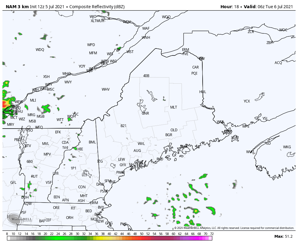 Wednesday should be similar to Tuesday in terms of temperature and precipitation across the state. We should see partly to mostly sunny skies in the southern part of the state with more cloud cover expected across the north. High temperatures on Wednesday should range from the low to mid-80's across the southern part of the state to the 70's for the northern part of the state with the increased cloud cover. There could be scattered showers or thundershowers across the state on Wednesday with areas along the coast being most likely to see them in the vicinity of a stalled frontal boundary. Unsettled pattern expected into the weekend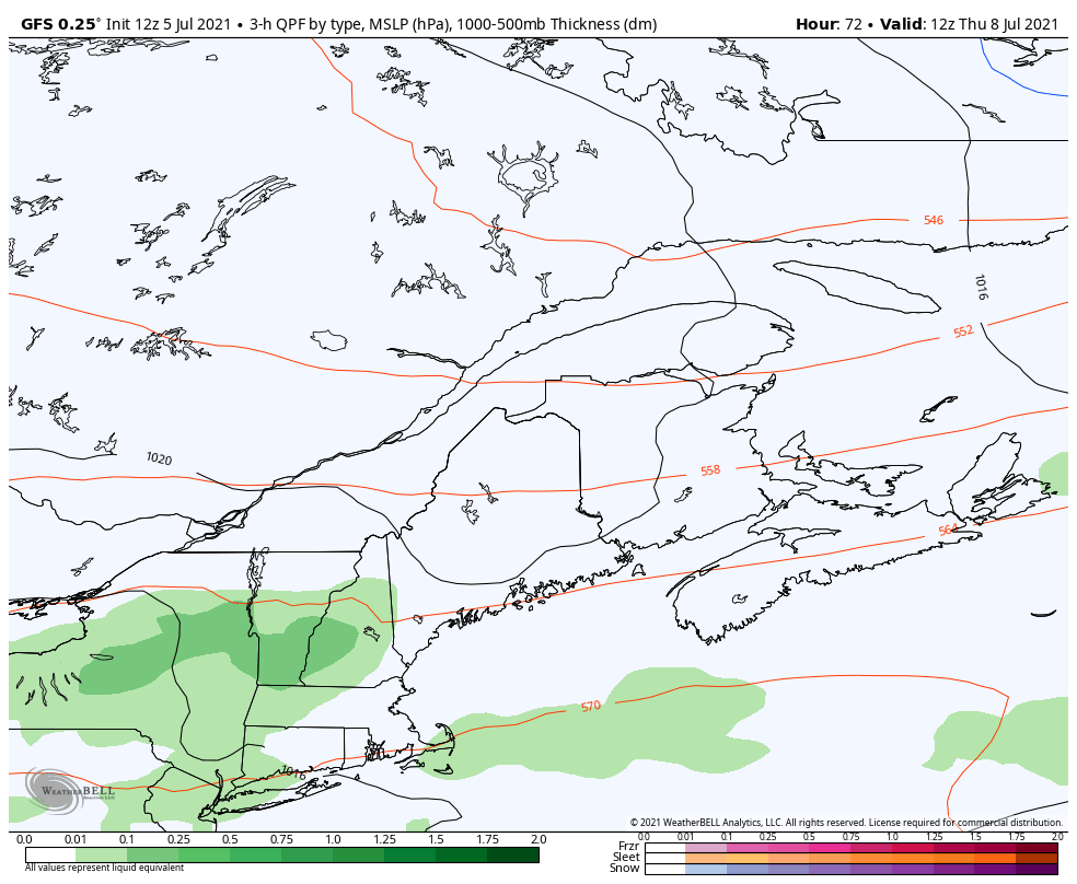 For Thursday into Friday, we expect a decent rainfall event favored over western Maine as there is sufficient atmospheric support. Over an inch of rain is possible over this region. Lower totals are expected at this time for southern and eastern locations. As we head into the weekend, we look to stay unsettled with ample precipitation chances especially for coastal locations as we watch the interaction of a stalled front with the remnants of Tropical Storm Elsa. With the ample precipitation chances, we expect temperatures to stay seasonable into the early part of next week for much of the state. Watching the tropics: Tropical Storm Elsa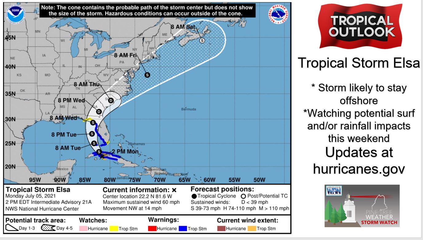 We are watching Tropical Storm Elsa which is about to enter the eastern Gulf of Mexico. According to The National Hurricane Center, the tropical storm is projected to make landfall in the continental United States Wednesday morning over Florida as a tropical storm. Their track then takes the storm over the southeastern US Wednesday and Thursday before it reemerges over the open waters of the Atlantic as we near the weekend. It is still too early to nail down specific impacts from this storm but we are watching for the possibility of some rainfall and maybe some increased wave heights for the weekend for our area. Stay tuned to the NHC for further updates on the track as well as potential impacts for Maine in the coming days! Flash flooding can escalate quickly Flash flooding is a common occurrence in the summer in localized areas when thunderstorms develop and train over the same areas. This is because training thunderstorms can drop a few inches of rain or more in just an hour or two. The threat of flash flooding increases further if the area is near a body of water such as rivers, creeks, or streams. Here are some tips from the National Weather Service regarding how to prepare for flash flooding scenarios. www.weather.gov/wrn/summer-infographics Be prepared to receive alerts and stay updated!
For more information in between posts, please follow Pine Tree Weather on Facebook and Twitter.
Thank you for supporting this community-based weather information source which operates by reader supported financial contributions. Stay updated, stay on alert, and stay safe! |

Mike Haggett
|