
Flash flood risk is elevated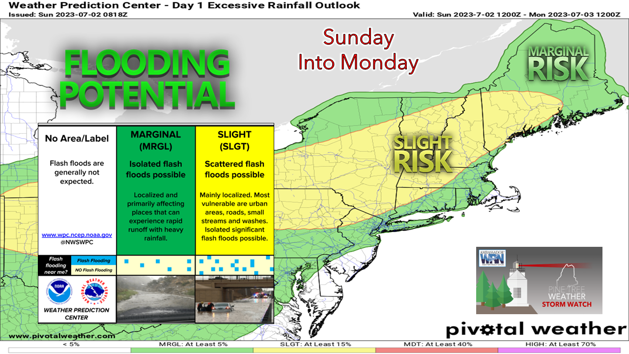 The potential for flash flooding, road washouts, urban street flooding, and ponding on roadways is expected through Monday morning. The flash flood guidance remains at around 1"-2" per hour rainfall rates, which with this tropical airmass is very easy to achieve. The ground is saturated and will continue to be with no meaningful dry period in sight. One thing that needs to watch for is training of thunderstorms that could dump 3-6" or more of rainfall as that threat will continue. Pattern is more progressive but remains muggy and wet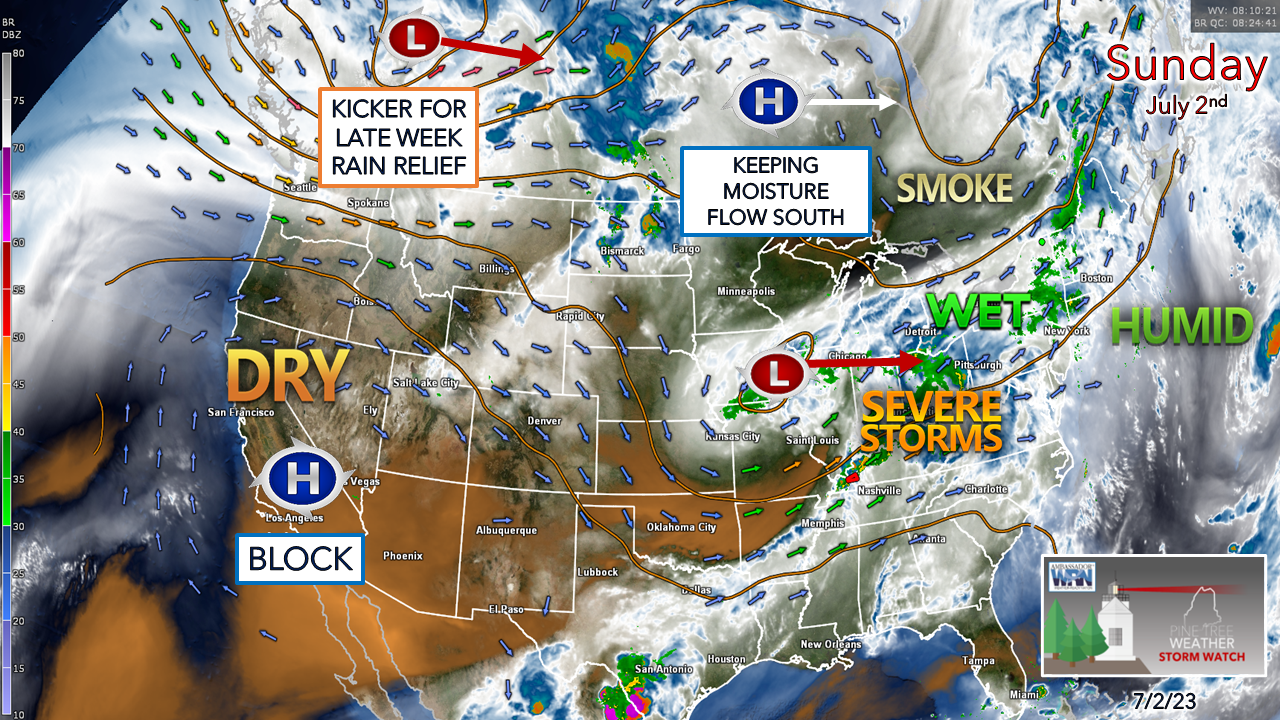 A look here at the 500mb steering level of the atmosphere shows a strong blocking ridge over the southwest which will make that region sizzle. An upper low to the east of that is being held in that position by a ridge to north that is moving east in conjunction with it. A strong upper low over northwestern Canada dips into Ontario later in the week and moves the two systems out, which appears to diminish, but not eliminate rain chances later in the week. Sunday into Monday a washout south of the mountains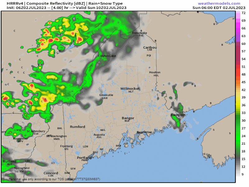 Sunday 6 AM to Monday Midnight - Showers with the potential for thunderstorms work into the region from west to east south of the mountains through the day. Northern areas see scattered activity. Expect areas of fog, tropical downpours, and slow travel. 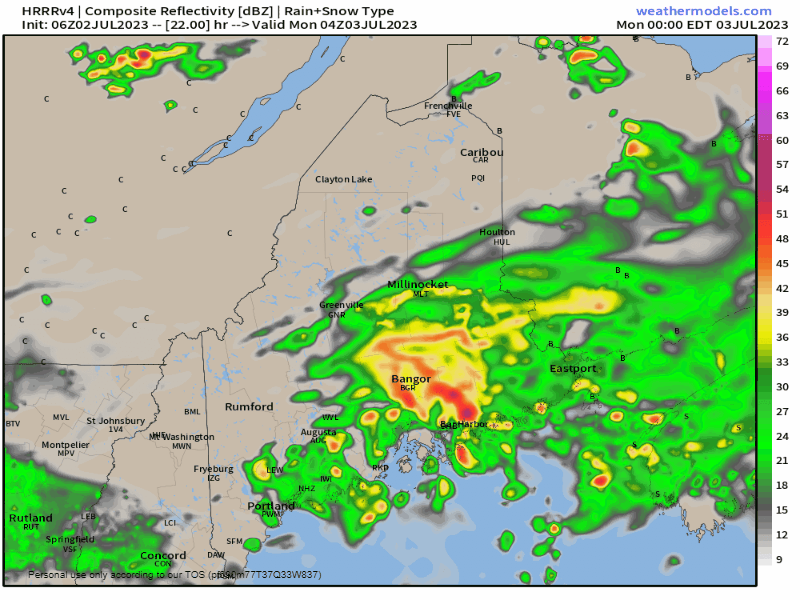 Monday Midnight to Tuesday 2 AM - Surface low pressure heads to the east and steady rainfall then turns into scattered showers and storms in the afternoon. The sun may poke through. With the still humid airmass in place, the atmosphere will be ripe to pop strong to severe storms heading into Monday night. 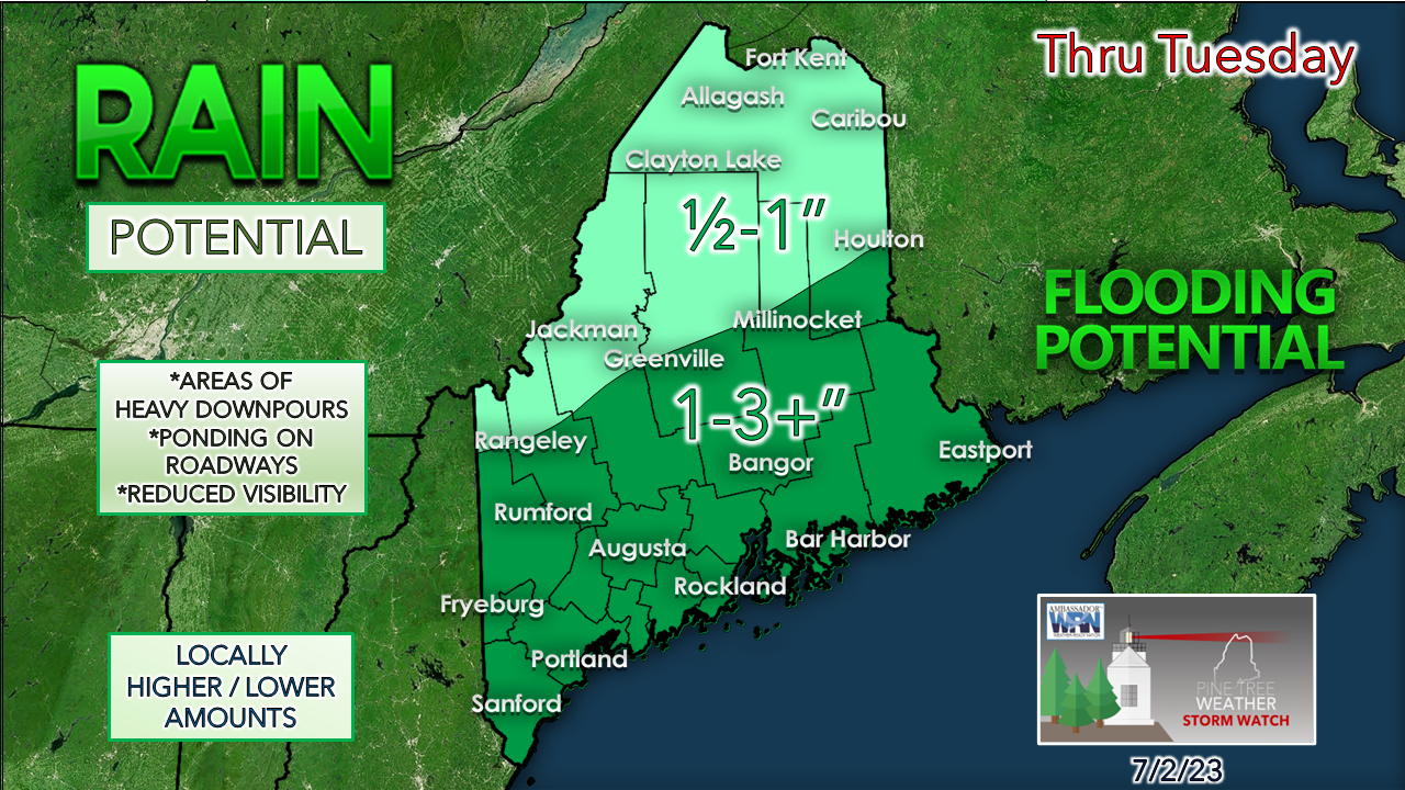 A general 1-3" of rainfall is expected south of the mountains overall through the Fourth, with most of this falling on Sunday and Monday. There is a strong likelihood that some areas will get double that number or more.  Outlook for the Fourth and the rest of the week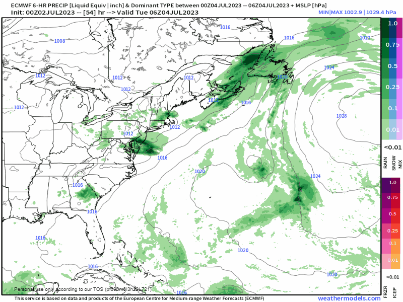 Tuesday 2 AM to Friday 8 PM - Showers and storms are possible, mainly in the afternoon and evenings for the Fourth on Tuesday and also for Wednesday. Thursday and Friday appear to be the drier days for the region, but there is still the risk of a pop-up shower or storm given the humidity and a shot of heat. A slow-moving frontal boundary may washout next weekend. The 10-day temperature outlook for Fryeburg shows the heat building in midweek. Northern and coastal areas will be slightly cooler, but most areas will be able to make a run into the 80s for at least a couple of days. I do expect temperatures will be cooler than the idea presented here for next weekend if the idea of the slow-moving frontal boundary takes shape. 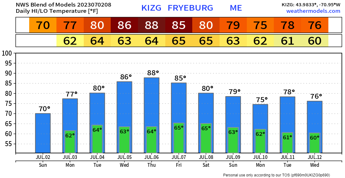 Pine Tree Weather is funded from followers like you. I would appreciate your financial support. Click here for how you can contribute. You may not like the weather, but I hope you like what I do, and support my efforts. Thank you! Stay updated, stay on alert, and stay safe! - Mike NOTE: The forecast information depicted on this platform is for general information purposes only for the public and is not designed or intended for commercial use. For those seeking pinpoint weather information for business operations, you should use a private sector source. For information about where to find commercial forecasters to assist your business, please message me and I will be happy to help you. |

Mike Haggett
|


